


Why visit Hà Giang
Townapedia lists 9 museums and landmarks, 3 parks and trails, 78 places to eat, 70 places to stay and 10 attractions in and around town.
Weather in Hà Giang
Forecast from MET Norway (CC BY 4.0). Full forecast
About Hà Giang
Hà Giang (Vietnamese pronunciation: [haː2 zaːŋ1], ) is a former city located on the banks of the Lô River in Northeast Vietnam. The city has an area of 135.33 km2 and had a population of 55,559 inhabitants as of the 2019 census. The population is composed of 22 different ethnicities, of which 55.7% are Vietnamese people (Kinh) and Tày people. The area has been referred to as "the most beautiful place in all of Vietnam".
From the Wikipedia article Hà Giang (city) (this version), under CC BY-SA 4.0.
Travel tips from other travellers: Hà Giang on Wikivoyage (CC BY-SA 4.0).
Things to do10



Museums and landmarks9

Thach Lam Vien - Ha Giang - gardens and ponds
Monument and historic site · 3.4 km
Mo-Su 07:00-20:00
Parks, trails and playgrounds3

Restaurants and cafes78

Pizza Here | Restaurant & Delivery
Restaurant · Italian Pizza, Pizza
137 Đường Nguyễn Thái Học, Ha Giang
24/7


Anh Yen Cafe
Cafe · Regional, Tea, Vietnamese, Coffee Shop, Local
18 Duong Kim Dong
Mo-Su 07:00-20:00
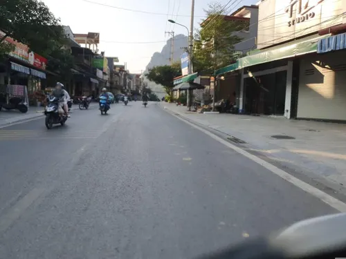
Bong Restaurant
Restaurant · Vietnamese, Burger, American, Seafood, Fish And Chips, Coffee Shop, Sandwich, Pizza, Japanese, International, Italian, Regional, Kebab, French, Ice Cream, Chicken, Mexican, German · 0.8 km
115 Minh Khai
Mo-Su 07:00-23:15

Simple Bar
Bar and pub · Asian, Breakfast, Burger, Coffee Shop, Diner, Hotdog, Italian Pizza, Pasta, Pizza, Tea, Vietnamese · 1.2 km
113a Nguyễn Trãi
24/7
Bread Bakery - 53. Le Hong Phong St.
Bakery
53 Lê Hồng Phong
Mo-Su 07:00-20:00
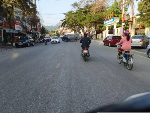


66 more on the map.
History
Until the 19th century, the settlement of Vị Xuyên, to the south of Hà Giang (chu Han: 河楊), was the principal market town and the largest settlement in the area. Under the Nguyễn dynasty (1802–1945) the town of Hà Giang, in what is now Trần Phú District, began to grow in size. In 1842, the town was included in the former Tuyên Quang Province.
In 1842, Hà Giang was incorporated into the new Tuyên Quang Province, which at that time stretched north as far as the Chinese border. Following the French conquest of the area in 1886, Hà Giang became an important French colonial military outpost. On 13 August 1945, during the August Revolution, the Việt Nam Quốc Dân Đảng took power here.
On August 12, 1991, the province of Hà Giang was re-established and separated from Tuyên Quang Province. When separated, Hà Giang Province contained 10 administrative units, and Hà Giang town became the provincial town of Hà Giang.
On September 27, 2010, Hà Giang town was officially upgraded into a provincial city.
In March 2014, the urban development project type II was approved by the Prime Minister in Decision No. 190, which includes the provinces of Vĩnh Phúc, Hà Giang, and Thừa Thiên–Huế, thanks to a non-refundable aid package from the Asian Development Bank (ADB). With regards to Hà Giang province, the project includes upgrading of roads, construction of 2 new bridges, and upgrading the sewage system.
From the History section of Hà Giang (city) on Wikipedia, under CC BY-SA 4.0.
Where to stay70
Churches and places of worship5
Shopping8
Gas and EV charging9
Schools, colleges and libraries20
Trường Phổ thông dân tộc nội trú Trung học phổ thông tỉnh Hà Giang
School · 1.2 km
Healthcare7
Map of Hà Giang
219 places. The map loads OpenStreetMap tiles when you open it.
Getting there and nearby towns
- Thị Trấn Yên Minh 37 km northeast, about 37 min by car
- Bắc Quang 40 km south, about 40 min by car
- Thị Trấn Việt Quang 49 km south, about 49 min by car
- Pác Miầu 52 km east, about 52 min by car
- Thị Trấn Phố Bảng 52 km northeast, about 52 min by car
- Sà Phìn 56 km northeast, about 56 min by car
- Mabai 58 km west, about 58 min by car
- Thị Trấn Mèo Vạc 58 km northeast, about 58 min by car
- Thị Trấn Vĩnh Tuy 62 km south, about 1 h by car
- Thị Trấn Đồng Văn 64 km northeast, about 1 h by car
Drive times are estimates from straight-line distance, not routes.
Local news
Headlines from INDB.
Reviews, tips and questions
Loading what members have shared...
Sources and licences
- GeoNames (CC BY 4.0): population, coordinates, regions and time zone
- Mapillary (see each image): photos
- OpenStreetMap contributors (ODbL 1.0): places, airports, map data
- Wikidata (CC0 1.0): elevation, founding date, time zone, website
- Wikimedia Commons (see each image): photos
- Wikipedia (CC BY-SA 4.0): overview and history text
Photo credits
- Hà Giang City, Idan Robbins, CC BY-SA 4.0
- Nguyễn Trãi, tp. Hà Giang, Ha Giang, Vietnam - panoramio (5), trungydang, CC BY 3.0
- Nguyễn Trãi, tp. Hà Giang, Ha Giang, Vietnam - panoramio (4), trungydang, CC BY 3.0
- Nguyễn Trãi, tp. Hà Giang, Ha Giang, Vietnam - panoramio (1), trungydang, CC BY 3.0
- Nguyễn Trãi, tp. Hà Giang, Ha Giang, Vietnam - panoramio (2), trungydang, CC BY 3.0
- Nguyễn Trãi, tp. Hà Giang, Ha Giang, Vietnam - panoramio (3), trungydang, CC BY 3.0
- Nguyễn Trãi, tp. Hà Giang, Ha Giang, Vietnam - panoramio, trungydang, CC BY 3.0
- Trần Phú, tp. Hà Giang, Ha Giang, Vietnam - panoramio, trungydang, CC BY 3.0
- Nguyễn Trãi, tp. Hà Giang, Ha Giang, Vietnam - panoramio (7), trungydang, CC BY 3.0
- Nguyễn Trãi, tp. Hà Giang, Ha Giang, Vietnam - panoramio (8), trungydang, CC BY 3.0
- Nguyễn Trãi, tp. Hà Giang, Ha Giang, Vietnam - panoramio (6), trungydang, CC BY 3.0
- Quang Trung, tp. Hà Giang, Ha Giang, Vietnam - panoramio, trungydang, CC BY 3.0
- Quang Trung, tp. Hà Giang, Ha Giang, Vietnam - panoramio (2), trungydang, CC BY 3.0
- Quang Trung, tp. Hà Giang, Ha Giang, Vietnam - panoramio (1), trungydang, CC BY 3.0
- Ha Giang city government palace in 2014, Vuong Tri Binh, CC BY-SA 4.0
- Ha Giang Km0 in 2014 01, Vuong Tri Binh, CC BY-SA 4.0
- Ha Giang Km0 in 2014 02, Vuong Tri Binh, CC BY-SA 4.0
- Statue of Ho Chi Minh playing with children in Ha Giang city, Vuong Tri Binh, CC BY-SA 4.0
- Dried up fountain in Ha Giang city in 2014 02, Vuong Tri Binh, CC BY-SA 4.0
- Tourism billboard for the scenery of Ha Giang province in 2014, Vuong Tri Binh, CC BY-SA 4.0
- Dried up fountain in Ha Giang city in 2014 01, Vuong Tri Binh, CC BY-SA 4.0
- Billboards celebrating love and the military in Ha Giang city, Vuong Tri Binh, CC BY-SA 4.0
- View of the hills behind Ha Giang city from within the urban area in 2014, Vuong Tri Binh, CC BY-SA 4.0
- Van Chai, Ha Giang - Viet Nam, Nhi Dang, CC BY 2.0
- Ha Giang City Square, HuangWending18072009, CC0
- People's Committee of Ha Giang Province, HuangWending18072009, CC0
- Ha Giang Km0 in 2014 03, Vuong Tri Binh, CC BY-SA 4.0
- Small public park in Ha Giang city in 2014, Vuong Tri Binh, CC BY-SA 4.0
- Milestone 0 in Ha Giang Province, HuangWending18072009, CC0
- Ha Giang local foods in Ha Giang City, Vuong Tri Binh, CC BY-SA 4.0
- Taken in a hotel room in Ha Giang Ward, Tuyen Quang Province in 2025, HuangWending18072009, CC0
- Vinh Tường - panoramio, Thủy Trần, CC BY 3.0
- Street near the end of Ha Giang city in 2014, Vuong Tri Binh, CC BY-SA 4.0
- Restaurant serving Vietnamese (Kinh) food in Ha Giang in 2014, Vuong Tri Binh, CC BY-SA 4.0
- Ha Giang Banner, Vuong Tri Binh, CC BY-SA 4.0
- Shopping street in Ha Giang city on the main road, Vuong Tri Binh, CC BY-SA 4.0
- Song Lo @Nam TpHaGiang'2005, BacLuong at Vietnamese Wikipedia, Public domain
- Street-level photo, russmcd, CC BY-SA 4.0
- Street-level photo, russmcd, CC BY-SA 4.0
- Street-level photo, russmcd, CC BY-SA 4.0
- Street-level photo, russmcd, CC BY-SA 4.0
- Street-level photo, russmcd, CC BY-SA 4.0
- Street-level photo, russmcd, CC BY-SA 4.0


Page built November 8, 2026. Spotted a mistake? Tell us or suggest a place.