


Hạ Long, Vietnam
Hạ Long is a regional capital of 270,054 people in Quảng Ninh, Vietnam.
Why visit Hạ Long
Townapedia lists 14 museums and landmarks, 15 parks and trails, 62 places to eat, 60 places to stay and 9 attractions in and around town.
Highlights include Bai Chay Bridge, Ocean Park Ha Long, Dragon's Run and G. X. Ti Tốp.
Weather in Hạ Long
Forecast from MET Norway (CC BY 4.0). Full forecast
About Hạ Long
Hạ Long (Vietnamese: [hâːˀ lawŋm] , transl. 'descending dragon') is a former first-class provincial city and capital city of Quảng Ninh province, Vietnam. It was founded in 1993, when the old capital, Hòn Gai, was merged with Bãi Cháy, the main tourist area. The city mainly lies on Hạ Long Bay, and is located at about 178 km (111 mi) east of Hà Nội. The city's population in 2019 was 270,054.
From the Wikipedia article Hạ Long (city) (this version), under CC BY-SA 4.0.
Travel tips from other travellers: Hạ Long on Wikivoyage (CC BY-SA 4.0).
Things to do9


Ocean Park Ha Long
Monument and historic site · 2.5 km
Amusement park



Museums and landmarks14


Quang Ninh Exhibition Center
Monument and historic site · 2.9 km
Trần Quốc Nghiễn

2 more on the map.
Parks, trails and playgrounds15
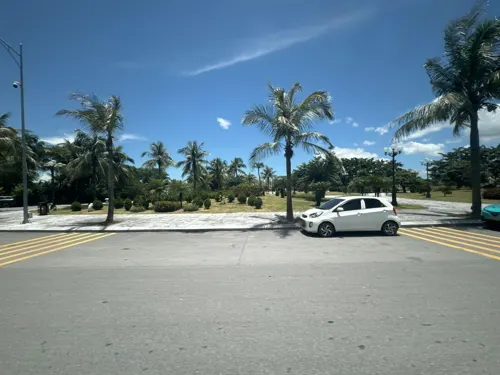





3 more on the map.
Restaurants and cafes62

Nhà Hàng Phương Nam 2
Restaurant · Vietnamese · 4.2 km
LV2, 03, Sun Premier Village, Quảng Ninh
Mo-Su 09:00-21:00
14 Pizza Halong
Restaurant · American, Pasta, Chicken, Italian Pizza · 5.2 km
17 Lê Văn Lương
We-Mo 10:00-22:00
An Nhiên
Restaurant · Vietnamese · 4.7 km
Mo-Su 18:00-22:00
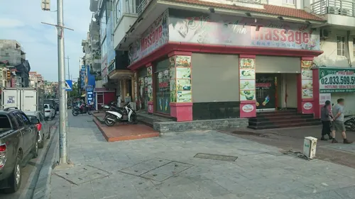



50 more on the map.
History
Mankind has been present in Hạ Long for a long time. Archaeologists and historians concluded that during the Stone Age, there had been three cultures known as Soi Nhụ, Hạ Long and Cái Bèo, affirming that the bay and its surrounding areas were one of the cradles of mankind. The heartland of today's Hạ Long is formerly a fishing village named Bãi Hàu (lit. 'Oyster coast'). By the beginning of the Dynasty of Nguyễn, it was renamed to Mẫu Lệ. The current city was then part of Hoành Bồ.
In 1883, during French rule, the French carried out coal mining in the mines on the bay's coast. As many islands were populated with hemp, the French called them Ile des brouilles or a name translated from "Hòn Gai" to "Hòn Gay", and later renamed them Hòn Gai. According to the researchers, "Hòn Gai" is a deviation from the place of the French Red Sea at that time. The "H" is a silent sound when spoken in French. During this period, Hòn Gai was an administrative unit of Quảng Yên province.
From the History section of Hạ Long (city) on Wikipedia, under CC BY-SA 4.0.
Where to stay60
Hidden Charm Hotel Halong
Motel and hotel · 8.4 km
Lô 22D , Khu biệt thự Tuần Châu
Churches and places of worship11
Shopping14
Gas and EV charging7
Schools, colleges and libraries59
Trường Cao đẳng Than - Khoáng sản Việt Nam (phân hiệu Hoành Bồ)
School · 12.8 km
Healthcare11
Map of Hạ Long
250 places. The map loads OpenStreetMap tiles when you open it.
Getting there and nearby towns
Cat Bi International Airport (HPH) is the nearest airport with scheduled flights listed in OpenStreetMap, 39 km away.
- Cẩm Phả 22 km east, about 22 min by car
- Cẩm Phả Mines 25 km east, about 25 min by car
- Cát Bà 25 km south, about 25 min by car
- Thành Phố Uông Bí 33 km west, about 33 min by car
- Thị Trấn Cái Rồng 38 km east, about 38 min by car
- Đố Sơn 40 km southwest, about 40 min by car
- Haiphong 42 km west, about 42 min by car
- Thị Trấn Ba Chẽ 42 km northeast, about 42 min by car
- Kiến An 49 km west, about 49 min by car
- Thị Trấn Mạo Khê 51 km west, about 51 min by car
Drive times are estimates from straight-line distance, not routes.
Local news
Headlines from INDB.
Reviews, tips and questions
Loading what members have shared...
Sources and licences
- GeoNames (CC BY 4.0): population, coordinates, regions and time zone
- Mapillary (see each image): photos
- OpenStreetMap contributors (ODbL 1.0): places, airports, map data
- Wikidata (CC0 1.0): elevation, founding date, time zone, website, landmarks and historic places
- Wikimedia Commons (see each image): photos
- Wikipedia (CC BY-SA 4.0): overview and history text
Photo credits
- Vietnam-2145504 1920, Webkims, CC0
- Hồng Gai, tp. Hạ Long, Quảng Ninh, Vietnam - panoramio, Zack Knowles, CC BY-SA 3.0
- Hạ Long City (49373608458), Martin Lewison from Forest Hills, NY, U.S.A., CC BY 2.0
- Le pont suspendu d'Halong, Jean-Pierre Dalbéra, CC BY 2.0
- Halong ensemble (colour corrected), Thierry Borie colour adjusted by Lycaon, Public domain
- LZTR (Majority) (3), Coasterman1234, CC BY-SA 3.0
- Halong TitowIsland2, Catatine, CC BY-SA 4.0
- Sun World Ha Long Park (49370121263), Martin Lewison from Forest Hills, NY, U.S.A., CC BY 2.0
- Vịnh Hạ Long - NKS, NKSTTSSHNVN, CC BY-SA 4.0
- Bai Chay 2023, Pdhadam, CC BY-SA 4.0
- Bay Chai bay - panoramio, u7shin, CC BY-SA 3.0
- View of Ha Long (49357543233), Martin Lewison from Forest Hills, NY, U.S.A., CC BY 2.0
- Ha Long 2019 taken by DJI FC220, Dratharr, CC BY-SA 4.0
- Ha Long City - panoramio (2), Zack Knowles, CC BY-SA 3.0
- 2025,Halon Bay,29 (147), SOUTHPASIFIC, CC BY-SA 4.0
- View of Ha Long town from Sun World Halong Park, Vietnam, 20240129 1458 4123, Jakub Hałun, CC BY 4.0
- View of Ha Long town from Sun World Halong Park, Vietnam, 20240129 1520 4176, Jakub Hałun, CC BY 4.0
- 2025,Halon Bay,29 (153), SOUTHPASIFIC, CC BY-SA 4.0
- View of Ha Long town from Sun World Halong Park, Vietnam, 20240129 1519 4173, Jakub Hałun, CC BY 4.0
- Fish pond in Sun World Halong Park. Ha Long Town, Vietnam, 20240129 1453 4117, Jakub Hałun, CC BY 4.0
- Fish pond in Sun World Halong Park. Ha Long Town, Vietnam, 20240129 1453 4113, Jakub Hałun, CC BY 4.0
- Fish pond in Sun World Halong Park. Ha Long Town, Vietnam, 20240129 1453 4110, Jakub Hałun, CC BY 4.0
- View of Ha Long City at night (49373497483), Martin Lewison from Forest Hills, NY, U.S.A., CC BY 2.0
- View of Ha Long City at night (49372727383), Martin Lewison from Forest Hills, NY, U.S.A., CC BY 2.0
- Fish pond in Sun World Halong Park. Ha Long Town, Vietnam, 20240129 1534 4198, Jakub Hałun, CC BY 4.0
- Fish pond in Sun World Halong Park. Ha Long Town, Vietnam, 20240129 1534 4200, Jakub Hałun, CC BY 4.0
- 2025,Halon Bay,29 (122), SOUTHPASIFIC, CC BY-SA 4.0
- View of Ha Long City at night (49357901576), Martin Lewison from Forest Hills, NY, U.S.A., CC BY 2.0
- Sun World Ha Long Park (49355153068), Martin Lewison from Forest Hills, NY, U.S.A., CC BY 2.0
- Sun World Ha Long Park (49356769731), Martin Lewison from Forest Hills, NY, U.S.A., CC BY 2.0
- 2025,Halon Bay,29 (171), SOUTHPASIFIC, CC BY-SA 4.0
- 2025,Halon Bay,29 (95), SOUTHPASIFIC, CC BY-SA 4.0
- 2025,Halon Bay,29 (172), SOUTHPASIFIC, CC BY-SA 4.0
- Bai Chay Pano 10-2023, Pdhadam, CC BY-SA 4.0
- Sun World Ha Long Park (49374136717), Martin Lewison from Forest Hills, NY, U.S.A., CC BY 2.0
- 2025,Halon Bay,29 (184), SOUTHPASIFIC, CC BY-SA 4.0
- Sun World Ha Long Park (49355971102), Martin Lewison from Forest Hills, NY, U.S.A., CC BY 2.0
- Ha Long City - panoramio (3), Zack Knowles, CC BY-SA 3.0
- Sun World Ha Long Park (49373914413), Martin Lewison from Forest Hills, NY, U.S.A., CC BY 2.0
- Sun World Ha Long Park (49373965641), Martin Lewison from Forest Hills, NY, U.S.A., CC BY 2.0
- Street-level photo, velmyshanovnyi, CC BY-SA 4.0
- Street-level photo, filipb, CC BY-SA 4.0
- Street-level photo, alllenwang, CC BY-SA 4.0
- Street-level photo, hn_right_2, CC BY-SA 4.0
- Street-level photo, hn_right_2, CC BY-SA 4.0
- Street-level photo, 24dakenlo, CC BY-SA 4.0
- Street-level photo, hn_right_2, CC BY-SA 4.0


Page built November 8, 2026. Spotted a mistake? Tell us or suggest a place.