
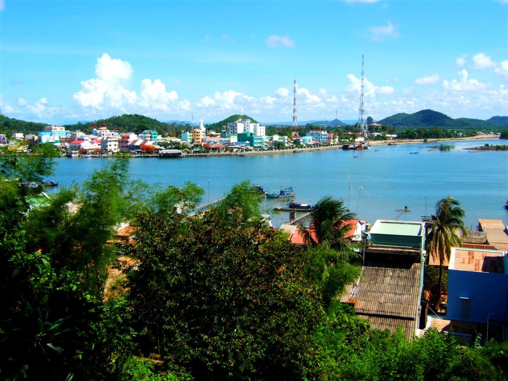


Why visit Hà Tiên
Townapedia lists 9 museums and landmarks, 9 parks and trails, 23 places to eat, 18 places to stay and 6 attractions in and around town.
Weather in Hà Tiên
Forecast from MET Norway (CC BY 4.0). Full forecast
About Hà Tiên
Hà Tiên is a former provincial city belong to former Kiên Giang province, Mekong Delta in Vietnam. Its area is 10,049 ha (100.49 km2; 38.80 sq mi) and the population as of 2019 is 81,576. The city borders Cambodia to the west. Hà Tiên is a tourist site of the region thanks to its beaches and landscapes.
From the Wikipedia article Hà Tiên (city) (this version), under CC BY-SA 4.0.
Travel tips from other travellers: Hà Tiên on Wikivoyage (CC BY-SA 4.0).
Things to do6

Museums and landmarks9




Parks, trails and playgrounds9

Restaurants and cafes23



11 more on the map.
History
A settlement and a port seem to have existed at the site of the present town of Hà Tiên from a very early period. Ptolemy's Geography identified a town there as Akadra and that it was the port for the Cambodian district of Pithonobaste - Banteay Meas, all this being part of the Kingdom of Funan. The local capital of this district, also called Banteay Meas, was not on the coast, but located about a day's journey up the Giang-thành river. The name Banteay Meas, (Khmer: បន្ទាយមាស, Thai: บันทายมาศ; lit: "golden ramparts"), referred to the bamboo fortifications once used about the town. The town of Hà Tiên was originally known under the Khmer, name of Piem or Peam (Khmer: ពាម, Thai: เปียม, Chinese: 港口; also Pie, Pam, Bam), the Khmer for "port", "harbour" or "river mouth", while the Vietnamese called it Mang-Kham, from the Vietnamese term for the Khmers, "mang". It was through this port that Buddhism is said to have reached Cambodia, brought there by chance when a ship carrying Buddhaghosa was blown there by a storm in 415 AD.
From the History section of Hà Tiên (city) on Wikipedia, under CC BY-SA 4.0.
Where to stay18
Churches and places of worship3
Gas and EV charging3
Schools, colleges and libraries2
Healthcare1
Map of Hà Tiên
74 places. The map loads OpenStreetMap tiles when you open it.
Getting there and nearby towns
Phu Quoc International Airport (PQC) is the nearest airport with scheduled flights listed in OpenStreetMap, 59 km away.
- Ba Chúc 48 km east, about 48 min by car
- Phú Quốc 53 km west, about 53 min by car
- Hàm Ninh 53 km southwest, about 53 min by car
- Tịnh Biên 55 km northeast, about 55 min by car
- Cô Tô 58 km east, about 58 min by car
- Phu Quoc 59 km west, about 59 min by car
- Kiên Hải 60 km southeast, about 1 h by car
- Dương Đông 61 km west, about 1 h by car
- Nhà Bàng 62 km northeast, about 1 h by car
- Rạch Giá 77 km southeast, about 1 h 15 min by car
Drive times are estimates from straight-line distance, not routes.
Local news
Headlines from INDB.
Reviews, tips and questions
Loading what members have shared...
Sources and licences
- GeoNames (CC BY 4.0): population, coordinates, regions and time zone
- OpenStreetMap contributors (ODbL 1.0): places, airports, map data
- Wikidata (CC0 1.0): elevation, founding date, time zone, website
- Wikimedia Commons (see each image): photos
- Wikipedia (CC BY-SA 4.0): overview and history text
Photo credits
- DSCF8696, Daniel Berthold, CC BY-SA 4.0
- Bức tường cổ tại chùa Tam Bảo - Hà Tiên (52353242435), Kien Mike, Public domain
- Chùa Tam Bảo - Hà Tiên (52353242700), Kien Mike, Public domain
- Vịnh Hà Tiên (52353244595), Kien Mike, Public domain
- Lăng Tổng Trấn Hà Tiên - Mạc Cửu (52352815996), Kien Mike, Public domain
- Chùa Phật Đà - Hà Tiên (52353056998), Kien Mike, Public domain
- Chùa Phật Đà - Hà Tiên (52351871552), Kien Mike, Public domain
- Chùa Phật Đà - Hà Tiên (52353138004), Kien Mike, Public domain
- Chùa Phật Đà - Hà Tiên (52352815351), Kien Mike, Public domain
- Phù Dung Cổ Tự - Hà Tiên (52352816921), Kien Mike, Public domain
- Phù Dung Cổ Tự - Hà Tiên (52352816716), Kien Mike, Public domain
- Sua Da Me, Tonbi ko, CC BY-SA 4.0
- Ha Tien shophouses, Sgnpkd, CC BY-SA 4.0
- Ngôi mộ của Bà Từ ( Người coi quản chùa trước đây), Chile89, CC BY-SA 4.0
- Phu Quoc Express 8, David Ackerman, CC BY 2.0
- Ngôi nhà ngói ( Căn bếp) đã xuống cấp, Chile89, CC BY-SA 4.0
- Ngôi nhà ngói đã xuống cấp, Chile89, CC BY-SA 4.0
- Chùa Phật Đà - Hà Tiên (52353056458), Kien Mike, Public domain
- Phù Dung Cổ Tự - Hà Tiên (52353245845), Kien Mike, Public domain


Page built November 8, 2026. Spotted a mistake? Tell us or suggest a place.