


Why visit Mui Ne
Townapedia lists 6 museums and landmarks, 1 park or trail, 174 places to eat, 128 places to stay and 4 attractions in and around town.
Highlights include Vita Garden Mini-Zoo.
Weather in Mui Ne
Forecast from MET Norway (CC BY 4.0). Full forecast
About Mui Ne
Mũi Né is a coastal fishing ward in the Lâm Đồng Province of Vietnam. The ward has approximately 25,000 residents. Mui Ne and the other wards of Phan Thiet stretch along the coast for approximately 50 kilometers and have been transformed into a resort destination since the mid-1990s, when many visited the area to view the solar eclipse of October 24, 1995.
From the Wikipedia article Mũi Né (this version), under CC BY-SA 4.0.
Travel tips from other travellers: Mui Ne on Wikivoyage (CC BY-SA 4.0).
Things to do4


Museums and landmarks6

Parks, trails and playgrounds1

Restaurants and cafes174

Backstage Bar & Grill
Restaurant · Vietnamese, French · 7.7 km
139D Nguyễn Đình Chiểu
Mo-Su 08:00-23:00

Modjo Bar & Restaurant
Restaurant · French, Swiss, Steak House, Cheese, Cheese Fondue, Cheese Raclette, Cheese Platter, Cold Cuts, Sandwich, Pizza, Burger, Dessert, Asian, Hot Stone Steak, Steak, Tenderloin, Striploin, Cheese Bar, Homemade, Imported, Hot-Stone Plate · 7.7 km
139c Nguyễn Đình Chiểu, Ham Tien, Mui Ne
Mo-Su 11:00-23:00
Mot Nang seaside restaurant bar
Restaurant · International, Grill, Seafood, Coffee Shop, Asian, Russian, Diner, Vietnamese · 6.8 km
122 (199) Nguyễn Đình Chiểu
Mo-Su 08:30-22:00
Pit Stop Food Court & Beer Garden
Restaurant · Hungarian, Mexican, Pizza, Seafood · 7.0 km
193 Nguyễn Đình Chiểu
Mo-Su 08:00-23:00
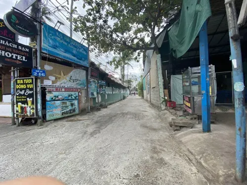
May Bowls Muine
Restaurant · 4.6 km
246/2 Nguyễn Đình Chiểu, khu phố 3, Thành phố Phan Thiết, Bình Thuận
Mo-Su 07:30-15:30
Phat Hamburger
Restaurant · Burger · 5.7 km
253 Nguyễn Đình Chiểu
10:00-21:30

Quán Cơm Nghinh Phong
Cafe · Vietnamese · 7.7 km
139c Nguyễn Đình Chiểu, Phường Hàm Tiến, Thành phố Phan Thiết, Bình Thuận
Mo-Su 07:30-21:00
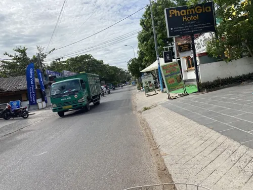


Surfing Bird's WOK
Restaurant · Asian · 4.6 km
371B Nguyễn Đình Chiểu, Phường Hàm Tiến, Thành phố Phan Thiết, Bình Thuận
Mo-Su 06:00-22:00
162 more on the map.
History
During the Republic of Vietnam era, Mũi Né was the district capital of Hải Long district, Bình Thuận province. After 1975, Hải Long district merged with Hàm Thuận and Thiện Giáo districts to form Hàm Thuận district, Thuận Hải province. At that time, Mũi Né was part of Hàm Dũng commune, Hàm Thuận district.
On March 13, 1979, the Government Council issued Decision 104-CP. According to this decision, Hàm Dũng commune was dissolved to establish Mũi Né town as the district capital of Hàm Thuận district.
On December 30, 1982, the Council of Ministers issued Decision 204-HĐBT. According to this decision, Hàm Thuận district was divided into two new districts: Hàm Thuận Bắc and Hàm Thuận Nam. At the same time, Mũi Né town was placed under the administration of Phan Thiết town and was renamed Mũi Né ward.
From the History section of Mũi Né on Wikipedia, under CC BY-SA 4.0.
Where to stay128
Churches and places of worship5
Shopping17
Gas and EV charging2
Healthcare4
Map of Mui Ne
250 places. The map loads OpenStreetMap tiles when you open it.
Getting there and nearby towns
Lien Khuong International Airport (DLI) is the nearest airport with scheduled flights listed in OpenStreetMap, 91 km away.
- Ấp Hòa Thanh 17 km northwest, about 17 min by car
- Phan Thiết 20 km west, about 20 min by car
- La Gi 64 km southwest, about 1 h by car
- Bảo Lộc 86 km northwest, about 1 h 30 min by car
- Phú Quý 85 km southeast, about 1 h 30 min by car
- Đưc Trọng 90 km north, about 1 h 30 min by car
Drive times are estimates from straight-line distance, not routes.
Local news
Headlines from INDB.
Reviews, tips and questions
Loading what members have shared...
Sources and licences
- GeoNames (CC BY 4.0): population, coordinates, regions and time zone
- Mapillary (see each image): photos
- OpenStreetMap contributors (ODbL 1.0): places, airports, map data
- Wikidata (CC0 1.0): elevation, founding date, time zone, website
- Wikimedia Commons (see each image): photos
- Wikipedia (CC BY-SA 4.0): overview and history text
Photo credits
- Mui ne - Fischerdorf in Abenddämmerung sunset (404869455), Martin Fisch from Wiesbaden, Germany, CC BY 2.0
- Mui Ne Fishing Boats - panoramio, zabaluev, CC BY 3.0
- Malibu Resourt, Mui Ne, Gerd Fahrenhorst, CC BY 4.0
- Pandanus Resort, Mui Ne, Gerd Fahrenhorst, CC BY 4.0
- Asteria Mui Ne, Gerd Fahrenhorst, CC BY-SA 4.0
- Jump. (Unsplash), Thien Dang thiendanga9, CC0
- 20180411-23Mũi Né Đồi Cát Trắng tour truck, choi kwangmo, CC0
- 20180411 133925Mũi Né beach, choi kwangmo, CC0
- Mui Ne fishing village, Woong Deewaa, CC BY-SA 4.0
- Mũi Né, Phan Thiet, Binh Thuan, Vietnam - panoramio (9), jetsun, CC BY-SA 3.0
- Hải Long, Mũi Né, tp. Phan Thiết, Bình Thuận, Vietnam - panoramio, trungydang, CC BY 3.0
- Đồi Hồng-DT 706B-Mũi Né, tp. Phan Thiết, Bình Thuận, Việt Nam - panoramio, trungydang, CC BY 3.0
- Đường hồ Xuân Hương-Hải Long, Mũi Né, tp. Phan Thiết, Bình Thuận, Việt Nam - panoramio, trungydang, CC BY 3.0
- Đường Hồ Xuân hương-khách sạn The sailing bay resort- Mũi Né, tp. Phan Thiết, Bình Thuận, Việt Nam - panoramio, trungydang, CC BY 3.0
- Bãi biển Mũi Né, tp. Phan Thiết, Bình Thuận, Việt Nam - panoramio, trungydang, CC BY 3.0
- Bãi biển - Mũi Né, tp. Phan Thiết, Bình Thuận, Việt Nam - panoramio, trungydang, CC BY 3.0
- Đường huỳnh tấn Phát-Mũi Né, tp. Phan Thiết, Bình Thuận, Việt Nam - panoramio, trungydang, CC BY 3.0
- Mũi Né, Phan Thiet, Binh Thuan, Vietnam - panoramio (7), BaoHieu, CC BY 3.0
- 베트남 무이네 모래언덕(Sand Dune) - panoramio, 우한길(HK Woo), CC BY 3.0
- Sleeping Beauty - panoramio, sonpano, CC BY-SA 3.0
- The beginning - panoramio, sonpano, CC BY-SA 3.0
- Mimela signaticollis 182558602, minhkhang, CC BY 4.0
- Mimela signaticollis 182558683, minhkhang, CC BY 4.0
- Mimela signaticollis 182558631, minhkhang, CC BY 4.0
- Mimela signaticollis 182558662, minhkhang, CC BY 4.0
- Mũi Né, Phan Thiet, Binh Thuan, Vietnam - panoramio (5), jetsun, CC BY-SA 3.0
- Đường DT 706B-Mũi Né, tp. Phan Thiết, Bình Thuận, Việt Nam - panoramio, trungydang, CC BY 3.0
- Mũi Né, Phan Thiet, Binh Thuan, Vietnam - panoramio (3), jetsun, CC BY-SA 3.0
- Mũi Né, Phan Thiet, Binh Thuan, Vietnam - panoramio (10), jetsun, CC BY-SA 3.0
- Mũi Né, Phan Thiet, Binh Thuan, Vietnam - panoramio (8), jetsun, CC BY-SA 3.0
- Red sand dunes - panoramio, jetsun, CC BY-SA 3.0
- Mũi Né, Phan Thiet, Binh Thuan, Vietnam - panoramio (2), jetsun, CC BY-SA 3.0
- Đồi cát Mũi Né - 1, Prenn, CC BY-SA 3.0
- Đồi cát Mũi Né - 2, Prenn, CC BY-SA 3.0
- Mũi Né, Phan Thiet, Binh Thuan, Vietnam - panoramio (1), jetsun, CC BY-SA 3.0
- Mũi Né, Phan Thiet, Binh Thuan, Vietnam - panoramio (6), Kirill Flerov, CC BY 3.0
- Mũi Né, Phan Thiet, Binh Thuan, Vietnam - panoramio (4), jetsun, CC BY-SA 3.0
- Mũi Né, Phan Thiet, Binh Thuan, Vietnam - panoramio (11), BaoHieu, CC BY 3.0
- Đồi cát Mũi Né, Martin Fisch, CC BY-SA 2.0
- Street-level photo, vadi, CC BY-SA 4.0
- Street-level photo, vadi, CC BY-SA 4.0
- Street-level photo, vadi, CC BY-SA 4.0
- Street-level photo, vadi, CC BY-SA 4.0


Page built November 8, 2026. Spotted a mistake? Tell us or suggest a place.