


Nha Trang, Vietnam
Nha Trang is a regional capital of 579,000 people in Khanh Hoa, Vietnam.
Why visit Nha Trang
Townapedia lists 15 museums and landmarks, 3 parks and trails, 322 places to eat, 158 places to stay and 2 attractions in and around town.
Highlights include Nha Trang Water puppet theater, Yersin Museum and Nha Trang August 19th Stadium.
Weather in Nha Trang
Forecast from MET Norway (CC BY 4.0). Full forecast
About Nha Trang
Nha Trang (English: or ; Vietnamese: [ɲa˧ ʈʂaŋ˧] ) is a former coastal city and the former capital of Khánh Hòa, on the South Central Coast of Vietnam. It was bounded on the north by the Ninh Hoà town, on the south by Cam Ranh city and on the west by Diên Khánh District. The city had a population of about 535,000 people in 2023.
From the Wikipedia article Nha Trang (city) (this version), under CC BY-SA 4.0.
Travel tips from other travellers: Nha Trang on Wikivoyage (CC BY-SA 4.0).
Things to do2
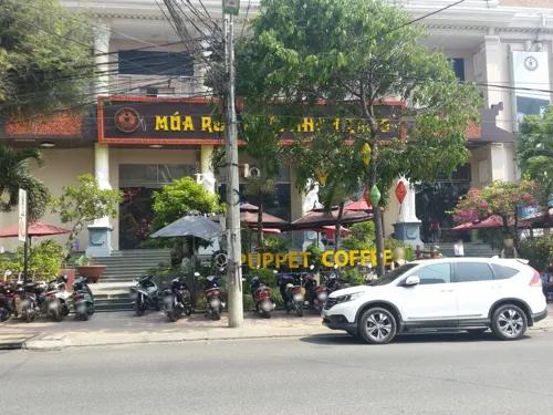
Nha Trang Water puppet theater
Cinema and theater · 0.7 km
46 Tran Phu street, Nha Trang, Khanh Hoa, Viet Nam
Mo-Su 14:00-22:00

Museums and landmarks15


Museum of Yersin
Museum · 0.7 km
Mo-Fr 07:30-11:30,14:00-17:00; Sa 07:30-11:30

3 more on the map.
Parks, trails and playgrounds3


Restaurants and cafes322
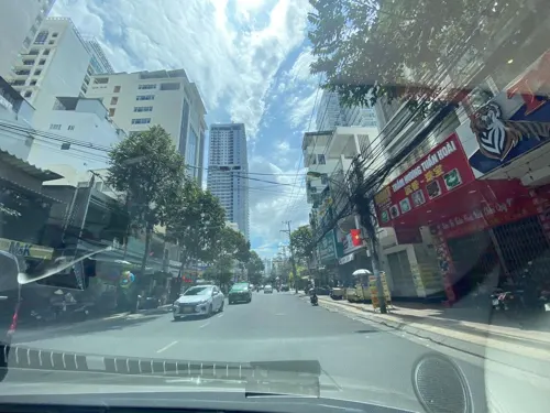

Nè Noddles
Restaurant · Vietnamese, Thai, Regional, Asian · 0.9 km
Dịch vụ ăn uống phong cách Việt, Thái
18 Hai Bà Trưng, Nha Trang
Mo-Su 10:00-22:00
TT Pilates Nha Trang
Restaurant · Pizza, Regional · 0.7 km
2 Đường Nguyễn Thị Minh Khai, Nha Trang
24/7
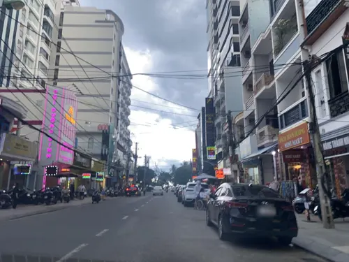
AIR BBQ& SEAFOOD
Restaurant · American, Asian, Barbecue, Breakfast, Chicken, Coffee Shop, Grill, International, Russian · 1.3 km
182 Hùng Vương
Mo-Su 10:00-23:30
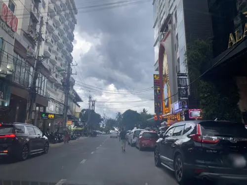

LIVINcollective
Restaurant · American, Barbecue, Burger · 0.6 km
77 Bạch Đằng, Nha Trang
Mo-Sa 10:00-22:00


Pinsa De Roma
Restaurant · Italian, Pizza · 0.6 km
53/7 Nguyễn Thiện Thuật, Nha Trang
Mo-Su 11:00-22:00
310 more on the map.
History
Kauthara, also translated as an ancient clam, is a constituent state of the empire-leading kingdom and its ruling area is located in the area from today's Fu A province to Cam Ranh. Yanpunagara, the capital of Yangpu, occupies the faith of a man and is deeply influenced by religions such as Hinduism and Buddhism. However, in addition to that, the gods who formerly occupied ruled the indigenous faith in the motherland, such as Çri Maladakuthara (釋利摩落陀古笪羅) in the ancient Gur'an region in the south, are one of those who can preserve the old God Most of the old gods who dominated the motherland were replaced by brahmanist gods such as the goddess Yan Pu Nagara (楊浦那竭羅) and the Bhagavati (妻婆伽婆底), Replaced, located in Nha Trang near today. Bhagavati is mixed with Yan Pu Nagara, a goddess in the local faith, which is quite revered by the people and has dedicated ancestral temples to enshrine it.
From 1653 to the 19th century, Nha Trang was a deserted area rich in wildlife (animals like tigers) and was a part of Hà Bạc, Vĩnh Xương County, Diên Khánh Province. After just two decades in the early 20th century, Nha Trang underwent a rapid change. On August 30, 1924, the Governor-General of French Indochina decreed Nha Trang as a townlet (urban centre). Nha Trang Townlet was established from the ancient villages of Xương Huân, Phương Câu, Vạn Thạnh, Phương Sài, and Phước Hải.
From the History section of Nha Trang (city) on Wikipedia, under CC BY-SA 4.0.
Where to stay158
Churches and places of worship11
Christ the King Cathedral, Nha Trang
Church · Catholic · 0.7 km
31a Thái Nguyên, Nha Trang
Shopping40
Gas and EV charging3
Schools, colleges and libraries20
Healthcare8
Map of Nha Trang
250 places. The map loads OpenStreetMap tiles when you open it.
Getting there and nearby towns
Cam Ranh International Airport (CXR) is the nearest airport with scheduled flights listed in OpenStreetMap, 28 km away.
- Ninh Hòa 28 km north, about 28 min by car
- Cam Ranh 36 km south, about 36 min by car
- Vạn Thạnh 53 km northeast, about 53 min by car
- Tu Bông 59 km north, about 59 min by car
- Khánh Hải 75 km south, about 1 h 15 min by car
- Phan Rang-Tháp Chàm 79 km south, about 1 h 15 min by car
- Ðà Lạt 88 km west, about 1 h 30 min by car
Drive times are estimates from straight-line distance, not routes.
Local news
Headlines from INDB.
Reviews, tips and questions
Loading what members have shared...
Sources and licences
- GeoNames (CC BY 4.0): population, coordinates, regions and time zone
- Mapillary (see each image): photos
- OpenStreetMap contributors (ODbL 1.0): places, airports, map data
- Wikidata (CC0 1.0): elevation, founding date, time zone, website, landmarks and historic places
- Wikimedia Commons (see each image): photos
- Wikipedia (CC BY-SA 4.0): overview and history text
Photo credits
- Nha Trang, Khánh Hòa, Chris Lewis, CC BY 3.0
- Nha Trang, Vietnam at night (24267026625), cloud.shepherd, CC BY 2.0
- Nha Trang, Vietnam (24124059492), cloud.shepherd, CC BY 2.0
- Nha Trang, Vietnam (24158651103), cloud.shepherd, CC BY 2.0
- Nha Trang, Vietnam - cloud.shepherd, cloud.shepherd, CC BY 2.0
- Nha Trang, Vietnam (23636538624), cloud.shepherd, CC BY 2.0
- Nha Trang , Vietnam - panoramio (77), Kaz Ish, CC BY-SA 3.0
- Nha Trang , Vietnam - panoramio (33), Kaz Ish, CC BY-SA 3.0
- InterContinental Nha Trang - Exterior, Twoduy, CC BY-SA 3.0
- Nha Trang , Vietnam - panoramio (30), Kaz Ish, CC BY-SA 3.0
- Nha Trang , Vietnam - panoramio (34), Kaz Ish, CC BY-SA 3.0
- Nha Trang , Vietnam - panoramio (32), Kaz Ish, CC BY-SA 3.0
- Nha Trang , Vietnam - panoramio (29), Kaz Ish, CC BY-SA 3.0
- Nha Trang , Vietnam - panoramio (36), Kaz Ish, CC BY-SA 3.0
- Phuong Hoang Hotel, Nha Trang - panoramio, The Erica Chang, CC BY 3.0
- Nha Trang , Vietnam - panoramio (35), Kaz Ish, CC BY-SA 3.0
- Nha Trang , Vietnam - panoramio (31), Kaz Ish, CC BY-SA 3.0
- Nha Trang City Hall - panoramio, The Erica Chang, CC BY 3.0
- Nha Trang , Vietnam - panoramio (76), Kaz Ish, CC BY-SA 3.0
- Beach in Nha Trang, Vietnam - panoramio (1), The Erica Chang, CC BY 3.0
- Nha Trang , Vietnam - panoramio (37), Kaz Ish, CC BY-SA 3.0
- Nha Trang , Vietnam - panoramio (1), Kaz Ish, CC BY-SA 3.0
- Nha Trang , Vietnam - panoramio (38), Kaz Ish, CC BY-SA 3.0
- Nha Trang , Vietnam - panoramio, Kaz Ish, CC BY-SA 3.0
- Nha Trang , Vietnam - panoramio (2), Kaz Ish, CC BY-SA 3.0
- Nha Trang - panoramio, vbif333, CC BY 3.0
- Nha Trang , Vietnam - panoramio (3), Kaz Ish, CC BY-SA 3.0
- View from Nha Trang Center, Christophe95, CC BY-SA 4.0
- Nha Trang , Vietnam - panoramio (39), Kaz Ish, CC BY-SA 3.0
- Nha Trang , Vietnam - panoramio (4), Kaz Ish, CC BY-SA 3.0
- Nha Trang , Vietnam - panoramio (40), Kaz Ish, CC BY-SA 3.0
- Preĝejo de Sankta Jozefo (Nha Trang) 01, RG72, CC BY-SA 4.0
- Plaĝo en Nha Trang 06, RG72, CC BY-SA 4.0
- Beach in Nha Trang, Christophe95, CC BY-SA 4.0
- Yersin Museum (Nha Trang), Walej, CC BY-SA 4.0
- NhaTrangStd, Flickr user Vintrantran, CC BY-SA 2.0
- August 19th Stadium, AxitTDTbenzoic, CC BY-SA 4.0
- InterContinental Nha Trang, InterContinental Nha Trang, CC BY-SA 4.0
- Mặt tiền Nhà thờ Núi, Hoangvantoanajc, CC BY-SA 3.0
- Boats on the river (24041291270), cloud.shepherd, CC BY 2.0
- Street-level photo, DriveWithHoang, CC BY-SA 4.0
- Street-level photo, skir, CC BY-SA 4.0
- Street-level photo, ruslan_fat, CC BY-SA 4.0
- Street-level photo, ruslan_fat, CC BY-SA 4.0
- Street-level photo, ruslan_fat, CC BY-SA 4.0
- Street-level photo, DriveWithHoang, CC BY-SA 4.0
- Street-level photo, DriveWithHoang, CC BY-SA 4.0
- Street-level photo, DriveWithHoang, CC BY-SA 4.0
- Street-level photo, wills, CC BY-SA 4.0
- Street-level photo, DriveWithHoang, CC BY-SA 4.0
- Street-level photo, DriveWithHoang, CC BY-SA 4.0
- Street-level photo, DriveWithHoang, CC BY-SA 4.0
- Street-level photo, ruslan_fat, CC BY-SA 4.0
- Street-level photo, wills, CC BY-SA 4.0
- Street-level photo, ruslan_fat, CC BY-SA 4.0
- Street-level photo, DriveWithHoang, CC BY-SA 4.0
- Street-level photo, DriveWithHoang, CC BY-SA 4.0


Page built November 8, 2026. Spotted a mistake? Tell us or suggest a place.