


Quận Ba, Vietnam
Quận 3
Quận Ba is a city of 220,375 people in Ho Chi Minh City (HCMC), Vietnam.
Why visit Quận Ba
Townapedia lists 18 museums and landmarks, 13 parks and trails, 317 places to eat, 141 places to stay and 13 attractions in and around town.
Highlights include Ba Son Bridge, Bến Thành Theatre, Independence Palace and War Remnants Museum.
Weather in Quận Ba
Forecast from MET Norway (CC BY 4.0). Full forecast
About Quận Ba
District 3 (Vietnamese: Quận 3) is a former urban district of Ho Chi Minh City, the largest city in Vietnam. Together with District 1, District 3 was considered the bustling heart of the city, with a multitude of businesses, religious sites, historical buildings and tourist attractions.
From the Wikipedia article District 3, Ho Chi Minh City (this version), under CC BY-SA 4.0.
Things to do13


Bến Thành Theatre
Cinema and theater · 1.7 km
Theatre in Ho Chi Minh City, Vietnam


Hoa Binh Theater
Cinema and theater · 1.4 km
Theater, cinema in Ho Chi Minh City, Vietnam


Saigon Opera House
Cinema and theater · 1.8 km
Opera house in Ho Chi Minh City, Vietnam


The Golden Dragon Water Puppet Theater
Cinema and theater · 0.7 km
55B Nguyễn Thị Minh Khai, Ho Chi Minh City
1 more on the map.
Museums and landmarks18

Independence Palace
Monument and historic site · 1.0 km
135 Nam Kỳ Khởi Nghĩa, Ho Chi Minh City
Mo-Su 08:00-18:00


Dragon House
Monument and historic site · 2.4 km
Historic house museum in District 4, Ho Chi Minh City

Ho Chi Minh City Museum of Fine Arts
Museum · 1.6 km
Art museum in Vietnam

Ho Chi Minh City Museum of History
Museum · 2.6 km
History museum in Ho Chi Minh City, Vietnam

Museum of Ho Chi Minh City
Museum · 1.5 km
Museum in Ho Chi Minh, Vietnam

Southeastern Armed Forces Museum Military Zone 7
Museum · 3.6 km
Military museum in Ho Chi Minh City, Vietnam

Statue of Saint Matthew Lê Văn Gẫm (1813-1847)
Monument and historic site · Catholic · 0.8 km



6 more on the map.
Parks, trails and playgrounds13

September 23 Park
Park · 1.0 km
Public park in central Ho Chi Minh City, Vietnam
24/7


April 30 Park
Park · 1.3 km
Public park in central Ho Chi Minh City, Vietnam

Bách Tùng Diệp Park
Park · 1.4 km
Public park in central Ho Chi Minh City, Vietnam

Chi Lăng Park
Park · 1.7 km
Public park in central Ho Chi Minh City, Vietnam


Hoàng Văn Thụ Park
Park · 3.8 km
Public park near Tan Son Nhat Airport, HCMC, Vietnam

Lê Thị Riêng Park
Park · 2.6 km
Park in District 10, Ho Chi Minh City, Vietnam


No. 1 Lý Thái Tổ Park
Park · 1.3 km
Public park in Ho Chi Minh City, Vietnam

Saigon Zoo and Botanical Gardens
Park · 2.5 km
Zoo in District , Ho Chi Minh City

1 more on the map.
Restaurants and cafes317
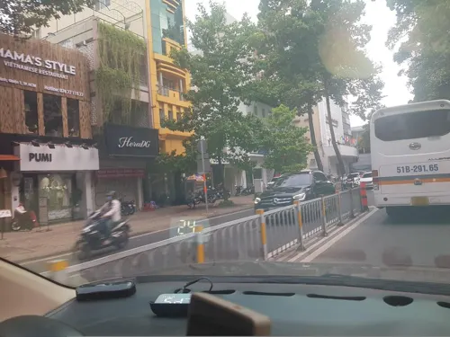
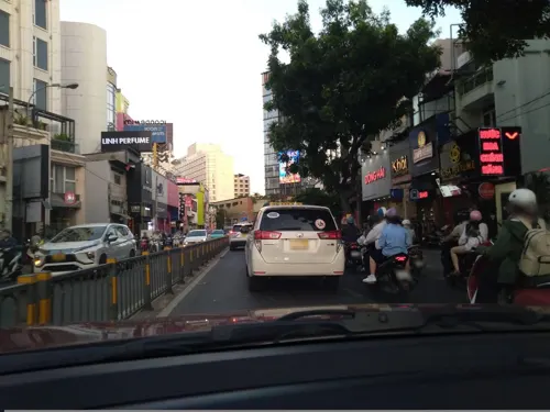
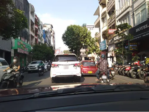
Cà Phê Nhà Hàng Journeys Sandwich
Restaurant · Sandwich · 0.9 km
21 Nguyễn Văn Tráng
Mo-Su 07:00-22:00


Highlands Coffee
Cafe · Coffee Shop, Vietnamese · 0.6 km
180 Nguyen Thi Minh Khai, Ho Chi Minh City
06:00-22:00
Phạm Nghiêm Trai
Restaurant · Sushi, Japanese, International · 1.0 km
199 Đường Nguyễn Trãi
Mo-Su 08:00-22:00


305 more on the map.
History
Established in December 1920, it was one of the first districts of Saigon.
From the History section of District 3, Ho Chi Minh City on Wikipedia, under CC BY-SA 4.0.
Where to stay141
Khách Sạn Saigon Backpackers - Cống Quỳnh
Motel and hotel · 1.0 km
200 Đường Cống Quỳnh, Ho Chi Minh City
Churches and places of worship25
Huyện Sỹ Church (St. Philip the Apostle)
Church · Catholic · 0.8 km
1 Tôn Thất Tùng
Congregation of the Most Holy Redeemer - Province of Vietnam
Church · Roman Catholic · 0.9 km
Shopping24
Co.opmart - Nguyễn Đình Chiểu
Grocery · 1.0 km
168 Nguyễn Ðình Chiểu, Ho Chi Minh City
Gas and EV charging7
Schools, colleges and libraries49
Healthcare15
Phòng Khám Đa Khoa Quốc Tế Yersin
Clinic and pharmacy · 0.6 km
10 Đường Trương Định, Thành Phố Hồ Chí Minh
Trạm Y tế phường Nhiêu Lộc
Clinic and pharmacy · 0.9 km
80/5 Hẻm 80 Bà Huyện Thanh Quan
Map of Quận Ba
250 places. The map loads OpenStreetMap tiles when you open it.
Getting there and nearby towns
Tan Son Nhat International Airport (SGN) is the nearest airport with scheduled flights listed in OpenStreetMap, 6 km away.
- Quận Mười 2 km west, about 2 min by car
- Quận Bốn 2 km southeast, about 2 min by car
- Quận Năm 3 km southwest, about 3 min by car
- Quận Mười Một 5 km west, about 5 min by car
- Gò Vấp 5 km north, about 5 min by car
- Quận Sáu 5 km southwest, about 5 min by car
- Ho Chi Minh City 8 km northwest, about 8 min by car
- Thủ Đức 12 km northeast, about 12 min by car
- Thuận An 17 km north, about 17 min by car
- Dĩ An 17 km northeast, about 17 min by car
Drive times are estimates from straight-line distance, not routes.
Local news
Headlines from INDB.
Reviews, tips and questions
Loading what members have shared...
Sources and licences
- GeoNames (CC BY 4.0): population, coordinates, regions and time zone
- Mapillary (see each image): photos
- OpenStreetMap contributors (ODbL 1.0): places, airports, map data
- Wikidata (CC0 1.0): elevation, founding date, time zone, website, landmarks and historic places
- Wikimedia Commons (see each image): photos
- Wikipedia (CC BY-SA 4.0): overview and history text
Photo credits
- Cầu Ba Son, TP.HCM, 042022, Prenn, CC BY-SA 4.0
- Bến Thành Theatre, Mickey Đại Phát, CC BY-SA 4.0
- Cầu Kiệu-Tân Định, Quận 1, TPHCM, Việt Nam - panoramio, trungydang, CC BY 3.0
- Nhà hát Hòa Bình, Nguyễn Thanh Quang, CC BY-SA 3.0
- PANO0002-Pano, Lê Minh Phát, CC BY 2.0
- Municipal Theatre of Ho Chi Minh City, 2023 (01), Bahnfrend, CC BY-SA 4.0
- Cauphumy17052009007, Nguoitaihinh, CC BY-SA 3.0
- Ho Chi Minh Museum, Saigon, Gary Todd, CC0
- Museum of Fine Arts, HCMC, thalling55, CC BY 2.0
- Vietnam History Museum HCMC, Nguyễn Thanh Quang, CC BY-SA 3.0
- Bảo tàng Thành phố Hồ Chí Minh 7, Bùi Thụy Đào Nguyên, CC BY-SA 3.0
- Vietnam-021-3rd-Field-front, Tucker Smallwood, CC BY 3.0
- Công Viên 23 Tháng 9 - Ho Chi Minh City, Vietnam - DSC01084, Daderot, CC0
- Tao Dan Park, Vano111ru, CC BY-SA 4.0
- April 30 Park (52680487582), Kevin Rutherford from United States, CC BY-SA 2.0
- Bách Tùng Diệp Park, Vano111ru, CC BY-SA 4.0
- Chi Lang Park, xiquinhosilva, CC BY 2.0
- Tàu lộn vòng siêu tốc, Công viên Đầm Sen, Prenn, CC BY-SA 3.0
- CV Lê Thị Riêng 2022 (giả sơn) (4), Phương Huy, CC BY-SA 4.0
- Le Van Tam park, TrungLH, CC BY 3.0
- Hồ nước ở Thảo Cầm Viên, Hoangvantoanajc, CC BY-SA 3.0
- Basílica de Nuestra Señora, Ciudad Ho Chi Minh, Vietnam, 2013-08-14, DD 03, Diego Delso, CC BY-SA 3.0
- Tân Định Church 20190922, Suicasmo, CC BY-SA 4.0
- HCMC Dai Hoc Kien Truc 01, Dragfyre, CC BY-SA 3.0
- HCMUT Library in main campus, Nguyen Chi Trung, CC BY-SA 1.0
- Ho Chi Minh City Pedagogical University August 30, 2018, Damian Vo, CC BY-SA 4.0
- Ho Chi Minh City Open University, Vano111ru, CC BY-SA 4.0
- War Remnants Museum, Christophe95, CC BY-SA 4.0
- 20190923 Independence Palace-10, Balon Greyjoy, CC0
- Mariamman Shrine HCMC, Dragfyre, CC BY-SA 3.0
- Instituto Le Quy Don, Ciudad Ho Chi Minh, Vietnam, 2013-08-14, DD 01, Diego Delso, CC BY-SA 3.0
- Nguyen Du Secondary School, Vano111ru, CC BY-SA 4.0
- Truong Nguyen thi minh khai q3. hcm - panoramio, trungydang, CC BY 3.0
- Nhà thờ huyện Sỹ ở HCM, Bùi Thụy Đào Nguyên, CC BY-SA 3.0
- Tượng đài thánh Mátthêu Lê Văn Gẫm, Bùi Thụy Đào Nguyên, CC BY-SA 3.0
- Ho Chi Minh City Dermatology Hospital, Vano111ru, CC BY-SA 4.0
- Benh vien Mat saigon - panoramio, trungydang, CC BY 3.0
- Independence Palace (9982462506), Gary Todd from Xinzheng, China, CC0
- Dinh Độc Lập vào nàm 2024, Yesvn123, CC BY-SA 4.0
- Trường Nguyễn thị Minh Khai, Ngô Trung, CC BY-SA 3.0
- Tu Du Maternity Hospital 01, Karel Bilek, CC BY-SA 4.0
- Ảnh Mặt Trước UTH, UTH-TV, CC0
- Hoang Van Thu Park, Duong Pham Photography, CC BY 2.0
- Tear Drop Monument and plaza at No. 1 Ly Thai To Park, Ho Chi Minh City - 2026, MagnaFine, CC BY-SA 4.0
- Street-level photo, bemaps1, CC BY-SA 4.0
- Street-level photo, sg_front_1, CC BY-SA 4.0
- Street-level photo, sg_front_1, CC BY-SA 4.0
- Street-level photo, bemaps1, CC BY-SA 4.0
- Street-level photo, sg_front_1, CC BY-SA 4.0
- Street-level photo, bemaps1, CC BY-SA 4.0
- Street-level photo, bemaps1, CC BY-SA 4.0
- Street-level photo, sg_front_1, CC BY-SA 4.0
- Street-level photo, bemaps1, CC BY-SA 4.0
- Street-level photo, sg_right_2, CC BY-SA 4.0
- Street-level photo, sg_right_1, CC BY-SA 4.0
- Street-level photo, bemaps1, CC BY-SA 4.0
- Street-level photo, sg_front_1, CC BY-SA 4.0
- Street-level photo, sg_front_1, CC BY-SA 4.0
- Street-level photo, bemaps1, CC BY-SA 4.0
- Street-level photo, bemaps1, CC BY-SA 4.0
- Street-level photo, VPTD, CC BY-SA 4.0
- Street-level photo, bemaps1, CC BY-SA 4.0
- Street-level photo, sg_front_1, CC BY-SA 4.0


Page built November 8, 2026. Spotted a mistake? Tell us or suggest a place.