


Thanh Hóa, Vietnam
Thanh Hóa is a regional capital of 850,000 people in Thanh Hóa Province, Vietnam.
Why visit Thanh Hóa
Townapedia lists 7 museums and landmarks, 7 parks and trails, 12 places to eat, 19 places to stay and 5 attractions in and around town.
Highlights include Thanh Hoa Bridge and Sân vận động Thanh Hóa.
Weather in Thanh Hóa
Forecast from MET Norway (CC BY 4.0). Full forecast
About Thanh Hóa
Thanh Hóa (Vietnamese: [tʰajŋ̟ hwǎː] ) is the capital of Thanh Hóa Province. The city is situated in the east of the province on the Ma River (Sông Mã), about 150 kilometers (93 miles) south of capital Hanoi and 1560 kilometers (969 miles) north of Ho Chi Minh City. Thanh Hoa became one of the most populous cities in North Central Coast after expanding in 2012, with a population of approximately 400,000. Thanh Hoa township was upgraded to Thanh Hoa City in 1994 and has been the historical center of politics, economy, culture, education and entertainment of Thanh Hóa Province.
From the Wikipedia article Thanh Hóa (city) (this version), under CC BY-SA 4.0.
Travel tips from other travellers: Thanh Hóa on Wikivoyage (CC BY-SA 4.0).
Things to do5


Museums and landmarks7


Parks, trails and playgrounds7


Restaurants and cafes12






Bánh Khoái Tép - Cô Tâm
Fast food · Vietnamese · 1.7 km
22 Đinh Lễ
Mo-Su 06:00-18:30
History
The Citadel of the Hồ Dynasty was the capital of the Trần dynasty from 1398 to 1400 and the Hồ dynasty from 1400 to 1407.
The Thanh Hóa town and region were an area of popular support for Lê Lợi and the Lê dynasty in the 1580s, leading to the reestablishment of the southern court near the town following the withdrawal of Ming dynasty armies. After 1945 the city was a stronghold of the Communist-led Viet Minh. In January 1946 the Viet Minh transported all local cells of the VNQDD to the city. During the Vietnam War, US strategic bombing destroyed much of the buildings and infrastructure; the whole city has been totally rebuilt since then.
From the History section of Thanh Hóa (city) on Wikipedia, under CC BY-SA 4.0.
Where to stay19
Dai Viet Hotel
Motel and hotel · 1.5 km
19 Phan Chu Trinh, Dien Bien Ward, Thanh Hoa, , Thanh Hóa
Churches and places of worship4
Shopping6
Gas and EV charging6
Schools, colleges and libraries24
Trường Trung học phổ thông chuyên Lam Sơn
School · 3.0 km
307 Đường Lê Lai
Trung tâm Giáo dục nghề nghiệp-Giáo dục thường xuyên huyện Đông Sơn
School · 5.2 km
Trung tâm Giáo dục Quốc phòng và An ninh - Trường Đại học Hồng Đức
School · 4.6 km
Healthcare18
Bệnh viện đa khoa Hợp Lực
Hospital · 3.4 km
595 Nguyễn Chí Thanh, P. Trường Thi, Thành phố Thanh Hóa, Thanh Hoá
Map of Thanh Hóa
108 places. The map loads OpenStreetMap tiles when you open it.
Getting there and nearby towns
Tho Xuan Airport (THD) is the nearest airport with scheduled flights listed in OpenStreetMap, 33 km away.
- Sầm Sơn 16 km southeast, about 16 min by car
- Nga Sơn 31 km northeast, about 31 min by car
- Bỉm Sơn 32 km north, about 32 min by car
- Thị Trấn Sao Vàng 33 km west, about 33 min by car
- Thị Trấn Bình Minh 38 km northeast, about 38 min by car
- Thị Trấn Vân Du 39 km north, about 39 min by car
- Thị Trấn Lam Sơn 40 km west, about 40 min by car
- Nghi Sơn 53 km south, about 53 min by car
- Hoa Lư 56 km northeast, about 56 min by car
- Hoàng Mai 59 km south, about 59 min by car
Drive times are estimates from straight-line distance, not routes.
Local news
Headlines from INDB.
Reviews, tips and questions
Loading what members have shared...
Sources and licences
- GeoNames (CC BY 4.0): population, coordinates, regions and time zone
- Mapillary (see each image): photos
- OpenStreetMap contributors (ODbL 1.0): places, airports, map data
- Wikidata (CC0 1.0): elevation, founding date, time zone, website, landmarks and historic places
- Wikimedia Commons (see each image): photos
- Wikipedia (CC BY-SA 4.0): overview and history text
Photo credits
- Sa Majesté Bao-Daï fit le pèlerinage aux Tombeaux des ancêtres de la Dynastie à Thanh-Hóa, 1932, Unknown author Unknown author, Public domain
- Meliá Vinpearl Thanh Hóa, Bùi Lê Việt Cường, CC BY-SA 4.0
- Ham Rong Bridge, Rolers.FTU, CC BY-SA 3.0
- Camandbi, CamCat138, CC BY-SA 4.0
- Nokia 105 (2019) (Clock), Dienthoaiquangcao96, CC BY-SA 4.0
- Nokia 105 (2019) (Clock) (Message), Dienthoaiquangcao96, CC BY-SA 4.0
- Nokia 105 (2019), Dienthoaiquangcao63, CC BY-SA 4.0
- Masstel IZI 112, AnVuong1222004, CC BY-SA 4.0
- Nokia 105 (2017) Dual SIM (Clock) (Messeage), Dienthoaiquangcao89, CC BY-SA 4.0
- Nokia 6700 classic, Dienthoaiquangcao3, CC BY-SA 4.0
- Nokia 105 (2017), Khanhlong566 (Cutout by Dienthoaiquangcao63 ), CC BY-SA 4.0
- Samsung Galaxy J7 (2017), Dienthoaiquangcao96, CC BY-SA 4.0
- Nokia 105 (2017) Dual SIM (Clock), Dienthoaiquangcao89, CC BY-SA 4.0
- Nokia 105 (2017) Dual SIM, Dienthoaiquangcao84, CC BY-SA 4.0
- Samsung Galaxy J2 Prime, Dienthoaiquangcao63, CC BY-SA 4.0
- Philips Xenium E160, AnVuong1222004, CC BY-SA 4.0
- Philips Xenium E160, Khanhlong566, CC BY-SA 4.0
- Nokia 105 2017, Khanhlong566, CC BY-SA 4.0
- Samsung Galaxy J2 Prime, Dienthoaiquangcao60, CC BY-SA 4.0
- Oppo F11 Pro (1), Dienthoaiquangcao2, CC BY-SA 4.0
- Oppo F11 Pro (3), Dienthoaiquangcao2, CC BY-SA 4.0
- Oppo F11 Pro (2), Dienthoaiquangcao2, CC BY-SA 4.0
- Sony remote RM-GA016, Khanhlong566, CC BY-SA 4.0
- Casio DX-120B, AnVuong1222004 (10), CC BY-SA 4.0
- Nokia 150, Dienthoaiquangcao75, CC BY-SA 4.0
- Samsung Galaxy A7 (2018), Dienthoaiquangcao62, CC BY-SA 4.0
- Nokia 6700 Classic, Dienthoaiquangcao62, CC BY-SA 4.0
- Nokia 230 rear, Khanhlong566, CC BY-SA 4.0
- Lenovo IdeaPad 320, Dienthoaiquangcao59, CC BY-SA 4.0
- Nokia 220, Dienthoaiquangcao59, CC BY-SA 4.0
- Nokia 105 (2019), Dienthoaiquangcao63, CC BY-SA 4.0
- Sony Xperia L1, Dienthoaiquangcao62, CC BY-SA 4.0
- Nokia 150 (2020), AnVuong1222004 (2), CC BY-SA 4.0
- Nokia 220, Dienthoaiquangcao84, CC BY-SA 4.0
- Nokia 230, Dienthoaiquangcao84, CC BY-SA 4.0
- Viettel V6214, Dienthoaiquangcao63, CC BY-SA 4.0
- Nokia 1, Dienthoaiquangcao63, CC BY-SA 4.0
- Masstel A235, AnVuong1222004, CC BY-SA 4.0
- Samsung Galaxy A7 (2018), Dienthoaiquangcao89, CC BY-SA 4.0
- Viettel V6214, Dienthoaiquangcao60, CC BY-SA 4.0
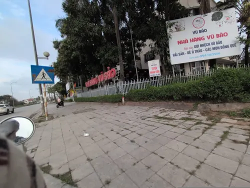
- Street-level photo, JeushsUUZhenw, CC BY-SA 4.0


Page built November 8, 2026. Spotted a mistake? Tell us or suggest a place.