


Why visit Yên Bái
Townapedia lists 2 museums and landmarks, 4 parks and trails, 10 places to eat, 8 places to stay and 1 attraction in and around town.
Weather in Yên Bái
Forecast from MET Norway (CC BY 4.0). Full forecast
About Yên Bái
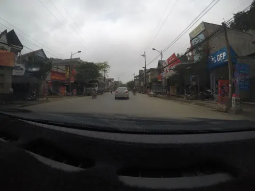
Yên Bái () is a former city in Vietnam. It was located in the province of Yen Bai, in the north-east region of Vietnam. The city bordered the former districts of Yên Bình District and Trấn Yên District. The city was a settlement along the banks of the Red River, approximately 183 km northwest of Hanoi.
From the Wikipedia article Yên Bái (city) (this version), under CC BY-SA 4.0.
Things to do1

Museums and landmarks2


Parks, trails and playgrounds4

Bảo tàng Lào Cai
Park
Thứ Năm 08:00–11:00 14:00–16:30 Thứ Sáu 08:00–11:00 14:00–16:30...

Youth Stadium of Yen Bai city
Sports field and stadium · 0.7 km
Training stadium for students of Yen Bai Sports and Phisical Training College.
Ngô Gia Tự, Yên Bái
Restaurants and cafes10

Bun Hue O Thanh
Restaurant · Vietnamese · 5.1 km
414 Nguyễn Thái Học
Mo-Su 06:00-20:00

Bamboo Coffee
Cafe · Cafe
Thứ Năm 07:00–22:30 Thứ Sáu 07:00–22:30 Thứ Bảy 07:00–22:30 ...



History
At the end of the sixteenth century Yên Bái was a small village in Bach Lam district, Quy Hoa district, Hung Hoa province. On April 11, 1900, Yen Bai province was established by the French colonialist government. The city grew in size with the opening of the Hanoi–Lào Cai railway, which attracted many migrants.
On February 10, 1930, part of the 4th Regiment of Tonkinese Rifles stationed at Yen Bai mutinied against their French officers in the Yên Bái mutiny. They were suppressed by loyal troops from the same unit. This incident led to widespread disturbances against French rule across northeastern Vietnam during 1930–31.
On July 1, 2025, as per the plan to arrange and merge administrative units in Vietnam, Yên Bái province and Lào Cai province merged to become the new Lào Cai province. In addition to the merge, due to the disestablishment of the "provincial city" tier according to the plan, the capital of Yên Bái province, Yên Bái city was disbanded. The former Yên Bái city was divided into 4 wards: Yên Bái ward, Văn Phú ward, Nam Cường ward and Âu Lâu ward.
Yên Bái ward is currently the new capital of the new Lào Cai province.
From the History section of Yên Bái (city) on Wikipedia, under CC BY-SA 4.0.
Where to stay8
Shopping2
Gas and EV charging2
Schools, colleges and libraries9
Trường Phổ thông Dân tộc nội trú Trung học phổ thông tỉnh Yên Bái
School · 1.6 km
Healthcare7
Map of Yên Bái
45 places. The map loads OpenStreetMap tiles when you open it.
Getting there and nearby towns
Na San Airport (SQH) is the nearest airport with scheduled flights listed in OpenStreetMap, 107 km away.
- Thị Trấn Yên Bình 5 km east, about 5 min by car
- Lương Bằng 15 km southeast, about 15 min by car
- Nông Trường Trần Phú 33 km southwest, about 33 min by car
- Tuyên Quang 33 km east, about 33 min by car
- Phương Linh 34 km southeast, about 34 min by car
- Thị Trấn Tân Yên 40 km north, about 40 min by car
- Nghĩa Lộ 43 km west, about 43 min by car
- Phú Thọ 48 km southeast, about 48 min by car
- Việt Trì 67 km southeast, about 1 h by car
- Cổ Đô 68 km southeast, about 1 h 15 min by car
Drive times are estimates from straight-line distance, not routes.
Local news
Headlines from INDB.
Reviews, tips and questions
Loading what members have shared...
Sources and licences
- GeoNames (CC BY 4.0): population, coordinates, regions and time zone
- Mapillary (see each image): photos
- OpenStreetMap contributors (ODbL 1.0): places, airports, map data
- Wikidata (CC0 1.0): elevation, founding date, time zone, website
- Wikimedia Commons (see each image): photos
- Wikipedia (CC BY-SA 4.0): overview and history text
Photo credits
- Một góc TP.Yên Bái, vi:User:ASM~viwiki, CC BY-SA 3.0
- Đồng Tâm, tp. Yên Bái, Yên Bái, Vietnam - panoramio, Tiên Ông, CC BY-SA 3.0
- ISS065-E-348295 - View of Earth, Earth Science and Remote Sensing Unit , Lyndon B. Johnson Space Center, Public domain
- Derolus blaisei Pic, 1923, URSchmidt, CC BY-SA 4.0
- Lophyra striolata striolata (Illiger, 1800), Udo Schmidt from Deutschland, CC BY-SA 2.0
- Blabephorus pinguis Fairmaire, 1898 Female (32487392731), Udo Schmidt from Deutschland, CC BY-SA 2.0
- Trichogomphus rongi Dechambre & Drumont, 2000 Male (34540126341), Udo Schmidt from Deutschland, CC BY-SA 2.0
- Stromatium longicorne (Newman, 1842) (3378445081), Udo Schmidt from Deutschland, CC BY-SA 2.0
- Prosopocoilus suturalis (Olivier, 1789) male (3979391891) (2), Udo Schmidt from Deutschland, CC BY-SA 2.0
- Megopis marginalis (Fabricius, 1775) (3406169417) (2), Udo Schmidt from Deutschland, CC BY-SA 2.0
- Prosopocoilus suturalis (Olivier, 1789) male (3979391891), Udo Schmidt from Deutschland, CC BY-SA 2.0
- Megopis marginalis (Fabricius, 1775) (3406169417), Udo Schmidt from Deutschland, CC BY-SA 2.0
- Rhaphipodus fruhstorferi Lameere, 1903 (3214659219), Udo Schmidt from Deutschland, CC BY-SA 2.0
- Aegus chelifer chelifer MacLeay, 1819 female (3034370757), Udo Schmidt from Deutschland, CC BY-SA 2.0
- Aegus chelifer chelifer MacLeay, 1819 male (3034369651), Udo Schmidt from Deutschland, CC BY-SA 2.0
- Megopis sinica (White, 1853) (3926918342), Udo Schmidt from Deutschland, CC BY-SA 2.0
- Prosopocoilus forficula nakamurai Mizunuma, 1994 (3212600598) (2), Udo Schmidt from Deutschland, CC BY-SA 2.0
- Prosopocoilus forficula nakamurai Mizunuma, 1994 (3212600598), Udo Schmidt from Deutschland, CC BY-SA 2.0
- Priotyrannus closteroides (Thomson, 1877) (3052932896), Udo Schmidt from Deutschland, CC BY-SA 2.0
- Dorysthenes granulosus (Thomson, 1860) (3248393214) (2), Udo Schmidt from Deutschland, CC BY-SA 2.0
- Dorysthenes granulosus (Thomson, 1860) (3248393214), Udo Schmidt from Deutschland, CC BY-SA 2.0
- Hoplocerambyx spinicornis (Newman, 1842) male (3934675836), Udo Schmidt from Deutschland, CC BY-SA 2.0
- Hoplocerambyx spinicornis (Newman, 1842) male (3934675836) (2), Udo Schmidt from Deutschland, CC BY-SA 2.0
- Callirhipis tonkinea Pic, 1907 (35751365483), Udo Schmidt from Deutschland, CC BY-SA 2.0
- Didrepanephorus anthracinus (Ohaus) (32443658361), Udo Schmidt from Deutschland, CC BY-SA 2.0
- Prosopocoilus spineus (Didier, 1927) male (3934675514) (2), Udo Schmidt from Deutschland, CC BY-SA 2.0
- Street-level photo, 24dakenlo, CC BY-SA 4.0


Page built November 8, 2026. Spotted a mistake? Tell us or suggest a place.