


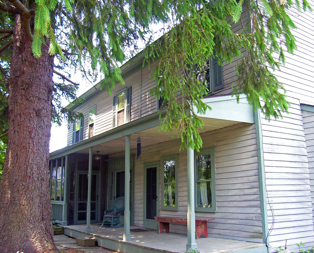
Washington Heights, New York
Washington Heights is a community of 2,383 people in Orange County, New York.
Why visit Washington Heights
Townapedia lists 5 museums and landmarks, 9 parks and trails, 27 places to eat, 2 places to stay and 1 attraction in and around town.
Highlights include Oliver Avenue Bridge, Hillside Cemetery and John Tears Inn.
July is the warmest month, with average highs of 82°F; January lows average 18°F.
Weather in Washington Heights
Forecast from the National Weather Service. Full forecast
About Washington Heights
Washington Heights is a census-designated place (CDP) in Orange County, New York, United States. The population was 2,205 at the 2020 census.
From the Wikipedia article Washington Heights, New York (this version), under CC BY-SA 4.0.
Things to do1

Oliver Avenue Bridge
Bridge · National Register of Historic Places · 1.8 mi
Historic railroad bridge in New York, United States
Museums and landmarks5

Hillside Cemetery
Monument and historic site · National Register of Historic Places · 2.4 mi
Cemetery in Middletown, New York
John Tears Inn
Monument and historic site · National Register of Historic Places · 2.7 mi
Hotel in the USA

New York, Ontario & Western Railway Company Middletown Station
Monument and historic site · National Register of Historic Places · 1.5 mi
Historic railway station in New York, USA built in the 1890's

Paramount Theatre
Monument and historic site · National Register of Historic Places · 2.1 mi
Movie theater in Middletown, Orange County, New York, United States


Webb Horton House
Monument and historic site · National Register of Historic Places · 2.6 mi
Historic house in New York, United States
Parks, trails and playgrounds9


Restaurants and cafes27

Maddy's Diner
Restaurant · American, Diner · 0.8 mi
439 Route 17M, Middletown
Mo-Tu 05:30-18:00, We-Sa 05:30-20:00; Su 07:00-17:00

Family Farm Ice Cream
Ice cream · 1.5 mi
Open year-round.
253 Tower Drive, Middletown
Th 15:00-20:00; Fr-Sa 12:00-21:00; Su 12:00-20:00

Daddy's Donuts
Bakery · 1.5 mi
Founded as Daddy's Donuts. Guilio closed it to avoid alimony payments after a divorce, then reopened the store as Daddy's Bakery.
4 Fairlawn Avenue, Middletown
Th-Su 07:00-17:00
Bella Lena's Restaurant & Pizzeria
Restaurant · Pizza · 0.5 mi
511 Route 17M, Middletown
15 more on the map.
Where to stay2
Churches and places of worship9
Christ Church
Church · National Register of Historic Places · 2.0 mi
First Congregational Church of Middletown
Church · National Register of Historic Places · 2.0 mi
Grace Episcopal Church
Church · National Register of Historic Places · 2.0 mi
Shopping4
Gas and EV charging8
Schools, colleges and libraries10
Healthcare2
Neighbor Pharmacy
Clinic and pharmacy · 1.5 mi
331 State Route 211 East, Middletown
Map of Washington Heights
77 places. The map loads OpenStreetMap tiles when you open it.
Climate by month
Monthly table
| Month | High | Low | Rain |
|---|---|---|---|
| Jan | 34°F | 18°F | 2.6 in |
| Feb | 37°F | 18°F | 2.1 in |
| Mar | 47°F | 26°F | 3.0 in |
| Apr | 60°F | 38°F | 4.0 in |
| May | 70°F | 48°F | 3.8 in |
| Jun | 78°F | 57°F | 4.6 in |
| Jul | 82°F | 62°F | 4.2 in |
| Aug | 81°F | 60°F | 4.5 in |
| Sep | 73°F | 53°F | 4.3 in |
| Oct | 62°F | 43°F | 4.5 in |
| Nov | 50°F | 33°F | 3.2 in |
| Dec | 39°F | 24°F | 3.5 in |
U.S. Climate Normals 1991-2020 for Middletown 2 Nw (2 mi away), NOAA NCEI.
People and cost of living
American Community Survey 5-year estimates, 2020-2024, U.S. Census Bureau. Estimates have margins of error, larger for small towns.
Disaster history
Orange County has had 26 federal disaster declarations since 2000, most often for severe storms.
- 2024-11-15: Jennings Creek Fire (Fire)
- 2023-07-22: Severe Storms And Flooding (Severe Storm)
- 2021-09-05: Remnants Of Hurricane Ida (Hurricane)
- 2021-09-02: Remnants Of Hurricane Ida (Hurricane)
- 2021-08-22: Hurricane Henri (Hurricane)
- 2020-03-20: Covid-19 Pandemic (Biological)
OpenFEMA disaster declarations summaries.
Getting there and nearby towns
Orange County Airport (MGJ) is the nearest airport with scheduled flights listed in OpenStreetMap, 8 miles away.
- Middletown 2 mi south, about 3 min by car
- Mechanicstown 2 mi southeast, about 3 min by car
- Scotchtown 2 mi east, about 4 min by car
- Goshen 7 mi southeast, about 11 min by car
- Otisville 7 mi west, about 11 min by car
- Wurtsboro 8 mi northwest, about 13 min by car
- Montgomery 10 mi east, about 15 min by car
- Maybrook 10 mi east, about 17 min by car
- Florida 10 mi south, about 17 min by car
- Chester 11 mi southeast, about 17 min by car
Drive times are estimates from straight-line distance, not routes.
Local news
Headlines from INDB, the NEMICO news database.
Reviews, tips and questions
Loading what members have shared...
Sources and licences
- NCES EDGE (Public domain): public schools
- NOAA NCEI U.S. Climate Normals 1991-2020 (Public domain): climate by month
- OpenFEMA (Public domain): disaster declarations
- OpenStreetMap contributors (ODbL 1.0): places, airports, map data
- U.S. Census Bureau (Public domain): population, income, housing, education, commute
- Wikidata (CC0 1.0): elevation, founding date, time zone, website, landmarks and historic places
- Wikimedia Commons (see each image): photos
- Wikipedia (CC BY-SA 4.0): overview and history text
Photo credits
- Church in Middletown, New York, Doug Kerr, CC BY-SA 2.0
- First Congregationalist Church of Middletown, Daniel Case, CC BY-SA 3.0
- Former O&W station, Middletown, NY, Daniel Case, CC BY-SA 3.0
- Morrison Hall, SUNY Orange, Middletown, NY, Daniel Case, CC BY-SA 3.0
- Paramount Theatre, Middletown, NY, Daniel Case, CC BY-SA 3.0
- John Tears Inn, The original uploader was Daniel Case at English Wikipedia ., CC BY-SA 3.0
- Hillside Cemetery, Middletown, NY 2, Daniel Case, CC BY-SA 3.0
- NY 17M wb approaching Highland Avenue, Wallkill, June 2026, Mr. Matté (if there is an issue with this image, contact me using this image's Commons talk page , my Commons user talk page , or my English Wikipedia user talk page ; I'll know about it a lot faster), CC BY-SA 4.0
- NY 17M wb approaching NY 302, June 2026, Mr. Matté (if there is an issue with this image, contact me using this image's Commons talk page , my Commons user talk page , or my English Wikipedia user talk page ; I'll know about it a lot faster), CC BY-SA 4.0
- Acura Legend L (1992) (53652203039), Charles from Port Chester, New York, CC BY 2.0
- Porsche Boxster S (2000) (53645019577), Charles from Port Chester, New York, CC BY 2.0
- Toyota 4Runner TRD Off-Road (2024) (53646352685), Charles from Port Chester, New York, CC BY 2.0


Page built October 30, 2026. Spotted a mistake? Tell us or suggest a place.