


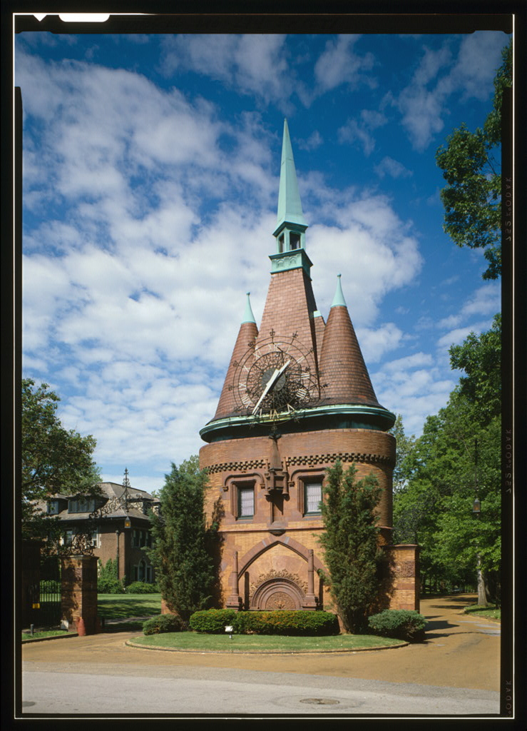


Why visit Wellston
Townapedia lists 54 museums and landmarks, 33 parks and trails, 61 places to eat, 2 places to stay and 12 attractions in and around town.
Highlights include 24:1 Cinema, Beverly Theater, A & P Food Stores Building and Bel Air Motel.
July is the warmest month, with average highs of 90°F; January lows average 25°F.
Weather in Wellston
Forecast from the National Weather Service. Full forecast
About Wellston
Wellston is a city in St. Louis County, Missouri, United States, along the northwest border of the city of St. Louis. As of the 2020 census, Wellston had a population of 1,537.
From the Wikipedia article Wellston, Missouri (this version), under CC BY-SA 4.0.
Things to do12


Beverly Theater
Cinema and theater · National Register of Historic Places · 2.3 mi
Former movie theater in University City, St. Louis County, Missouri, United States

Arts and Sciences at Washington University in St. Louis
School · 2.0 mi
Schools at Washington University in St. Louis
Concordia Seminary
School · 2.7 mi
Postsecondary institution to train pastors and church workers of the Lutheran Church-Missouri Synod
Douglass University
School · 3.0 mi
American black university in St. Louis
Fontbonne University
School · 2.5 mi
Private university in Clayton, Missouri
St. Louis Municipal Opera Theatre
Cinema and theater · 2.5 mi
Open-air theater in St. Louis, Missouri

U City Farmers
Farm and orchard · 1.4 mi
6655 Delmar Boulevard
Apr-Nov Sa 08:30-12:30;Sa 08:30-12:30;We 16:00-19:00
Washington University in St. Louis
School · 2.0 mi
Private research university in St. Louis, Missouri, United States
Washington University School of Dental Medicine
School · 3.2 mi
Dental school in St. Louis, Missouri, US
Museums and landmarks54

A & P Food Stores Building
Monument and historic site · National Register of Historic Places · 1.4 mi
United States historic place

Bel Air Motel
Monument and historic site · National Register of Historic Places · 2.9 mi
Historic building in St. Louis, Missouri

Butler House
Monument and historic site · National Register of Historic Places · 3.1 mi
Historic house in Missouri, United States

Carrswold Historic District
Monument and historic site · National Register of Historic Places · 2.8 mi
Historic district in Clayton, Missouri, USA

Chase Park Plaza Hotel
Monument and historic site · National Register of Historic Places · 2.7 mi
Building in Missouri, United States

Delmar Loop–Parkview Gardens Historic District
Monument and historic site · National Register of Historic Places · 1.4 mi
University City, Missouri, listed on the NRHP in Missouri

DeMun
Monument and historic site · National Register of Historic Places · 2.7 mi
Human settlement in St. Louis, Missouri, United States of America

Dr. Herman S. Dreer House
Monument and historic site · National Register of Historic Places · 3.0 mi
House in St. Louis, Missouri

Emmanuel DeHodiamont House
Monument and historic site · National Register of Historic Places · 1.0 mi
Historic house in Missouri, United States

Forest Park Hotel
Monument and historic site · National Register of Historic Places · 2.9 mi
Hotel in St. Louis, United States of America

Greenwood Cemetery
Monument and historic site · National Register of Historic Places · 1.0 mi
Historic cemetery in Hillsdale, Missouri


Hamilton Place Historic District
Monument and historic site · National Register of Historic Places · 1.2 mi
Historic district in Missouri, United States
42 more on the map.
Parks, trails and playgrounds33

Forest Park
Park · 2.5 mi
Large city park in St. Louis, Missouri, United States
Turtle Park
Park · 3.0 mi
Park in St. Louis, United States of America
21 more on the map.
Restaurants and cafes61



Brew Bites
Restaurant · Sandwich · 1.5 mi
6662 B Delmar Boulevard
Mo-Fr 07:00-20:30; Sa-Su 09:00-20:30
Corner 17
Restaurant · Chinese, Bubble Tea · 1.5 mi
6623 Delmar Boulevard, University City
Su-Mo, We-Th 11:00-21:00; Fr-Sa 11:00-22:00
Dumpling Plus
Restaurant · Chinese · 1.4 mi
6335 Delmar Boulevard
Su-Th 11:00-21:00; Fr-Sa 11:00-22:00
El Maguey Mexican Restaurant
Restaurant · Mexican · 1.4 mi
6333 Delmar Boulevard, University City
Mo-Th 11:00-21:00; Fr-Sa 11:00-22:00; Su 12:00-21:00

Hitea
Cafe · Asian, Bubble Tea, Japanese · 1.5 mi
6677 Delmar Boulevard
Mo-Th 11:00-21:00; Fr-Su 11:30-21:00
Sakatanoya
Restaurant · Japanese, Sushi · 1.5 mi
6683 Delmar Boulevard
Mo-Fr 11:00-15:00, 17:00-21:00; Sa-Su 12:00-21:00
49 more on the map.
History
Wellston was incorporated as a city in 1909. Due to "government difficulties" the city was dissolved three years later, becoming an unincorporated place in Central Township, only to be reestablished as a city in 1949. The city was named for Erastus Wells.
During the early 1900s, the Wagner Electric Company, a manufacturer of small motors for appliances and transformers, began development along Plymouth Avenue in Wellston, growing to occupy the entire block and providing 4,500 jobs during World War I. North of the Wagner site, ABEX Corporation built a steel foundry that began operation in 1923.
In 1982 ABEX moved out of its Wellston location; the next year, the Wagner Electric Company closed its doors. After closure, it took 22 years, and millions of dollars in tax credits and development grants, for the St. Louis County Economic Council to demolish five buildings and clean up 15 acres (6.1 ha) of the Wagner brownfield land along the MetroLink so that it could be made marketable as the Plymouth Industrial Park.
From the History section of Wellston, Missouri on Wikipedia, under CC BY-SA 4.0.
Where to stay2
Churches and places of worship60
Antioch Baptist Church
Church · National Register of Historic Places · 3.2 mi
Assumption Greek Orthodox Church
Church · National Register of Historic Places · 1.6 mi
Second Presbyterian Church
Church · National Register of Historic Places · 2.8 mi
Bracy Chapel Christian Methodist Episcopal Church;Bracy Chapel
Church · Methodist · 1.1 mi
Friendship Missionary Baptist Church
Church · Baptist · 1.1 mi
5597 Etzel Avenue, Saint Louis
Jerusalem Missionary Baptist Church
Church · Baptist · 1.1 mi
5596 Ridge Avenue, Saint Louis
Kingdom Hall of Jehovah's Witnesses
Church · Jehovahs Witness · 1.4 mi
5930 Delmar Boulevard, Saint Louis
Life of Jericho Baptist Church
Church · Baptist · 1.5 mi
5429 Saint Louis Avenue, Saint Louis
Mount Bethel Missionary Baptist Church
Church · Baptist · 1.2 mi
1600 Belt Avenue, St. Louis
Shopping6
Gas and EV charging2
Schools, colleges and libraries55
Normandy High School
School · 0.6 mi
Saint Charles Rock Road, Saint Louis
Brentwood Early Childhd Center
School · 5.1 mi
2350 St. Clair Ave - Suite B, Brentwood
Healthcare4
People's Health Centers
Clinic and pharmacy · 1.5 mi
5701 Delmar Boulevard, Saint Louis
Map of Wellston
250 places. The map loads OpenStreetMap tiles when you open it.
Climate by month
Monthly table
| Month | High | Low | Rain |
|---|---|---|---|
| Jan | 41°F | 25°F | 2.7 in |
| Feb | 46°F | 28°F | 2.3 in |
| Mar | 56°F | 38°F | 3.6 in |
| Apr | 68°F | 48°F | 4.8 in |
| May | 77°F | 59°F | 4.9 in |
| Jun | 86°F | 67°F | 4.7 in |
| Jul | 90°F | 72°F | 4.2 in |
| Aug | 88°F | 70°F | 3.8 in |
| Sep | 82°F | 62°F | 3.4 in |
| Oct | 70°F | 50°F | 3.2 in |
| Nov | 56°F | 39°F | 3.7 in |
| Dec | 45°F | 30°F | 2.6 in |
U.S. Climate Normals 1991-2020 for St Louis Sci Ctr (3 mi away), NOAA NCEI.
People and cost of living
American Community Survey 5-year estimates, 2020-2024, U.S. Census Bureau. Estimates have margins of error, larger for small towns.
Disaster history
St. Louis County has had 23 federal disaster declarations since 2000, most often for severe storms.
- 2025-06-09: Severe Storms, Straight-Line Winds, Tornadoes, And Flooding (Severe Storm)
- 2025-05-21: Severe Storms, Straight-Line Winds, Tornadoes, And Wildfires (Severe Storm)
- 2022-08-08: Severe Storms And Flooding (Flood)
- 2020-03-26: Covid-19 Pandemic (Biological)
- 2020-03-13: Covid-19 (Biological)
- 2017-06-02: Severe Storms, Tornadoes, Straight-Line Winds And Flooding (Flood)
OpenFEMA disaster declarations summaries.
Getting there and nearby towns
St. Louis Lambert International Airport (STL) is the nearest airport with scheduled flights listed in OpenStreetMap, 7 miles away.
- Pagedale 1 mi northwest, about 1 min by car
- Velda City 1 mi north, about 2 min by car
- Pine Lawn 2 mi northeast, about 3 min by car
- University City 2 mi west, about 3 min by car
- Hanley Hills 2 mi northwest, about 3 min by car
- Bel-Nor 2 mi northwest, about 3 min by car
- Pasadena Hills 2 mi north, about 4 min by car
- Clayton 3 mi southwest, about 5 min by car
- Vinita Park 3 mi west, about 4 min by car
- St. Louis 4 mi southeast, about 6 min by car
Drive times are estimates from straight-line distance, not routes.
Local news
Headlines from INDB, the NEMICO news database.
Reviews, tips and questions
Loading what members have shared...
Sources and licences
- NCES EDGE (Public domain): public schools
- NOAA NCEI U.S. Climate Normals 1991-2020 (Public domain): climate by month
- OpenFEMA (Public domain): disaster declarations
- OpenStreetMap contributors (ODbL 1.0): places, airports, map data
- U.S. Census Bureau (Public domain): population, income, housing, education, commute
- Wikidata (CC0 1.0): elevation, founding date, time zone, website, landmarks and historic places
- Wikimedia Commons (see each image): photos
- Wikipedia (CC BY-SA 4.0): overview and history text
Photo credits
- Wellston, Missouri - 1, Paul Sableman, CC BY 2.0
- Joseph Erlanger House, St. Louis, Missouri, Unknown author Unknown author, Public domain
- Washington terrace gate st. louis, Jack Boucher, Public domain
- STL The Ville 01, Onegentlemanofverona, CC BY 3.0
- WUBrook, Endersan, Public domain
- Forest Park Hotel, Jeffrey Beall, CC BY-SA 3.0
- Beverly Theater, Gavreh, CC BY-SA 3.0
- Antioch Baptist Church (St. Louis, Missouri), LittleT889, CC BY-SA 4.0
- St. Vincent's Hospital, LittleT889, CC BY-SA 4.0
- DeMun Avenue Night Aug 2012, Husgen, CC BY-SA 3.0
- Delmar Loop - Parkview Gardens Historic District, Liezl Moss, CC BY-SA 3.0
- Dr. Herman S. Dreer House, LittleT889, CC BY-SA 4.0
- St. Louis Colored Orphans Home, LittleT889, CC BY-SA 4.0
- Butler House - Central West End, St. Louis MO, Gavreh, CC BY-SA 3.0
- St Louis 2nd Presby PHS1035, Unknown author Unknown author, Public domain
- Shelley house lg, FrancisNancy, CC BY 3.0
- JewelBox2013, Marcus Qwertyus, CC BY-SA 3.0
- Greenwood Cemetery Entrance Pillar, Bb vc2254, CC BY-SA 4.0
- Portland Place, St Louis, LittleT889, CC BY-SA 4.0
- Sutter-Meyer House Current, Bmatthewshea, CC BY-SA 3.0
- Parkview Historic District, LittleT889, CC BY-SA 4.0
- Art deco building, Matthew Hurst from Brooklyn, NY, USA, CC BY-SA 2.0
- Chase Park Plaza, Josh, CC BY-SA 2.0
- Charles Sumner High School, Kenneth M Burke at English Wikipedia, Public domain
- Emmanuel DeHodiamont House, LittleT889, CC BY-SA 4.0
- Cool House on Enright, Paul Sableman, CC BY 2.0
- Assumption Greek Orthodox Church (corner view), Liezl Moss, CC BY-SA 3.0
- Kate Chopin House (St. Louis, Missouri), LittleT889, CC BY-SA 4.0
- Wydown-Forsyth District, Jon Roanhaus, CC BY-SA 3.0
- Westminster Place Entrance, Gavreh, CC BY-SA 3.0
- Bel Air Model, Gavreh, CC BY-SA 3.0
- Tandy Community Center, Paul Sableman, CC BY 2.0
- Simmons Colored School, LittleT889, CC BY-SA 4.0


Page built October 30, 2026. Spotted a mistake? Tell us or suggest a place.