


Why visit West Columbia
Townapedia lists 24 museums and landmarks, 7 parks and trails, 17 places to eat and 3 places to stay in and around town.
Highlights include Ammon Underwood House, Columbia Historical Museum Association, San Bernard National Wildlife Refuge and Varner–Hogg Plantation State Historical Site.
August is the warmest month, with average highs of 92°F; January lows average 47°F.
Weather in West Columbia
Forecast from the National Weather Service. Full forecast
About West Columbia
West Columbia is a city in Brazoria County, Texas, United States. The city is centered on the intersection of Texas Highways 35 & 36, 55 miles (89 km) southwest of downtown Houston. The population was 3,644 at the 2020 census.
From the Wikipedia article West Columbia, Texas (this version), under CC BY-SA 4.0.
Museums and landmarks24

Ammon Underwood House
Monument and historic site · National Register of Historic Places · 1.9 mi
Historic place in East Columbia, Brazoria County, Texas


12 more on the map.
Parks, trails and playgrounds7



Varner–Hogg Plantation State Historical Site
Park · National Register of Historic Places · 1.6 mi
Human settlement in Texas, United States of America


West Columbia Independent School District Football Stadium
Sports field and stadium
Restaurants and cafes17


Kate’s Coffee, Tea, & More
Cafe
421 South 17th Street, West Columbia
Mo-Fr 07:00-16:00; Sa 09:00-14:00


Sonic
Fast food · Burger · 0.4 mi
730 South Columbia Drive, West Columbia
Mo-Fr 06:00-23:00; Sa-Su 07:00-23:00
5 more on the map.
Where to stay3

Americas Best Value Inn
Motel and hotel · 0.4 mi
714 South Columbia Drive, West Columbia
History
Columbia was established in 1826 by Josiah Hughes Bell when the town was laid out two miles west of Marion, later known as East Columbia. Columbia served as the capital of the Republic of Texas from September 1836 until the government relocated to Houston in April 1837. The town hosted the First Congress of the Republic of Texas, which convened on October 3, 1836; Sam Houston was inaugurated as president on October 22. The House of Representatives convened in a two-story frame house, while the Senate met in a smaller house. On November 30, 1836, Congress convened in joint session and chose to relocate the seat of government to Houston, citing Columbia’s inadequate accommodations for government personnel. President Houston ordered the move on December 15. On December 27, 1836, Secretary of State Stephen F. Austin died at the home of George B. McKinstry in Columbia.
From the History section of West Columbia, Texas on Wikipedia, under CC BY-SA 4.0.
Shopping2
Gas and EV charging5
Schools, colleges and libraries6
Healthcare2
Map of West Columbia
66 places. The map loads OpenStreetMap tiles when you open it.
Climate by month
Monthly table
| Month | High | Low | Rain | Snow |
|---|---|---|---|---|
| Jan | 64°F | 47°F | 4.2 in | 0.0 in |
| Feb | 68°F | 51°F | 2.8 in | 0.0 in |
| Mar | 72°F | 56°F | 3.2 in | 0.0 in |
| Apr | 77°F | 62°F | 3.6 in | 0.0 in |
| May | 84°F | 70°F | 4.2 in | 0.0 in |
| Jun | 89°F | 75°F | 5.4 in | 0.0 in |
| Jul | 91°F | 76°F | 4.4 in | 0.0 in |
| Aug | 92°F | 76°F | 5.1 in | 0.0 in |
| Sep | 88°F | 73°F | 6.8 in | 0.0 in |
| Oct | 82°F | 64°F | 4.9 in | 0.0 in |
| Nov | 73°F | 55°F | 4.2 in | 0.0 in |
| Dec | 67°F | 50°F | 4.5 in | 0.0 in |
U.S. Climate Normals 1991-2020 for Angleton 2 W (12 mi away), NOAA NCEI.
People and cost of living
American Community Survey 5-year estimates, 2020-2024, U.S. Census Bureau. Estimates have margins of error, larger for small towns.
Disaster history
Brazoria County has had 23 federal disaster declarations since 2000, most often for hurricanes.
- 2024-07-09: Hurricane Beryl (Hurricane)
- 2021-02-19: Severe Winter Storms (Severe Ice Storm)
- 2021-02-14: Severe Winter Storm (Severe Ice Storm)
- 2020-08-24: Tropical Storms Marco And Laura (Hurricane)
- 2020-07-26: Hurricane Hanna (Hurricane)
- 2020-03-25: Covid-19 Pandemic (Biological)
OpenFEMA disaster declarations summaries.
Getting there and nearby towns
Texas Gulf Coast Regional Airport (LJN) is the nearest airport with scheduled flights listed in OpenStreetMap, 12 miles away.
- Sweeny 7 mi southwest, about 12 min by car
- Brazoria 8 mi southeast, about 14 min by car
- Angleton 13 mi east, about 22 min by car
- Lake Jackson 14 mi southeast, about 22 min by car
- Jones Creek 16 mi southeast, about 26 min by car
- Van Vleck 16 mi southwest, about 26 min by car
- Clute 17 mi southeast, about 28 min by car
- Danbury 19 mi east, about 31 min by car
- Bay City 22 mi southwest, about 35 min by car
- Freeport 22 mi southeast, about 36 min by car
Drive times are estimates from straight-line distance, not routes.
Local news
Headlines from INDB, the NEMICO news database.
Reviews, tips and questions
Loading what members have shared...
Sources and licences
- NCES EDGE (Public domain): public schools
- NOAA NCEI U.S. Climate Normals 1991-2020 (Public domain): climate by month
- OpenFEMA (Public domain): disaster declarations
- OpenStreetMap contributors (ODbL 1.0): places, airports, map data
- U.S. Census Bureau (Public domain): population, income, housing, education, commute
- Wikidata (CC0 1.0): elevation, founding date, time zone, website, landmarks and historic places
- Wikimedia Commons (see each image): photos
- Wikipedia (CC BY-SA 4.0): overview and history text
Photo credits
- WestColumbiaTX, WhisperToMe, Public domain
- VarnerHoggHouse (1 of 1), Renelibrary, CC BY-SA 4.0
- AmmonUnderwoodHouse2 (1 of 1), Renelibrary, CC BY-SA 4.0
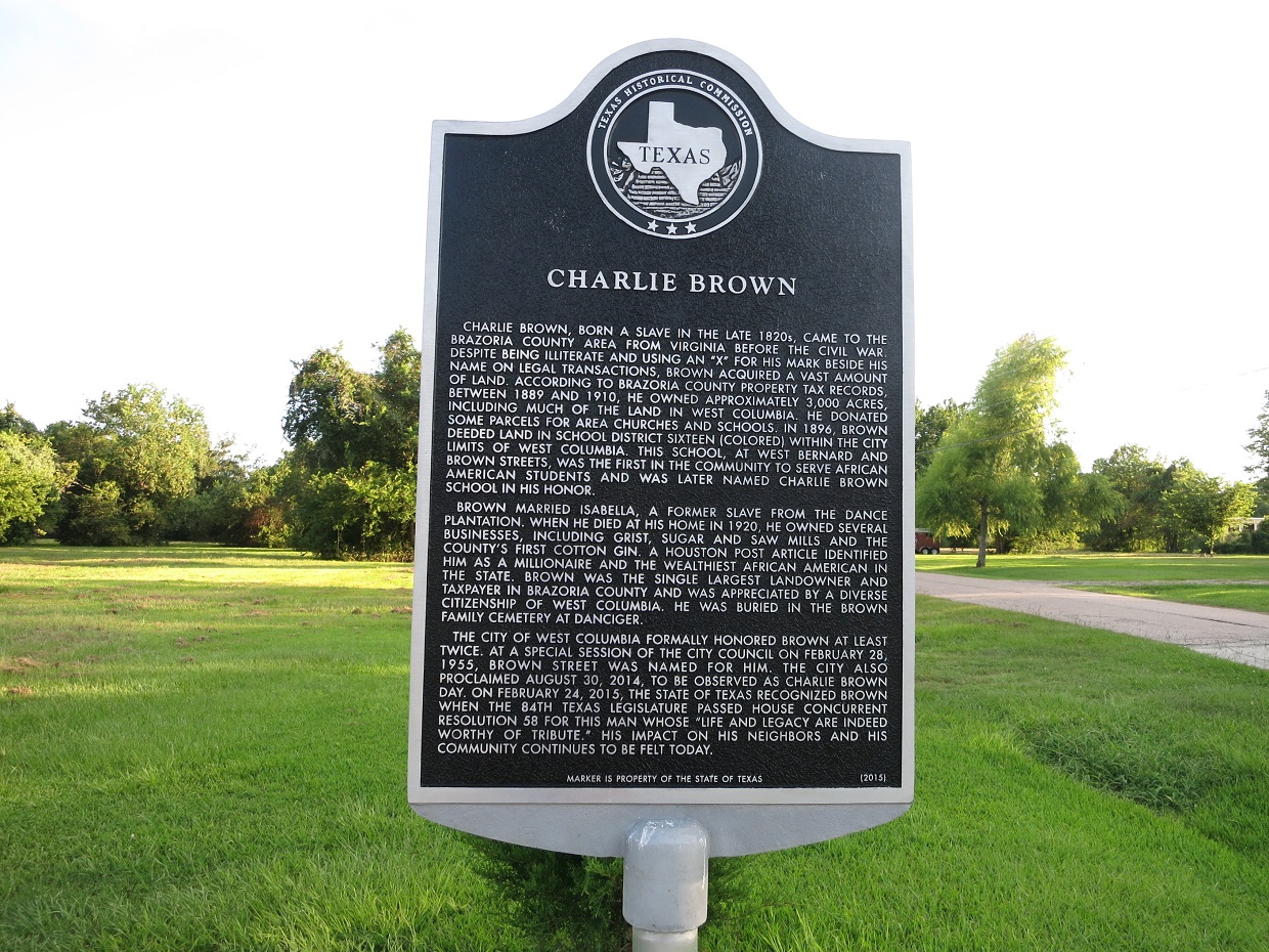
- West Columbia TX Charlie Brown, Djmaschek, CC BY-SA 4.0
Page built October 30, 2026. Spotted a mistake? Tell us or suggest a place.