


Whitinsville, Massachusetts
Whitinsville is a community of 7,115 people in Worcester County, Massachusetts.
Why visit Whitinsville
Townapedia lists 45 museums and landmarks, 18 parks and trails, 17 places to eat and 3 attractions in and around town.
Highlights include A. Chapin House, A. Whipple House, Purgatory Chasm State Reservation and Whitinsville Golf Club.
July is the warmest month, with average highs of 82°F; January lows average 15°F, and about 47 inches of snow fall in a normal year.
Weather in Whitinsville
Forecast from the National Weather Service. Full forecast
About Whitinsville
Whitinsville is an unincorporated village within the town of Northbridge in Worcester County, Massachusetts, United States. Whitinsville is a census-designated place (CDP) and its population was 6,750 at the 2020 census. Whitinsville is pronounced as if it were spelled "White-ins-ville." It was founded by the Whitin family, after whom it is also named. It is a post office jurisdiction, with a ZIP Code of 01588.
From the Wikipedia article Whitinsville, Massachusetts (this version), under CC BY-SA 4.0.
Things to do3

Museums and landmarks45
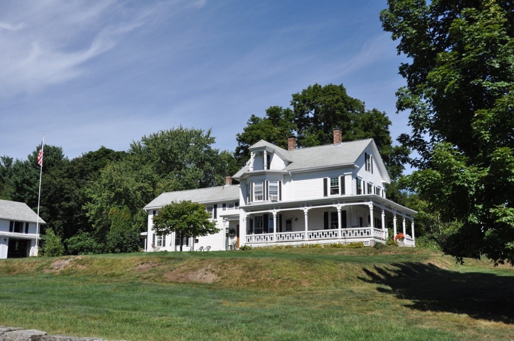
A. Chapin House
Monument and historic site · National Register of Historic Places · 3.8 mi
United States historic place

A. Whipple House
Monument and historic site · National Register of Historic Places · 1.4 mi
United States historic place
Aaron Taft House
Monument and historic site · National Register of Historic Places · 2.9 mi
House in Uxbridge, Massachusetts
Bank Building
Monument and historic site · National Register of Historic Places · 3.8 mi
Former building in Massachusetts, United States
Benjamin Adams House
Monument and historic site · National Register of Historic Places · 3.3 mi
House in Uxbridge, Massachusetts, United States


Butler Block
Monument and historic site · National Register of Historic Places · 2.1 mi
Building in Uxbridge, Massachusetts
Central Woolen Mills District
Monument and historic site · National Register of Historic Places · 3.8 mi
Historic district in Massachusetts, United States
Charles Capron House
Monument and historic site · National Register of Historic Places · 3.7 mi
Historic house in Massachusetts, United States
Coronet John Farnum, Jr., House
Monument and historic site · National Register of Historic Places · 3.7 mi
Historic house in Massachusetts, United States
E. Brown House
Monument and historic site · National Register of Historic Places · 2.3 mi
Historic house in Massachusetts, United States

E. N. Jenckes Store
Museum · National Register of Historic Places · 3.9 mi
Historic store on Main Street in Douglas, Massachusetts
Farnum Block
Monument and historic site · National Register of Historic Places · 3.7 mi
Commercial building in Uxbridge, Massachusetts, on the NRHP
33 more on the map.
Parks, trails and playgrounds18

Purgatory Chasm State Reservation
Park · 2.2 mi
Park in Sutton, Massachusetts



6 more on the map.
Restaurants and cafes17

Maison de Manger - House of Eats
Restaurant · Crepe, Sandwich, Coffee Shop, Tea · 2.0 mi
670 Linwood Avenue, Whitinsville
We-Sa 10:00-16:00

Murder Hill
Brewery and winery · 2.0 mi
670 Linwood Avenue, Whitinsville
Th 12:00-20:00; Fr,Sa 12:00-21:00; Su 12:00-18:00

Jumbo Donuts
Cafe · Donut, Breakfast, Coffee Shop · 1.4 mi
1115 Providence Road, Whitinsville
Mo-Su 05:00-17:00
Stephanie's Daily Grind
Cafe · Coffee Shop, Breakfast, Bagel, Sandwich, Tea · 1.5 mi
1 Plummers Corner, Whitinsville
Mo-Sa 06:00-15:00; Su 07:00-15:00

New China Pacific Restaurant & Lounge
Restaurant · Chinese · 2.0 mi
683 Linwood Avenue

5 more on the map.
History
This village was originally Nipmuc native lands, and was first settled as part of Mendon in 1662. From 1662 to 1727 it was part of Mendon, then later it became part of Uxbridge from 1727 to 1772. In 1772 Northbridge finally became a separate town. The village's early name was "South Northbridge", before the Whitin family's rise to prominence. Col. John Spring led a militia training company from Uxbridge which fought in the American Revolution. Col. Spring was from the section that became South Northbridge.
Today a visitor can see much of the original village, including the housing for workers and their families, churches, and the Whitin Community Center. The textile machine company and industrial village were written up as one of the Harvard studies of history in business. Whitin Machine, founded in 1831, became the largest manufacturer of textile machinery in the world before its closing in 1964.
A 1936 Berlin Olympics champion backstroke swimmer, Alice Bridges, then of Uxbridge, trained in the local gym pool (Whitin Community Center) in Whitinsville. The Whitinsville Savings Bank was involved in a precedent-setting case in the U.S., involving tort and contract law, known as "Swinton vs. Whitinsville Savings Bank (1942)". A real estate transaction two years earlier had failed to disclose termites in a building.
From the History section of Whitinsville, Massachusetts on Wikipedia, under CC BY-SA 4.0.
Churches and places of worship11
United Presbyterian Church at Whitinsville
Church · Presbyterian · 0.7 mi
51 Cottage Street
Shopping2
Gas and EV charging2
Schools, colleges and libraries26
Healthcare1
Map of Whitinsville
125 places. The map loads OpenStreetMap tiles when you open it.
Climate by month
Monthly table
| Month | High | Low | Rain | Snow |
|---|---|---|---|---|
| Jan | 34°F | 15°F | 3.8 in | 14.2 in |
| Feb | 36°F | 15°F | 3.2 in | 12.6 in |
| Mar | 45°F | 24°F | 4.4 in | 8.6 in |
| Apr | 57°F | 34°F | 4.3 in | 2.6 in |
| May | 69°F | 45°F | 3.6 in | 0.0 in |
| Jun | 77°F | 55°F | 4.0 in | 0.0 in |
| Jul | 82°F | 60°F | 3.9 in | 0.0 in |
| Aug | 81°F | 58°F | 4.2 in | 0.0 in |
| Sep | 74°F | 51°F | 4.1 in | 0.0 in |
| Oct | 61°F | 39°F | 4.8 in | 0.1 in |
| Nov | 50°F | 30°F | 3.9 in | 1.4 in |
| Dec | 39°F | 21°F | 4.6 in | 7.1 in |
U.S. Climate Normals 1991-2020 for Buffumville Lake (12 mi away), NOAA NCEI.
People and cost of living
American Community Survey 5-year estimates, 2020-2024, U.S. Census Bureau. Estimates have margins of error, larger for small towns.
Disaster history
Worcester County has had 24 federal disaster declarations since 2000, most often for severe storms.
- 2024-05-15: Severe Storms And Flooding (Flood)
- 2023-09-15: Hurricane Lee (Hurricane)
- 2020-03-27: Covid-19 Pandemic (Biological)
- 2020-03-13: Covid-19 (Biological)
- 2018-07-19: Severe Winter Storm And Snowstorm (Snowstorm)
- 2015-04-13: Severe Winter Storm, Snowstorm, And Flooding (Severe Storm)
OpenFEMA disaster declarations summaries.
Getting there and nearby towns
Worcester Regional Airport (ORH) is the nearest airport with scheduled flights listed in OpenStreetMap, 15 miles away.
- East Douglas 4 mi southwest, about 6 min by car
- Upton 5 mi northeast, about 9 min by car
- Hopedale 7 mi east, about 11 min by car
- Milford 8 mi east, about 13 min by car
- Bellingham 10 mi east, about 16 min by car
- Oxford 10 mi west, about 16 min by car
- Westborough 11 mi north, about 17 min by car
- Hopkinton 11 mi northeast, about 17 min by car
- Woonsocket 12 mi southeast, about 19 min by car
- Worcester 13 mi northwest, about 20 min by car
Drive times are estimates from straight-line distance, not routes.
Local news
Headlines from INDB, the NEMICO news database.
Reviews, tips and questions
Loading what members have shared...
Sources and licences
- NCES EDGE (Public domain): public schools
- NOAA NCEI U.S. Climate Normals 1991-2020 (Public domain): climate by month
- OpenFEMA (Public domain): disaster declarations
- OpenStreetMap contributors (ODbL 1.0): places, airports, map data
- U.S. Census Bureau (Public domain): population, income, housing, education, commute
- Wikidata (CC0 1.0): elevation, founding date, time zone, website, landmarks and historic places
- Wikimedia Commons (see each image): photos
- Wikipedia (CC BY-SA 4.0): overview and history text
Photo credits
- Whitin Machine Works, Whitinsville, Massachusetts, Kenneth C. Zirkel, CC BY 4.0
- Northbridge Town Hall entrance, Whitinsville Massachusetts, Kenneth C. Zirkel, CC BY 4.0
- Northbridge Town Hall, Whitinsville Massachusetts, Hill Street side, Kenneth C. Zirkel, CC BY-SA 4.0
- Aldrich School in Whitinsville Massachusetts, Kenneth C. Zirkel, CC BY-SA 4.0
- Northbridge Town Hall, Whitinsville Massachusetts, Kenneth C. Zirkel, CC BY-SA 4.0
- Whitinsville ma library - panoramio, LEONARDO DASILVA, CC BY 3.0
- Cotton Mill Apartments, Whitinsville Massachusetts, Kenneth C. Zirkel, CC BY 4.0
- Whitinsville Bank Building Massachusetts, Kenneth C. Zirkel, CC BY-SA 4.0
- Whitinsville, Northbridge, MA, USA - panoramio (2), LEONARDO DASILVA, CC BY 3.0
- Whitinsville, Northbridge, MA, USA - panoramio (3), LEONARDO DASILVA, CC BY 3.0
- Whitinsville, Northbridge, MA, USA - panoramio (5), LEONARDO DASILVA, CC BY 3.0
- Civil War Memorial in Whitinsville, Massachusetts, Kenneth C. Zirkel, CC BY-SA 4.0
- Whitinsville, Northbridge, MA, USA - panoramio (4), LEONARDO DASILVA, CC BY 3.0
- Whitinsville Historic District Massachusetts, Kenneth C. Zirkel, CC BY-SA 4.0
- Whitinsville, Northbridge, MA, USA - panoramio (10), LEONARDO DASILVA, CC BY 3.0
- Northbridge Town Hall, Whitinsville Massachusetts, Main Street side, Kenneth C. Zirkel, CC BY-SA 4.0
- Whitinsville, Northbridge, MA, USA - panoramio (9), LEONARDO DASILVA, CC BY 3.0
- Whitinsville, Northbridge, MA, USA - panoramio (8), LEONARDO DASILVA, CC BY 3.0
- Whitinsville, Northbridge, MA, USA - panoramio (6), LEONARDO DASILVA, CC BY 3.0
- Village of Whitinsville Historic District, Town of Northbridge, Massachusetts, Kenneth C. Zirkel, CC BY 4.0
- Whitinsville, Northbridge, MA, USA - panoramio (7), LEONARDO DASILVA, CC BY 3.0
- Whitinsville, Northbridge, MA, USA - panoramio (12), LEONARDO DASILVA, CC BY 3.0
- Whitinsville, Northbridge, MA, USA - panoramio (11), LEONARDO DASILVA, CC BY 3.0
- Whitinsville, Northbridge, MA, USA - panoramio (1), LEONARDO DASILVA, CC BY 3.0
- Whitinsville, Northbridge, MA, USA - panoramio, LEONARDO DASILVA, CC BY 3.0
- United Methodist Church, Whitinsville Massachusetts, Kenneth C. Zirkel, CC BY-SA 4.0
- Church Street, Whitinsville, Massachusetts - 1920s postcard, Unknown author Unknown author, Public domain
- Whitinsville Bank Building, C.S. Imming, CC BY-SA 3.0
- Whitinsville Social Library, C.S. Imming, CC BY-SA 3.0
- Whitinsville Community Center, C.S. Imming, CC BY-SA 3.0
- Whitinsville Congregational Church, C.S. Imming, CC BY-SA 3.0
- Northbridge Memorial Town Hall--Whitinsville Historic District, C.S. Imming, CC BY-SA 3.0
- Hayward Landing Douglas, Marcbela (Marc N. Belanger), Public domain
- Uxbridge Town Hall Massachusetts 2013, Kenneth C. Zirkel, CC BY-SA 3.0
- George Carpenter House, Tim Pierce, CC BY-SA 3.0
- UxbridgeMA JudsonTaftHouse, Magicpiano, CC BY-SA 3.0
- Uxbridge Academy Building, Uxbridge, MA, Ksherin, CC BY-SA 3.0
- UxbridgeMA AChapinHouse, Magicpiano, CC BY-SA 3.0
- Butler Block Uxbridge, MA, Ksherin, CC BY-SA 3.0
- Moses Taft House Uxbridge MA, Tim Pierce, CC BY-SA 3.0


Page built October 30, 2026. Spotted a mistake? Tell us or suggest a place.