


William Paterson University of New Jersey, New Jersey
William Paterson University of New Jersey is a community of 1,133 people in Passaic County, New Jersey.
Why visit William Paterson University of New Jersey
Townapedia lists 29 museums and landmarks, 10 parks and trails, 32 places to eat and 11 attractions in and around town.
Highlights include Arch Street Bridge, William Paterson University, Ailsa Farms and Cairns-Whitten-Blauvelt House.
July is the warmest month, with average highs of 86°F; January lows average 22°F.
Weather in William Paterson University of New Jersey
Forecast from the National Weather Service. Full forecast
Things to do11

Arch Street Bridge
Bridge · National Register of Historic Places · 2.1 mi
Bridge in United States of America

William Paterson University
School
University in New Jersey, United States
300 Pompton Road, Wayne


Hillery Street Bridge
Bridge · 2.9 mi
Vehicular bridge over the Passaic River in Totowa and Woodland Park, New Jersey

Sixth Avenue Bridge
Bridge · 1.8 mi
Bridge in United States of America
West Broadway Bridge
Bridge · 2.1 mi
Bridge in United States of America



Museums and landmarks29

Ailsa Farms
Monument and historic site · National Register of Historic Places
Mansion in Wayne, New Jersey

Cairns-Whitten-Blauvelt House
Monument and historic site · National Register of Historic Places · 3.3 mi
Historic house in New Jersey, United States

Danforth Memorial Library
Monument and historic site · National Register of Historic Places · 2.6 mi
Library in Paterson, New Jersey

Daniel Thompson and John Ryle Houses
Monument and historic site · National Register of Historic Places · 2.3 mi
Building in New Jersey, United States

Dey Mansion
Museum · National Register of Historic Places · 2.8 mi
Historic house in New Jersey, United States

Frederick William Cooke Residence
Monument and historic site · National Register of Historic Places · 2.8 mi
Historic house in Passaic County, New Jersey
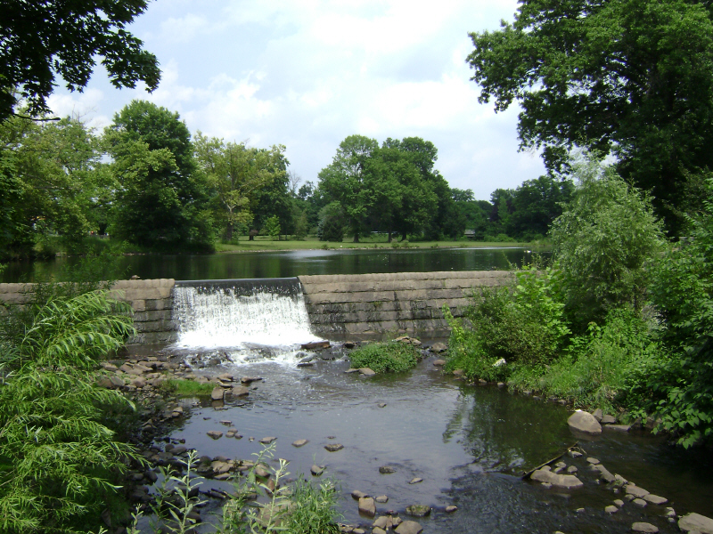
Goffle Brook Park
Monument and historic site · National Register of Historic Places · 1.9 mi
Park in New Jersey, United States

Hinchliffe Stadium
Monument and historic site · National Register of Historic Places · 2.1 mi
Stadium in New Jersey
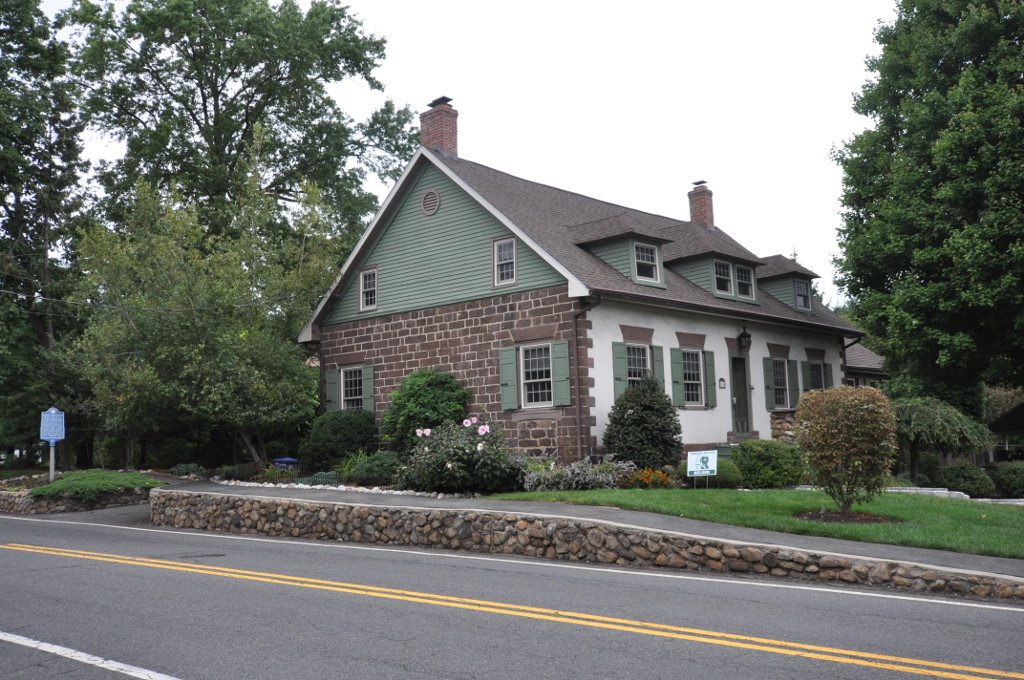
John C. Stagg House
Monument and historic site · National Register of Historic Places · 3.0 mi
Historic house in New Jersey, United States

John W. Ferguson House
Monument and historic site · National Register of Historic Places · 3.3 mi
Historic house in New Jersey, United States

John W. Rea House
Monument and historic site · National Register of Historic Places · 2.1 mi
Historic house in New Jersey, United States

Mead-Van Duyne House
Monument and historic site · National Register of Historic Places · 3.2 mi
Historic house in Passaic County, New Jersey
17 more on the map.
Parks, trails and playgrounds10

Garret Mountain Reservation
Park · 3.3 mi
Public park in Passaic County, New Jersey





North Jersey Country Club
Golf course · 1.4 mi
594 Paterson-Hamburg Turnpike, Wayne
Playground Inspection Professionals, LLC
Playground · 1.2 mi
73 Pike Drive, Wayne
Restaurants and cafes32


The Shepherd & the Knucklehead Pub & Steakhouse
Bar and pub · 0.7 mi
529 Belmont Avenue, Haledon
Mo-Fr 16:00-01:45; Sa-Su 12:00-01:45


Basilico Italian Kitchen & Brick Oven Pizza
Restaurant · Italian, Pizza
Former site of Brother Bruno's Pizza.
140 Paterson-Hamburg Turnpike, Wayne
Biagio's Pizza & Pasta
Restaurant · Italian, Pizza · 0.4 mi
179 Paterson-Hamburg Turnpike, Wayne
Brother Bruno's Pizza, Deli & Bagels
Restaurant · Pizza, Deli, Bagel
200 Paterson-Hamburg Turnpike, Wayne
Paesano's Restaurant & Pizzeria
Restaurant · Italian, Pizza, Sandwich, Regional · 0.7 mi
885 Belmont Avenue, North Haledon
Taichi Bubble Tea - Poke Bowl & Ramen
Cafe · Bubble Tea
163 Paterson-Hamburg Turnpike, Wayne
20 more on the map.
Churches and places of worship18
Cathedral of St. John the Baptist
Church · National Register of Historic Places · 2.6 mi
Shomrei Torah: The Wayne Conservative Congregation
Place of worship · Conservative · 1.3 mi
30 Hinchman Avenue, Wayne
St. Michael's Episcopal Church
Church · Episcopal · 1.4 mi
1219 Ratzer Road, Wayne
Mahatma Gandhi Center & Hindu Temple
Place of worship · 1.3 mi
714 Preakness Avenue, Wayne
Shopping7
Destination Athlete of Bergen, Passaic, & Rockland NY
Shop · 0.6 mi
321 Paterson-Hamburg Turnpike, Wayne
Gas and EV charging1
Schools, colleges and libraries58
Classical Academy Charter School of Clifton
School · 5.5 mi
1255 Main Avenue, Clifton
College Achieve Paterson Charter School
School · 2.4 mi
21 Market Street, Paterson
Franklin Avenue Middle School
School · 5.2 mi
755 Franklin Avenue, Franklin Lakes
Healthcare40
Advanced Cardiology Practice
Clinic and pharmacy · 0.4 mi
246 Paterson-Hamburg Turnpike, Wayne
Advanced Pain Therapy
Clinic and pharmacy · 0.7 mi
401 Paterson-Hamburg Turnpike, Wayne
American Imaging Wayne
Clinic and pharmacy · 1.0 mi
516 Paterson-Hamburg Turnpike, Wayne
Arthritis Alliance
Clinic and pharmacy · 0.9 mi
506 Paterson-Hamburg Turnpike, Wayne
Clean Slate Laser Tattoo Removal
Clinic and pharmacy · 0.4 mi
246 Paterson-Hamburg Turnpike, Wayne
CURA Medical Group
Clinic and pharmacy · 0.7 mi
401 Paterson-Hamburg Turnpike, Wayne
CURA Pain Doctors - Pain Management Center
Clinic and pharmacy · 0.7 mi
401 Paterson-Hamburg Turnpike, Wayne
Map of William Paterson University of New Jersey
206 places. The map loads OpenStreetMap tiles when you open it.
Climate by month
Monthly table
| Month | High | Low | Rain |
|---|---|---|---|
| Jan | 39°F | 22°F | 3.6 in |
| Feb | 41°F | 23°F | 3.0 in |
| Mar | 50°F | 31°F | 4.2 in |
| Apr | 63°F | 40°F | 4.3 in |
| May | 73°F | 50°F | 4.0 in |
| Jun | 82°F | 60°F | 4.6 in |
| Jul | 86°F | 65°F | 4.6 in |
| Aug | 84°F | 64°F | 4.7 in |
| Sep | 76°F | 56°F | 4.5 in |
| Oct | 65°F | 44°F | 4.2 in |
| Nov | 54°F | 35°F | 3.4 in |
| Dec | 44°F | 27°F | 4.3 in |
U.S. Climate Normals 1991-2020 for Little Falls (4 mi away), rain and snow from Hawthorne 1.0 Sse, NOAA NCEI.
People and cost of living
American Community Survey 5-year estimates, 2020-2024, U.S. Census Bureau. Estimates have margins of error, larger for small towns.
Disaster history
Passaic County has had 20 federal disaster declarations since 2000, most often for hurricanes.
- 2021-09-05: Remnants Of Hurricane Ida (Hurricane)
- 2021-09-02: Remnants Of Hurricane Ida (Hurricane)
- 2020-03-25: Covid-19 Pandemic (Biological)
- 2020-03-13: Covid-19 (Biological)
- 2018-06-08: Severe Winter Storm And Snowstorm (Severe Storm)
- 2012-10-30: Hurricane Sandy (Hurricane)
OpenFEMA disaster declarations summaries.
Getting there and nearby towns
Essex County Airport (CDW) is the nearest airport with scheduled flights listed in OpenStreetMap, 7 miles away.
- Preakness 1 mi west, about 2 min by car
- Hawthorne 2 mi east, about 4 min by car
- Paterson 3 mi southeast, about 5 min by car
- Totowa 3 mi south, about 5 min by car
- Woodland Park 4 mi south, about 6 min by car
- Glen Rock 4 mi east, about 6 min by car
- Fair Lawn 4 mi east, about 7 min by car
- Franklin Lakes 4 mi north, about 7 min by car
- Elmwood Park 5 mi southeast, about 8 min by car
- Ridgewood 5 mi northeast, about 8 min by car
Drive times are estimates from straight-line distance, not routes.
Local news
Headlines from INDB, the NEMICO news database.
Reviews, tips and questions
Loading what members have shared...
Sources and licences
- NCES EDGE (Public domain): public schools
- NOAA NCEI U.S. Climate Normals 1991-2020 (Public domain): climate by month
- OpenFEMA (Public domain): disaster declarations
- OpenStreetMap contributors (ODbL 1.0): places, airports, map data
- U.S. Census Bureau (Public domain): population, income, housing, education, commute
- Wikidata (CC0 1.0): landmarks and historic places
- Wikimedia Commons (see each image): photos
Photo credits
- DANFORTH MEMORIAL LIBRARY, PASSAIC COUNTY, NJ, Jerrye & Roy Klotz, MD, CC BY-SA 4.0
- VAN BLARCOM HOUSE, FRANKLIN LAKES, BERGEN COUNTY, NJ, JERRYE & ROY KLOTZ MD, CC BY-SA 4.0
- Cathedral of St. John the Baptist - Paterson, New Jersey 02, Farragutful, CC BY-SA 4.0
- Dey Mansion 1, Cmileo88, Public domain
- CAIRNS-WHITTEN-BLAUVELT HOUSE, WYCKOFF, BERGEN COUNTY, NJ, JERRYE & ROY KLOTZ MD, CC BY-SA 4.0
- Arch Street Bridge 20070829-jag9889, Jag9889, CC BY-SA 4.0
- VAN HOUTEN-ACKERMAN HOUSE, WYCKOFF, BERGEN COUNTY, JERRYE & ROY KLOTZ MD, CC BY-SA 4.0
- VanRiper-Hopper House, Lithium6ion, Public domain
- VAN WINKLE HOUSE, FRANKLIN LAKES, BERGEN COUNTY, NJ, JERRYE & ROY KLOTZ MD, CC BY-SA 4.0
- Reinhardt Mills, Lithium6ion, Public domain
- Pietro-betto-house, Dmadeo, CC BY-SA 4.0
- Rea House, Lithium6ion, Public domain
- Paterson City Hall 2008 jeh, Jim.henderson, Public domain
- Straight Street Bridge 20070829-jag9889, Jag9889, CC BY-SA 4.0
- Daniel Thompson and John Ryle Houses, Lithium6ion, Public domain
- Hinchliffe Stadium July 2023, Oknazevad, CC BY-SA 4.0
- Westside Park VanHouten House, Lithium6ion, Public domain
- Van Houten House, Franklin Lakes, NJ, Karel de Waal Malefyt, CC BY-SA 4.0
- PUBLIC SCHOOL NUMBER TWO, PATERSON, PASSAIC COUNTY, NJ, Jerrye & Roy Klotz, MD, CC BY-SA 4.0
- Ailsa Farms Hobart Manor, Lithium6ion, Public domain
- Van Houten-Van Allen House, Totowa, NJ, Zeete, CC BY-SA 4.0
- GoffleBrookPark ArnoldsPond, Lithium6ion, Public domain
- WyckoffNJ JohnCStaggHouse, Magicpiano, CC BY-SA 4.0
- PatersonNJ CookeHouse, Cheek Funeral Home, Public domain
- PatersonNJ JohnFergusonHouse, New Jersey Office of Historic Preservation, Public domain
- Kossuth Street School, Lithium6ion, Public domain
- Great Falls of Paterson 2016, FirozAnsari, CC BY-SA 4.0
- Hillery Street Bridge 20090427-jag9889, Jag9889, CC BY-SA 4.0
- West Side Park Bridge 20070829-jag9889, Jag9889, CC BY-SA 4.0
- Barbour Pond, Garret Mountain Reservation, NJ - panorama, Zeete, CC BY-SA 4.0
- Carl Palmer performs at William Paterson University, JazzyJoeyD, CC BY-SA 4.0
- William Paterson University campus from University Drive, Jan. 2025, Mr. Matté (if there is an issue with this image, contact me using this image's Commons talk page , my Commons user talk page , or my English Wikipedia user talk page ; I'll know about it a lot faster), CC BY-SA 4.0
- 2021-09-24 15 38 44 View east along Passaic County Route 504 (Pompton Road) from the pedestrian overpass at William Paterson University in Wayne Township, Passaic County, New Jersey, Famartin, CC BY-SA 4.0
- 2021-09-24 15 38 19 View west along Passaic County Route 504 (Pompton Road) from the pedestrian overpass at William Paterson University in Wayne Township, Passaic County, New Jersey, Famartin, CC BY-SA 4.0
- 2018-07-25 12 01 35 View east along Passaic County Route 504 (Pompton Road) just east of Passaic County Route 673 (Paterson-Hamburg Turnpike) in Wayne Township, Passaic County, New Jersey, Famartin, CC BY-SA 4.0
- 2018-07-25 14 19 20 View west along Passaic County Route 504 (Pompton Road) just west of Passaic County Route 676 (Alisa Avenue) in Wayne Township, Passaic County, New Jersey, Famartin, CC BY-SA 4.0
- Camp Veritans entrance, Haledon, NJ, Jan. 2025, Mr. Matté (if there is an issue with this image, contact me using this image's Commons talk page , my Commons user talk page , or my English Wikipedia user talk page ; I'll know about it a lot faster), CC BY-SA 4.0
- 2018-07-25 12 04 35 View east along Passaic County Route 504 (Pompton Road) just east of Passaic County Route 676 (Alisa Avenue) in Haledon, Passaic County, New Jersey, Famartin, CC BY-SA 4.0
- West Overlook Avenue eb, North Haledon, NJ (1), Jan. 2025, Mr. Matté (if there is an issue with this image, contact me using this image's Commons talk page , my Commons user talk page , or my English Wikipedia user talk page ; I'll know about it a lot faster), CC BY-SA 4.0
- Overlook Avenue eb, North Haledon, NJ (1), Jan. 2025, Mr. Matté (if there is an issue with this image, contact me using this image's Commons talk page , my Commons user talk page , or my English Wikipedia user talk page ; I'll know about it a lot faster), CC BY-SA 4.0


Page built October 30, 2026. Spotted a mistake? Tell us or suggest a place.