


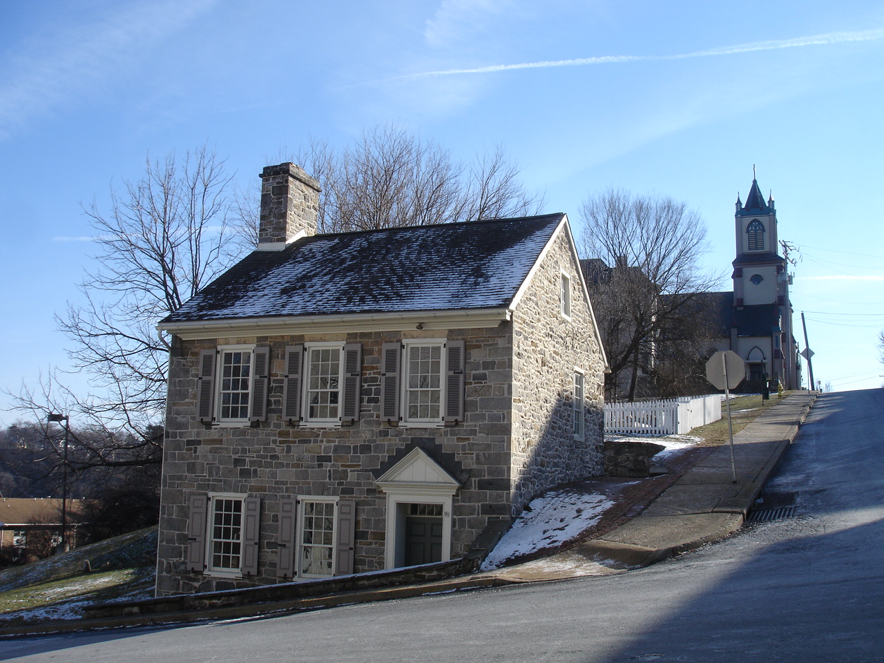


Wilson, Pennsylvania
Wilson is a borough of 8,183 people in Northampton County, Pennsylvania, founded in 1914.
Why visit Wilson
Townapedia lists 23 museums and landmarks, 37 parks and trails, 74 places to eat, 2 places to stay and 5 attractions in and around town.
Highlights include Chain Bridge, Bushkill Park, College Hill Residential Historic District and Delaware Division of the Pennsylvania Canal.
July is the warmest month, with average highs of 86°F; January lows average 22°F.
Weather in Wilson
Forecast from the National Weather Service. Full forecast
About Wilson
Wilson is a borough in Northampton County, Pennsylvania, United States. The population was 8,259 at the 2020 census. Wilson is located adjacent to the city of Easton and is part of the Lehigh Valley metropolitan area, which had a population of 861,899 and was the 68th-most populous metropolitan area in the U.S. as of the 2020 census.
From the Wikipedia article Wilson, Pennsylvania (this version), under CC BY-SA 4.0.
Things to do5

Chain Bridge
Bridge · National Register of Historic Places · 2.1 mi
Historic change bridge spanning the Lehigh River

Bushkill Park
Monument and historic site · 1.3 mi
Small amusement park in Easton, Pennsylvania
2100 Bushkill Park Drive, Easton


Lehigh Valley Railroad Bridge
Bridge · 2.1 mi
Abandoned railway bridge over the Delaware River between Easton, Pennsylvania and Phillipsburg, New Jersey

Northampton Street Bridge
Bridge · 2.0 mi
Bridge over the Delaware River between Easton, Pennsylvania and Phillipsburg, New Jersey
Museums and landmarks23

College Hill Residential Historic District
Monument and historic site · National Register of Historic Places · 2.4 mi
Easton, PA, listed on the NRHP in Pennsylvania

Delaware Division of the Pennsylvania Canal
Monument and historic site · National Register of Historic Places · 1.9 mi
Canal in eastern Pennsylvania

Easton Cemetery
Monument and historic site · National Register of Historic Places · 1.6 mi
Cemetery in Easton, Pennsylvania

Easton Historic District
Monument and historic site · National Register of Historic Places · 1.6 mi
Listed on the NRHP in Pennsylvania

Easton House
Museum · National Register of Historic Places · 1.8 mi
History building in Easton, Pennsylvania, United States of America

Herman Simon House
Monument and historic site · National Register of Historic Places · 2.6 mi
Historic house in Pennsylvania, United States

Jacob Mixsell House
Monument and historic site · National Register of Historic Places · 1.7 mi
Historic house in Pennsylvania, United States
Jacob Nicholas House
Monument and historic site · National Register of Historic Places · 1.5 mi
Historic house in Pennsylvania, United States

John Roseberry Homestead
Monument and historic site · National Register of Historic Places · 3.2 mi
Historic house in Phillipsburg, New Jersey

Lander–Stewart Mansion and Stites Building
Monument and historic site · National Register of Historic Places · 2.2 mi
Historic houses in Phillipsburg, New Jersey

Parsons-Taylor House
Monument and historic site · National Register of Historic Places · 1.7 mi
House in Easton, Pennsylvania, United States


Phillipsburg Commercial Historic District
Monument and historic site · National Register of Historic Places · 2.1 mi
Historic district in Phillipsburg, New Jersey
11 more on the map.
Parks, trails and playgrounds37

25 more on the map.
Restaurants and cafes74

1001 Thai
Restaurant · Thai · 1.1 mi
1001 Northampton Street, Easton
Mo-Th 16:00-20:00; Fr-Sa 16:00-21:00; Su off
Daddy's Place
Restaurant · Mediterranean · 1.4 mi
650 Northampton Street, Easton
Mo off; Tu-Sa 11:00-21:00; Su 13:00-20:00
George's Pizza
Restaurant · Italian Pizza, Pizza
2049 Freemansburg Avenue
Mo-Th 11:00-21:00; Fr-Sa 11:00-22:00; Su 12:00-21:00
My New Place Pizzeria & Italian Restaurant
Restaurant · Pizza · 1.3 mi
153 South 7th Street, Easton
Mo-Th 10:30-21:30; Fr-Sa 10:30-22:00; Su closed
Takumi Sushi
Restaurant · Sushi · 1.3 mi
2928 Old Nazareth Road, Easton
Mo off; Tu-Th 11:00-21:30; Fr-Sa 11:00-22:30; Su 12:00-21:00

62 more on the map.
History
Wilson Borough is named after former U.S. President Woodrow Wilson. First formed as a township on February 10, 1913 during the first half of 1920, a number of property owners solicited the courts to change the form of government from a township to that of a borough.
According to the 1920 book, History of the Northampton County (Pennsylvania) and the Grand Valley of Lehigh, by the American Historical Association, supervised and revised by William J. Heller, the township was consummated by the courts in 1914, but the court case of Palmer School District v. Wilson School District indicates the township's formation occurred on February 10, 1913.
There are two very early court cases soon after the creation of the new township in 1913. The first, Palmer School District v. Wilson School District, related to Wilson owing Palmer for a certain amount of indebtedness caused by the township's creation. The second, Township of Wilson v. Easton Transit Co. in 1916, related to Wilson officials suing the transit company for performing work without first obtaining necessary permissions. The township lost this case, but in an appeal to Supreme Court of Pennsylvania on May 22, 1917, then Pennsylvania Supreme Court Justice Walling ruled, "The assignments of error are overruled and the decree is affirmed at the cost of the appellant."
From the History section of Wilson, Pennsylvania on Wikipedia, under CC BY-SA 4.0.
Where to stay2
Churches and places of worship10
Saint Anthony of Padua Catholic Church
Church · Roman Catholic · 1.1 mi
841 Washington Street, Easton
Trinity Orthodox Presbyterian Church
Church · Orthodox Presbyterian Church · 1.0 mi
531 Milford Street, Easton
Our Lady of Mercy Catholic Church
Church · Roman Catholic · 1.5 mi
129 Davis Street, Easton
Shopping25
Gas and EV charging14
Schools, colleges and libraries54
Bethlehem Area Vocational-Technical School
School · 5.0 mi
3300 Chester Avenue, Bethlehem
Healthcare7
LVHN Health Center at Easton
Clinic and pharmacy · 0.5 mi
2401 Northampton Street, Easton
Map of Wilson
250 places. The map loads OpenStreetMap tiles when you open it.
Climate by month
Monthly table
| Month | High | Low | Rain |
|---|---|---|---|
| Jan | 38°F | 22°F | 3.7 in |
| Feb | 40°F | 22°F | 3.0 in |
| Mar | 49°F | 29°F | 3.6 in |
| Apr | 62°F | 39°F | 3.9 in |
| May | 72°F | 49°F | 4.3 in |
| Jun | 81°F | 59°F | 4.8 in |
| Jul | 86°F | 64°F | 5.6 in |
| Aug | 82°F | 62°F | 5.2 in |
| Sep | 77°F | 54°F | 4.7 in |
| Oct | 65°F | 44°F | 4.5 in |
| Nov | 53°F | 32°F | 3.4 in |
| Dec | 42°F | 26°F | 4.4 in |
U.S. Climate Normals 1991-2020 for Phillipsburg-Easton Brg (2 mi away), NOAA NCEI.
People and cost of living
American Community Survey 5-year estimates, 2020-2024, U.S. Census Bureau. Estimates have margins of error, larger for small towns.
Disaster history
Northampton County has had 17 federal disaster declarations since 2000, most often for hurricanes.
- 2021-09-10: Remnants Of Hurricane Ida (Hurricane)
- 2020-03-30: Covid-19 Pandemic (Biological)
- 2020-03-13: Covid-19 (Biological)
- 2018-11-27: Severe Storms And Flooding (Severe Storm)
- 2016-03-23: Severe Winter Storm And Snowstorm (Snowstorm)
- 2013-01-10: Hurricane Sandy (Hurricane)
OpenFEMA disaster declarations summaries.
Getting there and nearby towns
Lehigh Valley International Airport (ABE) is the nearest airport with scheduled flights listed in OpenStreetMap, 11 miles away.
- West Easton 1 mi southeast, about 1 min by car
- Easton 1 mi east, about 2 min by car
- Palmer Heights 1 mi west, about 2 min by car
- Old Orchard 2 mi southwest, about 3 min by car
- Morgan Hill 2 mi southeast, about 4 min by car
- Phillipsburg 3 mi east, about 5 min by car
- Chestnut Hill 3 mi northeast, about 5 min by car
- Tatamy 4 mi north, about 6 min by car
- Raubsville 4 mi southeast, about 7 min by car
- Upper Pohatcong 5 mi east, about 7 min by car
Drive times are estimates from straight-line distance, not routes.
Local news
Headlines from INDB, the NEMICO news database.
Reviews, tips and questions
Loading what members have shared...
Sources and licences
- NCES EDGE (Public domain): public schools
- NOAA NCEI U.S. Climate Normals 1991-2020 (Public domain): climate by month
- OpenFEMA (Public domain): disaster declarations
- OpenStreetMap contributors (ODbL 1.0): places, airports, map data
- U.S. Census Bureau (Public domain): population, income, housing, education, commute
- Wikidata (CC0 1.0): elevation, founding date, time zone, website, landmarks and historic places
- Wikimedia Commons (see each image): photos
- Wikipedia (CC BY-SA 4.0): overview and history text
Photo credits
- Wilson, PA Keystone Marker, Doug Kerr from Albany, NY, United States, CC BY-SA 2.0
- Seventh Street Gate, Easton Cemetery 01, Shuvaev, CC BY-SA 3.0
- EASTON PENNSYLVANIA HISTORIC DISTRICT, JERRYE & ROY KLOTZ MD, CC BY-SA 3.0
- JacobNicholasHouse, KForce, CC BY-SA 3.0
- Seipsville Hotel 02, Shuvaev, CC BY-SA 3.0
- Cattell St 200, College Hill HD, Easton PA 03, Shuvaev, CC BY-SA 3.0
- Delaware Canal w dog, Smallbones, Public domain
- BachmannPublickHouse, KForce, CC BY-SA 3.0
- Zeta Psi Fraternity House, Lafayette College 01, Shuvaev, CC BY-SA 3.0
- Parsons-Taylor House, Delos H. Smith, Public domain
- JOHN ROSEBERRY HOMESTEAD, WARREN COUNTY, NJ, Jerrye & Roy Klotz, MD, CC BY-SA 3.0
- JacobMixsellHouse, KForce, CC BY-SA 3.0
- Chain Bridge on Lehigh River, Easton PA 04, Shuvaev, CC BY-SA 3.0
- HermanSimonHouse, KForce, CC BY-SA 3.0
- StateTheatreEastonPA, KForce, CC BY-SA 3.0
- William Jacob Heller House, Shuvaev, CC BY-SA 3.0
- 17, 21-27 Union Square, Phillipsburg, NJ, Zeete, CC BY-SA 4.0
- 102-104 South Main Street, Phillipsburg, NJ, Zeete, CC BY-SA 4.0
- Barl Of Fun Funhouse, Bushkill Park, 2017, Mr6507, CC BY-SA 4.0
- Colton Chapel, Lafayette College 04, Daniel Chester French, CC BY-SA 3.0
- Easton-free-bridge, Krevnasty at English Wikipedia, Public domain
- Lehigh Valley Railroad, Delaware River Bridge - looking northwest, Zeete, CC BY-SA 4.0


Page built October 30, 2026. Spotted a mistake? Tell us or suggest a place.