
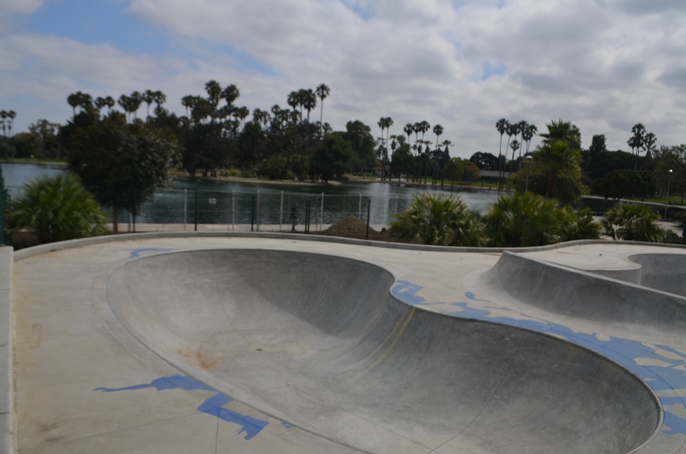


Alondra Park, California
Alondra Park is a community of 8,373 people in Los Angeles County, California.
Why visit Alondra Park
Townapedia lists 1 museum or landmark, 19 parks and trails, 104 places to eat, 9 places to stay and 1 attraction in and around town.
Highlights include Gardena Cinema, Toyota USA Automobile Museum, Alondra Community Regional Park and Alondra Park Golf Course.
August is the warmest month, with average highs of 79°F; December lows average 49°F.
Weather in Alondra Park
Forecast from the National Weather Service. Full forecast
About Alondra Park
Alondra Park (), also known as El Camino Village, is an unincorporated community and census designated place (CDP) in the South Bay region of Los Angeles County, California, United States. It is the unincorporated area north of Alondra Community Regional Park and El Camino College. It is east of Lawndale, south of Hawthorne, west of Gardena, and north of Torrance. Manhattan Beach Boulevard and Crenshaw Boulevard are the two major cross streets in the area.
From the Wikipedia article Alondra Park, California (this version), under CC BY-SA 4.0.
Things to do1

Museums and landmarks1


Toyota USA Automobile Museum
Museum · 2.8 mi
Automobile museum in Torrance, California
Parks, trails and playgrounds19

Alondra Community Regional Park
Park · 0.6 mi
3850 Manhattan Beach Boulevard, Lawndale
Mo-Su 06:30-21:00

Alondra Park Golf Course
Golf course · 0.6 mi
18 hole Par 72 + 18 hole Par 54
16400 South Prairie Avenue, Lawndale
Columbia Park, Torrance, California
Park · 2.2 mi
Piece of open land for recreational use in Torrance, California

Murdock Stadium
Sports field and stadium · 0.4 mi
16007 Crenshaw Boulevard, Torrance
7 more on the map.
Restaurants and cafes104



CM Chicken
Restaurant · Chicken, Korean · 1.4 mi
15420 South Western Avenue
Mo-Th 11:00-15:00, 17:00-17:00; Fr-Sa 11:00-02:00; Su 12:00-00:00
Colombian Delicatessen
Restaurant · Latin, Colombian · 1.4 mi
14329 Hawthorne Boulevard
Mo-Su 10:00-17:00
Heng Heng Chicken Rice
Restaurant · Chicken, Thai · 0.9 mi
3255 West Rosecrans Avenue
We-Th 11:00-15:00, 16:00-20:00; Fr 11:00-20:00; Sa-Su 11:30-15:00,...
Pizza Hut
Restaurant · Pizza · 1.5 mi
2208 Artesia Boulevard, Torrance
Su-Th 10:00-23:00, Fr,Sa 10:00-24:00
Pizzaroni
Restaurant · Pizza · 1.0 mi
3909 Rosecrans Avenue, Hawthorne
Su-Th 10:30-21:30; Fr,Sa 10:30-20:00

Nagomi Cake House
Bakery · 1.4 mi
15915 South Western Avenue, Gardena
Mo, Th-Fr 10:00-18:00; Tu 10:00-14:00; Sa-Su 10:00-17:00
92 more on the map.
Where to stay9
Days Inn Los Angeles LAX/Redondo And Manhattan Beach
Motel and hotel · 1.0 mi
15636 Hawthorne Boulevard, Lawndale
Baymont Lawndale/South Bay
Motel and hotel · 1.1 mi
14814 Hawthorne Boulevard, Lawndale
Churches and places of worship23
Shopping20
Gas and EV charging15
Schools, colleges and libraries85
Lawndale Branch County of Los Angeles Public Library
Library · 1.3 mi
14615 Burin Avenue, Lawndale
Healthcare10
DaVita Hawthorne Dialysis
Clinic and pharmacy · 1.0 mi
14204 Prairie Avenue, Hawthorne
Map of Alondra Park
250 places. The map loads OpenStreetMap tiles when you open it.
Climate by month
Monthly table
| Month | High | Low | Rain |
|---|---|---|---|
| Jan | 67°F | 49°F | 2.7 in |
| Feb | 67°F | 51°F | 3.0 in |
| Mar | 68°F | 53°F | 1.7 in |
| Apr | 70°F | 55°F | 0.6 in |
| May | 71°F | 58°F | 0.3 in |
| Jun | 73°F | 62°F | 0.0 in |
| Jul | 77°F | 65°F | 0.0 in |
| Aug | 79°F | 65°F | 0.0 in |
| Sep | 78°F | 64°F | 0.2 in |
| Oct | 76°F | 60°F | 0.5 in |
| Nov | 72°F | 54°F | 0.7 in |
| Dec | 66°F | 49°F | 2.2 in |
U.S. Climate Normals 1991-2020 for Hawthorne Muni Ap (2 mi away), NOAA NCEI.
People and cost of living
American Community Survey 5-year estimates, 2020-2024, U.S. Census Bureau. Estimates have margins of error, larger for small towns.
Disaster history
Los Angeles County has had 67 federal disaster declarations since 2000, most often for fires.
- 2025-08-08: Canyon Fire (Fire)
- 2025-01-08: Wildfires And Straight-Line Winds (Fire)
- 2025-01-08: Eaton Fire (Fire)
- 2025-01-08: Hurst Fire (Fire)
- 2025-01-07: Palisades Fire (Fire)
- 2024-12-10: Franklin Fire (Fire)
OpenFEMA disaster declarations summaries.
Getting there and nearby towns
Hawthorne Municipal Airport (HHR) is the nearest airport with scheduled flights listed in OpenStreetMap, 2 miles away.
- Lawndale 1 mi west, about 2 min by car
- Gardena 2 mi east, about 2 min by car
- Hawthorne 2 mi northwest, about 3 min by car
- Del Aire 3 mi northwest, about 4 min by car
- Lennox 4 mi northwest, about 6 min by car
- Torrance 4 mi south, about 7 min by car
- West Rancho Dominguez 4 mi east, about 6 min by car
- Westmont 4 mi northeast, about 6 min by car
- Hermosa Beach 4 mi west, about 7 min by car
- Inglewood 5 mi north, about 7 min by car
Drive times are estimates from straight-line distance, not routes.
Local news
Headlines from INDB, the NEMICO news database.
Reviews, tips and questions
Loading what members have shared...
Sources and licences
- NCES EDGE (Public domain): public schools
- NOAA NCEI U.S. Climate Normals 1991-2020 (Public domain): climate by month
- OpenFEMA (Public domain): disaster declarations
- OpenStreetMap contributors (ODbL 1.0): places, airports, map data
- U.S. Census Bureau (Public domain): population, income, housing, education, commute
- Wikidata (CC0 1.0): elevation, founding date, time zone, website, landmarks and historic places
- Wikimedia Commons (see each image): photos
- Wikipedia (CC BY-SA 4.0): overview and history text
Photo credits
- Alondra Skate Park 2012-7-16, DFCardella, CC BY-SA 3.0
- Toyota USA Automobile Museum - 003 - Flickr - Moto@Club4AG, Motohide Miwa from USA, CC BY 2.0
- ColumbiaParkSignage, -- Suntag ☼, Public domain
- Los Angeles CA 20241120 (330), Sony 1992, CC0
- Los Angeles CA 20241120 (137), Sony 1992, CC0
- Los Angeles CA 20241120 (142), Sony 1992, CC0
- Los Angeles CA 20241120 (322), Sony 1992, CC0
- Los Angeles CA 20241120 (63), Sony 1992, CC0
- Los Angeles CA 20241120 (324), Sony 1992, CC0
- Los Angeles CA 20241120 (314), Sony 1992, CC0
- Los Angeles CA 20241120 (72), Sony 1992, CC0
- Los Angeles CA 20241120 (155), Sony 1992, CC0
- Los Angeles CA 20241120 (422), Sony 1992, CC0
- Los Angeles CA 20241120 (68), Sony 1992, CC0
- Los Angeles CA 20241120 (144), Sony 1992, CC0
- Los Angeles CA 20241120 (349), Sony 1992, CC0
- Los Angeles CA 20241120 (54), Sony 1992, CC0
- Los Angeles CA 20241120 (415), Sony 1992, CC0
- Los Angeles CA 20241120 (425), Sony 1992, CC0
- Los Angeles CA 20241120 (149), Sony 1992, CC0
- Los Angeles CA 20241120 (60), Sony 1992, CC0
- Los Angeles CA 20241120 (146), Sony 1992, CC0
- Los Angeles CA 20241120 (152), Sony 1992, CC0
- Los Angeles CA 20241120 (317), Sony 1992, CC0
- Los Angeles CA 20241120 (329), Sony 1992, CC0
- Los Angeles CA 20241120 (343), Sony 1992, CC0
- Los Angeles CA 20241120 (334), Sony 1992, CC0
- Los Angeles CA 20241120 (416), Sony 1992, CC0
- Los Angeles CA 20241120 (410), Sony 1992, CC0
- Los Angeles CA 20241120 (160), Sony 1992, CC0
- Los Angeles CA 20241120 (147), Sony 1992, CC0
- Los Angeles CA 20241120 (423), Sony 1992, CC0
- Los Angeles CA 20241120 (69), Sony 1992, CC0
- Los Angeles CA 20241120 (312), Sony 1992, CC0
- Los Angeles CA 20241120 (157), Sony 1992, CC0
- Los Angeles CA 20241120 (153), Sony 1992, CC0
- Los Angeles CA 20241120 (62), Sony 1992, CC0
- Los Angeles CA 20241120 (61), Sony 1992, CC0
- Los Angeles CA 20241120 (70), Sony 1992, CC0
- Los Angeles CA 20241120 (411), Sony 1992, CC0


Page built October 30, 2026. Spotted a mistake? Tell us or suggest a place.