


Torrance, California
Torrance is a city of 142,130 people in Los Angeles County, California.
Why visit Torrance
Townapedia lists 19 museums and landmarks, 37 parks and trails, 325 places to eat, 25 places to stay and 3 attractions in and around town.
Highlights include AMC Del Amo 18, RAT Beach, Fern Elementary School and Auditorium (Torrance High School).
August is the warmest month, with average highs of 76°F; December lows average 47°F.
Weather in Torrance
Forecast from the National Weather Service. Full forecast
About Torrance
Torrance is a city in the Los Angeles metropolitan area in southwestern Los Angeles County, California, United States, founded in 1912, neighboring Redondo Beach, Rolling Hills Estates, Palos Verdes Estates, Lomita, Gardena, Lawndale, and Alondra Park, as well as the Los Angeles neighborhoods of Harbor City and Harbor Gateway. The city is part of what is known as the South Bay region.
From the Wikipedia article Torrance, California (this version), under CC BY-SA 4.0.
Things to do3


Museums and landmarks19

Fern Elementary School
Monument and historic site · National Register of Historic Places · 1.5 mi
Public elementary school in Torrance, California, United States

Auditorium (Torrance High School)
Monument and historic site · National Register of Historic Places · 2.1 mi
Event venue in Torrance, United States of America
Diamond Apartments
Monument and historic site · National Register of Historic Places · 2.0 mi
Historic apartment building in Redondo Beach, California, United States

Home Economics Building
Monument and historic site · National Register of Historic Places · 2.0 mi
Torrance, California, listed on the NRHP in Los Angeles County, California
Main Building
Monument and historic site · National Register of Historic Places · 2.1 mi
Building in California, United States

Malaga Cove Library
Monument and historic site · National Register of Historic Places · 2.9 mi
Public library in Palos Verdes Estates, California, USA

Pacific Electric Railroad Bridge
Bridge · National Register of Historic Places · 2.7 mi
Railway bridge in Torrance, California, United States

Redondo Beach Original Townsite Historic District
Monument and historic site · National Register of Historic Places · 2.1 mi
Area in Los Angeles County, CA, USA
Redondo Beach Public Library
Monument and historic site · National Register of Historic Places · 1.9 mi
Library building in Redondo Beach, California
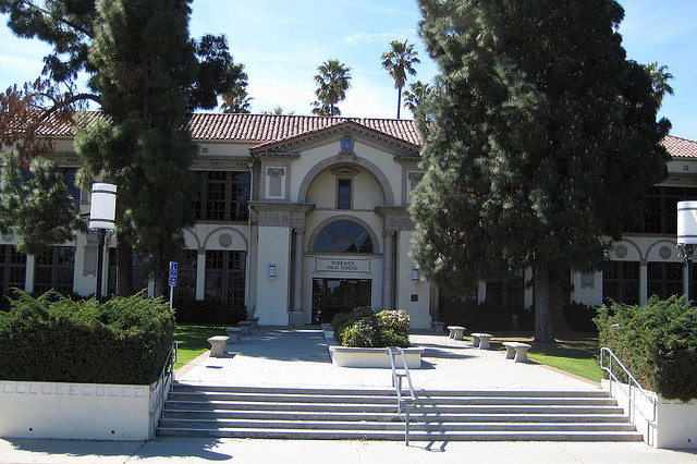
Torrance School
Monument and historic site · National Register of Historic Places · 2.2 mi
School building in California, United States of America


Woman's Club of Redondo Beach
Monument and historic site · National Register of Historic Places · 1.7 mi
Clubhouse in California, United States of America

7 more on the map.
Parks, trails and playgrounds37

Madrona Marsh Nature Preserve
Hiking and trails · 0.9 mi
Tu-Th 10:00-15:00; Fr 10:00-16:00; Sa 10:00-17:00; Su-Mo off

F E Hopkins Wilderness Park
Park · 1.0 mi
1102 South Camino Real
Th-Tu 10:00-17:30; We off
Columbia Park, Torrance, California
Park · 2.2 mi
Piece of open land for recreational use in Torrance, California
Del Cerro Park
Park · 5.1 mi
Park in California, United States of America, United States of America
Ken Malloy Harbor Regional Park
Park · 4.7 mi
Park in Los Angeles County, California, United States of America
Sand Dune Park
Park · 5.7 mi
Sand dunes in Manhattan Beach, California
25 more on the map.
Restaurants and cafes325


Buca di Beppo
Restaurant · Italian · 1.8 mi
1670 South Pacific Coast Highway
Mo-Th 11:00-22:00; Fr-Sa 11:00-23:00; Su 11:00-21:30

CoCo Ichibanya
Restaurant · Curry, Japanese · 1.8 mi
2455 Sepulveda Boulevard, Torrance
Mo-Th, Su 11:00-22:00; Fr-Sa 11:00-23:00
Copa Vida
Cafe · Coffee Shop, Sandwich, Breakfast · 0.5 mi
21250 Hawthorne Boulevard, Torrance
Mo-Fr 07:00-15:00
Din Tai Fung
Restaurant · Taiwanese · 0.4 mi
21540 Hawthorne Boulevard, Torrance
Mo-Th 11:00-21:00; Fr 11:00-21:30; Sa 10:00-21:30; Su 10:00-20:30
Fatto a Mano
Restaurant · Italian · 1.5 mi
610 Torrance Boulevard
Tu 11:30-19:00; We-Su 11:30-21:00; Mo off
Georgio's Pizza
Restaurant · Pizza, Wings · 1.9 mi
4964 West 190th Street, Torrance
Mo-Fr 10:00-23:00, Sa-Su 10:30-23:00
Good Vibes Pizza
Restaurant · Italian Pizza, Pizza · 0.8 mi
22825 Hawthorne Boulevard
Mo-Sa 11:00-21:00; Su 12:00-21:00
Japonica
Restaurant · Japanese, Sushi · 1.7 mi
1304 1/2 South Pacific Coast Highway
Su-Th 11:30-21:00; Fr-Sa 11:30-22:00
313 more on the map.
History
Torrance was founded in October 1912 and was incorporated on May 12, 1921.
From the History section of Torrance, California on Wikipedia, under CC BY-SA 4.0.
Where to stay25
Courtyard Los Angeles Torrance/Palos Verdes
Motel and hotel · 1.5 mi
2633 Sepulveda Boulevard, Torrance
Torrance Inn LAX Airport Area
Motel and hotel · 2.0 mi
2360 Sepulveda Boulevard, Torrance
Bluestem Hotel Torrance-Los Angeles, Ascend Hotel Collection
Motel and hotel · 1.8 mi
2448 West Sepulveda Boulevard, Torrance
Extended Stay America - Los Angeles - Torrance - Del Amo Circle
Motel and hotel
3995 W Carson Street, Torrance
Howard Johnson by Wyndham Torrance
Motel and hotel · 0.6 mi
3673 Torrance Boulevard, Torrance
Pacific Coast Inn Redondo Beach
Motel and hotel · 1.6 mi
716 South Pacific Coast Highway, Redondo Beach
Churches and places of worship25
Saint Katherine Greek Orthodox Church
Church · Greek Orthodox · 1.3 mi
722 Knob Hill Avenue, Redondo Beach
Redondo Beach Church of Christ
Church · Church Of Christ · 1.7 mi
6122 Pacific Coast Highway, Redondo Beach
Shopping70
Gas and EV charging30
Schools, colleges and libraries72
El Retiro Branch Torrance Public Library
Library · 1.6 mi
126 Vista del Parque, Redondo Beach
Healthcare32
Providence Little Company of Mary Medical Center Torrance
Hospital · 0.6 mi
4101 Torrance Boulevard, Torrance
Providence Little Company of Mary Outpatient Rehabilitation Center
Clinic and pharmacy · 0.6 mi
21135 Hawthorne Boulevard
Map of Torrance
250 places. The map loads OpenStreetMap tiles when you open it.
Climate by month
Monthly table
| Month | High | Low | Rain |
|---|---|---|---|
| Jan | 67°F | 47°F | 3.0 in |
| Feb | 66°F | 48°F | 3.7 in |
| Mar | 66°F | 50°F | 2.2 in |
| Apr | 68°F | 52°F | 0.6 in |
| May | 70°F | 56°F | 0.3 in |
| Jun | 72°F | 58°F | 0.1 in |
| Jul | 76°F | 62°F | 0.1 in |
| Aug | 76°F | 63°F | 0.0 in |
| Sep | 76°F | 62°F | 0.1 in |
| Oct | 74°F | 57°F | 0.5 in |
| Nov | 71°F | 51°F | 0.8 in |
| Dec | 66°F | 47°F | 2.4 in |
U.S. Climate Normals 1991-2020 for Redondo Beach (1 mi away), NOAA NCEI.
People and cost of living
American Community Survey 5-year estimates, 2020-2024, U.S. Census Bureau. Estimates have margins of error, larger for small towns.
Disaster history
Los Angeles County has had 67 federal disaster declarations since 2000, most often for fires.
- 2025-08-08: Canyon Fire (Fire)
- 2025-01-08: Wildfires And Straight-Line Winds (Fire)
- 2025-01-08: Eaton Fire (Fire)
- 2025-01-08: Hurst Fire (Fire)
- 2025-01-07: Palisades Fire (Fire)
- 2024-12-10: Franklin Fire (Fire)
OpenFEMA disaster declarations summaries.
Getting there and nearby towns
Zamperini Field (TOA) is the nearest airport with scheduled flights listed in OpenStreetMap, 2 miles away.
- Redondo Beach 3 mi northwest, about 5 min by car
- Lomita 3 mi southeast, about 5 min by car
- West Carson 4 mi east, about 6 min by car
- Hermosa Beach 4 mi northwest, about 6 min by car
- Lawndale 4 mi north, about 6 min by car
- Rolling Hills Estates 4 mi south, about 6 min by car
- Alondra Park 4 mi north, about 7 min by car
- Gardena 5 mi northeast, about 8 min by car
- Manhattan Beach 5 mi northwest, about 9 min by car
- Hawthorne 6 mi north, about 9 min by car
Drive times are estimates from straight-line distance, not routes.
Local news
Headlines from INDB, the NEMICO news database.
Reviews, tips and questions
Loading what members have shared...
Sources and licences
- NCES EDGE (Public domain): public schools
- NOAA NCEI U.S. Climate Normals 1991-2020 (Public domain): climate by month
- OpenFEMA (Public domain): disaster declarations
- OpenStreetMap contributors (ODbL 1.0): places, airports, map data
- U.S. Census Bureau (Public domain): population, income, housing, education, commute
- Wikidata (CC0 1.0): elevation, founding date, time zone, website, landmarks and historic places
- Wikimedia Commons (see each image): photos
- Wikipedia (CC BY-SA 4.0): overview and history text
Photo credits
- Torranceca, Cardinalngold at English Wikipedia, Public domain
- Mitsuwa Marketplace Torrance food court panorama, 2025-11-11, TeddyBearInMind007, CC BY-SA 4.0
- Mitsuwa Torrance 2025-10-15, TeddyBearInMind007, CC0
- Mitsuwa Marketplace Torrance aisles, 2025-11-11, TeddyBearInMind007, CC BY-SA 4.0
- Rivian at the Del Amo Mall in Torrance CA rear, RykJ, CC BY-SA 2.0
- Rivian at the Del Amo Mall in Torrance CA, RykJ, CC BY-SA 2.0
- Rivian at the Del Amo Mall in Torrance CA front, RykJ, CC BY-SA 2.0
- Goodyear Blimp low over Torrance, Blervis, CC0
- 2010-1101-FernAveSchool, Bobak Ha'Eri, CC BY 3.0
- Redondo Woman's Club, ChildofMidnight, CC BY 3.0
- THS HomeEc, Original uploader was Alton at en.wikipedia, CC BY-SA 3.0
- Malaga Cove Library, Palos Verdes Library District, CC BY 2.0
- 2010-1101-02-RedondoBeachHD, Bobak Ha'Eri, CC BY 3.0
- Torrance High School entrance, LCfam, CC BY-SA 3.0
- Python Code, Weal2019, CC0
- Bee on cosmos - panoramio, ncollette, CC BY-SA 3.0
- Del Amo Fashion Center 2 2018-09-19, F ASTILY, CC BY-SA 4.0
- Del Amo Fashion Center 3 2018-09-19, F ASTILY, CC BY-SA 4.0
- Interior of Del Amo Fashion Center, Rjung2k, CC BY-SA 4.0
- Harry Potter Midnight Premiere - 12 screens emptying at once (5941366300), The Conmunity - Pop Culture Geek from Los Angeles, CA, USA, CC BY 2.0
- Harry Potter Midnight Premiere - lines of fans (5940807137), The Conmunity - Pop Culture Geek from Los Angeles, CA, USA, CC BY 2.0
- Harry Potter Midnight Premiere - lines of fans (5941366244), The Conmunity - Pop Culture Geek from Los Angeles, CA, USA, CC BY 2.0
- Harry Potter Midnight Premiere - in mourning at 2-45am (5941366362), The Conmunity - Pop Culture Geek from Los Angeles, CA, USA, CC BY 2.0
- Harry Potter Midnight Premiere - SOLD OUT (5941366190), The Conmunity - Pop Culture Geek from Los Angeles, CA, USA, CC BY 2.0
- Harry Potter Midnight Premiere - costumed fans (5941366424), The Conmunity - Pop Culture Geek from Los Angeles, CA, USA, CC BY 2.0
- Del Amo Fashion Center 1 2018-09-19, F ASTILY, CC BY-SA 4.0
- Del Amo Fashion Center 4 2018-09-19, F ASTILY, CC BY-SA 4.0
- Cat Pocket - panoramio, bahniuk, CC BY 3.0
- Lifestyle Court, Del Amo Fashion Center, Rjung2k, CC BY-SA 4.0
- Championship Rings (51333095028), mark6mauno, CC BY 2.0
- Arctic Zero in store, garretteb, CC BY 2.0
- Diploicia canescens 84964296, redrovertracy, CC BY 4.0
- A Loyal American Eskimo Dog, Abcheng, CC BY-SA 4.0
- North American BT-14 (AC 40-1147) (5230249460), Bill Larkins, CC BY-SA 2.0
- MaxDevereaux1, Mountainsareagainmountains, CC BY-SA 4.0
- Porsche Panamera 4S CrossTurismo (2022) (54210281337), Charles from Port Chester, New York, CC BY 2.0
- U.S. Congresswoman Maxine Waters (42238314391), mark6mauno, CC BY 2.0
- U.S. Congresswoman Maxine Waters (41516585674), mark6mauno, CC BY 2.0
- California State Senator Ben Allen (41337385055), mark6mauno, CC BY 2.0
- California State Senator Steven Bradford, mark6mauno, CC BY 2.0


Page built October 30, 2026. Spotted a mistake? Tell us or suggest a place.