


Amherst Town, Massachusetts
Amherst Town is a city of 38,182 people in Hampshire County, Massachusetts, founded in 1703.
Why visit Amherst Town
Townapedia lists 60 museums and landmarks, 150 parks and trails, 130 places to eat, 11 places to stay and 38 attractions in and around town.
Highlights include Cinemark at Hampshire Mall, Amherst Cinema, Eric Carle Museum of Picture Book Art and Beneski Museum of Natural History.
July is the warmest month, with average highs of 83°F; January lows average 14°F, and about 36 inches of snow fall in a normal year.
Weather in Amherst Town
Forecast from the National Weather Service. Full forecast
About Amherst Town
Amherst is a city in Hampshire County, Massachusetts, United States, in the Connecticut River valley. Amherst has a council–manager form of government, and is considered a city under Massachusetts state law. Amherst is one of several Massachusetts municipalities that have city forms of government but retain "The Town of" in their official names. At the 2020 census, the population was 39,263, making it the most populated municipality in Hampshire County (although the county seat is Northampton).
From the Wikipedia article Amherst, Massachusetts (this version), under CC BY-SA 4.0.
Things to do38

Cinemark at Hampshire Mall
Cinema and theater · 2.1 mi
Tu,Fr 11:45-23:00; Sa,Su 10:45-23:00; Mo 11:45-20:30; We...
Amherst Cinema
Cinema and theater · 1.1 mi
28 Amity Street, Amherst
Mo-Fr 13:30-22:00; Sa-Su 10:00-22:00

Calvin Coolidge Bridge
Bridge · 5.9 mi
Bridge in Hadley, Massachusetts

Norwottuck Rail Trail Bridge
Bridge · 6.0 mi
Bridge in Massachusetts to Hadley, Massachusetts
Simple Gifts Farm
Farm and orchard · 3.2 mi
1089 North Pleasant Street, Amherst
Mo-Fr 10:00-19:00; Sa,Su 08:00-19:00

26 more on the map.
Museums and landmarks60

Eric Carle Museum of Picture Book Art
Museum · 3.2 mi
The Eric Carle Museum of Picture Book Art is a museum devoted to the art of the picture book and especially the children's book. It is a...
125 West Bay Road, Amherst
We-Fr 10:00-16:00; Sa 10:00-17:00; Su 12:00-17:00


East Village Historic District
Monument and historic site · National Register of Historic Places · 1.0 mi
Listed on the NRHP in Massachusetts

Emily Dickinson Museum
Museum · National Register of Historic Places · 1.0 mi
Historic house museum
280 Main Street, Amherst

Hadley Center Historic District
Monument and historic site · National Register of Historic Places · 4.5 mi
Historic district in Massachusetts, United States

Amherst Central Business District
Monument and historic site · National Register of Historic Places · 1.2 mi
Historic district in Amherst, Massachusetts

Amherst West Cemetery
Monument and historic site · National Register of Historic Places · 1.2 mi
Cemetery in Amherst, Massachusetts
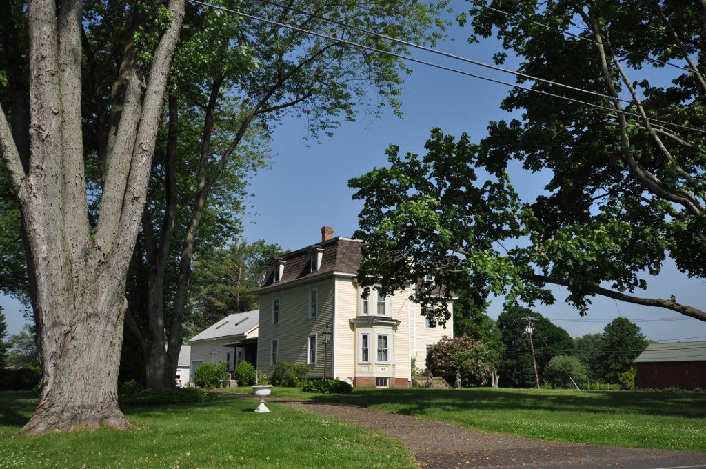
Bradstreet Historic District
Monument and historic site · National Register of Historic Places · 5.1 mi
Historic district in Massachusetts, United States

Conkey-Stevens House
Monument and historic site · National Register of Historic Places · 0.9 mi
Amherst, Massachusetts, NRHP-listed


Cushman Village Historic District
Monument and historic site · National Register of Historic Places · 3.7 mi
Historic district in Massachusetts, United States

Dickinson Historic District
Monument and historic site · National Register of Historic Places · 1.0 mi
Historic district in Massachusetts, United States
48 more on the map.
Parks, trails and playgrounds150

Fort River Grasslands Division
Hiking and trails · 2.9 mi
Small hiking trail and wildlife refuge in Hadley Massachusetts managed by the US Fish and Wildlife Service
69 Moody Bridge Road, Hadley


J. A. Skinner State Park
Park · 5.8 mi
Park in Hampshire County, Massachusetts, United States of America

138 more on the map.
Restaurants and cafes130

Amherst Coffee + Bar
Cafe · Coffee Shop · 1.1 mi
28 Amity Street, Amherst
Mo 07:00-17:00; Tu-Su 07:00-23:30

Amherst House of Pizza
Restaurant · Pizza · 3.5 mi
17 Montague Road, Amherst
Mo closed; Tu-Th 11:00-20:00; Fr 11:00-21:00; Sa 11:30-20:30; Su...

Amherst Public House
Diner · American · 1.4 mi
40 University Drive
Mo-Th 11:30-24:00; Fr,Sa 00:00-01:00,11:30-24:00; Su...
Bistro 63 at the Monkey Bar and Grill
Diner · American · 1.1 mi
63 North Pleasant Street, Amherst
Su-Th 11:30-20:30; Fr-Sa 11:30-21:00
Cushman Market & Cafe
Cafe · Coffee Shop, Sandwich, Breakfast · 3.4 mi
491 Pine Street, Amherst
Mo-Fr 07:00-19:00; Sa 08:00-19:00; Su 08:00-17:00
El Comalito
Restaurant · Mexican, Salvadoran · 1.7 mi
460 West Street, Amherst
Su-Th 10:30-20:00; Fr-Sa 10:30-21:00
Fresh Side
Restaurant · Chinese · 1.0 mi
39 South Pleasant Street, Amherst
Su-Th 11:00-21:00; Fr-Sa 11:00-21:30
La Veracruzana
Restaurant · Mexican · 1.2 mi
104 North Pleasant Street, Amherst
Mo-We 11:00-21:00; Th-Sa 11:00-22:00; Su 11:30-21:00
118 more on the map.
History
The earliest known document of the lands now comprising Amherst is the deed of purchase dated December 1658 between John Pynchon of Springfield and three native inhabitants, referred to as Umpanchla, Quonquont, and Chickwalopp. According to the deed, "ye Indians of Nolwotogg (Norwottuck) upon ye River of Quinecticott (Connecticut)" sold the entire area in exchange for "two Hundred fatham of Wampam & Twenty fatham, and one large Coate at Eight fatham wch Chickwollop set of, of trusts, besides severall small giftes" [sic].
Amherst was first visited by Europeans no later than 1665, when Nathaniel Dickinson surveyed the lands for its mother town Hadley. The first permanent English settlements arrived in 1727. It remained a part of Hadley, even when it gained precinct status in 1734, before becoming a township in 1759.
From the History section of Amherst, Massachusetts on Wikipedia, under CC BY-SA 4.0.
Where to stay11
Comfort Inn & Suites hadley - Amherst
Motel and hotel · 2.0 mi
400 Russell Street
Homewood Suites by Hilton Hadley Amherst
Motel and hotel · 2.4 mi
350 Russell Street
Churches and places of worship22
Goodwin Memorial African Methodist Episcopal Zion Church
Church · National Register of Historic Places · 0.9 mi
The Church of Jesus Christ of Latter-day Saints
Church · Mormon · 1.5 mi
23 Brigham Lane
Shopping32
Mom's House Chinese Food Market
Grocery · Asian · 0.7 mi
318 College Street, Amherst
Gas and EV charging8
Schools, colleges and libraries39
Healthcare8
Hampshire College Health and Counseling Services
Clinic and pharmacy · 2.7 mi
893C West Street
MedExpress Urgent Care Center
Clinic and pharmacy · 1.7 mi
424 Russell Street, Hadley
University Health Services
Clinic and pharmacy · 2.0 mi
150 Infirmary Way, Amherst
Cooley Dickinson Medical Building
Clinic and pharmacy · 1.3 mi
170 University Drive
Map of Amherst Town
250 places. The map loads OpenStreetMap tiles when you open it.
Climate by month
Monthly table
| Month | High | Low | Rain | Snow |
|---|---|---|---|---|
| Jan | 34°F | 14°F | 3.4 in | 8.1 in |
| Feb | 37°F | 15°F | 2.9 in | 11.0 in |
| Mar | 45°F | 24°F | 3.5 in | 7.3 in |
| Apr | 58°F | 34°F | 3.8 in | 1.0 in |
| May | 70°F | 45°F | 3.7 in | 0.0 in |
| Jun | 78°F | 55°F | 4.5 in | 0.0 in |
| Jul | 83°F | 60°F | 4.1 in | 0.0 in |
| Aug | 82°F | 58°F | 4.1 in | 0.0 in |
| Sep | 74°F | 50°F | 4.6 in | 0.0 in |
| Oct | 62°F | 39°F | 4.7 in | 0.0 in |
| Nov | 50°F | 29°F | 3.4 in | 1.6 in |
| Dec | 39°F | 21°F | 3.9 in | 7.5 in |
U.S. Climate Normals 1991-2020 for Amherst Hcn (2 mi away), NOAA NCEI.
People and cost of living
American Community Survey 5-year estimates, 2020-2024, U.S. Census Bureau. Estimates have margins of error, larger for small towns.
Disaster history
Hampshire County has had 19 federal disaster declarations since 2000, most often for severe storms.
- 2023-09-15: Hurricane Lee (Hurricane)
- 2020-03-27: Covid-19 Pandemic (Biological)
- 2020-03-13: Covid-19 (Biological)
- 2013-04-19: Severe Winter Storm, Snowstorm, And Flooding (Severe Storm)
- 2012-10-28: Hurricane Sandy (Hurricane)
- 2012-01-06: Severe Storm And Snowstorm (Severe Storm)
OpenFEMA disaster declarations summaries.
Getting there and nearby towns
Northampton Airport (7B2) is the nearest airport with scheduled flights listed in OpenStreetMap, 6 miles away.
- Springfield 17 mi south, about 28 min by car
- Agawam Town 22 mi south, about 35 min by car
- Windsor Locks 31 mi south, about 50 min by car
- Worcester 36 mi east, about 58 min by car
- Manchester 40 mi south, about 1 h by car
- Storrs 41 mi south, about 1 h by car
- Hartford 42 mi south, about 1 h 15 min by car
- East Hartford 42 mi south, about 1 h 15 min by car
- West Hartford 43 mi south, about 1 h 15 min by car
- Wethersfield 46 mi south, about 1 h 15 min by car
Drive times are estimates from straight-line distance, not routes.
Local news
Headlines from INDB, the NEMICO news database.
Reviews, tips and questions
Loading what members have shared...
Sources and licences
- NCES EDGE (Public domain): public schools
- NOAA NCEI U.S. Climate Normals 1991-2020 (Public domain): climate by month
- OpenFEMA (Public domain): disaster declarations
- OpenStreetMap contributors (ODbL 1.0): places, airports, map data
- U.S. Census Bureau (Public domain): population, income, housing, education, commute
- Wikidata (CC0 1.0): elevation, founding date, time zone, website, landmarks and historic places
- Wikimedia Commons (see each image): photos
- Wikipedia (CC BY-SA 4.0): overview and history text
Photo credits
- Downtown Amherst 6, AlexiusHoratius, CC BY-SA 3.0
- Eric Carle Museum of Picture Book Art, September 2016, Amherst MA, John Phelan, CC BY-SA 4.0
- First Congregational Church, Hadley MA, John Phelan, CC BY 3.0
- Dickinson Baggs Tavern, Amherst MA, John Phelan, CC BY 3.0
- Emily Dickinson Museum, Amherst, MA - front, Daderot, Public domain
- Jervis Gilbert House, East Leverett MA, John Phelan, CC BY-SA 4.0
- Gravestones in West Cemetery, Amherst, Massachusetts, DyanFrench, CC BY-SA 3.0
- ShutesburyMA SouthSchool 02, User:Magicpiano, CC BY-SA 4.0
- 324 Pomeroy Lane, South Amherst MA, John Phelan, CC BY 3.0
- South Pleasant Street, Amherst MA, John Phelan, CC BY 3.0
- Cushman Market and Cafe, Cushman MA, John Phelan, CC BY 4.0
- A house on North Prospect St, Amherst MA, John Phelan, CC BY 3.0
- A house on Lincoln Ave, Amherst MA, John Phelan, CC BY 3.0
- Old Pelham Town Hall, Pelham MA, John Phelan, CC BY 3.0
- Upper Main Street Historic District, Hatfield MA, John Phelan, CC BY-SA 3.0
- Goodwin Church, DyanFrench, CC BY-SA 3.0
- Old Mill on the Falls, Hatfield MA, John Phelan, CC BY-SA 3.0
- HatfieldMA ElmStreetHD 02, User:Magicpiano, CC BY-SA 4.0
- HatfieldMA BradstreetHD, User:Magicpiano, CC BY-SA 4.0
- Hillsboro Cemetery, Leverett, MA (October 2020), Marty Aligata, CC BY-SA 4.0
- Northampton Road (Rt. 9) at Snell Street, DyanFrench, CC BY-SA 3.0
- Conkey-Stevens House, Amherst MA, John Phelan, CC BY 3.0
- North Congregational Church, North Amherst MA, John Phelan, CC BY-SA 3.0
- AmherstMA BairdHouse, John H. Martin, Public domain
- Strong House, Amherst MA, John Phelan, CC BY 3.0
- Porter-Phelps-Huntington House, Hadley MA, John Phelan, CC BY 3.0
- Congregational Church, North Hadley MA, John Phelan, CC BY-SA 4.0
- Center School - Hatfield, Massachusetts - DSC01888, Daderot, CC0
- Umass Amherst Skyline, The original uploader was Eraboin at English Wikipedia ., CC BY 2.5


Page built October 30, 2026. Spotted a mistake? Tell us or suggest a place.