



Why visit Avon
Townapedia lists 5 museums and landmarks, 45 parks and trails, 140 places to eat, 10 places to stay and 2 attractions in and around town.
Highlights include Regal Cinemas, 103rd Ohio Volunteer Infantry Association Barracks, Aaron Aldrich House and Mercy Health Stadium.
July is the warmest month, with average highs of 85°F; January lows average 22°F, and about 44 inches of snow fall in a normal year.
Weather in Avon
Forecast from the National Weather Service. Full forecast
About Avon
Avon is a city in northeastern Lorain County, Ohio, United States. The population was 24,847 at the 2020 census. It is part of the Cleveland metropolitan area.
From the Wikipedia article Avon, Ohio (this version), under CC BY-SA 4.0.
Things to do2

Olde Towne Hall Theatre
Cinema and theater · 3.9 mi
36119 Center Ridge Road, North Ridgeville
Museums and landmarks5

103rd Ohio Volunteer Infantry Association Barracks
Monument and historic site · National Register of Historic Places · 5.0 mi
United States historic place


Aaron Aldrich House
Monument and historic site · National Register of Historic Places · 4.3 mi
House in Bay Village, Ohio
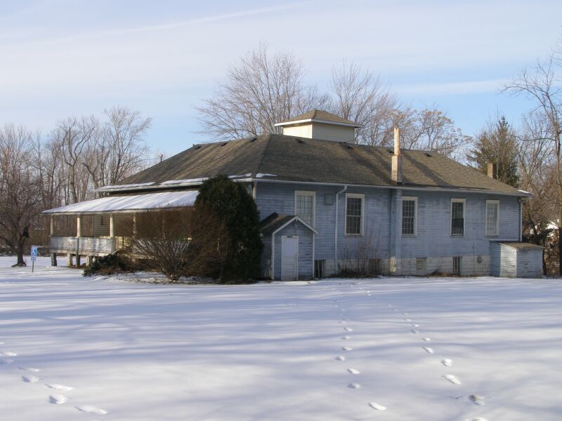
Avon Isle
Monument and historic site · National Register of Historic Places · 1.5 mi
Building in Ohio, United States
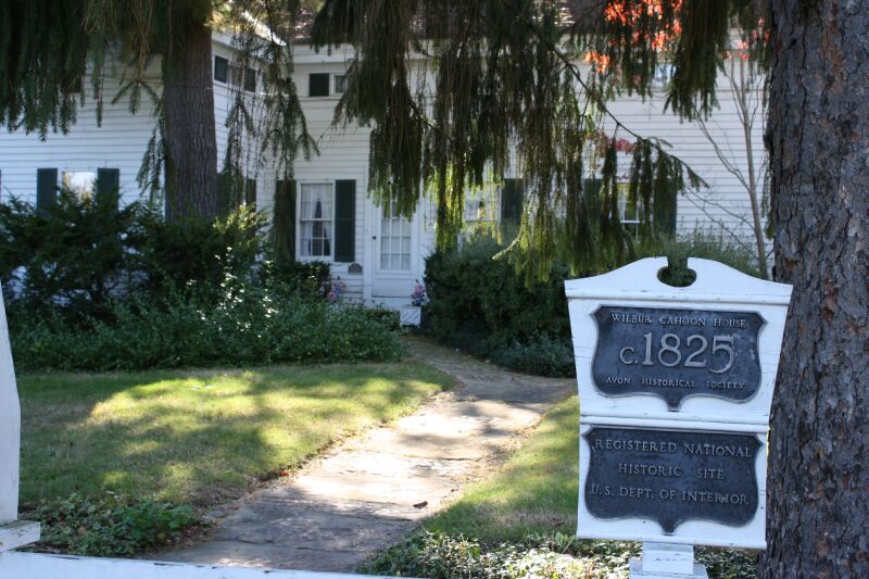
Wilbur Cahoon House
Monument and historic site · National Register of Historic Places · 1.4 mi
Historic house in Ohio, United States

Parks, trails and playgrounds45

Mercy Health Stadium
Sports field and stadium · 3.1 mi
2009 Baseball Boulevard, Avon



33 more on the map.
Restaurants and cafes140

Aladdin's
Restaurant · Lebanese · 3.0 mi
151 Crocker Park Boulevard, Westlake
Mo-Th 11:00-22:00; Fr-Sa 11:00-22:30; Su 11:00-21:30
Cafe Tandoor
Restaurant · Indian · 3.0 mi
30030 Detroit Road, Westlake
Mo-Th 17:00-21:30; Fr,Sa 16:30-21:30; Su 15:00-21:00
Hummus Republic
Restaurant · Mediterranean · 1.8 mi
33420 Just Imagine Drive, Avon
Mo-Sa 11:00-20:00; Su 11:00-19:00

Klingshirn Winery
Brewery and winery · 3.3 mi
Family owned winery, tasting room.
33059 Webber Road
Mo-Sa 10:00-18:00

Condado Tacos
Restaurant · Mexican · 2.9 mi
203 Market Street, Westlake
Su-Th 11:00-23:00, Fr,Sa 11:00-24:00

Graeter's
Ice cream · Ice Cream · 2.9 mi
261 Main Street, Westlake
Su-Th 11:00-21:30; Fr,Sa 11:00-22:00

Moosehead BBQ Grill
Restaurant · American, Barbecue, Chicken, Burger, Seafood, Pasta · 2.5 mi
820 Center Road, Avon
128 more on the map.
History
In the 17th century, what is now Avon, Avon Lake, Bay Village, and Westlake were all once one territory. This territory was inhabited by various Native American tribes, such as the Wyandots, Ottawas, and Eries, who lived in wigwams or simple-stone dwellings. They settled, traded, fought, and later forcibly moved elsewhere.
Township Number 7 in Range 16 of the Western Reserve received its first permanent American settlers during 1814 from Montgomery County, New York, led by Wilbur Cahoon. The township was administered by Dover township and was part of Cuyahoga County. In 1818, Township Number 7 was organized and named Xeuma, then later renamed Troy Township. In 1824, Lorain County was created, and the name was changed to Avon Township. An Avon post office was established in 1825. The entire township was incorporated into a village in 1917, and it became the City of Avon in 1961.
From the History section of Avon, Ohio on Wikipedia, under CC BY-SA 4.0.
Where to stay10
Extended Stay America Select Suites - Cleveland - Avon
Motel and hotel · 2.7 mi
1610 Moore Road, Avon
Fairfield Inn & Suites Cleveland Avon
Motel and hotel · 3.1 mi
39050 Colorado Avenue, Avon
Residence Inn Cleveland Avon at The Emerald Event Center
Motel and hotel · 1.9 mi
33040 Just Imagine Drive, Avon
Churches and places of worship14
First Universalist Church of Olmsted
Church · National Register of Historic Places · 4.4 mi
Saint Mary of the Immaculate Conception Parish
Church · Catholic · 1.5 mi
2660 Stoney Ridge Road, Avon
St. Ladislas Roman Catholic Church
Church · Roman Catholic · 3.2 mi
2345 Bassett Road, Westlake
Westlake Bible Fellowship
Church · Nondenominational · 3.9 mi
27975 Hilliard Boulevard, Westlake
Shopping31
Gas and EV charging20
Schools, colleges and libraries51
North Ridgeville High School
School · 3.9 mi
34600 Bainbridge Road, North Ridgeville
Healthcare23
Cleveland Clinic - Avon - Richard E. Jacobs Health Center
Clinic and pharmacy · 2.0 mi
33100 Cleveland Clinic Boulevard, Avon
Cleveland Clinic - Avon Lake Family Health Center
Clinic and pharmacy · 3.5 mi
450 Avon Belden Road, Avon Lake
Cleveland Clinic Medical Outpatient Center
Clinic and pharmacy · 3.4 mi
34960 Center Ridge Road, North Ridgeville
Cleveland Clinic Outpatient + Urgent Care
Clinic and pharmacy · 1.4 mi
1813 Nagel Road, Avon
Cleveland Clinic Primary Care & Optometry Services
Clinic and pharmacy · 3.6 mi
35105 Center Ridge Road, North Ridgeville
Cleveland Clinic Rehabilitation Hospital
Hospital · 2.2 mi
33355 Health Campus Boulevard, Avon
Map of Avon
250 places. The map loads OpenStreetMap tiles when you open it.
Climate by month
Monthly table
| Month | High | Low | Rain | Snow |
|---|---|---|---|---|
| Jan | 36°F | 22°F | 2.8 in | 12.9 in |
| Feb | 40°F | 23°F | 2.4 in | 10.2 in |
| Mar | 49°F | 30°F | 3.0 in | 7.6 in |
| Apr | 63°F | 40°F | 3.8 in | 1.9 in |
| May | 73°F | 51°F | 3.9 in | 0.0 in |
| Jun | 81°F | 60°F | 4.0 in | 0.0 in |
| Jul | 85°F | 65°F | 4.1 in | 0.0 in |
| Aug | 83°F | 63°F | 4.1 in | 0.0 in |
| Sep | 77°F | 56°F | 4.0 in | 0.0 in |
| Oct | 65°F | 46°F | 3.6 in | 0.0 in |
| Nov | 52°F | 36°F | 3.0 in | 2.2 in |
| Dec | 41°F | 27°F | 3.1 in | 8.8 in |
U.S. Climate Normals 1991-2020 for Elyria 3 E (5 mi away), NOAA NCEI.
People and cost of living
American Community Survey 5-year estimates, 2020-2024, U.S. Census Bureau. Estimates have margins of error, larger for small towns.
Disaster history
Lorain County has had 9 federal disaster declarations since 2000, most often for severe storms.
- 2020-03-31: Covid-19 Pandemic (Biological)
- 2020-03-13: Covid-19 (Biological)
- 2012-06-30: Severe Storms (Severe Storm)
- 2005-09-13: Hurricane Katrina Evacuation (Hurricane)
- 2005-02-15: Severe Winter Storms, Flooding, And Mudslides (Severe Storm)
- 2004-09-19: Severe Storms And Flooding (Severe Storm)
OpenFEMA disaster declarations summaries.
Getting there and nearby towns
Cleveland Hopkins International Airport (CLE) is the nearest airport with scheduled flights listed in OpenStreetMap, 8 miles away.
- Avon Lake 3 mi north, about 6 min by car
- Westlake 4 mi east, about 6 min by car
- North Ridgeville 4 mi south, about 7 min by car
- North Olmsted 5 mi southeast, about 8 min by car
- Bay Village 5 mi northeast, about 8 min by car
- Elyria 7 mi southwest, about 11 min by car
- Fairview Park 8 mi east, about 13 min by car
- Rocky River 8 mi east, about 13 min by car
- Lorain 9 mi west, about 15 min by car
- Berea 9 mi southeast, about 15 min by car
Drive times are estimates from straight-line distance, not routes.
Local news
Headlines from INDB, the NEMICO news database.
Reviews, tips and questions
Loading what members have shared...
Sources and licences
- NCES EDGE (Public domain): public schools
- NOAA NCEI U.S. Climate Normals 1991-2020 (Public domain): climate by month
- OpenFEMA (Public domain): disaster declarations
- OpenStreetMap contributors (ODbL 1.0): places, airports, map data
- U.S. Census Bureau (Public domain): population, income, housing, education, commute
- Wikidata (CC0 1.0): elevation, founding date, time zone, website, landmarks and historic places
- Wikimedia Commons (see each image): photos
- Wikipedia (CC BY-SA 4.0): overview and history text
Photo credits
- Avon Ohio Old Townhall 26, Chris Light at English Wikipedia, CC BY-SA 3.0
- First Universalist Church of Olmsted, Carl F. Waite, Public domain
- 103rd OVI Infantry Barracks Museum, Philip Sutherland, CC BY-SA 4.0
- 2940 Stoney Ridge Wilbur Cahoon Home IMG 2073, Chris Light, CC BY-SA 3.0
- Avon Isle Park22, Chris Light, CC BY-SA 3.0
- Aaron Aldrich House, Nyttend, Public domain
Page built October 30, 2026. Spotted a mistake? Tell us or suggest a place.