




Westlake, Ohio
Westlake is a city of 34,104 people in Cuyahoga County, Ohio, founded in October 10, 1810.
Why visit Westlake
Townapedia lists 14 museums and landmarks, 48 parks and trails, 158 places to eat, 19 places to stay and 6 attractions in and around town.
Highlights include Puritas Springs Park, Regal Cinemas, Aaron Aldrich House and Avon Isle.
July is the warmest month, with average highs of 84°F; January lows average 22°F, and about 64 inches of snow fall in a normal year.
Weather in Westlake
Forecast from the National Weather Service. Full forecast
About Westlake
Westlake is a city in Cuyahoga County, Ohio, United States. It is a suburb located 12 miles (19 km) west of downtown Cleveland. The population was 34,228 at the 2020 census.
From the Wikipedia article Westlake, Ohio (this version), under CC BY-SA 4.0.
Things to do6

Puritas Springs Park
Monument and historic site · 4.9 mi
Amusement park


Museums and landmarks14

Aaron Aldrich House
Monument and historic site · National Register of Historic Places · 3.6 mi
House in Bay Village, Ohio
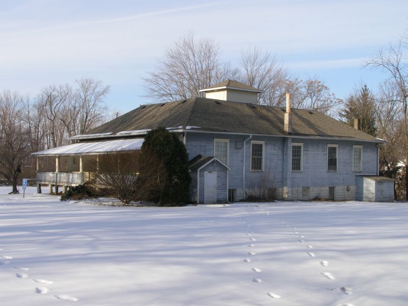
Avon Isle
Monument and historic site · National Register of Historic Places · 5.3 mi
Building in Ohio, United States

Bay View Hospital
Monument and historic site · National Register of Historic Places · 3.6 mi
Hospital located on 23200 Lake Rd in Bay Village, Ohio


John and Maria Adams House
Monument and historic site · National Register of Historic Places · 4.8 mi
Building in Ohio, United States
Rocket Engine Test Facility
Monument and historic site · National Register of Historic Places · 4.5 mi
Facility at Glenn Research Center
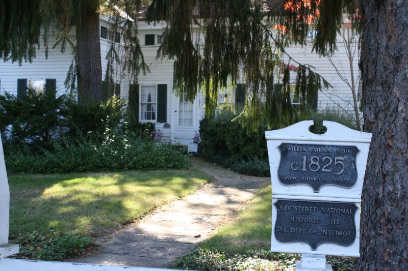
Wilbur Cahoon House
Monument and historic site · National Register of Historic Places · 5.3 mi
Historic house in Ohio, United States
Zero Gravity Research Facility
Monument and historic site · National Register of Historic Places · 4.3 mi

Art Academy Of Westlake
Museum · 0.6 mi
26914 Center Ridge Road
2 more on the map.
Parks, trails and playgrounds48




Little Clague Park Playground
Playground · 2.3 mi
3000 Clague Road, North Olmsted
36 more on the map.
Restaurants and cafes158

Aladdin's
Restaurant · Lebanese · 1.3 mi
151 Crocker Park Boulevard, Westlake
Mo-Th 11:00-22:00; Fr-Sa 11:00-22:30; Su 11:00-21:30

Applebee's
Diner · American · 2.5 mi
5010 Great Northern Plaza, North Olmsted
Su-Th 11:00-24:00, Fr,Sa 11:00-01:00
Bezoria
Restaurant · Arab, Mediterranean · 2.5 mi
27670 Lorain Road, North Olmsted
Mo-Sa 10:00-22:00, Su 11:00-21:00
Buffalo Wild Wings
Restaurant · Wings · 2.2 mi
26774 Lorain Road, North Olmsted
Su-Tu 11:00-23:00, Fr-Sa 11:00-00:00
Cafe Tandoor
Restaurant · Indian · 1.6 mi
30030 Detroit Road, Westlake
Mo-Th 17:00-21:30; Fr,Sa 16:30-21:30; Su 15:00-21:00
Canary's Family Restaurant
Restaurant · Diner · 3.0 mi
28981 Lorain Road, North Olmsted
Mo-Sa 06:00-21:00, Su 07:00-15:00
El Arepazo Y Pupuseria
Restaurant · Hispanic, Columbian, El Salvadorian · 3.1 mi
22799 Lorain Road, Fairview Park
Mo-Sa 12:00-21:00
Hummus Republic
Restaurant · Mediterranean · 3.2 mi
33420 Just Imagine Drive, Avon
Mo-Sa 11:00-20:00; Su 11:00-19:00
Imperial Garden
Restaurant · Chinese · 2.5 mi
24201 Lorain Road
Mo-Th 11:00-21:30; Fr-Sa 11:00-22:00; Su 12:00-21:00
Mashiso Asian Grille
Restaurant · Asian · 2.7 mi
24954 Brookpark Road, North Olmsted
Mo-Sa 11:00-21:00, Su 11:00-20:00
RAAN THAI
Restaurant · Thai · 3.2 mi
22610 Lorain Road
Su 16:00-21:00; Tu-Fr 11:00-14:30,17:00-21:00; Sa 12:00-15:00,17:00-21:00
146 more on the map.
History
The area now known as the city of Westlake was first settled by European Americans on October 10, 1810. At the time, it was part of Dover Township.
In 1901, the northern part of the township seceded to form Bay Village. In 1912, a southern portion left to join North Olmsted. The remaining township residents formed Dover Village in 1913, taking with it a portion of Olmsted Township.
In order to avoid confusion with the city of Dover in Tuscarawas County, Dover Village was renamed Westlake in 1940. The village of Westlake became a city in 1957.
In September 1966, a house in Westlake which had recently been bought by John R. Compton, a black pastor, was firebombed. No one was injured, although the bombing did cause around $10,000 of damage, equivalent to $99,231 in 2025. According to the Cleveland Press, the mayor of Westlake, Alexander R. Roman, "criticized the parties involved in the sale of the home... He said no one was notified so the community could be prepared to accept a Negro family."
From the History section of Westlake, Ohio on Wikipedia, under CC BY-SA 4.0.
Where to stay19
Courtyard Cleveland Airport North
Motel and hotel · 2.9 mi
24901 Country Club Boulevard, North Olmsted
Hampton Inn North Olmsted Cleveland Airport
Motel and hotel · 3.0 mi
24601 Country Club Boulevard, North Olmsted
Aloft Cleveland Airport
Motel and hotel · 3.1 mi
5550 Great Northern Boulevard, North Olmsted
Extended Stay America - Cleveland - Airport - North Olmsted
Motel and hotel · 2.9 mi
24851 Country Club Boulevard, North Olmsted
Holiday Inn Cleveland Airport West by IHG
Motel and hotel · 2.7 mi
25070 Country Club Boulevard, North Olmsted
Residence Inn Cleveland Avon at The Emerald Event Center
Motel and hotel · 3.2 mi
33040 Just Imagine Drive, Avon
Sonesta Simply Suites Cleveland North Olmsted
Motel and hotel · 2.9 mi
24741 Country Club Boulevard, North Olmsted
Churches and places of worship28
First Universalist Church of Olmsted
Church · National Register of Historic Places · 2.3 mi
North Olmsted United Methodist Church
Church · Methodist · 1.9 mi
4600 Dover Center Road, North Olmsted
Saint Demetrios Greek Orthodox Church
Church · Greek Orthodox · 2.9 mi
22909 Center Ridge Road, Rocky River
Ascension Lutheran Church
Church · Lutheran · 2.7 mi
28081 Lorain Road, North Olmsted
Church of the Redeemer
Church · United Church Of Christ · 2.6 mi
23500 Center Ridge Road, Westlake
Saint Richard's Catholic Church
Church · Catholic · 2.3 mi
26855 Lorain Road, North Olmsted
St. Ladislas Roman Catholic Church
Church · Roman Catholic · 0.8 mi
2345 Bassett Road, Westlake
The Church of Saint Clarence
Church · Catholic · 3.5 mi
30106 Lorain Road, North Olmsted
Shopping44
Gas and EV charging23
Schools, colleges and libraries61
Constellation Schools: Puritas Community Elementary
School · 5.8 mi
17720 Puritas Ave, Cleveland
Healthcare27
Cleveland Clinic - Avon - Richard E. Jacobs Health Center
Clinic and pharmacy · 3.0 mi
33100 Cleveland Clinic Boulevard, Avon
Alternative Healing
Clinic and pharmacy · 2.2 mi
4965 Dover Center Road, North Olmsted
Cleveland Clinic - Community Pediatrics Westlake
Clinic and pharmacy · 2.3 mi
805 Columbia Road, Westlake
Map of Westlake
250 places. The map loads OpenStreetMap tiles when you open it.
Climate by month
Monthly table
| Month | High | Low | Rain | Snow |
|---|---|---|---|---|
| Jan | 36°F | 22°F | 3.0 in | 18.4 in |
| Feb | 38°F | 24°F | 2.5 in | 15.1 in |
| Mar | 47°F | 31°F | 3.1 in | 10.8 in |
| Apr | 60°F | 41°F | 3.8 in | 2.7 in |
| May | 71°F | 51°F | 3.8 in | 0.0 in |
| Jun | 80°F | 61°F | 3.8 in | 0.0 in |
| Jul | 84°F | 65°F | 3.7 in | 0.0 in |
| Aug | 82°F | 64°F | 3.6 in | 0.0 in |
| Sep | 76°F | 57°F | 3.9 in | 0.0 in |
| Oct | 64°F | 46°F | 3.6 in | 0.1 in |
| Nov | 51°F | 37°F | 3.4 in | 4.5 in |
| Dec | 40°F | 28°F | 3.0 in | 12.2 in |
U.S. Climate Normals 1991-2020 for Cleveland 72524 (4 mi away), NOAA NCEI.
People and cost of living
American Community Survey 5-year estimates, 2020-2024, U.S. Census Bureau. Estimates have margins of error, larger for small towns.
Disaster history
Cuyahoga County has had 11 federal disaster declarations since 2000, most often for severe storms.
- 2020-03-31: Covid-19 Pandemic (Biological)
- 2020-03-13: Covid-19 (Biological)
- 2013-01-03: Severe Storms And Flooding Due To The Remnants Of Hurricane Sandy (Hurricane)
- 2012-06-30: Severe Storms (Severe Storm)
- 2006-07-02: Severe Storms, Tornadoes, Straight Line Winds, And Flooding (Severe Storm)
- 2005-09-13: Hurricane Katrina Evacuation (Hurricane)
OpenFEMA disaster declarations summaries.
Getting there and nearby towns
Cleveland Hopkins International Airport (CLE) is the nearest airport with scheduled flights listed in OpenStreetMap, 5 miles away.
- North Olmsted 2 mi south, about 4 min by car
- Bay Village 3 mi north, about 4 min by car
- Avon 4 mi west, about 6 min by car
- Fairview Park 4 mi east, about 6 min by car
- Rocky River 4 mi east, about 7 min by car
- Avon Lake 5 mi northwest, about 9 min by car
- North Ridgeville 6 mi southwest, about 10 min by car
- Brook Park 6 mi southeast, about 10 min by car
- Berea 7 mi southeast, about 10 min by car
- Lakewood 7 mi east, about 11 min by car
Drive times are estimates from straight-line distance, not routes.
Local news
Headlines from INDB, the NEMICO news database.
Reviews, tips and questions
Loading what members have shared...
Sources and licences
- NCES EDGE (Public domain): public schools
- NOAA NCEI U.S. Climate Normals 1991-2020 (Public domain): climate by month
- OpenFEMA (Public domain): disaster declarations
- OpenStreetMap contributors (ODbL 1.0): places, airports, map data
- U.S. Census Bureau (Public domain): population, income, housing, education, commute
- Wikidata (CC0 1.0): elevation, founding date, time zone, website, landmarks and historic places
- Wikimedia Commons (see each image): photos
- Wikipedia (CC BY-SA 4.0): overview and history text
Photo credits
- Westlake Porter Public Library, Kulshrax, Public domain
- First Universalist Church of Olmsted, Carl F. Waite, Public domain
- 2940 Stoney Ridge Wilbur Cahoon Home IMG 2073, Chris Light, CC BY-SA 3.0
- John and Maria Adams House, Nyttend, Public domain
- Avon Isle Park22, Chris Light, CC BY-SA 3.0
- Bay View Hospital, Nyttend, Public domain
- Aaron Aldrich House, Nyttend, Public domain
Page built October 30, 2026. Spotted a mistake? Tell us or suggest a place.