
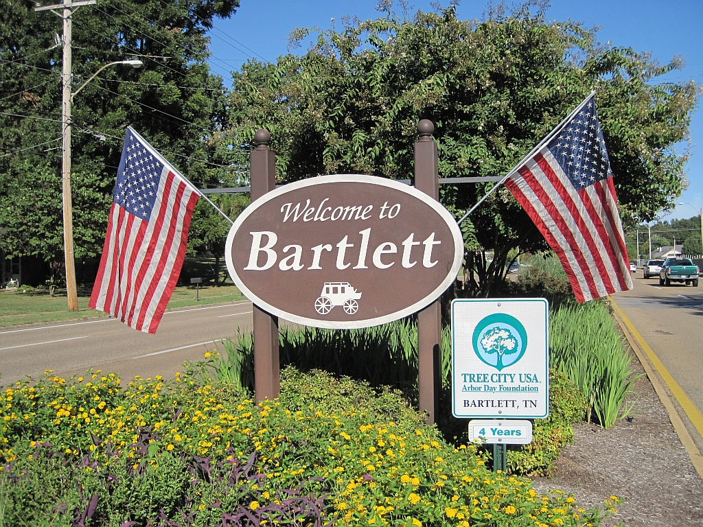


Bartlett, Tennessee
Bartlett is a city of 56,876 people in Shelby County, Tennessee, founded in 1829.
Why visit Bartlett
Townapedia lists 6 museums and landmarks, 23 parks and trails, 120 places to eat, 20 places to stay and 3 attractions in and around town.
Highlights include Hollywood 20, Malco Stage Cinema, Davies Manor and Goodwinslow.
July is the warmest month, with average highs of 91°F; January lows average 30°F.
Weather in Bartlett
Forecast from the National Weather Service. Full forecast
About Bartlett
Bartlett is a city in Shelby County, Tennessee, United States. The population was 57,786 at the 2020 census, and was estimated at 56,708 in 2024, making it the 14th-most populous city in Tennessee.
From the Wikipedia article Bartlett, Tennessee (this version), under CC BY-SA 4.0.
Things to do3

Museums and landmarks6
Davies Manor
Monument and historic site · National Register of Historic Places · 4.0 mi
Historic house in Tennessee, United States

Goodwinslow
Monument and historic site · National Register of Historic Places · 6.2 mi
Raleigh, Tennessee, listed on the NRHP in Shelby County, Tennessee
John H. McFadden House
Monument and historic site · National Register of Historic Places · 0.6 mi
Historic house in Tennessee, United States
Nicholas Gotten House
Monument and historic site · National Register of Historic Places · 3.6 mi
Historic house in Tennessee, United States

Parks, trails and playgrounds23


Davies Plantation Park
Park · 3.4 mi
9041 Davies Plantation Road, Bartlett
Mo-Su 04:00-23:00
11 more on the map.
Restaurants and cafes120

Baskin-Robbins
Ice cream · Ice Cream · 2.5 mi
8057 Highway 64, Memphis
Mo-Sa 10:30-22:00; Su 11:00-22:00

Biscuits& Jam
Restaurant · Breakfast, Brunch · 3.4 mi
5806 Stage Road, Bartlett
Mo-Fr 08:00-14:00; Sa,Su 09:00-15:00


Waldo's Chicken & Beer
Restaurant · Chicken, Sandwich, Salad · 3.8 mi
2200 North Germantown Parkway, Memphis
Su-Th 11:00-21:00; Fr-Sa 11:00-22:00
Ali Baba
Restaurant · Mediterranean · 4.5 mi
5800 Raleigh-Lagrange Road, Memphis
Mo off; Tu-Th 11:00-21:00; Fr-Sa 11:00-22:00; Su 11:00-21:00
Jim 'N Nick's Bar-B-Q
Diner · American · 3.4 mi
2359 North Germantown Parkway
Su-Th 11:00-21:00; Fr-Sa 11:00-21:30
Tommy’s Burger California Style
Restaurant · Burger · 2.3 mi
2931 Kirby-Whitten Parkway, Bartlett
Mo-Su 06:00-23:00
108 more on the map.
History
Bartlett, originally called "Union Depot", first served as the last major Tennessean depot along the westward stagecoach route from Nashville. It later shifted to serve as a rail station after the stagecoach route was replaced by the Memphis & Ohio Railroad. An agricultural community gradually emerged around the depot and subsequent station that saw little growth until after the American Civil War.
The community saw quick growth during Reconstruction, and by 1886 was home to a school, two gristmills, three churches, several general stores, and about 300 inhabitants. It had been officially incorporated on November 1, 1866, with a population of less than 100 under the inaugural mayorship of Bryan Wither. The city derived its name from Major Gabriel M. Bartlett, a planter and pioneer settler of the area, whose homeplace was located on the old Raleigh-Somerville Road (Stage Road) at the present location of Bartlett Station Plaza.
From the History section of Bartlett, Tennessee on Wikipedia, under CC BY-SA 4.0.
Where to stay20
Holiday Inn & Suites Memphis - Wolfchase Galleria
Motel and hotel · 3.1 mi
2751 New Brunswick Road, Memphis
Home2 Suites by Hilton Memphis Wolfchase Galleria
Motel and hotel · 3.2 mi
2809 New Brunswick Road, Memphis
Country Inn & Suites, Wolfchase-Memphis, TN
Motel and hotel · 3.6 mi
2270 North Germantown Parkway, Cordova
Hampton Inn and Suites Memphis - Wolfchase Galleria
Motel and hotel · 2.5 mi
2935 North Germantown Road, Bartlett
Churches and places of worship64
Bartlett Woods Church of Christ
Church · Church Of Christ · 2.3 mi
7900 East Old Brownsville Road, Arlington
St. Francis of Assisi Catholic Church
Church · Catholic · 4.0 mi
8151 Chimney Rock Boulevard, Memphis
Shopping32
Gas and EV charging48
Schools, colleges and libraries51
Saint Francis of Assisi Catholic School
School · Catholic · 3.9 mi
2100 North Germantown Parkway, Memphis
Healthcare16
Map of Bartlett
250 places. The map loads OpenStreetMap tiles when you open it.
Climate by month
Monthly table
| Month | High | Low | Rain | Snow |
|---|---|---|---|---|
| Jan | 49°F | 30°F | 4.3 in | 0.8 in |
| Feb | 54°F | 33°F | 4.8 in | 1.1 in |
| Mar | 63°F | 40°F | 5.7 in | 0.8 in |
| Apr | 73°F | 49°F | 5.8 in | 0.0 in |
| May | 81°F | 59°F | 5.5 in | 0.0 in |
| Jun | 88°F | 68°F | 4.7 in | 0.0 in |
| Jul | 91°F | 71°F | 4.5 in | 0.0 in |
| Aug | 91°F | 69°F | 3.4 in | 0.0 in |
| Sep | 85°F | 62°F | 3.7 in | 0.0 in |
| Oct | 75°F | 50°F | 4.2 in | 0.0 in |
| Nov | 62°F | 39°F | 4.8 in | 0.0 in |
| Dec | 52°F | 33°F | 5.7 in | 0.1 in |
U.S. Climate Normals 1991-2020 for Memphis Wfo (7 mi away), NOAA NCEI.
People and cost of living
American Community Survey 5-year estimates, 2020-2024, U.S. Census Bureau. Estimates have margins of error, larger for small towns.
Disaster history
Shelby County has had 24 federal disaster declarations since 2000, most often for severe storms.
- 2026-02-06: Severe Winter Storm (Winter Storm)
- 2026-01-24: Severe Winter Storm (Winter Storm)
- 2025-06-19: Severe Storms, Straight-Line Winds, Tornadoes, And Flooding (Severe Storm)
- 2025-04-02: Severe Storms, Straight-Line Winds, Tornadoes, And Flooding (Severe Storm)
- 2023-09-04: Severe Storms And Straight-Line Winds (Severe Storm)
- 2023-08-17: Severe Storms And Straight-Line Winds (Severe Storm)
OpenFEMA disaster declarations summaries.
Getting there and nearby towns
Millington Regional Jetport (NQA) is the nearest airport with scheduled flights listed in OpenStreetMap, 9 miles away.
- Lakeland 6 mi east, about 9 min by car
- Arlington 9 mi east, about 15 min by car
- Memphis 12 mi southwest, about 19 min by car
- Olive Branch 19 mi south, about 31 min by car
- Southaven 21 mi southwest, about 34 min by car
- West Memphis 22 mi west, about 36 min by car
- Marion 22 mi west, about 35 min by car
- Horn Lake 23 mi southwest, about 38 min by car
- Hernando 28 mi south, about 46 min by car
- Blytheville 49 mi north, about 1 h 15 min by car
Drive times are estimates from straight-line distance, not routes.
Local news
Headlines from INDB, the NEMICO news database.
Reviews, tips and questions
Loading what members have shared...
Sources and licences
- NCES EDGE (Public domain): public schools
- NOAA NCEI U.S. Climate Normals 1991-2020 (Public domain): climate by month
- OpenFEMA (Public domain): disaster declarations
- OpenStreetMap contributors (ODbL 1.0): places, airports, map data
- U.S. Census Bureau (Public domain): population, income, housing, education, commute
- Wikidata (CC0 1.0): elevation, founding date, time zone, website, landmarks and historic places
- Wikimedia Commons (see each image): photos
- Wikipedia (CC BY-SA 4.0): overview and history text
Photo credits
- Bartlett TN Welcome to Bartlett, Thomas R Machnitzki ([email protected]), CC BY 3.0
- Nicholas Gotten House Bartlett TN 3, Thomas R Machnitzki, CC BY-SA 3.0
- Davies Manor Shelby Cty TN Outside 1, Thomas R Machnitzki, CC BY-SA 3.0
- Memphis Tennessee Temple 01, Dmm1169 ( talk ), CC BY-SA 3.0
Page built October 30, 2026. Spotted a mistake? Tell us or suggest a place.