




Sylhet, Bangladesh
সিলেট
Sylhet is a regional capital of 237,000 people in Sylhet Division, Bangladesh, founded in 1867.
Why visit Sylhet
Townapedia lists 10 museums and landmarks, 17 parks and trails, 110 places to eat, 35 places to stay and 10 attractions in and around town.
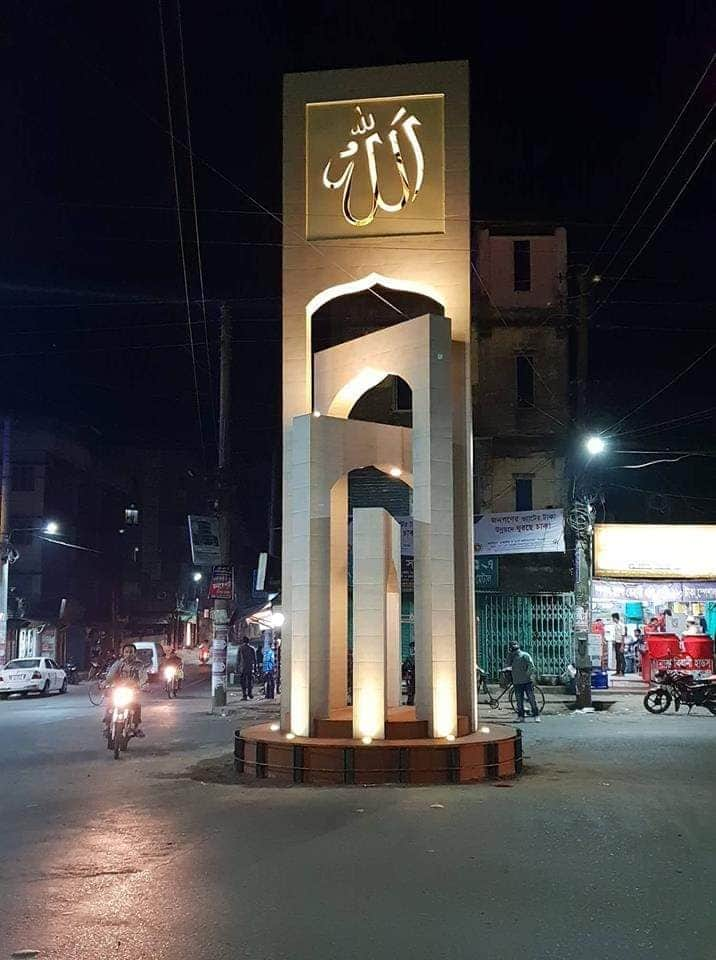
Highlights include Sylhet Agricultural University, Sylhet International University, Museum of Rajas' and Madani Chattar.
Weather in Sylhet
Forecast from MET Norway (CC BY 4.0). Full forecast
About Sylhet
Sylhet is a metropolitan city in the northeastern region of Bangladesh. It serves as the administrative centre for both the Sylhet District and the Sylhet Division. The city is situated on the banks of the Surma River and, as of 2025, the metro area population of Sylhet is estimated to be 1,033,000, reflecting a 3.4% increase from 2024.
From the Wikipedia article Sylhet (this version), under CC BY-SA 4.0.
Travel tips from other travellers: Sylhet on Wikivoyage (CC BY-SA 4.0).
Things to do10


Sylhet International University
School · 2.9 km
Bangladeshi University

Metropolitan University
School
Education organization in Sylhet, Bangladesh
North East University Bangladesh
School · 1.5 km
Bangladeshi Private University

Shahjalal University of Science and Technology
School · 4.3 km
Public University in Bangladesh


Museums and landmarks10

Madani Chattar
Monument and historic site
Monument in Sylhet, Bangladesh

Osmany Museum
Museum · 0.8 km
A museum in Kotwali Thana of Sylhet, Bangladesh


Kobi Nazrul Auditorium, Bangladesh Shishu Academy
Museum · 1.0 km
Chowhatta Road, সিলেট

Parks, trails and playgrounds17





5 more on the map.
Restaurants and cafes110



98 more on the map.
History
In 1303, the Sultan of Lakhnauti Shamsuddin Firoz Shah conquered Sylhet by defeating Gour Govinda. Sylhet became a part of the Bengal Sultanate. In the 16th century, Sylhet was controlled by the Baro-Bhuiyan zamindars such as Sardars of Pathan Confederacy. Later it became a sarkar (district) of the Mughal Empire. Sylhet emerged after 1612 as the Mughals' most significant imperial outpost in Bengal east of Dhaka, and its importance remained as such throughout the seventeenth century. British rule began in the 18th century under the administration of the East India Company. Sylhet became a key source of lascars in the British Empire due in part to its ancient seafaring tradition. The Sylhet municipal board was established in 1867. Originally part of the Bengal Presidency and later Eastern Bengal and Assam, the town became part of Colonial Assam in 1874. A devastating earthquake demolished almost the entire town on 12 June 1897 following which a modern and European model new town was built on the wreckage. From the beginning of the 20th century, the importance of Sylhet increased with the establishment of the tea industry.
In 1947, following a referendum and the partition of British India, Sylhet became part of East Pakistan. In 1995, the Government of Bangladesh declared Sylhet as the sixth divisional headquarters of the country.
From the History section of Sylhet on Wikipedia, under CC BY-SA 4.0.
Where to stay35
Hotel River View
Motel and hotel · 1.0 km
Commercial Building, Sylhet Station Club Ltd. Hazrat Shajalal (R.) Road, Bondor Bazar, Sylhet, Bangladesh. Contact: 01313727790,01973727790,0821-727046. Sylhet, Sylhet
Churches and places of worship67
Hazrat Shahjalal (R:) Jame Masjid
Place of worship · Sunni · 0.7 km
Dorgah Mohollah Road
বাইতুল মামুর জামে মসজিদ
Place of worship · Sunni · 2.0 km
Shahjalal Uposhahar Main Road
Shopping48
Afza's Sweet & Dessert
Shopping center · 1.0 km
Commercial Building, Sylhet Station Club Ltd. Sylhet Hazrat Shajalal (R.) Road, Bondor Bazar, Sylhet
Gas and EV charging15
Schools, colleges and libraries54
Shahjalal Upashahar High School
School · 2.0 km
Shahjalal Uposhahar Main Road, Sylhet
Healthcare68
M.A.G Osmani Medical College Hospital, Sylhet
Hospital · 1.9 km
Kajolshah Road, Sylhet
North East Medical College Hospital
Hospital · 4.1 km
Dhaka - Sylhet Highway, Sylhet
Map of Sylhet
250 places. The map loads OpenStreetMap tiles when you open it.
Getting there and nearby towns
M.A.G. Osmani International Airport (ZYL) is the nearest airport with scheduled flights listed in OpenStreetMap, 7 km away.
- Jahedpur 24 km west, about 24 min by car
- Chhātak 26 km northwest, about 26 min by car
- Shella 39 km northwest, about 39 min by car
- Maulavi Bāzār 47 km south, about 47 min by car
- Batarashi 47 km east, about 47 min by car
- Karīmganj 49 km east, about 49 min by car
- Cherrapunjee 48 km north, about 48 min by car
- Kanisail Pt I 50 km east, about 50 min by car
- Sunāmganj 51 km west, about 51 min by car
- Shillong 74 km north, about 1 h 15 min by car
Drive times are estimates from straight-line distance, not routes.
Local news
Headlines from INDB.
Reviews, tips and questions
Loading what members have shared...
Sources and licences
- GeoNames (CC BY 4.0): population, coordinates, regions and time zone
- OpenStreetMap contributors (ODbL 1.0): places, airports, map data
- Wikidata (CC0 1.0): elevation, founding date, time zone, website, landmarks and historic places
- Wikimedia Commons (see each image): photos
- Wikipedia (CC BY-SA 4.0): overview and history text
Photo credits
- SAU Gate, Ifagun, CC BY-SA 4.0
- Keane Bridge (23679487254), Kuruman from Tokyo, Japan, CC BY 2.0
- Raja-Kunjo, Museum of Rajas' (01), Moheen Reeyad, CC BY-SA 4.0
- Madani chattar, Nayasarak, Sylhet, Jishnu Kumar Das, CC BY-SA 4.0
- ওসমানী জাদুঘরের প্রবেশপথ, Rafi Bin Tofa, CC BY-SA 4.0
- নয়ন জুড়ানো সবুজ।, মেহেদী জাহান, CC BY-SA 4.0
- Keane Bridge and Ali Amjad's Clock, Sylhet, Shafqat Rabbi, CC BY 2.0
- West side of main entrance, SUST, Rocky Masum, CC BY-SA 4.0
- Sylhet District Stadium evening view by Tohid, Ajharul islam tohid patwary, CC BY-SA 4.0
- Bangladesh v Seychelles 28 March 2023, FNH004, CC BY-SA 4.0

Page built November 4, 2026. Spotted a mistake? Tell us or suggest a place.