

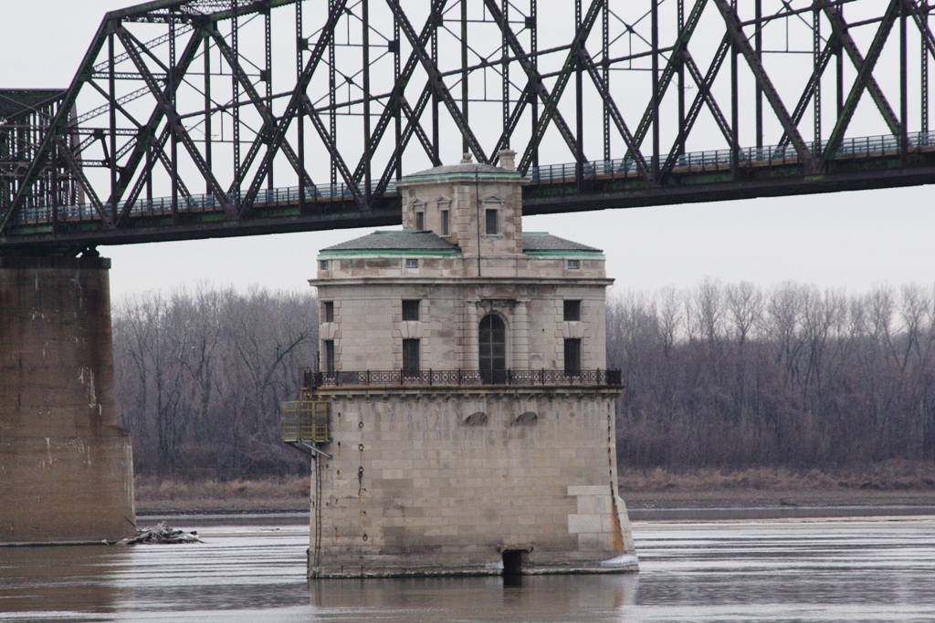


Bellefontaine Neighbors, Missouri
Bellefontaine Neighbors is a city of 10,498 people in St. Louis County, Missouri, founded in June 19, 1950.
Why visit Bellefontaine Neighbors
Townapedia lists 7 museums and landmarks, 16 parks and trails, 19 places to eat and 1 attraction in and around town.
Highlights include New Chain of Rocks Bridge, Bellefontaine Cemetery, Chain of Rocks Bridge and Cementland.
July is the warmest month, with average highs of 90°F; January lows average 24°F.
Weather in Bellefontaine Neighbors
Forecast from the National Weather Service. Full forecast
About Bellefontaine Neighbors
Bellefontaine Neighbors is an inner-ring suburban city in St. Louis County, Missouri, United States. The population was 10,740 at the 2020 census.
From the Wikipedia article Bellefontaine Neighbors, Missouri (this version), under CC BY-SA 4.0.
Things to do1

New Chain of Rocks Bridge
Bridge · 3.0 mi
Bridge in United States of America
Museums and landmarks7

Bellefontaine Cemetery
Monument and historic site · National Register of Historic Places · 3.8 mi
Cemetery in St. Louis, Missouri
Chain of Rocks Bridge
Bridge · National Register of Historic Places · 2.8 mi
Footbridge

Gen. Daniel Bissell House
Monument and historic site · National Register of Historic Places
Historic house in Bellefontaine Neighbors, Missouri

Wildwood House
Monument and historic site · National Register of Historic Places · 3.5 mi
Style house

Wilson Larimore House
Monument and historic site · National Register of Historic Places · 1.9 mi
Historic site, former plantation

Norwood Hills Country Club
Monument and historic site · National Register of Historic Places · 3.7 mi
Parks, trails and playgrounds16

Chain of Rocks Park
Park · 2.2 mi
Park in Missouri, United States of America, United States of America


Colonel George H. Blasé Park
Park · 1.6 mi
Municipal park in St. Louis, Missouri

4 more on the map.
Restaurants and cafes19

Pizza Hut
Restaurant · Pizza · 1.4 mi
11051 Bellefontaine Road, Spanish Lake
Su-Th 10:30-22:00; Fr,Sa 10:30-24:00

Down Home Elegance
Diner · American · 1.2 mi
10832 Bellefontaine Road, Bellefontaine Neighbors

Leprechaun's Gold
Bar and pub · 0.6 mi
705 Chambers Road, Riverview
Kathy's Bissell Lounge
Bar and pub
10049 Bellefontaine Road, Bellefontaine Neighbors

Church's Chicken
Fast food · Chicken · 2.0 mi
10646 New Halls Ferry Road, Ferguson
Mo-Th 10:00-22:00; Fr-Sa 10:00-23:00; Su 10:00-22:00
Domino's
Fast food · Pizza · 0.6 mi
10109 Lewis And Clark Boulevard, Bellefontaine Neighbors
Mo-Th 10:30-24:00; Fr-Sa 10:30-01:00; Su 10:30-24:00
Popeyes
Fast food · Chicken · 1.5 mi
9854 Halls Ferry Road, Saint Louis
Mo-We 10:00-23:00; Th-Sa 10:00-24:00; Su 10:00-23:00
7 more on the map.
History
The history of Bellefontaine Neighbors, Missouri, can be traced back to the mid-1800s when the area was part of the Louisiana Territory, which was ceded by France to Spain in 1762 in the Treaty of Fontainebleau. Spanish military authorities constructed forts near the mouth of the Missouri River to strengthen their hold on the territory and discourage intruders from the east. A Captain Rios, who was dispatched to the area, established forts near the present-day locations of Spanish Pond (or Spanish Lake) and Fort San Carlos in St. Louis.
In 1800, Spain ceded the territory west of the Mississippi River back to France, which then sold it to the United States in 1803 as part of the Louisiana Purchase. In 1804, a treaty was made with the Sac and Fox Indians that led to the establishment of a trading post on the south bank of the Missouri River. The area was chosen for its natural advantages, including a large clear water spring called "la belle fontaine" by the early French settlers.
From the History section of Bellefontaine Neighbors, Missouri on Wikipedia, under CC BY-SA 4.0.
Churches and places of worship34
Knights of Columbus - Council #1215
Church · Catholic · 0.5 mi
800 Chambers Road, Bellefontaine Neighbors
One Way Missionary Baptist Church
Church · Baptist · 0.7 mi
10117 Lewis and Clark Boulevard, Bellefontaine Neighbors
Shopping2
Gas and EV charging5
Schools, colleges and libraries57
St. Louis County Library, Lewis and Clark Branch
Library · 0.8 mi
9909 Lewis and Clark Boulevard, Moline Acres
Healthcare3
DaVita Dialysis
Clinic and pharmacy · 0.7 mi
10241 Lewis and Clark Boulevard, Bellefontaine Neighbors
Map of Bellefontaine Neighbors
144 places. The map loads OpenStreetMap tiles when you open it.
Climate by month
Monthly table
| Month | High | Low | Rain | Snow |
|---|---|---|---|---|
| Jan | 40°F | 24°F | 2.6 in | 5.7 in |
| Feb | 46°F | 28°F | 2.2 in | 4.3 in |
| Mar | 57°F | 37°F | 3.5 in | 2.3 in |
| Apr | 68°F | 47°F | 4.7 in | 0.2 in |
| May | 77°F | 58°F | 4.8 in | 0.0 in |
| Jun | 86°F | 67°F | 4.5 in | 0.0 in |
| Jul | 90°F | 71°F | 3.9 in | 0.0 in |
| Aug | 88°F | 69°F | 3.4 in | 0.0 in |
| Sep | 81°F | 61°F | 3.0 in | 0.0 in |
| Oct | 69°F | 49°F | 3.1 in | 0.0 in |
| Nov | 56°F | 37°F | 3.4 in | 0.9 in |
| Dec | 44°F | 28°F | 2.5 in | 3.2 in |
U.S. Climate Normals 1991-2020 for St Louis Lambert Intl Ap 72434 (8 mi away), NOAA NCEI.
People and cost of living
American Community Survey 5-year estimates, 2020-2024, U.S. Census Bureau. Estimates have margins of error, larger for small towns.
Disaster history
St. Louis County has had 23 federal disaster declarations since 2000, most often for severe storms.
- 2025-06-09: Severe Storms, Straight-Line Winds, Tornadoes, And Flooding (Severe Storm)
- 2025-05-21: Severe Storms, Straight-Line Winds, Tornadoes, And Wildfires (Severe Storm)
- 2022-08-08: Severe Storms And Flooding (Flood)
- 2020-03-26: Covid-19 Pandemic (Biological)
- 2020-03-13: Covid-19 (Biological)
- 2017-06-02: Severe Storms, Tornadoes, Straight-Line Winds And Flooding (Flood)
OpenFEMA disaster declarations summaries.
Getting there and nearby towns
St. Louis Lambert International Airport (STL) is the nearest airport with scheduled flights listed in OpenStreetMap, 8 miles away.
- Granite City 6 mi east, about 9 min by car
- St. Louis 8 mi south, about 13 min by car
- East St. Louis 11 mi southeast, about 17 min by car
- Alton 11 mi north, about 18 min by car
- Wood River 11 mi northeast, about 18 min by car
- Collinsville 13 mi southeast, about 21 min by car
- Edwardsville 13 mi east, about 21 min by car
- Cahokia Heights 13 mi south, about 21 min by car
- Glen Carbon 13 mi east, about 21 min by car
- Godfrey 14 mi north, about 22 min by car
Drive times are estimates from straight-line distance, not routes.
Local news
Headlines from INDB, the NEMICO news database.
Reviews, tips and questions
Loading what members have shared...
Sources and licences
- NCES EDGE (Public domain): public schools
- NOAA NCEI U.S. Climate Normals 1991-2020 (Public domain): climate by month
- OpenFEMA (Public domain): disaster declarations
- OpenStreetMap contributors (ODbL 1.0): places, airports, map data
- U.S. Census Bureau (Public domain): population, income, housing, education, commute
- Wikidata (CC0 1.0): elevation, founding date, time zone, website, landmarks and historic places
- Wikimedia Commons (see each image): photos
- Wikipedia (CC BY-SA 4.0): overview and history text
Photo credits
- Bellefontaine Road, Bellefontaine Neighbors, Missouri, Paul Sableman, CC BY 2.0
- Water Intake CoRB, Rklawton at English Wikipedia, CC BY-SA 3.0
- Wainwright Tomb 2013, Viking55, CC BY-SA 3.0
- Wilson Larimore House 1985, National Park Service, U.S. Department of the Interior, Public domain
- Wildwood House, Chuck Morris, CC BY-SA 3.0
- Norwood Hills Country Club, LittleT889, CC BY-SA 4.0
- Colonel George H. Blasé Park, Sesamehoneytart, CC BY-SA 4.0
- Chain of Rocks Bridges 1997, USGS, Public domain
- BisselHouse, Chuck Morris, CC BY-SA 3.0
- Top of Tower (8681562969), Paul Sableman, CC BY 2.0
- The Archivist of the United States looks at burned records at NPRC, archivesnews, Public domain
- The Archivist of the United States and Preservation staff look at burned records at NPRC, archivesnews, Public domain
- Cementland in 2015, Paul Sableman, CC BY 2.0
- Stylurus plagiatus 143429325, Chrissy McClarren and Andy Reago, CC0
- Stylurus plagiatus 143429287, Chrissy McClarren and Andy Reago, CC0
- Mosenthein Island, LittleT889, CC BY-SA 4.0
- Jennings Convinience Center (24103593494), Paul Sableman, CC BY 2.0
- 1522 Heading South, David Ackerman, CC BY 2.0
- Church in Jennings, Missouri, LittleT889, CC BY-SA 4.0
- Maline Creek 2, LittleT889, CC BY-SA 4.0
- Maline Creek, LittleT889, CC BY-SA 4.0
- Woolworth's Store at River Roads Mall - (1988) - panoramio, Dwayne Pounds, CC BY 3.0
- Wilson Larimore House, LittleT889, CC BY-SA 4.0


Page built October 30, 2026. Spotted a mistake? Tell us or suggest a place.