
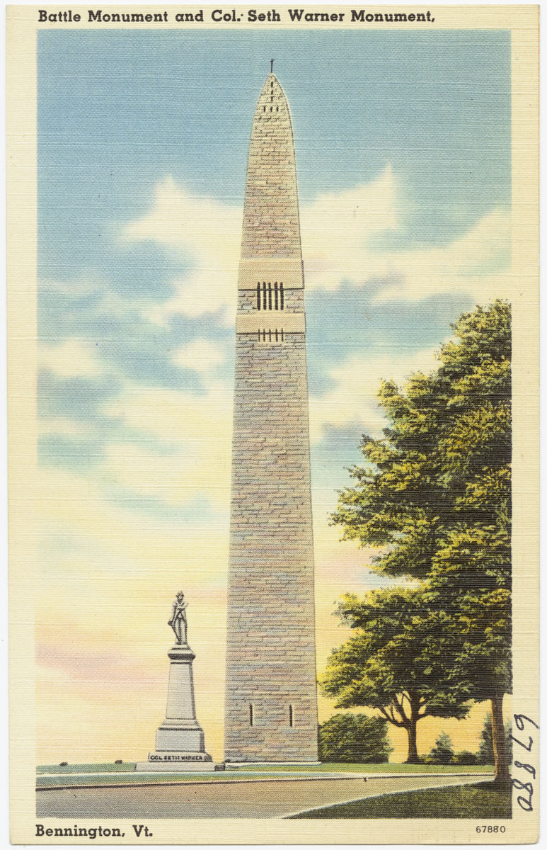


Bennington, Vermont
Bennington is a community of 9,245 people in Bennington County, Vermont.
Why visit Bennington
Townapedia lists 27 museums and landmarks, 5 parks and trails, 22 places to eat, 6 places to stay and 3 attractions in and around town.
Highlights include Silk Covered Bridge, Northeastern Baptist College, Bennington Battle Monument and Bennington Historical Museum.
July is the warmest month, with average highs of 81°F; January lows average 13°F.
Weather in Bennington
Forecast from the National Weather Service. Full forecast
About Bennington
Bennington is a census-designated place (CDP) in Bennington County, Vermont, United States. It is located entirely within the town of Bennington. The population of the CDP was 9,074 at the 2010 census, or 57.6% of the population of the entire town.
From the Wikipedia article Bennington (CDP), Vermont (this version), under CC BY-SA 4.0.
Things to do3

Silk Covered Bridge
Bridge · National Register of Historic Places · 3.5 mi
Covered bridge in Bennington, Vermont

Northeastern Baptist College
School · 1.9 mi
Bible college in Vermont, US

Museums and landmarks27

Bennington Battle Monument
Monument and historic site · National Register of Historic Places · 2.2 mi
Monument in Bennington, Vermont, United States
11 Monument Circle, Bennington


Bennington Fish Hatchery
Monument and historic site · National Register of Historic Places · 1.3 mi
Fish hatchery in Bennington, Vermont
Holden–Leonard Mill Complex
Monument and historic site · National Register of Historic Places · 1.5 mi
Historic industrial complex in Bennington, Vermont
160 Benmont Avenue, Bennington
Old Bennington High School
Monument and historic site · National Register of Historic Places · 0.8 mi
School building in Bennington, Vermont
650 Main Street, Bennington


W. H. Bradford Hook and Ladder Fire House
Monument and historic site · National Register of Historic Places · 0.8 mi
Fire station in Bennington, Vermont
212 Safford Street, Bennington
Bennington station
Monument and historic site · National Register of Historic Places · 1.2 mi
Railway station in Bennington, the United States of America
Carrigan Lane Historic District
Monument and historic site · National Register of Historic Places · 0.9 mi
Historic district in Bennington, Vermont
Cora B. Whitney School
Monument and historic site · National Register of Historic Places · 0.7 mi
Historic former school building in Bennington, Vermont
Frederick Squire House
Monument and historic site · National Register of Historic Places · 1.2 mi
Historic house in Vermont, United States
Furnace Grove Historic District
Monument and historic site · National Register of Historic Places · 1.5 mi
Historic district in Bennington, Vermont
Holden-Leonard Workers Housing Historic District
Monument and historic site · National Register of Historic Places · 1.4 mi
Historic district in Bennington, Vermont
15 more on the map.
Parks, trails and playgrounds5


Restaurants and cafes22

Ramunto's Brick Oven Pizza
Restaurant · Pizza, Burger, Pasta · 0.8 mi
519 Main Street, Bennington
Mo-Sa 11:00-22:00; Su 11:00-21:00
The 421 Craft Bar & Kitchen
Restaurant · American, Pizza · 1.0 mi
421 Main Street, Bennington
We-Sa 16:00-21:00
The Miller's Toll Dinner Club & Lounge
Restaurant · Cocktail Bar, Tapas, Small Plates · 0.6 mi
716 Main Street, Bennington
Th 17:00-21:00; Fr-Sa 17:00-22:00

Farm Road Brewing
Brewery and winery · 1.0 mi
400 Main Street, Bennington
Su 12:00-18:00; We-Th 16:00-20:00; Fr-Sa 12:00-20:00
Harvest Brewing
Brewery and winery · 1.0 mi
201 South Street, Bennington
Th-Fr 17:00-21:00; Sa 15:00-21:00; Su 13:00-17:00
Island Flavor Jamaican Café
Restaurant · Jamaican · 0.7 mi
Good idea to call and order ahead. Building sits at fork in the road. Can use street parking just past the left fork, or the parking up...
1001 Main Street, Bennington

Madison Brewing Co.
Bar and pub · 1.0 mi
428 Main Street, Bennington
Mo-Sa 11:30-21:00; Su 11:30-20:00

Village Garage Distillery
Brewery and winery · 1.1 mi
107 Depot Street, Bennington
We 12:00-16:00; Th-Sa 12:00-21:00; Su 12:00-16:00

10 more on the map.
Where to stay6
SOUTH SHIRE a Little Hotel
Motel and hotel · 1.1 mi
124 1/2 Elm Street, Bennington
Churches and places of worship11
First Congregational Church of Bennington
Church · National Register of Historic Places · 1.9 mi
60 Monument Avenue, Bennington
Unitarian Universalist Fellowship of Bennington
Place of worship · 0.9 mi
108 School Street, Bennington
Church of Sacred Heart, St. Francis de Sales
Church · Catholic · 1.2 mi
240 Main Street, Bennington
Shopping10
Gas and EV charging9
Schools, colleges and libraries25
Mt. Anthony Senior Union High School
School · 1.2 mi
301 Park Street Extension, Bennington
Healthcare2
Map of Bennington
120 places. The map loads OpenStreetMap tiles when you open it.
Climate by month
Monthly table
| Month | High | Low | Rain |
|---|---|---|---|
| Jan | 32°F | 13°F | 2.4 in |
| Feb | 35°F | 14°F | 1.9 in |
| Mar | 44°F | 23°F | 2.6 in |
| Apr | 57°F | 34°F | 2.5 in |
| May | 69°F | 44°F | 3.5 in |
| Jun | 76°F | 52°F | 4.0 in |
| Jul | 81°F | 57°F | 4.7 in |
| Aug | 79°F | 55°F | 3.9 in |
| Sep | 72°F | 48°F | 3.8 in |
| Oct | 60°F | 38°F | 3.6 in |
| Nov | 48°F | 29°F | 2.8 in |
| Dec | 38°F | 21°F | 2.9 in |
U.S. Climate Normals 1991-2020 for Bennington Morse St Ap 72516 (4 mi away), NOAA NCEI.
People and cost of living
American Community Survey 5-year estimates, 2020-2024, U.S. Census Bureau. Estimates have margins of error, larger for small towns.
Disaster history
Bennington County has had 17 federal disaster declarations since 2000, most often for severe storms.
- 2024-08-08: Tropical Depression Debby (Tropical Storm)
- 2023-07-14: Severe Storms, Flooding, Landslides, And Mudslides (Flood)
- 2023-07-10: Flooding (Flood)
- 2021-09-29: Severe Storm And Flooding (Flood)
- 2021-08-22: Tropical Storm Henri (Hurricane)
- 2020-04-08: Covid-19 Pandemic (Biological)
OpenFEMA disaster declarations summaries.
Getting there and nearby towns
Pittsfield Municipal Airport (PSF) is the nearest airport with scheduled flights listed in OpenStreetMap, 31 miles away.
- Hoosick Falls 9 mi west, about 14 min by car
- Williamstown 11 mi south, about 18 min by car
- North Adams 14 mi south, about 22 min by car
- Cambridge 15 mi northwest, about 24 min by car
- Adams 17 mi south, about 27 min by car
- Greenwich 22 mi northwest, about 35 min by car
- Stillwater 24 mi west, about 38 min by car
- Troy 27 mi west, about 43 min by car
- Cohoes 28 mi west, about 44 min by car
- Pittsfield 29 mi south, about 47 min by car
Drive times are estimates from straight-line distance, not routes.
Local news
Headlines from INDB, the NEMICO news database.
Reviews, tips and questions
Loading what members have shared...
Sources and licences
- NCES EDGE (Public domain): public schools
- NOAA NCEI U.S. Climate Normals 1991-2020 (Public domain): climate by month
- OpenFEMA (Public domain): disaster declarations
- OpenStreetMap contributors (ODbL 1.0): places, airports, map data
- U.S. Census Bureau (Public domain): population, income, housing, education, commute
- Wikidata (CC0 1.0): elevation, founding date, time zone, website, landmarks and historic places
- Wikimedia Commons (see each image): photos
- Wikipedia (CC BY-SA 4.0): overview and history text
Photo credits
- Battle Monument and Col. Seth Warner Monument, Bennington, Vt. (2381873386), Boston Public Library, CC BY 2.0
- Bennington, Vermont, Quintin Soloviev, CC BY 4.0
- Cora B Whitney School, Bennington VT, John Phelan, CC BY-SA 3.0
- First Baptist Church 601 Main Street downtown Bennington VT August 2023, Artaxerxes, CC BY-SA 4.0
- Bennington High School, Bennington VT, John Phelan, CC BY-SA 3.0
- BenningtonVT PrattMcDanielsLaFlammeHouse, Magicpiano, CC BY-SA 4.0
- BenningtonVT CarriganLaneHD, Magicpiano, CC BY-SA 4.0
- Main Street in Bennington with streetcar - 1912 postcard, Unknown author Unknown author, Public domain
- Frederick Squire House, Bennington VT, John Phelan, CC BY-SA 3.0
- Bennington, VT 05201, USA - panoramio, Roman Eugeniusz, CC BY-SA 3.0
- Kmart Bennington, VT 5 (8280575124), Mike Kalasnik from Fort Mill, USA, CC BY-SA 2.0
- BenningtonVT Hatchery1, Magicpiano, CC BY-SA 4.0
- BenningtonVT Hatchery4, Magicpiano, CC BY-SA 4.0
- BenningtonVT Hatchery3, Magicpiano, CC BY-SA 4.0
- BenningtonVT Hatchery5, Magicpiano, CC BY-SA 4.0
- BenningtonVT Hatchery2, Magicpiano, CC BY-SA 4.0
- 124-150 Benmont Avenue in the Holden Leonard Workers Housing District, Bennington VT, John Phelan, CC BY-SA 3.0
- 2017-09-10 15 44 49 View north along U.S. Route 7 (North Street) at Depot Street in Bennington, Bennington County, Vermont, Famartin, CC BY-SA 4.0
- Southwestern Vermont Medical Center 100 Hospital Drive Bennington VT July 2025 02, Artaxerxes, CC BY 4.0
- Southwestern Vermont Medical Center 100 Hospital Drive Bennington VT July 2025 01, Artaxerxes, CC BY 4.0
- Holden-Leonard Mill Complex, Bennington VT, John Phelan, CC BY-SA 3.0
- BenningtonVT FurnaceGroveHD 1, Magicpiano, CC BY-SA 4.0
- BenningtonVT FurnaceGroveHD 2, Magicpiano, CC BY-SA 4.0
- Kmart Bennington, VT 1 (8279514027), Mike Kalasnik from Fort Mill, USA, CC BY-SA 2.0
- 2025-09-16 16 20 33 The One Room Schoolhouse (Grandma Moses Schoolhouse) at the Bennington Museum in Bennington, Bennington County, Vermont, Famartin, CC BY-SA 4.0
- 2025-09-16 16 20 15 The One Room Schoolhouse (Grandma Moses Schoolhouse) at the Bennington Museum in Bennington, Bennington County, Vermont, Famartin, CC BY-SA 4.0
- 2025-09-16 16 20 57 The east side of the Bennington Museum in Bennington, Bennington County, Vermont, Famartin, CC BY-SA 4.0
- 2025-09-16 16 21 05 The south side of the Bennington Civil War Memorial at the Bennington Museum in Bennington, Bennington County, Vermont, Famartin, CC BY-SA 4.0
- 2025-09-16 16 21 17 The south side of the Bennington Civil War Memorial at the Bennington Museum in Bennington, Bennington County, Vermont, Famartin, CC BY-SA 4.0
- Old Bennington, Bennington, VT 05201, USA - panoramio, Roman Eugeniusz, CC BY-SA 3.0
- Kmart Bennington, VT 2 (8279514567), Mike Kalasnik from Fort Mill, USA, CC BY-SA 2.0
- Kmart Bennington, VT 3 (8280573886), Mike Kalasnik from Fort Mill, USA, CC BY-SA 2.0
- Kmart Bennington, VT 4 (8280574500), Mike Kalasnik from Fort Mill, USA, CC BY-SA 2.0
- Kmart Bennington, VT 8 (8280575882), Mike Kalasnik from Fort Mill, USA, CC BY-SA 2.0
- 2021-09-28 14 05 17 View north along U.S. Route 7 at Historic Vermont State Route 7A and Kocher Drive in Bennington, Bennington County, Vermont, Famartin, CC BY-SA 4.0
- Old Bennington, VT, post office, Daniel Case, CC BY-SA 3.0
- Bennington Battle Memorial, Phil Boucher, CC BY-SA 3.0
- FirstCongregationalChurchofBennington, Lvklock, CC BY-SA 4.0
- W H Bradford Hook and Ladder Fire House, Bennington VT, John Phelan, CC BY-SA 3.0
- School Street Duplexes, Bennington VT, John Phelan, CC BY-SA 3.0


Page built October 30, 2026. Spotted a mistake? Tell us or suggest a place.