



Pittsfield, Massachusetts
Pittsfield is a city of 43,457 people in Berkshire County, Massachusetts, founded in 1752.
Why visit Pittsfield
Townapedia lists 55 museums and landmarks, 67 parks and trails, 68 places to eat, 24 places to stay and 39 attractions in and around town.
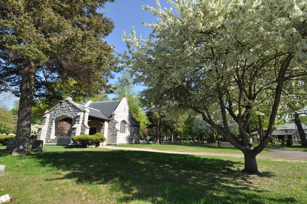
Highlights include Bousquet Mountain, Phoenix Theatres Beacon Cinema, Main Street Cemetery and Fairview Cemetery.
July is the warmest month, with average highs of 79°F; January lows average 14°F.
Weather in Pittsfield
Forecast from the National Weather Service. Full forecast
About Pittsfield
Pittsfield is the most populous city in and the county seat of Berkshire County, Massachusetts, United States. It is the principal city of the Pittsfield, Massachusetts Metropolitan Statistical Area, which encompasses Berkshire County. Pittsfield's population was 43,927 at the 2020 census. Although its population has declined in recent decades, Pittsfield remains the third-largest municipality in Western Massachusetts, behind only Springfield and Chicopee.
From the Wikipedia article Pittsfield, Massachusetts (this version), under CC BY-SA 4.0.
Things to do39


Colonial Theater
Cinema and theater · 0.5 mi
Theater and movie theater in Pittsfield, Massachusetts, United States

27 more on the map.
Museums and landmarks55
Main Street Cemetery
Cemetery · National Register of Historic Places · 4.6 mi
Cemetery in Dalton, Massachusetts
321 Main Street
Fairview Cemetery
Cemetery · National Register of Historic Places · 4.9 mi
Cemetery in Dalton, Massachusetts

Arrowhead
Monument and historic site · National Register of Historic Places · 2.6 mi
House in Pittsfield, Massachusetts
Fitch-Hoose House
Monument and historic site · National Register of Historic Places · 4.8 mi
Historic house in Massachusetts, United States
6 Gulf Road

Hancock Shaker Village
Museum · National Register of Historic Places · 4.5 mi
Non-profit organization in the USA

Pittsfield Cemetery
Monument and historic site · National Register of Historic Places · 1.1 mi
Cemetery in Pittsfield, Massachusetts

Wahconah Park
Monument and historic site · National Register of Historic Places · 0.8 mi
Baseball park in Pittsfield, Massachusetts, US
A. H. Rice Silk Mill
Monument and historic site · National Register of Historic Places · 1.0 mi
Historic building in Pittsfield, Massachusetts

Allen Hotel
Monument and historic site · National Register of Historic Places · 0.5 mi
United States historic place

Berkshire Life Insurance Company Building
Monument and historic site · National Register of Historic Places · 0.4 mi
Office building in Massachusetts, United States of America

Berkshire Museum
Museum · 0.5 mi
Art & natural history museum in Pittsfield, MA
39 South Street, Pittsfield


Charles Whittlesey Power House
Monument and historic site · National Register of Historic Places · 1.6 mi
Historic house in Massachusetts, United States
43 more on the map.
Parks, trails and playgrounds67



George L. Darey Housatonic Valley Wildlife Management Area
Hiking and trails · 3.1 mi
George L. Darey Housatonic Valley Wildlife Management Area
Hiking and trails · 1.4 mi
George L. Darey Housatonic Valley Wildlife Management Area
Hiking and trails · 2.0 mi
55 more on the map.
Restaurants and cafes68

Koto Hibachi Steak House
Restaurant · Steak House, Japanese · 3.0 mi
795 Dalton Avenue
Mo-Th 11:00-21:30; Fr-Sa 11:00-22:00; Su 12:00-21:30

Starbucks
Cafe · Coffee Shop · 3.5 mi
555 Hubbard Avenue, Pittsfield
Mo-Fr 05:00-21:00; Sa-Su 05:30-21:00
AURA Coffee and Cocktails
Cafe · 0.4 mi
41 North Street
Mo-Su 07:00-15:00, Mo-Th 17:00-23:00, Fr-Sa 17:00-00:00, Su 17:00-23:15
Hudpucker's Pub & Grill
Restaurant · American, Grill, Italian · 0.8 mi
Th-Sa 11:00-22:00; Su-We 11:00-21:00
Thrive Diner
Restaurant · 0.9 mi
145 Wahconah Street
We,Th 11:00-15:00,16:00-19:00; Fr,Sa 11:00-15:00,16:00-20:00
Wander Berkshires
Cafe · Coffee Shop
34 Depot Street
Mo-Fr 08:00-18:00; Sa 09:00-18:00; Su 09:00-14:00


Hot Plate Brewing Co
Bar and pub · 0.4 mi
1 School Street, Pittsfield
Mo -Th 16:00-22:00, Fr-Sa 12:00-23:00, Su 12:00-21:00
Otto's Kitchen & Comfort
Restaurant · Burger, American, Breakfast · 0.5 mi
95 East Street, Pittsfield
56 more on the map.
History
The Mohicans, an Algonquian people, inhabited the area that would later come to comprise Pittsfield until the early 18th century, when the population was greatly reduced by war and disease brought by European Colonists. Many migrated westward or were subjugated to live on the fringes of their land.
In 1738, wealthy Bostonian Colonel Jacob Wendell bought 24,000 acres (97 km2) of land known, originally as "Pontoosuck," from a Mohican word meaning "a field or haven for winter deer," as a speculative investment. He planned to subdivide and resell to others who would settle there. He formed a partnership with Philip Livingston, a wealthy kinsman from Albany, New York, and Col. John Stoddard of Northampton, Massachusetts, who had claim to 1,000 acres (4.0 km2) here.
A group of young armed militia men came and began to clear the land in 1743, but the threat of Indian resistance around the time of King George's War soon forced them to leave, and the land remained unoccupied by Englishmen for several years.
From the History section of Pittsfield, Massachusetts on Wikipedia, under CC BY-SA 4.0.
Where to stay24
Churches and places of worship42
Church of Our Saviour
Church · National Register of Historic Places · 6.3 mi
Church on the Hill
Church · National Register of Historic Places · 6.2 mi
Pilgrim Memorial Church and Parish House
Church · National Register of Historic Places · 1.0 mi
Trinity Episcopal Church
Church · National Register of Historic Places · 6.8 mi
First Church of Christ, Scientist
Church · Christian Scientist · 0.6 mi
17 Wendell Avenue, Pittsfield
Shopping30
Gas and EV charging5
Schools, colleges and libraries43
Healthcare11
Berkshire Community Pharmacy
Clinic and pharmacy · 0.8 mi
741 North Street, Pittsfield
Tapestry - Sexual & Reproductive Health Clinic
Clinic and pharmacy · 0.6 mi
100 Wendell Avenue, Pittsfield
Map of Pittsfield
250 places. The map loads OpenStreetMap tiles when you open it.
Climate by month
Monthly table
| Month | High | Low | Rain |
|---|---|---|---|
| Jan | 30°F | 14°F | 2.7 in |
| Feb | 33°F | 15°F | 2.5 in |
| Mar | 42°F | 23°F | 3.1 in |
| Apr | 55°F | 34°F | 3.4 in |
| May | 67°F | 44°F | 3.8 in |
| Jun | 75°F | 53°F | 4.6 in |
| Jul | 79°F | 58°F | 4.2 in |
| Aug | 78°F | 56°F | 3.8 in |
| Sep | 70°F | 49°F | 4.5 in |
| Oct | 58°F | 38°F | 4.6 in |
| Nov | 47°F | 29°F | 3.5 in |
| Dec | 36°F | 21°F | 3.6 in |
U.S. Climate Normals 1991-2020 for Pittsfield Muni Ap (2 mi away), NOAA NCEI.
People and cost of living
American Community Survey 5-year estimates, 2020-2024, U.S. Census Bureau. Estimates have margins of error, larger for small towns.
Disaster history
Berkshire County has had 19 federal disaster declarations since 2000, most often for severe storms.
- 2023-09-15: Hurricane Lee (Hurricane)
- 2020-03-27: Covid-19 Pandemic (Biological)
- 2020-03-13: Covid-19 (Biological)
- 2013-04-19: Severe Winter Storm, Snowstorm, And Flooding (Severe Storm)
- 2012-10-28: Hurricane Sandy (Hurricane)
- 2012-01-06: Severe Storm And Snowstorm (Severe Storm)
OpenFEMA disaster declarations summaries.
Getting there and nearby towns
Pittsfield Municipal Airport (PSF) is the nearest airport with scheduled flights listed in OpenStreetMap, 2 miles away.
- North Adams 17 mi northeast, about 27 min by car
- Albany 31 mi northwest, about 50 min by car
- Northampton 31 mi east, about 50 min by car
- Easthampton 33 mi southeast, about 53 min by car
- Holyoke 36 mi southeast, about 57 min by car
- Greenfield 36 mi east, about 57 min by car
- Amherst Town 39 mi east, about 1 h by car
- Chicopee 40 mi southeast, about 1 h by car
- Agawam Town 41 mi southeast, about 1 h by car
- Springfield 44 mi southeast, about 1 h 15 min by car
Drive times are estimates from straight-line distance, not routes.
Local news
Headlines from INDB, the NEMICO news database.
Reviews, tips and questions
Loading what members have shared...
Sources and licences
- NCES EDGE (Public domain): public schools
- NOAA NCEI U.S. Climate Normals 1991-2020 (Public domain): climate by month
- OpenFEMA (Public domain): disaster declarations
- OpenStreetMap contributors (ODbL 1.0): places, airports, map data
- U.S. Census Bureau (Public domain): population, income, housing, education, commute
- Wikidata (CC0 1.0): elevation, founding date, time zone, website, landmarks and historic places
- Wikimedia Commons (see each image): photos
- Wikipedia (CC BY-SA 4.0): overview and history text
Photo credits
- Pittsfield, Massachusetts skyline, Quintin Soloviev, CC BY 4.0
- DaltonMA MainStreetCemeteryChapel, Magicpiano, CC BY-SA 3.0
- DaltonMA FairviewCemetery, Magicpiano, CC BY-SA 3.0
- Round Stone Barn with "House form" in the foreground, Bestbudbrian, CC BY-SA 4.0
- DaltonMA FitchHooseHouse, Magicpiano, CC BY-SA 3.0
- Pittfield Cemetery, NatalieMaynor, CC BY 2.0
- Arrowhead (Herman Melville), Pittsfield, Massachusetts, Daderot., CC BY-SA 3.0
- Springside Park, Ivan Newton, CC BY-SA 3.0
- Old Central Fire Station, Pittsfield MA, John Phelan, CC BY-SA 3.0
- Samuel J. Tilden memorial, Billmckern, CC BY-SA 3.0
- Old Town Hall, Ivan Newton, CC BY-SA 3.0
- Bradford Block, Pittsfield, Massachusetts, Doug Kerr from Albany, NY, United States, CC BY-SA 2.0
- Berkshire Life Insurance Company Building, Pittsfield MA, John Phelan, CC BY-SA 3.0
- RichmondMA Goodwood, Magicpiano, CC BY-SA 3.0
- LanesboroughMA PettiboneFarm, Magicpiano, CC BY-SA 3.0
- Mount Lebanon Shaker Society 12July2008, Adam Lenhardt, CC BY-SA 3.0
- Lenox Academy, Lenox MA, John Phelan, CC BY-SA 3.0
- RichmondMA NicholsSternerHouse, Magicpiano, CC BY-SA 3.0
- Pilgrim Memorial Church and Parish House 2012-10-24 22-22-31, Erik617, CC BY-SA 3.0
- Providence Court, Pittsfield MA, John Phelan, CC BY-SA 3.0
- Our Saviour Church New Lebanon, Ymblanter, CC BY-SA 3.0
- Rev Samuel Harrison House, Ivan Newton, CC BY-SA 3.0
- RichmondMA Kenmore 2, Magicpiano, CC BY-SA 3.0
- First Church of Christ, Pittsfield MA, John Phelan, CC BY-SA 3.0
- Ventforthall, Chrissypan at en.wikipedia, Public domain
- RichmondMA ShakerFarm, Magicpiano, CC BY-SA 3.0
- William Russell Allen House, Pittsfield MA, John Phelan, CC BY-SA 3.0
- Church on the Hill, Lenox, Massachusetts, Daderot., CC BY-SA 3.0
- Wollison-Shipton Building, Pittsfield MA, John Phelan, CC BY-SA 3.0
- PittsfieldMA MorewoodSchool, Magicpiano, CC BY-SA 3.0
- Crane Museum, Dalton MA, John Phelan, CC BY 3.0
- Berkshire Scenic Railway Museum, Ham549 at English Wikipedia, CC BY 3.0
- DaltonMA CraneCompanyMuseum HABS, HABS government photographer Jack E. Boucher, Public domain
- PittsfieldMA CharlesWhittleseyPowerHouse, Magicpiano, CC BY-SA 3.0
- DaltonGrange, Unknown author Unknown author, Public domain
- Allen Hotel in Pittsfield, Berkshire County, Ivan Newton, CC BY-SA 3.0
- Hancock Town Hall, MA, John Phelan, CC BY 3.0
- Trinity Episcopal Church, Lenox MA, John Phelan, CC BY-SA 3.0
- DaltonMA EastMainStreetCemetery, Magicpiano, CC BY-SA 3.0
- Lenox Library, Lenox MA, John Phelan, CC BY-SA 3.0


Page built October 30, 2026. Spotted a mistake? Tell us or suggest a place.