


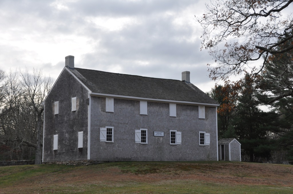
Bliss Corner, Massachusetts
Bliss Corner is a community of 5,405 people in Bristol County, Massachusetts.
Why visit Bliss Corner
Townapedia lists 60 museums and landmarks, 24 parks and trails, 30 places to eat and 6 attractions in and around town.
Highlights include Buttonwood Park Zoo, Clarks Point Light, Hazelwood Park and Acushnet Heights Historic District.
July is the warmest month, with average highs of 84°F; January lows average 22°F, and about 32 inches of snow fall in a normal year.
Weather in Bliss Corner
Forecast from the National Weather Service. Full forecast
About Bliss Corner
Bliss Corner is a census-designated place (CDP) in the town of Dartmouth in Bristol County, Massachusetts, United States. As of the 2020 census, Bliss Corner had a population of 5,480.
From the Wikipedia article Bliss Corner, Massachusetts (this version), under CC BY-SA 4.0.
Things to do6

Buttonwood Park Zoo
Zoo and aquarium · 1.8 mi
Zoo in Massachusetts, United States

Clarks Point Light
Lighthouse · 2.3 mi
Lighthouse in Massachusetts, United States
Fairhaven Bridge Light
Lighthouse · 2.7 mi
Lighthouse in Massachusetts, United States

New Bedford – Fairhaven Bridge
Bridge · 2.7 mi
Bridge in United States of America

Coastal Foodshed - Curbside Pickup Point
Farm and orchard · 1.3 mi
W Rodney French Boulevard, New Bedford
We 14:00-17:00
Museums and landmarks60
Hazelwood Park
Monument and historic site · National Register of Historic Places · 1.4 mi
Historic park in New Bedford, Massachusetts, USA
24/7

Acushnet Heights Historic District
Monument and historic site · National Register of Historic Places · 3.0 mi
Historic district in New Bedford, Massachusetts
Apponegansett Meeting House
Monument and historic site · National Register of Historic Places · 3.1 mi
United States historic place

Bradford Smith Building
Monument and historic site · National Register of Historic Places · 3.2 mi
Building in Massachusetts, United States

Butler Flats Light
Lighthouse · National Register of Historic Places · 2.5 mi
Lighthouse in Massachusetts, United States

Buttonwood Park Historic District
Monument and historic site · National Register of Historic Places · 1.9 mi
Historic district in Massachusetts, United States

Central New Bedford Historic District
Monument and historic site · National Register of Historic Places · 2.2 mi
Historic district in Massachusetts, United States

County Street Historic District
Monument and historic site · National Register of Historic Places · 1.9 mi
Historic district in Massachusetts, United States

Dawson Building
Monument and historic site · National Register of Historic Places · 3.2 mi
Building in Massachusetts, United States

Ezekiel Sawin House
Monument and historic site · National Register of Historic Places · 2.9 mi
Historic house in Massachusetts, United States
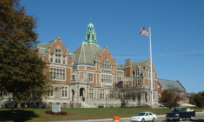


Fairhaven High School and Academy
Monument and historic site · National Register of Historic Places · 3.2 mi
High school in Massachusetts, United States

Fairhaven Town Hall
Monument and historic site · National Register of Historic Places · 2.9 mi
Town Hall in Fairhaven, Mass built in 1892
48 more on the map.
Parks, trails and playgrounds24

Dodge Reserve
Hiking and trails · 0.6 mi
The Dodge property is made up of a variety of habitats, from upland oak and laurel forest to the east, to the central cattail marsh and...
Russells Mills Road, Dartmouth
sunrise-sunset
Star Of The Sea Reserve
Hiking and trails · 1.4 mi
DNRT’s Star of the Sea Reserve was extensively mined for sand and gravel and the old gravel pits, with all the top soil gone and...
Star of the Sea Drive, Dartmouth
Mo-Su 06:00-18:00

Camara Field
Park · 1.1 mi
Pitch soccer field with off-street parking and lights
dawn-dusk

12 more on the map.
Restaurants and cafes30

G’s Kitchen
Restaurant · Haitian, Caribbean · 1.5 mi
812 Brock Avenue, New Bedford
Mo-Th 11:30-20:00,Fr-Sa 11:30-21:00
Jimmy's Pizza
Restaurant · Pizza · 1.5 mi
757 Brock Avenue, New Bedford
Mo,Tu,Th,Fr 11:00-21:00; We,Sa 16:00-21:00; Su off

Lighthouse Tavern
Bar and pub · 1.6 mi
578 Brock Avenue, New Bedford
Fr-Sa 11:30-02:00,Su 11:00-01:00,Mo 11:30-23:00,We 11:30-23:00,Th...

Little Moss
Diner · American · 1.2 mi
6 Bridge Street, Dartmouth
Mo-Tu closed, We-Th 17:00-21:00, Fr-Sa 17:00-22:00, Su 17:00-20:00
The Sail Loft
Diner · American · 1.3 mi
246 Elm Street, Dartmouth
Su-Th 11:30-23:00, Fr-Sa 11:30-24:00
Brigham's Corner Pizza and Seafood
Restaurant · Pizza, Seafood, Burger, Chicken, Middle Eastern · 1.4 mi
3 Brigham Street
El Caribe
Restaurant · Spanish · 1.5 mi
884 Brock Avenue, New Bedford
Mo-Su 11:00-20:30
Friendly Pizza
Restaurant · Pizza, Greek · 0.8 mi
216 Russells Mills Road, Dartmouth
Sa-Th 11:00-22:00, Fr 11:00-23:00

Beira Mar
Bakery · 1.5 mi
Portuguese bakery and sweets
82 Cove Street


Oxford Creamery
Ice cream · Ice Cream, Burger, · 1.6 mi
Ice cream and small concessions.
18 more on the map.
Churches and places of worship5
Union Baptist Church
Church · National Register of Historic Places · 2.0 mi
Shopping10
KJ Designs Screenprinting
Shop · 1.3 mi
127 West Rodney French Boulevard, New Bedford
Nelly's Bodega Gift Shop
Shop · 1.3 mi
127 W Rodney French Boulevard, New Bedford
Gas and EV charging7
Schools, colleges and libraries51
Healthcare1
Map of Bliss Corner
194 places. The map loads OpenStreetMap tiles when you open it.
Climate by month
Monthly table
| Month | High | Low | Rain | Snow |
|---|---|---|---|---|
| Jan | 38°F | 22°F | 3.8 in | 10.9 in |
| Feb | 40°F | 23°F | 4.1 in | 8.5 in |
| Mar | 47°F | 29°F | 5.3 in | 6.6 in |
| Apr | 56°F | 40°F | 4.6 in | 1.7 in |
| May | 68°F | 50°F | 3.7 in | 0.0 in |
| Jun | 78°F | 60°F | 4.2 in | 0.0 in |
| Jul | 84°F | 67°F | 3.6 in | 0.0 in |
| Aug | 82°F | 66°F | 4.1 in | 0.0 in |
| Sep | 75°F | 59°F | 4.2 in | 0.0 in |
| Oct | 64°F | 48°F | 4.9 in | 0.0 in |
| Nov | 53°F | 37°F | 4.6 in | 0.4 in |
| Dec | 43°F | 28°F | 5.2 in | 4.4 in |
U.S. Climate Normals 1991-2020 for New Bedford Coop Hcn (2 mi away), NOAA NCEI.
People and cost of living
American Community Survey 5-year estimates, 2020-2024, U.S. Census Bureau. Estimates have margins of error, larger for small towns.
Disaster history
Bristol County has had 23 federal disaster declarations since 2000, most often for severe storms.
- 2024-05-15: Severe Storms And Flooding (Flood)
- 2023-09-15: Hurricane Lee (Hurricane)
- 2022-04-18: Severe Winter Storm And Snowstorm (Snowstorm)
- 2020-03-27: Covid-19 Pandemic (Biological)
- 2020-03-13: Covid-19 (Biological)
- 2018-06-25: Severe Winter Storm And Flooding (Severe Storm)
OpenFEMA disaster declarations summaries.
Getting there and nearby towns
New Bedford Regional Airport (EWB) is the nearest airport with scheduled flights listed in OpenStreetMap, 5 miles away.
- New Bedford 4 mi north, about 6 min by car
- Smith Mills 4 mi northwest, about 7 min by car
- Acushnet Center 6 mi north, about 9 min by car
- Mattapoisett Center 9 mi northeast, about 14 min by car
- North Westport 10 mi northwest, about 16 min by car
- Fall River 11 mi northwest, about 18 min by car
- Marion Center 11 mi northeast, about 18 min by car
- Tiverton 14 mi west, about 22 min by car
- Somerset 15 mi northwest, about 24 min by car
- Wareham Center 15 mi northeast, about 24 min by car
Drive times are estimates from straight-line distance, not routes.
Local news
Headlines from INDB, the NEMICO news database.
Reviews, tips and questions
Loading what members have shared...
Sources and licences
- NCES EDGE (Public domain): public schools
- NOAA NCEI U.S. Climate Normals 1991-2020 (Public domain): climate by month
- OpenFEMA (Public domain): disaster declarations
- OpenStreetMap contributors (ODbL 1.0): places, airports, map data
- U.S. Census Bureau (Public domain): population, income, housing, education, commute
- Wikidata (CC0 1.0): elevation, founding date, time zone, website, landmarks and historic places
- Wikimedia Commons (see each image): photos
- Wikipedia (CC BY-SA 4.0): overview and history text
Photo credits
- Sunrise Bakery, Bliss Corner MA, John Phelan, CC BY-SA 4.0
- NewBedfordMA HazelwoodPark CongdonHouse 1, User:Magicpiano, CC BY-SA 4.0
- Union Baptist Church, New Bedford MA, John Phelan, CC BY-SA 3.0
- Johnson Properties, New Bedford, MA, Daniel Case, CC BY-SA 3.0
- Fort Phoenix, Marcbela (Marc N. Belanger), CC0
- DartmouthMA ApponegansettMeetingHouse, User:Magicpiano, CC BY-SA 4.0
- Sgt. William H. Carney House, New Bedford MA, John Phelan, CC BY-SA 3.0
- First Unitarian Church, New Bedford MA, John Phelan, CC BY 3.0
- NewBedfordMA MorelandTerraceHD 1, User:Magicpiano, CC BY-SA 4.0
- NewBedfordMA NorthBedfordHD 3, User:Magicpiano, CC BY-SA 4.0
- New Bedford Fire Museum, Daniel Case, CC BY-SA 3.0
- Dawson Building, New Bedford MA, John Phelan, CC BY-SA 3.0
- NewBedfordMA BradfordSmithBuilding, Janet Meunier, Public domain
- NewBedfordMA DonaghySchool, User:Magicpiano, CC BY-SA 4.0
- DartmouthMA TuckerFarmhouse, User:Magicpiano, CC BY-SA 4.0
- William Rotch House, New Bedford, MA, Daniel Case, CC BY-SA 3.0
- NPS Visitor Center, New Bedford, MA, Daniel Case, CC BY-SA 3.0
- NewBedfordMA MerrillsWharfHD CountingHouse, User:Magicpiano, CC BY-SA 4.0
- Butler Flats Light, New Bedford, MA, Lara ; cropped and color-corrected by Daniel Case 2008-07-14, CC BY 2.0
- NewBedfordMA RotchCottage Front, User:Magicpiano, CC BY-SA 4.0
- US Customshouse, New Bedford, MA, Daniel Case, CC BY-SA 3.0
- Linden Street, New Bedford MA, John Phelan, CC BY-SA 3.0
- Formal Garden, Buttonwood Park, New Bedford MA, John Phelan, CC BY-SA 3.0
- Downtown New Bedford MA, Marcbela (Marc N. Belanger), Public domain
- DartmouthMA Padanaram SouthworthLibrary, User:Magicpiano, CC BY-SA 4.0
- NewBedfordMA OakGroveCemetery Chapel, Magicpiano, CC BY-SA 3.0
- Union Street Railway Carbarn, New Bedford MA, John Phelan, CC BY-SA 3.0
- North Water Street, New Bedford, MA, Daniel Case, CC BY-SA 3.0
- Wamsutta Mills NB, Marcbela, Public domain
- Ezekial Sawin Front, Schlitzer90, CC BY-SA 3.0
- Thompson Street School, New Bedford MA, John Phelan, CC BY-SA 3.0
- Fairhaven High School MA, T.S. Custadio aka ToddC4176 at en.wikipedia ), CC BY-SA 3.0
- NewBedfordMA IngrahamSchool, User:Magicpiano, CC BY-SA 4.0
- Unitarian Memorial Church, Fairhaven MA, John Phelan, CC BY 3.0
- NewBedfordMA GriffinStreetCemetery, Magicpiano, CC BY-SA 3.0
- Palmer Island Light, Schlitzer90, CC BY-SA 3.0
- New Bedford Whaling National Historical Park Vistor Center 2006, Rolf Müller, CC BY-SA 3.0
- NewBedfordMA HowlandMillVillage, User:Magicpiano, CC BY-SA 4.0
- New Bedford Fort, Marcbela (Marc N. Belanger), Public domain
- New Bedford Gas and Edison Light Complex, New Bedford MA, John Phelan, CC BY-SA 3.0


Page built October 30, 2026. Spotted a mistake? Tell us or suggest a place.