


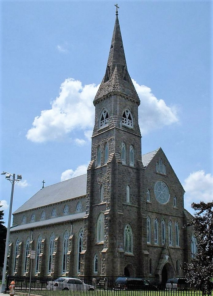

Tiverton, Rhode Island
Tiverton is a community of 8,091 people in Newport County, Rhode Island.
Why visit Tiverton
Townapedia lists 39 museums and landmarks, 5 parks and trails, 9 places to eat and 10 attractions in and around town.
Highlights include Borden Flats Light, Mount Hope Bridge, A. B. Chace Rowhouses and A. J. Borden Building.
July is the warmest month, with average highs of 85°F; January lows average 24°F, and about 38 inches of snow fall in a normal year.
Weather in Tiverton
Forecast from the National Weather Service. Full forecast
About Tiverton
Tiverton is a census-designated place (CDP) in Newport County, Rhode Island, United States. The CDP encompasses the town center of Tiverton and the adjacent village of North Tiverton. The population of the CDP was 7,557 at the 2010 census.
From the Wikipedia article Tiverton (CDP), Rhode Island (this version), under CC BY-SA 4.0.
Things to do10
Borden Flats Light
Lighthouse · National Register of Historic Places · 3.7 mi
Lighthouse in Massachusetts, United States

Mount Hope Bridge
Bridge · National Register of Historic Places · 3.1 mi
Bridge in Rhode Island and Bristol, Rhode Island

Musselbed Shoals Light
Lighthouse · 3.2 mi
Lighthouse in Rhode Island, United States

Roger Williams University
School · 3.0 mi
Rhode Island, United States

Sakonnet River Bridge
Bridge · 1.3 mi
Bridge in between Portsmouth and Tiverton
Sakonnet River Rail Bridge
Bridge · 1.2 mi
Bridge in United States of America

Museums and landmarks39

A. B. Chace Rowhouses
Monument and historic site · National Register of Historic Places · 3.8 mi
Terrace of houses in Fall River, Massachusetts

A. J. Borden Building
Monument and historic site · National Register of Historic Places · 4.0 mi
Building in Massachusetts, United States

Algonquin Printing Co.
Monument and historic site · National Register of Historic Places · 3.1 mi
Historic industrial complex in Fall River, Massachusetts

American Printing Co. and Metacomet Mill
Monument and historic site · National Register of Historic Places · 3.9 mi
The oldest textile mill in Fall River, Massachusetts.

Ariadne J. and Mary A. Borden House
Monument and historic site · National Register of Historic Places · 3.3 mi
Fall River, Massachusetts, listed on the NRHP in Massachusetts

Ashworth Brothers Mill
Monument and historic site · National Register of Historic Places · 2.9 mi
Textile mill in Fall River, Massachusetts

Benjamin Barker House
Monument and historic site · National Register of Historic Places · 0.9 mi
Historic house in Rhode Island, United States

Blithewold Mansion, Gardens and Arboretum
Monument and historic site · National Register of Historic Places · 3.3 mi
Non-profit organization in the USA

Borden Farm
Monument and historic site · National Register of Historic Places · 3.9 mi
Building in Rhode Island, United States

Bourne Mill
Monument and historic site · National Register of Historic Places · 1.6 mi
Mill in Tiverton, Newport County, Rhode Island, United States

Bristol County Courthouse
Monument and historic site · National Register of Historic Places · 3.6 mi
Courthouse in Rhode Island, United States


Bristol County Jail
Museum · National Register of Historic Places · 3.9 mi
Museum in Rhode Island, United States of America
27 more on the map.
Parks, trails and playgrounds5

Kennedy Park
Park · National Register of Historic Places · 3.3 mi
Park in Massachusetts, United States of America



Restaurants and cafes9

Le Moulin Rouge
Restaurant · French, American · 1.2 mi
1403 Main Road, Tiverton
Mo-Tu off; We-Th 17:00-20:00; Fr-Sa 17:00-20:30; Su 16:00-20:00



Churches and places of worship8
Brayton Methodist Episcopal Church
Church · National Register of Historic Places · 2.9 mi
Santo Christo Church
Church · National Register of Historic Places · 3.7 mi
St. Anne's Church and Parish Complex
Church · National Register of Historic Places · 3.4 mi
St. Louis Church
Church · National Register of Historic Places · 3.4 mi
St. Mary's Cathedral and Rectory
Church · National Register of Historic Places · 3.8 mi
St. Patrick's Church
Church · National Register of Historic Places · 2.6 mi
Shopping2
Gas and EV charging2
Schools, colleges and libraries36
Carlton M. Viveiros Elementary School
School · 2.6 mi
525 Slade Street, Fall River
Diman Regional Vocational Technical High
School · 5.1 mi
251 Stonehaven Rd, Fall River
Healthcare1
Map of Tiverton
112 places. The map loads OpenStreetMap tiles when you open it.
Climate by month
Monthly table
| Month | High | Low | Rain | Snow |
|---|---|---|---|---|
| Jan | 38°F | 24°F | 4.0 in | 10.9 in |
| Feb | 41°F | 24°F | 3.8 in | 11.3 in |
| Mar | 49°F | 30°F | 5.5 in | 7.4 in |
| Apr | 60°F | 39°F | 4.5 in | 0.6 in |
| May | 70°F | 49°F | 3.6 in | 0.0 in |
| Jun | 79°F | 58°F | 3.7 in | 0.0 in |
| Jul | 85°F | 65°F | 3.0 in | 0.0 in |
| Aug | 84°F | 64°F | 3.8 in | 0.0 in |
| Sep | 77°F | 57°F | 3.9 in | 0.0 in |
| Oct | 64°F | 47°F | 4.5 in | 0.0 in |
| Nov | 53°F | 37°F | 4.1 in | 0.6 in |
| Dec | 43°F | 30°F | 4.9 in | 7.3 in |
U.S. Climate Normals 1991-2020 for Tiverton (2 mi away), NOAA NCEI.
People and cost of living
American Community Survey 5-year estimates, 2020-2024, U.S. Census Bureau. Estimates have margins of error, larger for small towns.
Disaster history
Newport County has had 16 federal disaster declarations since 2000, most often for severe storms.
- 2024-03-20: Severe Storms And Flooding (Severe Storm)
- 2022-05-12: Severe Winter Storm And Snowstorm (Snowstorm)
- 2021-08-21: Hurricane Henri (Hurricane)
- 2020-03-30: Covid-19 Pandemic (Biological)
- 2020-03-13: Covid-19 (Biological)
- 2015-04-03: Severe Winter Storm And Snowstorm (Severe Storm)
OpenFEMA disaster declarations summaries.
Getting there and nearby towns
Newport State Airport (NPT) is the nearest airport with scheduled flights listed in OpenStreetMap, 9 miles away.
- North Westport 5 mi east, about 8 min by car
- Ocean Grove 5 mi north, about 8 min by car
- Somerset 6 mi north, about 10 min by car
- Fall River 7 mi northeast, about 12 min by car
- Melville 8 mi southwest, about 13 min by car
- Newport East 11 mi southwest, about 17 min by car
- Smith Mills 11 mi east, about 17 min by car
- Warwick 12 mi west, about 19 min by car
- East Providence 13 mi northwest, about 21 min by car
- New Bedford 14 mi east, about 22 min by car
Drive times are estimates from straight-line distance, not routes.
Local news
Headlines from INDB, the NEMICO news database.
Reviews, tips and questions
Loading what members have shared...
Sources and licences
- NCES EDGE (Public domain): public schools
- NOAA NCEI U.S. Climate Normals 1991-2020 (Public domain): climate by month
- OpenFEMA (Public domain): disaster declarations
- OpenStreetMap contributors (ODbL 1.0): places, airports, map data
- U.S. Census Bureau (Public domain): population, income, housing, education, commute
- Wikidata (CC0 1.0): landmarks and historic places
- Wikimedia Commons (see each image): photos
- Wikipedia (CC BY-SA 4.0): overview and history text
Photo credits
- Bennett-Hambly House, 1137 Main Rod, Osborn-Bennett HD, Tiverton, Beyond My Ken, CC BY-SA 4.0
- St-Patrick-Church FR, Marcbela (Marc N. Belanger), Public domain
- GriffinstFR, Marcbela (Marc N. Belanger), Public domain
- Borden Flats Light, Marcbela (Marc N. Belanger), Public domain
- St Marys Fall River - Northeast, ToddC4176 ( talk ), CC BY-SA 3.0
- Santo Christo FR, Marcbela (Marc N. Belanger), Public domain
- Bristol Old Jail, Marcbela (Marc N. Belanger), Public domain
- ST Louis Church FR, Marcbela (Marc N. Belanger), Public domain
- 2021 St. Anne's Church, Fall River, Beyond My Ken, CC BY-SA 4.0
- Bourne Mill 2011 crop, Marcbela (Marc N. Belanger), CC0
- King Phillip Mills, Marcbela (Marc N. Belanger), Public domain
- Mount Hope Farm Governor Bradford House, Kenneth C. Zirkel, CC BY-SA 3.0
- Row Houses FR, Marcbela (Marc N. Belanger), Public domain
- Borden House Fall River in 2008, DkEgy, Public domain
- Laurel Lake Mill1, Marcbela, Public domain
- 92 Globe FR, Marcbela (Marc N. Belanger), Public domain
- Thames Street Bristol RI, Marcbela (Marc N. Belanger), Public domain
- BenjaminBarkerHouse, Tiverton RI, unknown (reproduction of c. 1905 postcard), Public domain
- Mount Hope Bridge-2, John McDaid from Portsmouth, Rhode Island, USA, CC BY-SA 2.0
- Bristol RI Old Courthouse, Marcbela (Marc N. Belanger), Public domain
- Osborn School Fall River, Marcbela (Marc N. Belanger), Public domain
- Charlton Mill FR, Marcbela, Public domain
- Bristol Ferry Lighthouse in Rhode Island, Swampyank at English Wikipedia, CC BY-SA 3.0
- Borden Farm, Portsmouth RI, John Phelan, CC BY-SA 3.0
- Massasoit Firehouse FR, Marcbela (Marc N. Belanger), Public domain
- Globe Mills FR, Marcbela (Marc N. Belanger), Public domain
- Bristol Customshouse and Post Office front view, Kenneth C. Zirkel, CC BY-SA 3.0
- SwanseaMA DavidMAnthonyHouse, User:Magicpiano, CC BY-SA 4.0
- Ashworth Brothers Mill, Marcbela (Marc N. Belanger), Public domain
- Algonquin Mill, Marcbela (Marc N. Belanger), CC0
- Chace Mill FR, Marcbela (Marc N. Belanger), Public domain
- BristolRI JuniperHillCemetery 3, Magicpiano, CC BY-SA 3.0
- AJ Borden Building, Marcbela (Marc N. Belanger), Public domain
- Quequechan Mills District, Marcbela (Marc N. Belanger), Public domain
- SwanseaMA ColonyHD 2, User:Magicpiano, CC BY-SA 4.0
- Osborn House, Osborn-Bennett Historic District, Swampyank at English Wikipedia, CC BY-SA 3.0
- SwanseaMA HaroldHAnthonyHouse, User:Magicpiano, CC BY-SA 4.0
- Blithewold Mansion, Jbarta, CC0
- Bleachery Mill FR, Marcbela (Marc N. Belanger), Public domain
- Seaconnet Mill 2, Marcbela (Marc N. Belanger), Public domain


Page built October 30, 2026. Spotted a mistake? Tell us or suggest a place.