


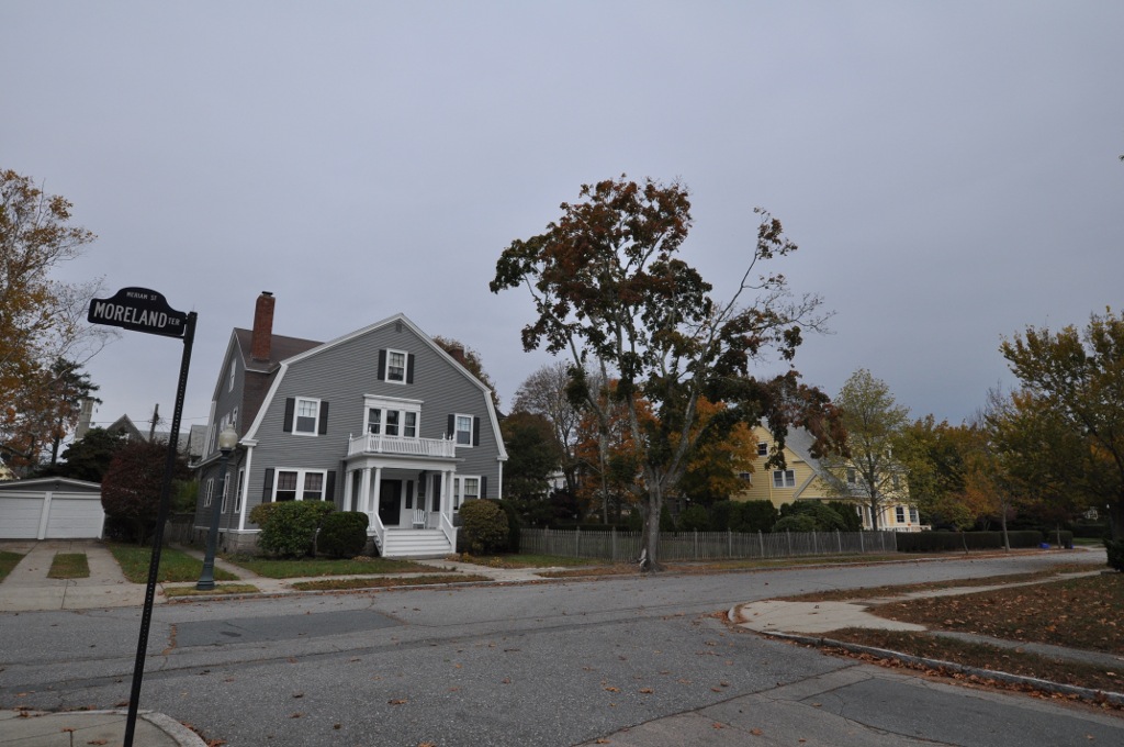
Smith Mills, Massachusetts
Smith Mills is a community of 4,612 people in Bristol County, Massachusetts.
Why visit Smith Mills
Townapedia lists 40 museums and landmarks, 23 parks and trails, 51 places to eat, 7 places to stay and 4 attractions in and around town.
Highlights include AMC Dartmouth Mall 11, Lincoln Park, Acushnet Heights Historic District and Bradford Smith Building.
July is the warmest month, with average highs of 82°F; January lows average 21°F.
Weather in Smith Mills
Forecast from the National Weather Service. Full forecast
About Smith Mills
Smith Mills is a census-designated place (CDP) in the town of Dartmouth in Bristol County, Massachusetts, United States. As of the 2020 census, Smith Mills had a population of 4,832.
From the Wikipedia article Smith Mills, Massachusetts (this version), under CC BY-SA 4.0.
Things to do4


Lincoln Park
Monument and historic site · 2.4 mi
Amusement park located in North Dartmouth, Massachusetts

University of Massachusetts Dartmouth
School · 1.3 mi
University in the United States
Museums and landmarks40

Acushnet Heights Historic District
Monument and historic site · National Register of Historic Places · 3.5 mi
Historic district in New Bedford, Massachusetts

Bradford Smith Building
Monument and historic site · National Register of Historic Places · 3.5 mi
Building in Massachusetts, United States

Buttonwood Park Historic District
Monument and historic site · National Register of Historic Places · 2.6 mi
Historic district in Massachusetts, United States

Central New Bedford Historic District
Monument and historic site · National Register of Historic Places · 3.7 mi
Historic district in Massachusetts, United States

County Street Historic District
Monument and historic site · National Register of Historic Places · 3.6 mi
Historic district in Massachusetts, United States

Dawson Building
Monument and historic site · National Register of Historic Places · 3.5 mi
Building in Massachusetts, United States

Hixville Village Historic District
Monument and historic site · National Register of Historic Places · 3.0 mi
Historic district in Massachusetts, United States

Hotel Waverly
Monument and historic site · National Register of Historic Places · 3.7 mi
On the National Register of Historic Places

Howland Mill Village Historic District
Monument and historic site · National Register of Historic Places · 4.0 mi
Historic district New Bedford, MA, US


Jewish Cemetery of New Bedford
Monument and historic site · National Register of Historic Places · 2.9 mi
Historic cemetery in Bristol County, Massachusetts
Lightship No. 114
Monument and historic site · National Register of Historic Places · 4.1 mi
Lightship
Moreland Terrace Historic District
Monument and historic site · National Register of Historic Places · 3.5 mi
Historic district in Massachusetts, United States
28 more on the map.
Parks, trails and playgrounds23


Paskamansett Woods
Park · 1.1 mi
The 11-acre Paskamansett Woods Reserve, along with a trail easement on a portion of Gidley Woods, provides trail access from Chase Road...
Chase Road, Dartmouth
Mo-Su 06:00-18:00
Buttonwood Park Zoo
Park · 2.6 mi
Zoo in Massachusetts, United States

11 more on the map.
Restaurants and cafes51

Riccardi's Restaurant
Restaurant · Italian, Pizza · 1.5 mi
901 Hathaway Road, Dartmouth
Mo-Th 11:00-20:00; Fr 11:00-21:00; Sa 12:00-21:00; Su 12:00-20:00



Village Cafe
Cafe · American · 1.7 mi
88 State Road, Dartmouth
Su 06:30-13:00; Mo-Sa 06:30-14:00
39 more on the map.
Where to stay7
Residence Inn New Bedford Dartmouthh
Motel and hotel · 0.8 mi
181 Faunce Corner Road, North Dartmouth
Churches and places of worship8
First Baptist Church
Church · National Register of Historic Places · 3.7 mi
Union Baptist Church
Church · National Register of Historic Places · 3.4 mi
New Bedford First Church of the Nazarene
Church · Nazarene · 1.8 mi
764 Hathaway Road, New Bedford
Shopping14
Gas and EV charging9
Schools, colleges and libraries51
Healthcare3
Map of Smith Mills
210 places. The map loads OpenStreetMap tiles when you open it.
Climate by month
Monthly table
| Month | High | Low | Rain |
|---|---|---|---|
| Jan | 39°F | 21°F | 3.7 in |
| Feb | 41°F | 22°F | 3.0 in |
| Mar | 47°F | 28°F | 4.8 in |
| Apr | 57°F | 36°F | 4.0 in |
| May | 67°F | 46°F | 3.3 in |
| Jun | 76°F | 55°F | 3.6 in |
| Jul | 82°F | 62°F | 3.0 in |
| Aug | 81°F | 60°F | 3.8 in |
| Sep | 74°F | 52°F | 3.6 in |
| Oct | 64°F | 42°F | 4.6 in |
| Nov | 54°F | 33°F | 4.3 in |
| Dec | 44°F | 26°F | 4.1 in |
U.S. Climate Normals 1991-2020 for New Bedford Muni Ap (3 mi away), NOAA NCEI.
People and cost of living
American Community Survey 5-year estimates, 2020-2024, U.S. Census Bureau. Estimates have margins of error, larger for small towns.
Disaster history
Bristol County has had 23 federal disaster declarations since 2000, most often for severe storms.
- 2024-05-15: Severe Storms And Flooding (Flood)
- 2023-09-15: Hurricane Lee (Hurricane)
- 2022-04-18: Severe Winter Storm And Snowstorm (Snowstorm)
- 2020-03-27: Covid-19 Pandemic (Biological)
- 2020-03-13: Covid-19 (Biological)
- 2018-06-25: Severe Winter Storm And Flooding (Severe Storm)
OpenFEMA disaster declarations summaries.
Getting there and nearby towns
New Bedford Regional Airport (EWB) is the nearest airport with scheduled flights listed in OpenStreetMap, 3 miles away.
- New Bedford 3 mi east, about 5 min by car
- Bliss Corner 4 mi southeast, about 7 min by car
- Acushnet Center 5 mi northeast, about 9 min by car
- North Westport 6 mi west, about 10 min by car
- Fall River 7 mi northwest, about 11 min by car
- Somerset 11 mi northwest, about 17 min by car
- Mattapoisett Center 11 mi east, about 17 min by car
- Ocean Grove 12 mi northwest, about 20 min by car
- Marion Center 13 mi east, about 21 min by car
- Taunton 18 mi north, about 30 min by car
Drive times are estimates from straight-line distance, not routes.
Local news
Headlines from INDB, the NEMICO news database.
Reviews, tips and questions
Loading what members have shared...
Sources and licences
- NCES EDGE (Public domain): public schools
- NOAA NCEI U.S. Climate Normals 1991-2020 (Public domain): climate by month
- OpenFEMA (Public domain): disaster declarations
- OpenStreetMap contributors (ODbL 1.0): places, airports, map data
- U.S. Census Bureau (Public domain): population, income, housing, education, commute
- Wikidata (CC0 1.0): elevation, founding date, time zone, website, landmarks and historic places
- Wikimedia Commons (see each image): photos
- Wikipedia (CC BY-SA 4.0): overview and history text
Photo credits
- Smith Mills Congregational Church, Smith Mills MA, John Phelan, CC BY-SA 4.0
- Union Baptist Church, New Bedford MA, John Phelan, CC BY-SA 3.0
- Johnson Properties, New Bedford, MA, Daniel Case, CC BY-SA 3.0
- Sgt. William H. Carney House, New Bedford MA, John Phelan, CC BY-SA 3.0
- First Unitarian Church, New Bedford MA, John Phelan, CC BY 3.0
- NewBedfordMA MorelandTerraceHD 1, User:Magicpiano, CC BY-SA 4.0
- NewBedfordMA NorthBedfordHD 3, User:Magicpiano, CC BY-SA 4.0
- New Bedford Fire Museum, Daniel Case, CC BY-SA 3.0
- Dawson Building, New Bedford MA, John Phelan, CC BY-SA 3.0
- NewBedfordMA BradfordSmithBuilding, Janet Meunier, Public domain
- DartmouthMA TuckerFarmhouse, User:Magicpiano, CC BY-SA 4.0
- William Rotch House, New Bedford, MA, Daniel Case, CC BY-SA 3.0
- NPS Visitor Center, New Bedford, MA, Daniel Case, CC BY-SA 3.0
- NewBedfordMA JewishCemetery 2, Magicpiano, CC BY-SA 3.0
- NewBedfordMA RotchCottage Front, User:Magicpiano, CC BY-SA 4.0
- US Customshouse, New Bedford, MA, Daniel Case, CC BY-SA 3.0
- Linden Street, New Bedford MA, John Phelan, CC BY-SA 3.0
- NewBedfordMA RuralCemetery Gate, Magicpiano, CC BY-SA 3.0
- First Church of Hixville, Hixville MA, John Phelan, CC BY-SA 3.0
- Formal Garden, Buttonwood Park, New Bedford MA, John Phelan, CC BY-SA 3.0
- Downtown New Bedford MA, Marcbela (Marc N. Belanger), Public domain
- NewBedfordMA HotelWaverly, User:Magicpiano, CC BY-SA 4.0
- NewBedfordMA OakGroveCemetery Chapel, Magicpiano, CC BY-SA 3.0
- Union Street Railway Carbarn, New Bedford MA, John Phelan, CC BY-SA 3.0
- North Water Street, New Bedford, MA, Daniel Case, CC BY-SA 3.0
- Wamsutta Mills NB, Marcbela, Public domain
- Thompson Street School, New Bedford MA, John Phelan, CC BY-SA 3.0
- DartmouthMA RussellGarrison1, Magicpiano, CC BY-SA 4.0
- New Bedford Whaling National Historical Park Vistor Center 2006, Rolf Müller, CC BY-SA 3.0
- NewBedfordMA HowlandMillVillage, User:Magicpiano, CC BY-SA 4.0


Page built October 30, 2026. Spotted a mistake? Tell us or suggest a place.