


Boston, Massachusetts
Boston is a city of 666,442 people in Suffolk County, Massachusetts, founded in September 17, 1630.
Why visit Boston
Townapedia lists 126 museums and landmarks, 93 parks and trails, 288 places to eat, 23 places to stay and 14 attractions in and around town.
Highlights include New England Aquarium, Simons Theatre, Boston Children's Museum and Edward M. Kennedy Institute for the United States Senate.
July is the warmest month, with average highs of 82°F; January lows average 23°F, and about 49 inches of snow fall in a normal year.
Weather in Boston
Forecast from the National Weather Service. Full forecast
About Boston
Boston is the capital and most populous city of the U.S. state of Massachusetts. It serves as a cultural and financial center of New England, a region of the Northeastern United States. Boston has an area of 48.4 square miles (125 km2) and a population of 675,647 as of the 2020 census, making it the third-most populous city in the Northeastern United States after New York City and Philadelphia. The larger Greater Boston metropolitan statistical area had a population of 5 million in 2025, making it the largest metropolis in New England and the eleventh-largest in the United States.
From the Wikipedia article Boston (this version), under CC BY-SA 4.0.
Things to do14

New England Aquarium
Zoo and aquarium · 2.6 mi
1 Central Wharf, Boston
Mo-Fr 09:00-18:00; Sa,Su 09:00-18:00

Simons Theatre
Cinema and theater · 2.6 mi
95 East India Right of Way, Boston
Mo-Fr 09:00-18:00; Sa,Su 09:00-18:00

Arsenal Street Bridge
Bridge · 7.1 mi
Bridge in United States of America

2 more on the map.
Museums and landmarks126

Boston Children's Museum
Museum · 2.3 mi
308 Congress Street, Boston
Mo-Su 09:00-16:00; Sa[1] 10:00-16:00
Edward M. Kennedy Institute for the United States Senate
Museum · 1.6 mi
Currently the Ed Kennedy Institute is only open for group visits.
210 William T Morrissey Boulevard, Dorchester

Alfred Douglass House
Monument and historic site · National Register of Historic Places · 6.8 mi
Historic house in Massachusetts, United States
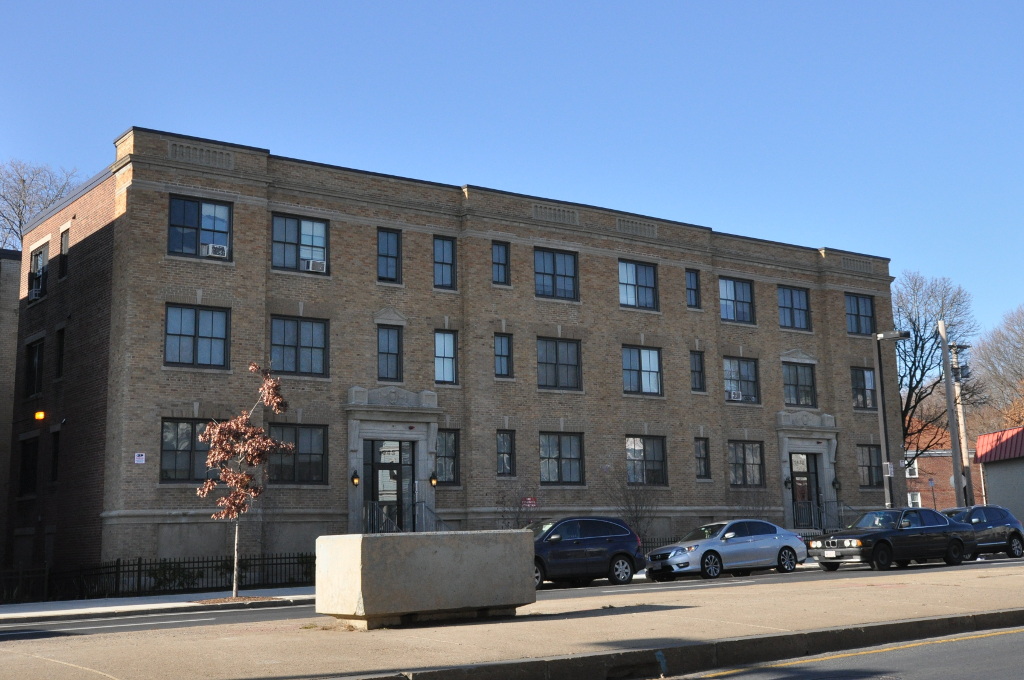


Almont Apartments
Monument and historic site · National Register of Historic Places · 5.7 mi
Historic building in Boston, Massachusetts, USA
Beaconsfield Terraces Historic District
Monument and historic site · National Register of Historic Places · 6.3 mi
Historic district in Massachusetts, United States
Benjamin White House
Monument and historic site · National Register of Historic Places · 7.0 mi
Listed on the National Register of Historic Places in Norfolk County, Massachusetts
Brandegee Estate
Monument and historic site · National Register of Historic Places · 7.0 mi
Historic house in Massachusetts, United States
Brighton Center Historic District
Monument and historic site · National Register of Historic Places · 7.3 mi
Historic district in Boston, Massachusetts, United States
Charles Heath House
Monument and historic site · National Register of Historic Places · 6.6 mi
Brookline, Massachusetts
Chestnut Hill Historic District
Monument and historic site · National Register of Historic Places · 7.4 mi
Historic district in Massachusetts, United States
Chestnut Hill Reservoir Historic District
Monument and historic site · National Register of Historic Places · 7.4 mi
Historic district in Massachusetts, United States
114 more on the map.
Parks, trails and playgrounds93


Savin Hill Yacht Club Office
Marina and boat launch · 2.3 mi
400 William T Morrissey Boulevard, Dorchester
Mo-Su 09:00-17:00

Squantum Point Park
Park · 2.6 mi
This former Naval airfield is now a beautiful waterfront park. Squantum Point offers great views of the Boston Skyline across the harbor...

Thomas W. Danehy Park
Park · 7.4 mi
Park in Middlesex County, Massachusetts, United States of America
Reggie Wong Memorial Park
Park · 2.6 mi
135 Kneeland Street, Boston
Mo-Su 08:00-dusk

Francis L. Murphy Skating Rink
Sports field and stadium · 0.6 mi
1880 William J. Day Boulevard, South Boston
81 more on the map.
Restaurants and cafes288


Borrachito
Restaurant · Mexican · 1.9 mi
70 Pier Four Boulevard, Boston
Mo-Sa 11:00-26:00; Su 11:00-24:00
Broadway's Pastry & Coffee Shop
Cafe · Coffee Shop · 2.0 mi
258 West Broadway
Mo-Fr 07:00-19:00; Sa-Su 08:00-19:00
Flour
Restaurant · Sandwich · 2.2 mi
12 Farnsworth Street, Boston
Mo-Fr 07:00-19:00; Sa 08:00-18:00; Su 09:00-16:00
Loco Taqueria & Oyster Bar
Restaurant · Seafood, Mexican · 1.8 mi
412 West Broadway
Mo-Fr 17:00-01:00; Sa-Su 10:00-01:00
276 more on the map.
Where to stay23
Churches and places of worship20
Saint George Albanian Orthodox Cathedral
Church · Albanian Orthodox · 1.5 mi
523 East Broadway, South Boston
Brighton Evangelical Congregational Church
Church · National Register of Historic Places · 7.3 mi
First Congregational Church of Hyde Park
Church · National Register of Historic Places · 7.5 mi
Holy Trinity Albanian Orthodox Church
Church · Albanian Orthodox · 2.0 mi
245 D Street, South Boston
Our Lady of Good Voyage Chapel
Church · Catholic · 2.2 mi
51 Seaport Boulevard, Boston
Unitarian Universalist Association of Congregations
Place of worship · 2.2 mi
24 Farnsworth Street, Boston
Blessed Mother Teresa
Church · Roman Catholic · 2.4 mi
800 Columbia Road, Dorchester
Dorchester Waymark Seventh-day Adventist Church
Church · Seventh Day Adventist · 2.5 mi
1048 Dorchester Avenue, Boston
Shopping30
Gas and EV charging7
Schools, colleges and libraries70
Healthcare5
Map of Boston
250 places. The map loads OpenStreetMap tiles when you open it.
Climate by month
Monthly table
| Month | High | Low | Rain | Snow |
|---|---|---|---|---|
| Jan | 37°F | 23°F | 3.4 in | 14.3 in |
| Feb | 39°F | 25°F | 3.2 in | 14.4 in |
| Mar | 46°F | 31°F | 4.2 in | 9.0 in |
| Apr | 56°F | 41°F | 3.6 in | 1.6 in |
| May | 66°F | 50°F | 3.2 in | 0.0 in |
| Jun | 76°F | 60°F | 3.9 in | 0.0 in |
| Jul | 82°F | 66°F | 3.3 in | 0.0 in |
| Aug | 80°F | 65°F | 3.2 in | 0.0 in |
| Sep | 73°F | 58°F | 3.6 in | 0.0 in |
| Oct | 62°F | 48°F | 4.0 in | 0.2 in |
| Nov | 52°F | 38°F | 3.7 in | 0.7 in |
| Dec | 42°F | 29°F | 4.3 in | 9.0 in |
U.S. Climate Normals 1991-2020 for Boston Logan Intl Ap 72509 (2 mi away), NOAA NCEI.
People and cost of living
American Community Survey 5-year estimates, 2020-2024, U.S. Census Bureau. Estimates have margins of error, larger for small towns.
Disaster history
Suffolk County has had 24 federal disaster declarations since 2000, most often for severe storms.
- 2023-09-15: Hurricane Lee (Hurricane)
- 2022-04-18: Severe Winter Storm And Snowstorm (Snowstorm)
- 2020-03-27: Covid-19 Pandemic (Biological)
- 2020-03-13: Covid-19 (Biological)
- 2018-07-19: Severe Winter Storm And Snowstorm (Snowstorm)
- 2015-04-13: Severe Winter Storm, Snowstorm, And Flooding (Severe Storm)
OpenFEMA disaster declarations summaries.
Getting there and nearby towns
Boston Harbor Seaplane Base (Cape Air Seaplanes) (BNH) is the nearest airport with scheduled flights listed in OpenStreetMap, 2 miles away.
- South Station map
- Quincy 5 mi south, about 8 min by car
- Chelsea 5 mi north, about 7 min by car
- Cambridge 6 mi northwest, about 10 min by car
- Lynn 10 mi north, about 16 min by car
- Brockton 17 mi south, about 28 min by car
- Lowell 26 mi northwest, about 42 min by car
- Worcester 41 mi west, about 1 h by car
- Providence 41 mi southwest, about 1 h by car
- New Bedford 47 mi south, about 1 h 15 min by car
- Manchester 50 mi northwest, about 1 h 15 min by car
Drive times are estimates from straight-line distance, not routes.
Local news
Headlines from INDB, the NEMICO news database.
Reviews, tips and questions
Loading what members have shared...
Sources and licences
- NCES EDGE (Public domain): public schools
- NOAA NCEI U.S. Climate Normals 1991-2020 (Public domain): climate by month
- OpenFEMA (Public domain): disaster declarations
- OpenStreetMap contributors (ODbL 1.0): places, airports, map data
- U.S. Census Bureau (Public domain): population, income, housing, education, commute
- Wikidata (CC0 1.0): elevation, founding date, time zone, website, landmarks and historic places
- Wikimedia Commons (see each image): photos
- Wikipedia (CC BY-SA 4.0): overview and history text
Photo credits
- Boston from the Harbour, Massachusetts (493360) (10772382303), Robert Linsdell from St. Andrews, Canada, CC BY 2.0
- South Boston, Boston, MA, USA - panoramio (1), Stanley Nova, CC BY 3.0
- South Boston, Boston, MA, USA - panoramio, Stanley Nova, CC BY 3.0
- City Point, Boston, MA 02127, USA - panoramio, Stanley Nova, CC BY 3.0
- D Street - West Broadway, Boston, MA, USA - panoramio, Eric Friedebach, CC BY 3.0
- Flight from Toronto to Boston. Over City Point, Boston (493350) (10568417535), Robert Linsdell from St. Andrews, Canada, CC BY 2.0
- D Street - West Broadway, Boston, MA, USA - panoramio (1), Eric Friedebach, CC BY 3.0
- D Street - West Broadway, Boston, MA, USA - panoramio (2), Eric Friedebach, CC BY 3.0
- D Street - West Broadway, Boston, MA, USA - panoramio (3), Eric Friedebach, CC BY 3.0
- Flight from Toronto to Boston. Over Fort Independence, Boston (493351) (10568544686), Robert Linsdell from St. Andrews, Canada, CC BY 2.0
- The GDF Suez, leaving Boston Harbor, is a monster! Wow! (14629275434), Jonathan Bowen from Quincy, MA, USA, CC BY 2.0
- South Boston Aerial View, February 2023, Fletcher, CC BY 4.0
- Kitesurfing in Boston.agr, ArnoldReinhold, CC BY 3.0
- Cronus Leader departing Boston.agr, ArnoldReinhold, CC BY-SA 4.0
- USCGC William Chadwick in Boston Harbor, Fletcher, CC BY 4.0
- Boston, MA, USA - panoramio (45), Stanley Nova, CC BY 3.0
- Boston, MA, USA - panoramio (43), Stanley Nova, CC BY 3.0
- World War II South Boston Memorial - panoramio, Stanley Nova, CC BY 3.0
- Boston, MA, USA - panoramio (44), Stanley Nova, CC BY 3.0
- Brilliance of the Seas Boston 2013 02, Ahecht, CC BY-SA 4.0
- Brilliance of the Seas Boston 2014 10, Ahecht, CC BY-SA 4.0
- Brilliance of the Seas Boston 2013 04, Ahecht, CC BY-SA 4.0
- Brilliance of the Seas Boston 2014 01, Ahecht, CC BY-SA 4.0
- Brilliance of the Seas Boston 2014 04, Ahecht, CC BY-SA 4.0
- Brilliance of the Seas Boston 2013 03, Ahecht, CC BY-SA 4.0
- Brilliance of the Seas Boston 2014 06, Ahecht, CC BY-SA 4.0
- BostonMA AlmontApartments, Magicpiano, CC BY-SA 3.0
- BostonMA CrawfordStreetHD 1, Magicpiano, CC BY-SA 4.0
- Henry F Barker House Quincy MA 01, Jameslwoodward, CC BY-SA 3.0
- BostonMA SarahDavidsonApartmentBlock, User:Magicpiano, CC BY-SA 4.0
- Ellen H. Swallow Richards House Boston MA 01, Jameslwoodward, CC BY-SA 3.0
- BostonMA EsmondStreetHD 2, Magicpiano, CC BY-SA 4.0
- Solon Dogget House, Sswonk, CC BY-SA 3.0
- BostonMA IntervaleStreetHD 5, Magicpiano, CC BY-SA 4.0
- FirstChurchofJP, Biruitorul, Public domain
- BostonMA ColumbiaRoadDevonStreetHD2, Magicpiano, CC BY-SA 4.0
- Winfield House Site Quincy MA, Jameslwoodward, CC BY-SA 4.0
- J Martin Nowland House Quincy MA 01, Jameslwoodward, CC BY-SA 3.0
- Head Island, Sturban, CC BY-SA 4.0
- Prairie horned lark by tVP, The Vertebrate Pokédex ( @thevertebratepokedex ), CC0


Page built October 30, 2026. Spotted a mistake? Tell us or suggest a place.