


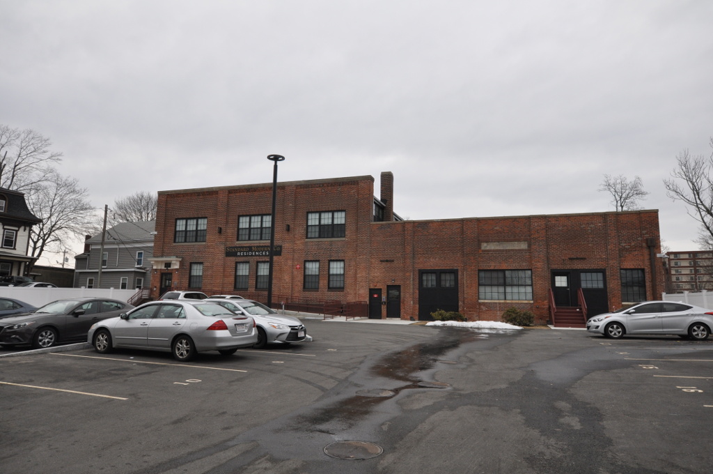

Brockton, Massachusetts
Brockton is a city of 105,386 people in Plymouth County, Massachusetts, founded in 1700.
Why visit Brockton
Townapedia lists 60 museums and landmarks, 117 parks and trails, 104 places to eat, 4 places to stay and 3 attractions in and around town.
Highlights include Langwater Farm, Brockton City Hall, Brockton Edison Electric Illuminating Company Power Station and D.W. Field Park.
July is the warmest month, with average highs of 84°F; January lows average 21°F, and about 34 inches of snow fall in a normal year.
Weather in Brockton
Forecast from the National Weather Service. Full forecast
About Brockton
Brockton is a city in Plymouth County, Massachusetts, United States. Its population was 105,643 at the 2020 United States census, and it is a major economic and commercial hub for the southern part of Greater Boston. Along with Plymouth, it is one of the two county seats of the county. It is the sixth-largest city in Massachusetts and is sometimes referred to as the "City of Champions", due to the success of native boxers Rocky Marciano and Marvin Hagler, as well as its successful Brockton High School sports programs.
From the Wikipedia article Brockton, Massachusetts (this version), under CC BY-SA 4.0.
Things to do3


Museums and landmarks60

Brockton City Hall
Monument and historic site · National Register of Historic Places
Rathaus in Massachusetts, United States
45 School Street, Brockton

Brockton Edison Electric Illuminating Company Power Station
Monument and historic site · National Register of Historic Places · 1.5 mi
Historic power plant
Central Fire Station
Monument and historic site · National Register of Historic Places
Fire station in Brockton, Massachusetts, United States
Centre and Montello Streets Historic District
Monument and historic site · National Register of Historic Places · 0.4 mi
Historic district in Massachusetts, United States

Commonwealth Shoe and Leather Co.
Monument and historic site · National Register of Historic Places · 4.8 mi
Factory in Whitman, Massachusetts
Curtis Building
Monument and historic site · National Register of Historic Places
Building in Massachusetts, United States
Dr. Edgar Everett Dean House
Monument and historic site · National Register of Historic Places
Historic house in Massachusetts, United States
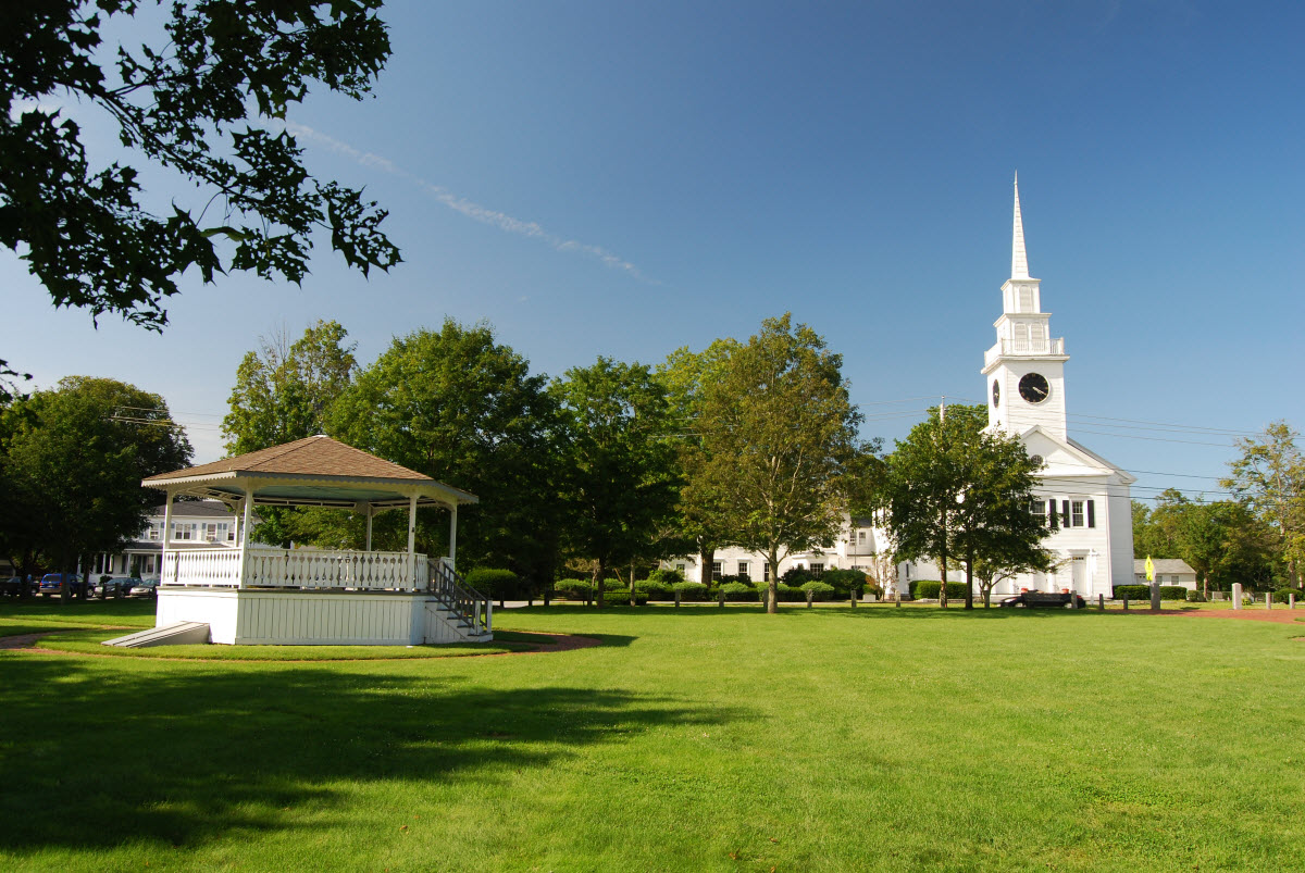
East Bridgewater Common Historic District
Monument and historic site · National Register of Historic Places · 5.2 mi
East Bridgewater, Massachusetts, listed on the NRHP in Massachusetts

Forest Avenue School
Museum · National Register of Historic Places · 1.2 mi
Museum in Massachusetts, United States of America

Gardner J. Kingman House
Monument and historic site · National Register of Historic Places
Historic house in Massachusetts, United States

H.H. Richardson Historic District of North Easton
Monument and historic site · National Register of Historic Places · 4.0 mi
Historic district in Easton, Massachusetts

Holbrook Square Historic District
Monument and historic site · National Register of Historic Places · 5.1 mi
Historic district in Massachusetts, United States
48 more on the map.
Parks, trails and playgrounds117


D.W. Field Park
Park · National Register of Historic Places · 1.9 mi
Park in Massachusetts, United States


War Memorial Park
Park · National Register of Historic Places · 4.7 mi
Park in West Bridgewater, Massachusetts, USA
Whitman Park
Park · National Register of Historic Places · 4.7 mi
Park in Massachusetts, United States of America
105 more on the map.
Restaurants and cafes104

Santana Restaurant & Function Hall
Restaurant · 1.7 mi
684 Crescent Street
Mo-Fr 08:00-18:30, Sa-Su 09:00-02:00
The Chateau Restaurant
Restaurant · 2.8 mi
1165 Park Street, Stoughton
Tu 16:00-20:00; We,Th,Su 11:30-20:00; Fr,Sa 11:30-21:00
IHOP
Restaurant · Breakfast, Pancake · 1.7 mi
400 Westgate Drive
Mo-Su 07:00-22:00
Reid's Ultimate Breakfast
Restaurant · Breakfast · 2.7 mi
2021 Main Street, Brockton
Mo-Su 05:30-13:00


92 more on the map.
History
In 1649, Ousamequin (Massasoit) sold the surrounding Wampanoag land—then known as Saughtucket—to Myles Standish as an addition to Duxbury. Brockton was part of this area, which the English renamed Bridgewater. On June 15, 1821, a portion of the then Bridgewater Township was established as North Bridgewater.
From the History section of Brockton, Massachusetts on Wikipedia, under CC BY-SA 4.0.
Where to stay4
Churches and places of worship54
Brockton Temple Seventh-Day Adventist Church
Church · Seventh Day Adventist · 0.8 mi
237 Court Street, Brockton
Shopping25
Gas and EV charging29
Schools, colleges and libraries88
Brockton Area Seventh-Day Adventist Academy
School · Seventh Day Adventist · 0.8 mi
243 Court Street, Brockton
Trinity Catholic Academy - Lower Campus
School · Roman Catholic · 1.2 mi
631 North Main Street, Brockton
Healthcare11
Passport Health Brockton Travel Clinic
Clinic and pharmacy · 0.7 mi
425 Pleasant Street, Brockton
Map of Brockton
250 places. The map loads OpenStreetMap tiles when you open it.
Climate by month
Monthly table
| Month | High | Low | Rain | Snow |
|---|---|---|---|---|
| Jan | 39°F | 21°F | 4.0 in | 9.1 in |
| Feb | 41°F | 22°F | 3.6 in | 12.8 in |
| Mar | 48°F | 29°F | 5.2 in | 6.9 in |
| Apr | 59°F | 38°F | 4.5 in | 0.7 in |
| May | 70°F | 47°F | 3.4 in | 0.0 in |
| Jun | 78°F | 57°F | 4.1 in | 0.0 in |
| Jul | 84°F | 63°F | 3.2 in | 0.0 in |
| Aug | 83°F | 62°F | 3.6 in | 0.0 in |
| Sep | 75°F | 54°F | 4.1 in | 0.0 in |
| Oct | 64°F | 43°F | 5.0 in | 0.1 in |
| Nov | 54°F | 34°F | 4.4 in | 0.2 in |
| Dec | 44°F | 26°F | 5.1 in | 4.5 in |
U.S. Climate Normals 1991-2020 for Brockton (3 mi away), NOAA NCEI.
People and cost of living
American Community Survey 5-year estimates, 2020-2024, U.S. Census Bureau. Estimates have margins of error, larger for small towns.
Disaster history
Plymouth County has had 20 federal disaster declarations since 2000, most often for hurricanes.
- 2023-09-15: Hurricane Lee (Hurricane)
- 2022-04-18: Severe Winter Storm And Snowstorm (Snowstorm)
- 2020-03-27: Covid-19 Pandemic (Biological)
- 2020-03-13: Covid-19 (Biological)
- 2018-06-25: Severe Winter Storm And Flooding (Severe Storm)
- 2015-04-13: Severe Winter Storm, Snowstorm, And Flooding (Severe Storm)
OpenFEMA disaster declarations summaries.
Getting there and nearby towns
Norwood Memorial Airport (OWD) is the nearest airport with scheduled flights listed in OpenStreetMap, 11 miles away.
- Abington 4 mi northeast, about 7 min by car
- Holbrook 4 mi north, about 7 min by car
- Quincy 12 mi north, about 20 min by car
- Boston 17 mi north, about 28 min by car
- Cambridge 21 mi north, about 33 min by car
- Providence 27 mi southwest, about 44 min by car
- Lynn 27 mi north, about 44 min by car
- New Bedford 29 mi south, about 47 min by car
- Lowell 41 mi north, about 1 h by car
- Worcester 42 mi west, about 1 h 15 min by car
Drive times are estimates from straight-line distance, not routes.
Local news
Headlines from INDB, the NEMICO news database.
Reviews, tips and questions
Loading what members have shared...
Sources and licences
- NCES EDGE (Public domain): public schools
- NOAA NCEI U.S. Climate Normals 1991-2020 (Public domain): climate by month
- OpenFEMA (Public domain): disaster declarations
- OpenStreetMap contributors (ODbL 1.0): places, airports, map data
- U.S. Census Bureau (Public domain): population, income, housing, education, commute
- Wikidata (CC0 1.0): elevation, founding date, time zone, website, landmarks and historic places
- Wikimedia Commons (see each image): photos
- Wikipedia (CC BY-SA 4.0): overview and history text
Photo credits
- BrocktonCityHall, Timothy Valentine, CC BY-SA 2.0
- BrocktonMA BlanchardPlat2, Magicpiano, CC BY-SA 4.0
- BrocktonMA BlanchardPlat1, Magicpiano, CC BY-SA 4.0
- Brockton, Massachusetts, Quintin Soloviev, CC BY 4.0
- BrocktonMA NETT FormerEngineeringOfficeBuilding, Magicpiano, CC BY-SA 4.0
- Race and ethnicity 2020 Brockton, MA, CensusDots, CC BY-SA 4.0
- BrocktonMA CentreMontelloHD1, Magicpiano, CC BY-SA 4.0
- BrocktonMA CentreMontelloHD3, Magicpiano, CC BY-SA 4.0
- BrocktonMA CentreMontelloHD2, Magicpiano, CC BY-SA 4.0
- Brockton station 1910 postcard (2), Unknown author Unknown author, Public domain
- Vacant lot in front of Brockton Station Dec 2024, 4300streetcar, CC BY 4.0
- Pedestrian level crossing at Brockton station, Jule 2017, Pi.1415926535, CC BY-SA 3.0
- Brockton Downtown MBTA Commuter Rail Station, Pliskin 49, CC BY-SA 4.0
- Brockton station platform from pedestrian crossing, June 2017, Pi.1415926535, CC BY-SA 3.0
- Top of staircase at Brockton station, June 2017, Pi.1415926535, CC BY-SA 3.0
- Possible CapeFLYER signage at Brockton station, June 2017, Pi.1415926535, CC BY-SA 3.0
- Brockton station platform and police station, June 2017, Pi.1415926535, CC BY-SA 3.0
- Brockton station platform and Anglim building, June 2017, Pi.1415926535, CC BY-SA 3.0
- 1906 Brockton station postcard, The Metropolitan News Company, Public domain
- Old and new mile markers at Brockton station, June 2017, Pi.1415926535, CC BY-SA 3.0
- Brockton station platform, June 2017, Pi.1415926535, CC BY-SA 3.0
- Court Street staircase at Brockton station, June 2017, Pi.1415926535, CC BY-SA 3.0
- Old stone ramps in Brockton, June 2017, Pi.1415926535, CC BY-SA 3.0
- Brockton, MA, Legion Parkway looking east, Tyoung0543, CC BY-SA 4.0
- Brockton, MA, Legion Parkway looking west, Tyoung0543, CC BY-SA 4.0
- Brockton, MA, intersection of N Main and Linden, looking south, Tyoung0543, CC BY-SA 4.0
- Brockton, MA, intersection of Legion, Centre, and Main looking north, Tyoung0543, CC BY-SA 4.0
- D.W. Field Park, Brockton MA, John Phelan, CC BY 3.0
- East Bridgewater Common, Marcbela (Marc N. Belanger), Public domain
- Lucius Clapp Memorial, Stoughton MA, John Phelan, CC BY 3.0
- Oakes Ames Memorial Hall and Ames Free Library (North Easton, MA), Daderot, CC BY-SA 3.0
- Brockton Edison, Marcbela (Marc N. Belanger), Public domain
- BrocktonMA ForestAvenueSchool, User:Magicpiano, CC BY-SA 4.0
- WhitmanMA CommonwealthShoeAndLeatherCompany, Magicpiano, CC BY-SA 4.0
- North Abington Depot, Marcbela (Marc N. Belanger), Public domain
- Gardner J. Kingman House, Brockton MA, John Phelan, CC BY 3.0
- Holbrook Town Hall, MA, John Phelan, CC BY 3.0
- Howard Block, Brockton MA, John Phelan, CC BY 3.0
- Roberts School, Holbrook MA, John Phelan, CC BY 3.0
- BrocktonMA SouthStreet 1, User:Magicpiano, CC BY-SA 4.0


Page built October 30, 2026. Spotted a mistake? Tell us or suggest a place.