


Why visit Bratenahl
Townapedia lists 15 museums and landmarks, 15 parks and trails, 13 places to eat and 2 attractions in and around town.
Highlights include Euclid Beach Park, Mandel School of Applied Social Sciences, Allen Memorial Medical Library and Alta Public Library.
July is the warmest month, with average highs of 81°F; January lows average 24°F.
Weather in Bratenahl
Forecast from the National Weather Service. Full forecast
About Bratenahl
Bratenahl is a village in Cuyahoga County, Ohio, United States, on the southern shore of Lake Erie. One of Cleveland's oldest streetcar suburbs, it is bordered by the city on three sides and by the Lake Erie shoreline to the north. The population was 1,430 at the 2020 census.
From the Wikipedia article Bratenahl, Ohio (this version), under CC BY-SA 4.0.
Things to do2
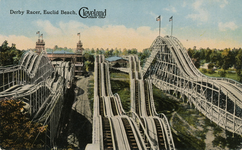
Euclid Beach Park
Monument and historic site · 2.5 mi
Amusement park in Cleveland, Ohio

Museums and landmarks15

Allen Memorial Medical Library
Monument and historic site · National Register of Historic Places · 3.4 mi
Library

Alta Public Library
Monument and historic site · National Register of Historic Places · 3.2 mi
Library building in Cleveland, Ohio

Ansel Road Apartment Buildings Historic District
Monument and historic site · National Register of Historic Places · 2.9 mi
Historic residential district in the Hough neighborhood of Cleveland, Ohio, in the United States

Cozad-Bates House
Monument and historic site · National Register of Historic Places · 3.2 mi
Historic house in Ohio, United States

Flora Stone Mather College Historic District
Monument and historic site · National Register of Historic Places · 3.2 mi
Historic district in Ohio, United States

Forest Hill
Monument and historic site · National Register of Historic Places · 2.6 mi
Historic neighborhood spanning parts of Cleveland Heights and East Cleveland, Ohio, United States

James A. Garfield Memorial
Monument and historic site · National Register of Historic Places · 3.2 mi
Building

Maltz Performing Arts Center
Monument and historic site · National Register of Historic Places · 3.3 mi
Historic arts center and synagogue building in Cleveland, Ohio, USA

Nela Park
Monument and historic site · National Register of Historic Places · 2.5 mi
Headquarters of GE Lighting in East Cleveland, Ohio
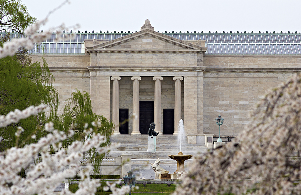
Cleveland Museum of Art
Museum · 3.2 mi
Art museum in Cleveland, Ohio


Italian American Museum of Cleveland
Museum · 3.2 mi
Museum in Cleveland, Ohio
3 more on the map.
Parks, trails and playgrounds15

Forest Hill Park
Park · National Register of Historic Places · 2.7 mi
Park in Cuyahoga County, Ohio, United States of America

Rockefeller Park
Park · National Register of Historic Places · 2.3 mi
Park in Cleveland, Ohio, United States of America

Cleveland Cultural Gardens
Park · 2.3 mi
Park in Cuyahoga County, Ohio, United States of America

Gordon Park
Park · 2.0 mi
Park in Cuyahoga County, Ohio, United States of America



Bratenahl Village Park
Park · 0.7 mi
Has a playground, baseball diamond, and tennis court. Good place to stop and read/ study, generally stays quiet.

Bump Taylor Field
Sports field and stadium · 1.4 mi
11901 Durant Avenue, Cleveland
3 more on the map.
Restaurants and cafes13

7 Entertainers Cafe & Lounge
Bar and pub · 1.4 mi
14804 Saint Clair Avenue, Cleveland


Subway
Fast food · Sandwich · 1.4 mi
10334 Saint Clair Avenue, Cleveland
Mo-Fr 09:00-21:00; Sa 10:00-20:00; Su 10:00-18:00
Subway
Fast food · Sandwich · 1.5 mi
944 East 152 Street, Cleveland
Mo-Fr 09:00-21:00; Sa 10:00-20:00; Su 10:00-18:00
China MountaIn
Fast food · Chinese · 1.5 mi
14959 Saint Clair Avenue, Cleveland
Mo-Sa 11:00-24:00; Su 13:00-22:00
Kim's Wings
Fast food · Chicken · 1.4 mi
14909 Saint Clair Avenue, Cleveland
10:00-24:00
Bratenahl Kitchen
Fast food · Jamaican · 1.4 mi
14002 Lake Shore Boulevard, Bratenahl
1 more on the map.
History
Bratenahl was incorporated in 1903, and named after its founder, Charles Bratenahl. It is one of the older residential suburbs of Cleveland along with Shaker Heights, Lakewood, and Cleveland Heights; of these, Bratenahl has the highest per capita wealth. Bratenahl is a small community of fewer than 1,200 population inhabiting approximately 700 households, some of which are stately estates, townhouses, and condominiums on the lakefront.
Bratenahl is home to a once controversial luxury high-rise condominium complex named Bratenahl Place. Though many residents opposed it at the time, in 1967 two large multi-occupancy buildings of brutalist architectural design were built on the lakefront. One of the two structures was originally intended to be a 180-unit rental apartment building, while the other, smaller one was a condominium from its inception. In 1976 however, the larger one also became a condominium.
Bratenahl was the subject of a joint Marshall Project and WEWS investigation that found that the majority of drivers cited for traffic violations by the Bratenahl police were Black. The report found that Bratenahl village had assessed more than $700,000 in fines, court costs, and other revenue since 2020, mostly from Black drivers passing through the village's jurisdiction.
From the History section of Bratenahl, Ohio on Wikipedia, under CC BY-SA 4.0.
Churches and places of worship28
Church of the Covenant
Church · National Register of Historic Places · 3.2 mi
First Church of Christ in Euclid
Church · National Register of Historic Places · 2.1 mi
Holy Rosary Church
Church · National Register of Historic Places · 3.2 mi
St. Paul's Episcopal Church of East Cleveland
Church · National Register of Historic Places · 2.0 mi
Wade Memorial Chapel
Church · National Register of Historic Places · 2.9 mi
Aspinwall church of god
Church · Pentecostal · 1.3 mi
1427 Aspinwall Avenue, cleveland
Second St. John Missionary Baptist Church
Church · Baptist · 1.3 mi
717 East 125th Street
Shopping4
Gas and EV charging4
Schools, colleges and libraries49
Cleveland Academy For Scholarship Technology And Leadership
School · 4.6 mi
3950 Prospect Ave E, Cleveland
Cleveland Arts And Social Sciences Academy
School · 4.9 mi
10701 Shaker Blvd, Cleveland
Map of Bratenahl
130 places. The map loads OpenStreetMap tiles when you open it.
Climate by month
Monthly table
| Month | High | Low | Rain |
|---|---|---|---|
| Jan | 35°F | 24°F | 1.8 in |
| Feb | 37°F | 24°F | 1.5 in |
| Mar | 45°F | 31°F | 2.4 in |
| Apr | 57°F | 41°F | 3.1 in |
| May | 68°F | 53°F | 3.5 in |
| Jun | 77°F | 63°F | 2.8 in |
| Jul | 81°F | 68°F | 3.7 in |
| Aug | 80°F | 67°F | 3.5 in |
| Sep | 74°F | 60°F | 2.9 in |
| Oct | 62°F | 49°F | 3.2 in |
| Nov | 50°F | 38°F | 2.9 in |
| Dec | 40°F | 30°F | 2.0 in |
U.S. Climate Normals 1991-2020 for Cleveland Burke Ap (5 mi away), NOAA NCEI.
People and cost of living
American Community Survey 5-year estimates, 2020-2024, U.S. Census Bureau. Estimates have margins of error, larger for small towns.
Disaster history
Cuyahoga County has had 11 federal disaster declarations since 2000, most often for severe storms.
- 2020-03-31: Covid-19 Pandemic (Biological)
- 2020-03-13: Covid-19 (Biological)
- 2013-01-03: Severe Storms And Flooding Due To The Remnants Of Hurricane Sandy (Hurricane)
- 2012-06-30: Severe Storms (Severe Storm)
- 2006-07-02: Severe Storms, Tornadoes, Straight Line Winds, And Flooding (Severe Storm)
- 2005-09-13: Hurricane Katrina Evacuation (Hurricane)
OpenFEMA disaster declarations summaries.
Getting there and nearby towns
Burke Lakefront Airport (BKL) is the nearest airport with scheduled flights listed in OpenStreetMap, 4 miles away.
- East Cleveland 2 mi southeast, about 3 min by car
- Cleveland Heights 4 mi southeast, about 6 min by car
- South Euclid 5 mi southeast, about 8 min by car
- Euclid 5 mi northeast, about 8 min by car
- Richmond Heights 5 mi east, about 8 min by car
- University Heights 6 mi southeast, about 9 min by car
- Shaker Heights 6 mi southeast, about 10 min by car
- Lyndhurst 6 mi southeast, about 10 min by car
- Cleveland 7 mi southwest, about 11 min by car
- Beachwood 8 mi southeast, about 12 min by car
Drive times are estimates from straight-line distance, not routes.
Local news
Headlines from INDB, the NEMICO news database.
Reviews, tips and questions
Loading what members have shared...
Sources and licences
- NCES EDGE (Public domain): public schools
- NOAA NCEI U.S. Climate Normals 1991-2020 (Public domain): climate by month
- OpenFEMA (Public domain): disaster declarations
- OpenStreetMap contributors (ODbL 1.0): places, airports, map data
- U.S. Census Bureau (Public domain): population, income, housing, education, commute
- Wikidata (CC0 1.0): elevation, founding date, time zone, website, landmarks and historic places
- Wikimedia Commons (see each image): photos
- Wikipedia (CC BY-SA 4.0): overview and history text
Photo credits
- Gwinn Estate gateway, Nyttend, Public domain
- Allen Memorial Medical Library Exterior, Soundoftoday, CC BY-SA 3.0
- Askew entrance - Alta House-Alta Public Library (34897341312), Tim Evanson from Cleveland Heights, Ohio, USA, CC BY-SA 2.0
- Toboggan hill 01 - Rockefeller Park, Tim Evanson, CC BY-SA 2.0
- Cleveland, chiesa del santo rosario, a little italy, Sailko, CC BY 3.0
- Empowerment Church, East Cleveland, Nyttend, Public domain
- The Temple Tifereth Israel, stu_spivack, CC BY-SA 2.0
- Cultural Gardens of Cleveland (20644562649), Erik Drost, CC BY 2.0
- Ansel Road at Kenmore in Cleveland, Nyttend, Public domain
- P1010768 - First United Presbyterian Church of East Cleveland, Ponceesponce, CC BY-SA 3.0
- Cozad-Bates House Cleveland Ohio, Christopher Busta-Peck, CC BY-SA 1.0
- Euclid Avenue Presbyterian Church Cleveland Ohio, Christopher Busta-Peck | Talk, CC BY-SA 1.0
- Brewster east of Henley in Forest Hill, Nyttend, Public domain
- Wade Chapel Cleveland Ohio, Christopher Busta-Peck, CC BY-SA 1.0
- Case western reserve campus 2005, Rdikeman at English Wikipedia, CC BY-SA 3.0
- Nela Park Building 307, Rpabst at en.wikipedia, Public domain
- The Museum of Contemporary Art Cleveland, Sarahnrehm, CC BY-SA 3.0
- St Casimir Church 03 - Cleveland, Tim Evanson, CC BY-SA 2.0
- Italian American Museum of Cleveland, Packer1028, CC0
- Afommus, Susan Donovan, CC BY-SA 3.0
- Cleveland Museum of Art - lagoon with statue, Daderot, Public domain
- Hungarian Cultural Garden, stu_spivack, CC BY-SA 2.0
- CHC Cleveland 01, Ɱ, CC BY-SA 4.0
- Springtime art museum, zenbikescience, CC BY 2.0
- Oh2 - Gordon Park, Cards84664, CC BY-SA 4.0
- Euclidbeach, Braun Post Card Co., Cleveland, Ohio. Ryecatcher773 at en.wikipedia, Public domain
- Dittrick Museum, Markeclartin, CC BY-SA 4.0
- St Vitus Church Cleveland, Tim Evanson, CC BY-SA 2.0
- Mandel School of Applied Social Sciences building, Packer1028, CC0


Page built October 30, 2026. Spotted a mistake? Tell us or suggest a place.