




Brooklyn Center, Minnesota
Brooklyn Center is a city of 32,479 people in Hennepin County, Minnesota, founded in 1852.
Why visit Brooklyn Center
Townapedia lists 7 museums and landmarks, 75 parks and trails, 58 places to eat, 11 places to stay and 5 attractions in and around town.
Highlights include Camden Bridge, Canadian Pacific Camden Place Rail Bridge, Banfill Tavern and Fredrika Bremer Intermediate School.
July is the warmest month, with average highs of 83°F; January lows average 7°F.
Weather in Brooklyn Center
Forecast from the National Weather Service. Full forecast
About Brooklyn Center
Brooklyn Center is a first-ring suburban city in Hennepin County, Minnesota, United States. The population was 33,782 at the 2020 census, and was estimated at 31,755 in 2024. It is part of the Minneapolis–Saint Paul metropolitan area.
From the Wikipedia article Brooklyn Center, Minnesota (this version), under CC BY-SA 4.0.
Things to do5

Camden Bridge
Bridge · 3.0 mi
Bridge in Minneapolis, Minnesota, United States
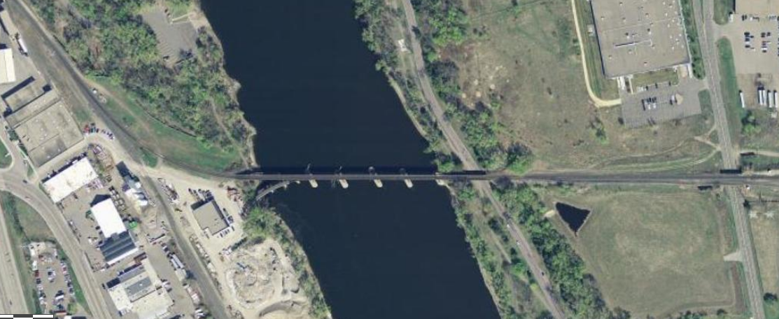
Canadian Pacific Camden Place Rail Bridge
Bridge · 3.2 mi
Bridge in Minneapolis, Minnesota


Lowry Avenue Bridge
Bridge · 4.3 mi
Tied-arch bridge that crosses the Mississippi River in Minneapolis, Minnesota, United States
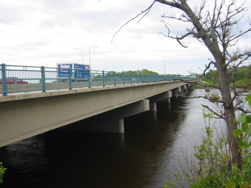
Richard P. Braun Bridge
Bridge · 4.3 mi
Highway bridge across the Mississippi River between Brooklyn Park, Minnesota and Coon Rapids, Minnesota
Museums and landmarks7
Banfill Tavern
Monument and historic site · National Register of Historic Places · 2.5 mi
Building in Fridley, Minnesota, United States

Fredrika Bremer Intermediate School
Monument and historic site · National Register of Historic Places · 3.9 mi
Building in Minneapolis, Minnesota, United States

Lawrence A. and Mary Fournier House
Monument and historic site · National Register of Historic Places · 3.4 mi
House in Minneapolis, United States of America
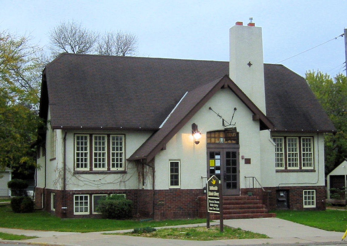
Robbinsdale Library
Monument and historic site · National Register of Historic Places · 2.8 mi
Branch library of the Hennepin County Library system in Robbinsdale, Minnesota

Parks, trails and playgrounds75

North Mississippi Regional Park
Park · 2.5 mi
Park in Hennepin County, Minnesota, United States of America
4900 Mississippi Court, Minneapolis


Graeser Park
Park · 2.4 mi
Park in Robbinsdale, Hennepin County, United States of America

63 more on the map.
Restaurants and cafes58

Irie Vybz Jamaican Restaurant LLC
Restaurant · Jamaican · 0.5 mi
6056 Shingle Creek Parkway, Brooklyn Center
Mo-Fr 11:30-20:00; Sa 14:00-20:00; Su 15:00-20:00
Teppenyaki Grill
Restaurant · Japanese, Sushi · 2.6 mi
268 57th Avenue Northeast
Su-Th 11:00-21:30; Fr-Sa 11:00-22:00
The Camden Social
Restaurant · American, Southern, Soul Food · 2.5 mi
4601 North Lyndale Avenue, Minneapolis
We-Th 15:00-22:00; Fr 15:00-24:00; Sa 11:00-23:00


Forgotten Star Brewing
Brewery and winery · 2.3 mi
38 Northern Stacks Drive Northeast, Fridley
Mo-Th 11:00-22:00; Fr-Sa 11:00-23:00; Su 11:00-21:00
Topgolf
Restaurant · Burger, Salad, Wings, Sandwich, Beer, Wine · 1.5 mi
640 Camden Avenue North, Brooklyn Center
Mo-Th 10:00-23:00; Fr-Sa 10:00-23:59; Su 10:00-23:00
Leeann Chin
Restaurant · Chinese · 0.6 mi
11:00-20:00; Th-Sa 11:00-21:00
Mama Ti's African Kitchen
Restaurant · African · 2.6 mi
7800 Zane Avenue North, Brooklyn Park
46 more on the map.
History
Pioneers organized town governments for Brooklyn Township and Crystal Lake Township when Minnesota became a state in 1858. Osseo Road was a main thoroughfare that brought settlers to an area centered around their school, post office, store, meeting hall, and Baptist and Methodist churches. That location thrived as a market gardening community. It abutted the encroaching development of Minneapolis to the south.
Steps were taken to protect the area from annexation by Minneapolis and to retain "simpler public business methods, and extra police protection" by incorporation. The Hennepin County Board of Commissioners accepted a petition to incorporate the Village of Brooklyn Center on January 16, 1911. An election followed, the boundaries were set, and documents filed with the state on February 18, 1911. P.W. Reidhead was the first president. The population was 500.
From the History section of Brooklyn Center, Minnesota on Wikipedia, under CC BY-SA 4.0.
Where to stay11
Country Inn & Suites, Brooklyn Center, MN
Motel and hotel · 0.5 mi
2550 Freeway Boulevard, Brooklyn Center
Embassy Suites by Hilton Minneapolis North
Motel and hotel · 0.6 mi
6300 Earle Brown Drive, Brooklyn Center
Churches and places of worship11
Brooklyn United Methodist Church
Church · Methodist · 1.7 mi
7200 Brooklyn Boulevard, Brooklyn Center
Brookdale Covenant Church
Church · Covenant · 1.3 mi
5139 Brooklyn Boulevard, Brooklyn Center
Cross of Glory Lutheran Church ELCA
Church · Lutheran · 0.5 mi
5929 Brooklyn Boulevard, Brooklyn Center
North Center Baptist Church
Church · Baptist · 2.4 mi
6601 68th Avenue North, Brooklyn Park
Peace Lutheran Church
Church · Lutheran · 2.2 mi
4512 France Avenue North, Robbinsdale
The Gathering Community Church
Church · Methodist · 2.4 mi
3620 43rd Avenue North, Robbinsdale
Unity Temple Church of God in Christ
Church · Church Of God In Christ · 1.2 mi
4801 63rd Avenue North, Brooklyn Center
Faith Evangelical Free Church
Church · 2.3 mi
4505 Halifax Avenue North, Robbinsdale
Shopping17
Gas and EV charging12
Schools, colleges and libraries60
4126 - Prairie Seeds Academy - Is
School · 2.8 mi
6200 W Broadway Ave, Brooklyn Park
Athlos Leadership Academy
School · 5.0 mi
10100 Noble Parkway North, Brooklyn Park
Healthcare6
Crystal Medical Center
Clinic and pharmacy · 2.2 mi
5700 Bottineau Boulevard, Crystal
Crystal Urgent Care
Clinic and pharmacy · 2.2 mi
5700 Bottineau Boulevard, Crystal
Northwest Family Clinics
Clinic and pharmacy · 2.1 mi
5700 Bottineau Boulevard, Crystal
Map of Brooklyn Center
250 places. The map loads OpenStreetMap tiles when you open it.
Climate by month
Monthly table
| Month | High | Low | Rain |
|---|---|---|---|
| Jan | 24°F | 7°F | 0.6 in |
| Feb | 29°F | 11°F | 0.6 in |
| Mar | 42°F | 23°F | 1.4 in |
| Apr | 57°F | 35°F | 2.9 in |
| May | 70°F | 47°F | 4.3 in |
| Jun | 79°F | 58°F | 4.4 in |
| Jul | 83°F | 62°F | 4.2 in |
| Aug | 81°F | 60°F | 4.1 in |
| Sep | 73°F | 52°F | 3.2 in |
| Oct | 58°F | 38°F | 2.6 in |
| Nov | 42°F | 26°F | 1.5 in |
| Dec | 29°F | 13°F | 0.9 in |
U.S. Climate Normals 1991-2020 for Mpls Crystal Ap (2 mi away), NOAA NCEI.
People and cost of living
American Community Survey 5-year estimates, 2020-2024, U.S. Census Bureau. Estimates have margins of error, larger for small towns.
Disaster history
Hennepin County has had 10 federal disaster declarations since 2000, most often for floods.
- 2020-04-07: Covid-19 Pandemic (Biological)
- 2020-03-13: Covid-19 (Biological)
- 2016-11-02: Severe Storms And Flooding (Flood)
- 2014-07-21: Severe Storms, Straight-Line Winds, Flooding, Landslides, And Mudslides (Flood)
- 2013-07-25: Severe Storms, Straight-Line Winds, And Flooding (Severe Storm)
- 2011-06-07: Severe Storms And Tornadoes (Severe Storm)
OpenFEMA disaster declarations summaries.
Getting there and nearby towns
Crystal Airport (MIC) is the nearest airport with scheduled flights listed in OpenStreetMap, 2 miles away.
- Crystal 3 mi southwest, about 5 min by car
- Fridley 3 mi east, about 5 min by car
- Brooklyn Park 3 mi northwest, about 5 min by car
- Minneapolis 8 mi south, about 12 min by car
- Blaine 9 mi northeast, about 14 min by car
- Anoka 11 mi north, about 17 min by car
- St. Paul 13 mi southeast, about 21 min by car
- Andover 13 mi north, about 21 min by car
- Apple Valley 23 mi south, about 37 min by car
- Big Lake 28 mi northwest, about 45 min by car
Drive times are estimates from straight-line distance, not routes.
Local news
Headlines from INDB, the NEMICO news database.
Reviews, tips and questions
Loading what members have shared...
Sources and licences
- NCES EDGE (Public domain): public schools
- NOAA NCEI U.S. Climate Normals 1991-2020 (Public domain): climate by month
- OpenFEMA (Public domain): disaster declarations
- OpenStreetMap contributors (ODbL 1.0): places, airports, map data
- U.S. Census Bureau (Public domain): population, income, housing, education, commute
- Wikidata (CC0 1.0): elevation, founding date, time zone, website, landmarks and historic places
- Wikimedia Commons (see each image): photos
- Wikipedia (CC BY-SA 4.0): overview and history text
Photo credits
- FBI Minneapolis - Federal Bureau of Investigation Building (27513665992), Tony Webster from Minneapolis, Minnesota, United States, CC BY-SA 2.0
- Fournier House 1, Elkman, CC BY-SA 4.0
- Robbinsdale Library 002, Elkman, CC BY-SA 4.0
- Fredrika Bremer Intermediate School, McGhiever, CC BY-SA 4.0
- Banfill Tavern, McGhiever, CC BY-SA 3.0
- Graeser Park Beehive Grill Spring, Elkman, CC BY 4.0
- Camden Bridge Mpls, McGhiever, CC BY-SA 4.0
- RichardPBraunBridge, Todd Murray, CC BY-SA 3.0
- New Lowry Avenue Bridge, Cadwaladr, CC BY-SA 3.0
- Canadian Pacific Camden Place Rail Bridge USGS, USGS, Public domain
Page built October 30, 2026. Spotted a mistake? Tell us or suggest a place.