


Broomall, Pennsylvania
Broomall is a community of 10,679 people in Delaware County, Pennsylvania.
Why visit Broomall
Townapedia lists 15 museums and landmarks, 24 parks and trails, 48 places to eat, 1 place to stay and 3 attractions in and around town.
Highlights include Bridge in Radnor Township No. 2, Delaware County Community College, Allgates and Bridge in Radnor Township No. 1.
July is the warmest month, with average highs of 88°F; January lows average 26°F, and about 23 inches of snow fall in a normal year.
Weather in Broomall
Forecast from the National Weather Service. Full forecast
About Broomall
Broomall is a census-designated place (CDP) in Marple Township, Pennsylvania, United States. The population was 10,789 at the 2010 census.
From the Wikipedia article Broomall, Pennsylvania (this version), under CC BY-SA 4.0.
Things to do3

Bridge in Radnor Township No. 2
Bridge · National Register of Historic Places · 3.0 mi
Bridge in United States of America

Delaware County Community College
School · 2.0 mi
Two-year college in Pennsylvania, U.S.
Museums and landmarks15

Allgates
Monument and historic site · National Register of Historic Places · 2.5 mi
House in Haverford Township, Pennsylvania

Bridge in Radnor Township No. 1
Bridge · National Register of Historic Places · 2.6 mi
Bridge in United States of America

Camp-Woods
Monument and historic site · National Register of Historic Places · 3.6 mi
Building in Pennsylvania, United States

Collen Brook Farm
Museum · National Register of Historic Places · 2.1 mi
Historic house in Pennsylvania, United States

Dr. Samuel D. Risley House
Monument and historic site · National Register of Historic Places · 3.7 mi
Historic house in Pennsylvania, United States

Federal School
Monument and historic site · National Register of Historic Places · 2.4 mi
Human settlement in Pennsylvania, United States of America

Glenays
Monument and historic site · National Register of Historic Places · 3.2 mi
Historic house in Pennsylvania, United States
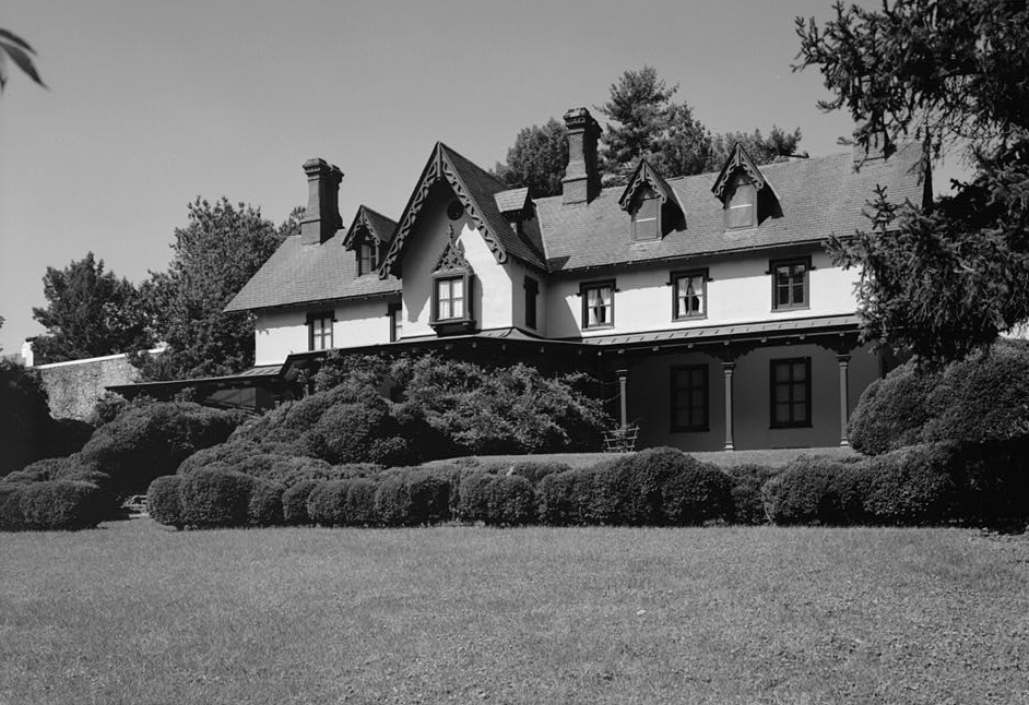
Grange Estate
Monument and historic site · National Register of Historic Places · 3.7 mi
Human settlement in Pennsylvania, United States of America

Hood Octagonal School
Monument and historic site · National Register of Historic Places · 2.2 mi
Newtown Township, Pennsylvania, a property listed on the NRHP

Llanerch Public School
Monument and historic site · National Register of Historic Places · 2.9 mi
Former school in Havertown, Pennsylvania


Merion Golf Club
Monument and historic site · National Register of Historic Places · 3.1 mi
Private golf club in Haverford Township, Pennsylvania, USA
Nitre Hall
Museum · National Register of Historic Places · 3.8 mi
Historic house in Pennsylvania, United States
3 more on the map.
Parks, trails and playgrounds24



12 more on the map.
Restaurants and cafes48

Alfredo's Pizza
Restaurant · Pizza, Burger, Sandwich, Italian, Cheesesteak, Fries · 1.3 mi
2900 West Chester Pike, Broomall
Mo-Th 10:30-10:00; Fr-Sa 10:30-11:00; Su 11:00-09:00

Applebee's
Diner · American · 1.7 mi
1305 West Chester Pike, Havertown
Mo-Th,Su 11:30-23:00; Fr-Sa 11:30-24:00
Bravo Pizza
Restaurant · Pizza · 1.7 mi
1345 West Chester Pike, Havertown
Mo-Th 10:00-21:00; Fr 10:00-22:00; Sa 10:00-21:00; Su 11:00-20:00
Cascata Caffe
Restaurant · Italian, Italian Pizza · 1.8 mi
801 West Sproul Road, Springfield
Mo off; Tu-Th,Su 15:00-20:00; Fr-Sa 15:00-21:00
Charlotte's Restaurant
Restaurant · Seafood · 1.8 mi
3207 West Chester Pike, Newtown Square
Tu 16:30-20:30; We-Sa 11:30-20:30
Drexel Hill Style Pizza
Restaurant · Pizza · 1.0 mi
2585 West Chester Pike, Broomall
Mo-Th 10:00-23:00; Fr-Sa 10:00-24:00; Su 10:00-22:00
Hanoi's Pho
Restaurant · Vietnamese · 1.6 mi
1501 West Chester Pike, Havertown
Mo-Th,Su 11:00-21:00; Fr-Sa 11:00-21:30
Italian Delite Pizza
Restaurant · Pizza
2052 Sproul Road, Broomall
Mo-Th,Sa 10:30-22:00; Fr 10:30-22:30; Su 11:00-21:00
New Leaf Chinese & Japanese Cuisine
Restaurant · Chinese, Japanese · 1.4 mi
2916 West Chester Pike, Broomall
Mo-Th,Su 11:30-21:30; Fr-Sa 11:30-22:30
P. J. Whelihan's Pub & Restaurant
Restaurant · Barbecue · 0.5 mi
1991 Sproul Road, Broomall
Mo-Th 11:00-23:00; Fr 11:00-24:00; Sa 00:00-01:00,11:00-24:00; Su...

36 more on the map.
History
This crossroads community was renamed for the post office established to honor John Martin Broomall, a 19th-century U.S. congressman, Electoral College member (at Ulysses S. Grant's 1872 presidential election), and Chester Gas Company president from Upper Chichester Township in Delaware County, Pennsylvania.
Broomall is home to the biotechnology company Drummond Scientific Company. Drummond's Pipet-Aid pipette controller, released in 1972, improved accuracy and pipetting capabilities in laboratories.
The Thomas Massey House is listed on the National Register of Historic Places.
From the History section of Broomall, Pennsylvania on Wikipedia, under CC BY-SA 4.0.
Where to stay1
Churches and places of worship18
Saint Anastasia Roman Catholic Church
Church · Roman Catholic · 1.9 mi
3301 West Chester Pike, Newtown Square
The Church of Jesus Christ of Latter-day Saints
Church · Mormon · 0.7 mi
721 Paxon Hollow Road, Broomall
Saint Matthew's Church
Church · Reformed Episcopal · 1.4 mi
202 Glen Gary Drive, Havertown
Cornerstone Christian Church
Church · Apostolic · 0.8 mi
2275 West Chester Pike, Broomall
Shopping13
Gas and EV charging6
Schools, colleges and libraries46
Healthcare8
Map of Broomall
182 places. The map loads OpenStreetMap tiles when you open it.
Climate by month
Monthly table
| Month | High | Low | Rain | Snow |
|---|---|---|---|---|
| Jan | 41°F | 26°F | 3.1 in | 7.1 in |
| Feb | 44°F | 28°F | 2.8 in | 8.4 in |
| Mar | 53°F | 34°F | 4.0 in | 3.6 in |
| Apr | 65°F | 44°F | 3.5 in | 0.3 in |
| May | 74°F | 54°F | 3.3 in | 0.0 in |
| Jun | 83°F | 64°F | 4.0 in | 0.0 in |
| Jul | 88°F | 70°F | 4.4 in | 0.0 in |
| Aug | 86°F | 68°F | 4.3 in | 0.0 in |
| Sep | 79°F | 61°F | 4.4 in | 0.0 in |
| Oct | 67°F | 49°F | 3.5 in | 0.0 in |
| Nov | 56°F | 39°F | 2.9 in | 0.2 in |
| Dec | 46°F | 31°F | 4.0 in | 3.5 in |
U.S. Climate Normals 1991-2020 for Philadelphia Intl Ap 72408 (10 mi away), NOAA NCEI.
People and cost of living
American Community Survey 5-year estimates, 2020-2024, U.S. Census Bureau. Estimates have margins of error, larger for small towns.
Disaster history
Delaware County has had 15 federal disaster declarations since 2000, most often for hurricanes.
- 2021-09-10: Remnants Of Hurricane Ida (Hurricane)
- 2020-03-30: Covid-19 Pandemic (Biological)
- 2020-03-13: Covid-19 (Biological)
- 2014-02-06: Severe Winter Storm (Severe Ice Storm)
- 2012-10-29: Hurricane Sandy (Hurricane)
- 2011-09-12: Tropical Storm Lee (Flood)
OpenFEMA disaster declarations summaries.
Getting there and nearby towns
Philadelphia Essington Seaplane Base (PSQ) is the nearest airport with scheduled flights listed in OpenStreetMap, 8 miles away.
- Ardmore 4 mi northeast, about 6 min by car
- Bala Cynwyd 7 mi northeast, about 12 min by car
- Philadelphia 12 mi east, about 19 min by car
- Camden 13 mi east, about 21 min by car
- Gloucester City 14 mi southeast, about 22 min by car
- Woodbury 14 mi southeast, about 23 min by car
- Collingswood 15 mi east, about 24 min by car
- Bellmawr 15 mi southeast, about 25 min by car
- Westmont 16 mi east, about 26 min by car
- Wilmington 19 mi southwest, about 30 min by car
Drive times are estimates from straight-line distance, not routes.
Local news
Headlines from INDB, the NEMICO news database.
Reviews, tips and questions
Loading what members have shared...
Sources and licences
- NCES EDGE (Public domain): public schools
- NOAA NCEI U.S. Climate Normals 1991-2020 (Public domain): climate by month
- OpenFEMA (Public domain): disaster declarations
- OpenStreetMap contributors (ODbL 1.0): places, airports, map data
- U.S. Census Bureau (Public domain): population, income, housing, education, commute
- Wikidata (CC0 1.0): landmarks and historic places
- Wikimedia Commons (see each image): photos
- Wikipedia (CC BY-SA 4.0): overview and history text
Photo credits
- Broomall, PA, IMG 1430, Squelle, CC BY-SA 3.0
- Broomall, United States (Unsplash), Chris Rhoads myfast, CC0
- Broomall, United States (Unsplash iB90wzpOOgI), Chris Rhoads myfast, CC0
- 2022-08-06 10 51 05 View north along Interstate 476 (Mid-County Expressway-"Blue Route") at Exit 9 (Pennsylvania State Route 3, Broomall, Upper Darby) in Marple Township, Delaware County, Pennsylvania, Famartin, CC BY-SA 4.0
- Grace Lutheran Church, Broomall, PA, March 2025, Mr. Matté (if there is an issue with this image, contact me using this image's Commons talk page , my Commons user talk page , or my English Wikipedia user talk page ; I'll know about it a lot faster), CC BY-SA 4.0
- NitreHall, User:Smallbones on English Wikipedia., Public domain
- Glenays, User:Smallbones on English Wikipedia., Public domain
- CollenbrookFarm, User:Smallbones on English Wikipedia., Public domain
- Bridge2Radnor, User:Smallbones at English Wikipedia., Public domain
- FederalSchool, User:Smallbones on English Wikipedia., Public domain
- Llanerch school, EytanMelech, CC BY-SA 4.0
- GoshenRoadBridge, User:Smallbones ., Public domain
- Camp-Woods, Fearless LeChien, CC BY-SA 4.0
- WestTavernNewTownSq, User:Smallbones on English Wikipedia., Public domain
- Allgates, User:Smallbones on English Wikipedia., Public domain
- Old Rose Tree from North, Smallbones, CC0
- GrangeEstate, Unknown (US government). Original uploader was BillFlis at en.wikipedia, Public domain
- Merion 1, Mark E. Wangerin on English Wikipedia., Public domain
- Pont Reading133671pu, HABS, Public domain
- RisleyFrontMediaPA, User:Smallbones on English Wikipedia., Public domain
- OctagonalSchool, User:Smallbones on English Wikipedia., Public domain
- Rainbow flames (Unsplash), Chris Rhoads myfast, CC0
- Popcorn plant, Libnoscenti, CC BY-SA 4.0
- Marple, PA Public Library, Nov. 2025, Mr. Matté (if there is an issue with this image, contact me using this image's Commons talk page , my Commons user talk page , or my English Wikipedia user talk page ; I'll know about it a lot faster), CC BY-SA 4.0
- 2022-10-17 14 10 46 View south along Pennsylvania State Route 320 (Sproul Road) at Candlewood Road in Marple Township, Delaware County, Pennsylvania, Famartin, CC BY-SA 4.0
- Marple Township, PA Municipal Building, Nov. 2025, Mr. Matté (if there is an issue with this image, contact me using this image's Commons talk page , my Commons user talk page , or my English Wikipedia user talk page ; I'll know about it a lot faster), CC BY-SA 4.0
- 2022-10-17 13 24 58 View north along Pennsylvania State Route 320 (Sproul Road) just north of Radcliffe Road in Marple Township, Delaware County, Pennsylvania, Famartin, CC BY-SA 4.0
- 2022-10-07 15 00 52 View north along Interstate 476 (Mid-County Expressway-"Blue Route") from the overpass for Lawrence Road in Marple Township, Delaware County, Pennsylvania, Famartin, CC BY-SA 4.0
- 2022-10-07 14 59 27 View south along Interstate 476 (Mid-County Expressway-"Blue Route") from the overpass for Lawrence Road in Marple Township, Delaware County, Pennsylvania, Famartin, CC BY-SA 4.0
- PA 320 nb approaching PA 3, Nov. 2025, Mr. Matté (if there is an issue with this image, contact me using this image's Commons talk page , my Commons user talk page , or my English Wikipedia user talk page ; I'll know about it a lot faster), CC BY-SA 4.0
- 2022-08-06 09 36 24 View south along Interstate 476 (Mid-County Expressway-"Blue Route") just south of Exit 9 in Marple Township, Delaware County, Pennsylvania, Famartin, CC BY-SA 4.0
- 2022-10-24 10 36 54 View west along Pennsylvania State Route 3 (West Chester Pike) just east of Mather Avenue in Marple Township, Delaware County, Pennsylvania, Famartin, CC BY-SA 4.0
- 2022-10-24 13 01 07 View east along Pennsylvania State Route 3 (West Chester Pike) at the exit for Interstate 476 SOUTH (Chester) in Marple Township, Delaware County, Pennsylvania, Famartin, CC BY-SA 4.0
- 2022-10-17 14 06 57 View south along Pennsylvania State Route 320 (Sproul Road) just south of Pennsylvania State Route 3 (West Chester Pike) in Marple Township, Delaware County, Pennsylvania, Famartin, CC BY-SA 4.0
- 2022-10-24 13 06 05 View east along Pennsylvania State Route 3 (West Chester Pike) at the exit for Interstate 476 NORTH (Plymouth Meeting) in Marple Township, Delaware County, Pennsylvania, Famartin, CC BY-SA 4.0
- 2022-10-07 15 09 12 View south along Interstate 476 (Mid-County Expressway-"Blue Route") from the overpass for Pennsylvania State Route 3 (West Chester Pike) in Marple Township, Delaware County..., Famartin, CC BY-SA 4.0
- 2022-10-24 10 35 18 View west along Pennsylvania State Route 3 (West Chester Pike) at the exit for Interstate 476 SOUTH (Chester) in Marple Township, Delaware County, Pennsylvania, Famartin, CC BY-SA 4.0
- Andrew Walton 2017-01-01 (Unsplash), Andrew Walton andy_walton, CC0
- 2022-10-07 15 11 15 View north along Interstate 476 (Mid-County Expressway-"Blue Route") from the overpass for Pennsylvania State Route 3 (West Chester Pike) in Marple Township, Delaware County..., Famartin, CC BY-SA 4.0
- I-476 NB from PA 3 overpass, Dough4872, CC BY-SA 4.0


Page built October 30, 2026. Spotted a mistake? Tell us or suggest a place.