


California, Pennsylvania
California is a borough of 4,864 people in Washington County, Pennsylvania, founded in 1849.
Why visit California
Townapedia lists 18 museums and landmarks, 13 parks and trails, 6 places to eat, 1 place to stay and 8 attractions in and around town.
Highlights include Belle Vernon Bridge, Lane Bane Bridge, Malden Inn and Bowman's Castle.
July is the warmest month, with average highs of 85°F; January lows average 21°F.
Weather in California
Forecast from the National Weather Service. Full forecast
About California
California is a borough on the Monongahela River in Washington County, Pennsylvania, United States. The population was 5,479 as of the 2020 census. It is part of the Pittsburgh metropolitan area. Founded in 1849, the borough was named for the territory of California following the gold rush.
From the Wikipedia article California, Pennsylvania (this version), under CC BY-SA 4.0.
Things to do8

Belle Vernon Bridge
Bridge · 4.5 mi
Bridge in Pennsylvania and Speers, Pennsylvania


Mon-Fayette Expressway Bridge
Bridge · 4.4 mi
Bridge in United States of America

PennWest California
School · 1.6 mi
Public university located in California, Pennsylvania, United States

Speers Railroad Bridge
Bridge · 4.5 mi
Bridge in United States of America

West Brownsville Junction Bridge
Bridge · 2.9 mi
Bridge in United States of America


Museums and landmarks18

Malden Inn
Monument and historic site · National Register of Historic Places · 2.2 mi
Hotel in Blainsburg, United States of America
384 Old National Pike, Brownsville

Bowman's Castle
Monument and historic site · National Register of Historic Places · 3.4 mi
Brownsville, Pennsylvania, NRHP-listed

Brownsville Bridge
Bridge · National Register of Historic Places · 3.3 mi
Bridge in United States of America

Brownsville Commercial Historic District
Monument and historic site · National Register of Historic Places · 3.4 mi
Historic district in Pennsylvania, United States
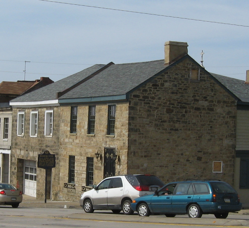
Brownsville Northside Historic District
Monument and historic site · National Register of Historic Places · 3.5 mi
Historic district in Pennsylvania, United States

Centerville Historic District
Monument and historic site · National Register of Historic Places · 3.7 mi
Historic district in Pennsylvania, United States
Dunlap's Creek Bridge
Bridge · National Register of Historic Places · 3.4 mi
Bridge in United States of America

Harrison House
Monument and historic site · National Register of Historic Places · 2.9 mi
Historic house in Centerville, Pennsylvania, United States

Jennings-Gallagher House
Monument and historic site · National Register of Historic Places · 1.1 mi
California, Pennsylvania

Joseph Dorsey House
Monument and historic site · National Register of Historic Places · 3.2 mi
Historic house in Pennsylvania, United States

Locus 7 Site
Monument and historic site · National Register of Historic Places · 4.8 mi
Human settlement in Pennsylvania, United States of America


Molly Fleming House
Monument and historic site · National Register of Historic Places · 1.7 mi
Historic building in California, Pennsylvania
6 more on the map.
Parks, trails and playgrounds13



1 more on the map.
Restaurants and cafes6

Don Patron Mexican Grill
Restaurant · Pizza, Mexican · 1.2 mi
153 Wood Street, California
Mo-Sa 11:00-22:00



History
Upon its founding in 1849, name suggestions included Columbia and Sagamore. Because the town's founding coincided with the California Gold Rush, it was named California to symbolize growth and prosperity. Before there were mayors in California, there were burgesses, the first of whom was Solomon Sibbitt.
East Pike Run Township merged with California Borough in 1953. The former Vigilant Mine in California once produced the largest single lump of coal in the world. California was once home to the largest soft coal mine in the world when Vesta # 4 opened in 1893. The unincorporated town of Philipsburg used to sit on land that is now occupied by PennWest California, the institution formerly known as California University of Pennsylvania before merging with Pennsylvania Western University in July 2022. This includes the Philipsburg Cemetery, which is still in use and includes a number of graves of Civil War soldiers. The first house built in California is next to the California Post Office on Second Street.
The Molly Fleming House, Jennings-Gallagher House, Malden Inn, Old Main, California State College and former Pennsylvania Railroad Passenger Station are listed on the National Register of Historic Places. The California Boatyards played an important role in building steamboats for western expansion.
From the History section of California, Pennsylvania on Wikipedia, under CC BY-SA 4.0.
Where to stay1
Churches and places of worship10
St. Peter's Church
Church · National Register of Historic Places · 3.6 mi
Holy Trinity Church
Church · Russian Orthodox · 1.4 mi
630 American Street, California
Taylor Church
Church · United Methodist · 2.7 mi
610 Old National Pike, Brownsville
Shopping1
Gas and EV charging1
Schools, colleges and libraries23
California Area Public Library
Library · National Register of Historic Places · 1.2 mi
100 Wood Street, California
Healthcare1
Map of California
82 places. The map loads OpenStreetMap tiles when you open it.
Climate by month
Monthly table
| Month | High | Low | Rain | Snow |
|---|---|---|---|---|
| Jan | 39°F | 21°F | 3.2 in | 3.8 in |
| Feb | 42°F | 22°F | 2.8 in | 2.7 in |
| Mar | 51°F | 29°F | 3.4 in | 2.1 in |
| Apr | 64°F | 39°F | 3.5 in | 0.0 in |
| May | 74°F | 51°F | 3.9 in | 0.0 in |
| Jun | 81°F | 60°F | 4.3 in | 0.0 in |
| Jul | 85°F | 64°F | 4.0 in | 0.0 in |
| Aug | 84°F | 62°F | 3.5 in | 0.0 in |
| Sep | 78°F | 56°F | 3.3 in | 0.0 in |
| Oct | 66°F | 44°F | 2.9 in | 0.0 in |
| Nov | 54°F | 34°F | 2.9 in | 0.2 in |
| Dec | 43°F | 27°F | 3.3 in | 1.5 in |
U.S. Climate Normals 1991-2020 for Charleroi Lock 4 (6 mi away), NOAA NCEI.
People and cost of living
American Community Survey 5-year estimates, 2020-2024, U.S. Census Bureau. Estimates have margins of error, larger for small towns.
Disaster history
Washington County has had 7 federal disaster declarations since 2000, most often for hurricanes.
- 2020-03-30: Covid-19 Pandemic (Biological)
- 2020-03-13: Covid-19 (Biological)
- 2012-10-29: Hurricane Sandy (Hurricane)
- 2005-09-10: Hurricane Katrina (Hurricane)
- 2004-09-19: Tropical Depression Ivan (Hurricane)
- 2004-09-19: Severe Storms And Flooding Associated With Tropical Depression Frances (Severe Storm)
OpenFEMA disaster declarations summaries.
Getting there and nearby towns
Greene County Airport (WAY) is the nearest airport with scheduled flights listed in OpenStreetMap, 16 miles away.
- West Brownsville 3 mi southeast, about 4 min by car
- Brownsville 4 mi south, about 6 min by car
- Hiller 4 mi south, about 7 min by car
- Speers 4 mi northeast, about 7 min by car
- North Belle Vernon 5 mi northeast, about 8 min by car
- Fairhope 5 mi northeast, about 8 min by car
- Bentleyville 6 mi northwest, about 10 min by car
- North Charleroi 6 mi north, about 9 min by car
- Republic 7 mi south, about 12 min by car
- Wickerham Manor-Fisher 8 mi north, about 12 min by car
Drive times are estimates from straight-line distance, not routes.
Local news
Headlines from INDB, the NEMICO news database.
Reviews, tips and questions
Loading what members have shared...
Sources and licences
- NCES EDGE (Public domain): public schools
- NOAA NCEI U.S. Climate Normals 1991-2020 (Public domain): climate by month
- OpenFEMA (Public domain): disaster declarations
- OpenStreetMap contributors (ODbL 1.0): places, airports, map data
- U.S. Census Bureau (Public domain): population, income, housing, education, commute
- Wikidata (CC0 1.0): elevation, founding date, time zone, website, landmarks and historic places
- Wikimedia Commons (see each image): photos
- Wikipedia (CC BY-SA 4.0): overview and history text
Photo credits
- Woodstreetcal, VitaleBaby at en.wikipedia, Public domain
- Calpubliclib, VitaleBaby ( talk ), Public domain
- Malden Inn, Generic1139, CC BY-SA 3.0
- Centerville Historic District, Generic1139, CC BY-SA 3.0
- Dunlap creek bridge jet lowe 1983, Jet Lowe, Public domain
- Nemacolin Castle PA1, Acroterion, CC BY-SA 4.0
- Locus 7 Site, Nyttend, Public domain
- Welsh-Emery House, Generic1139, CC BY-SA 3.0
- St. Peters from Church Street in Brownsville, The original uploader was Ikcerog at English Wikipedia ., Public domain
- CalOldMain, Wjmoore17, CC BY-SA 3.0
- Joseph Dorsey House, Jack Boucher, Public domain
- Jennings-Gallagher House south side, Generic1139, CC BY-SA 3.0
- Molly Fleming House, Generic1139, CC BY-SA 3.0
- Thomas H. Thompson House angle, Generic1139, CC BY-SA 3.0
- BrownsvilleNeck, Breakfastchief a/k/a Jonathan R. Henke, Public domain
- Harrison House (Centerville, Pennsylvania) Lot, Generic1139, CC BY-SA 3.0
- Brashear House, Brownsville_Northside_Historic_District.jpg : Nyttend derivative work: Sisyphos23 ( talk ), Public domain
- Oldbrownsville, VitaleBaby ( talk ), Public domain
- Wbvillerr, VitaleBaby at en.wikipedia, Public domain
- Speersrr, VitaleBaby ( talk ), Public domain
- Lanebane, VitaleBaby ( talk ), Public domain
- Bvbridge, VitaleBaby ( talk ), Public domain


Page built October 30, 2026. Spotted a mistake? Tell us or suggest a place.