


Carmel-by-the-Sea, California
Carmel-by-the-Sea is a city of 3,162 people in Monterey County, California.
Why visit Carmel-by-the-Sea
Townapedia lists 23 museums and landmarks, 18 parks and trails, 52 places to eat, 37 places to stay and 5 attractions in and around town.
Highlights include 17-Mile Drive, Golden Bough Playhouse, Mission San Carlos Borromeo de Carmelo and Mission San Carlos Borromeo de Carmelo Museum.
September is the warmest month, with average highs of 71°F; December lows average 44°F.
Weather in Carmel-by-the-Sea
Forecast from the National Weather Service. Full forecast
About Carmel-by-the-Sea
Carmel-by-the-Sea (), commonly known simply as Carmel, is a city in Monterey County, California, United States, located on the Central Coast of California. As of the 2020 census, the city had a population of 3,220, down from 3,722 at the 2010 census. Situated on the Monterey Peninsula, Carmel is a tourist destination, known for its natural scenery and artistic history.
From the Wikipedia article Carmel-by-the-Sea, California (this version), under CC BY-SA 4.0.
Things to do5


Golden Bough Playhouse
Cinema and theater
Theater in Carmel-by-the-Sea, California, United States

Theatre of the Golden Bough
Cinema and theater
Theater in Carmel, California; burned in 1935


Museums and landmarks23

Mission San Carlos Borromeo de Carmelo
Monument and historic site · National Register of Historic Places · 0.7 mi
Spanish mission in Carmel Valley, California


Mrs. Clinton Walker House
Monument and historic site · National Register of Historic Places · 0.9 mi
Historic house in Carmel Point, California

Outlands in the Eighty Acres
Monument and historic site · National Register of Historic Places · 0.4 mi
Tudor Revival residence was designed by Henry Higby Gutterson for real estate developer Paul Flanders.
Sunset Center
Monument and historic site · National Register of Historic Places
Performing arts center in Carmel, Monterey County, California
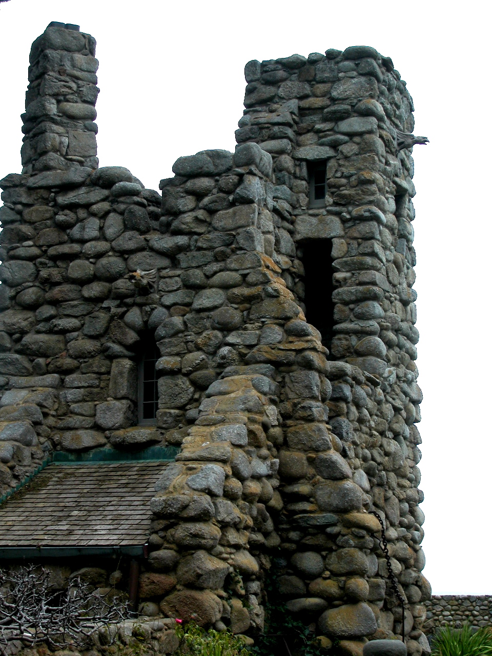
Tor House and Hawk Tower
Monument and historic site · National Register of Historic Places · 0.9 mi
Built by poet Robinson Jeffers in California

Whalers Cabin
Monument and historic site · National Register of Historic Places · 2.5 mi
Historic building in California, U.S

Carmel Art Association
Museum
Non-profit organization and gallery located in Carmel-by-the-Sea, California
555 Dolores Street, Carmel-by-the-Sea

Walker House
Monument and historic site · 0.8 mi
This ocean-front house was built between 1948-1952 for Mrs. Clinton Walker. It would turn out to be Frank Lloyd Wright’s last...
26336 Scenic Road, Carmel

Carmel Arts and Crafts Club
Museum
Art gallery founded in 1906, by Elsie Allen in Carmel-by-the-Sea.


Carmel-by-the-Sea World War I Memorial Arch
Monument and historic site
World War I Memorial Arch is a World War I memorial designed in 1919 by architect Charles Sumner Green and located at Ocean Avenue and...
11 more on the map.
Parks, trails and playgrounds18

Devendorf Park
Park
Park in Monterey County, California, United States of America
544 6th Avenue, Carmel-by-the-Sea
Jacks Peak Park
Park · 3.1 mi
Park in Monterey County, California, United States of America



6 more on the map.
Restaurants and cafes52

Alvarado Street Brewery & Bistro
Bar and pub · Regional, Pizza, Fish And Chips, Seafood, Sandwich, Burger, Chicken, Dessert
526 Ocean Avenue, Carmel By The Sea
Su-Th 11:30-21:00; Fr-Sa 11:30-22:00



Flying Fish Grill
Restaurant
Casually exquisite dining, with an East/West fusion.
526 Ocean Avenue, Carmel By The Sea
40 more on the map.
Where to stay37
Churches and places of worship7
Mission San Carlos Borromeo de Carmelo Basilica
Church · Roman Catholic · 0.7 mi
3080 Rio Road, Carmel
First church of christ
Place of worship
572 Monte Verde Street, Carmel-by-the-Sea
Shopping16
Gas and EV charging5
Schools, colleges and libraries26
Healthcare1
Map of Carmel-by-the-Sea
190 places. The map loads OpenStreetMap tiles when you open it.
Climate by month
Monthly table
| Month | High | Low | Rain | Snow |
|---|---|---|---|---|
| Jan | 60°F | 45°F | 4.3 in | 0.0 in |
| Feb | 61°F | 45°F | 4.0 in | 0.0 in |
| Mar | 63°F | 46°F | 3.3 in | 0.2 in |
| Apr | 63°F | 47°F | 1.5 in | 0.0 in |
| May | 64°F | 49°F | 0.6 in | 0.0 in |
| Jun | 66°F | 51°F | 0.1 in | 0.0 in |
| Jul | 67°F | 53°F | 0.1 in | 0.0 in |
| Aug | 69°F | 54°F | 0.1 in | 0.0 in |
| Sep | 71°F | 53°F | 0.1 in | 0.0 in |
| Oct | 71°F | 52°F | 0.9 in | 0.0 in |
| Nov | 64°F | 48°F | 1.8 in | 0.0 in |
| Dec | 59°F | 44°F | 3.6 in | 0.1 in |
U.S. Climate Normals 1991-2020 for Monterey (3 mi away), NOAA NCEI.
People and cost of living
American Community Survey 5-year estimates, 2020-2024, U.S. Census Bureau. Estimates have margins of error, larger for small towns.
Disaster history
Monterey County has had 19 federal disaster declarations since 2000, most often for fires.
- 2024-04-13: Severe Winter Storms, Tornadoes, Flooding, Landslides, And Mudslides (Severe Storm)
- 2023-04-03: Severe Winter Storms, Straight-Line Winds, Flooding, Landslides, And Mudslides (Severe Storm)
- 2023-03-10: Severe Winter Storms, Flooding, Landslides, And Mudslides (Flood)
- 2023-01-14: Severe Winter Storms, Flooding, Landslides, And Mudslides (Flood)
- 2023-01-09: Severe Winter Storms, Flooding, And Mudslides (Flood)
- 2020-08-22: Wildfires (Fire)
OpenFEMA disaster declarations summaries.
Getting there and nearby towns
Monterey Regional Airport (MRY) is the nearest airport with scheduled flights listed in OpenStreetMap, 5 miles away.
- Monterey 4 mi northeast, about 6 min by car
- Pacific Grove 5 mi north, about 8 min by car
- Seaside 8 mi northeast, about 12 min by car
- Marina 11 mi northeast, about 18 min by car
- Boronda 17 mi northeast, about 27 min by car
- Salinas 19 mi northeast, about 30 min by car
- Prunedale 23 mi northeast, about 37 min by car
- Watsonville 27 mi north, about 43 min by car
- Santa Cruz 30 mi north, about 48 min by car
- Live Oak 30 mi north, about 48 min by car
Drive times are estimates from straight-line distance, not routes.
Local news
Headlines from INDB, the NEMICO news database.
Reviews, tips and questions
Loading what members have shared...
Sources and licences
- NCES EDGE (Public domain): public schools
- NOAA NCEI U.S. Climate Normals 1991-2020 (Public domain): climate by month
- OpenFEMA (Public domain): disaster declarations
- OpenStreetMap contributors (ODbL 1.0): places, airports, map data
- U.S. Census Bureau (Public domain): population, income, housing, education, commute
- Wikidata (CC0 1.0): elevation, founding date, time zone, website, landmarks and historic places
- Wikimedia Commons (see each image): photos
- Wikipedia (CC BY-SA 4.0): overview and history text
Photo credits
- Carmel Monterey Cypress, Amadscientist, CC BY-SA 3.0
- Mrs. Clinton Walker House at Carmel-by-the-Sea, Bob Aronson, CC BY-SA 4.0
- Flanders Mansion, Isidoro, CC BY-SA 4.0
- Sunset Center - Carmel-by-the-Sea, Ca., Bob Aronson, CC BY-SA 3.0
- Whalers Cabin, Sean O'Flaherty, CC BY-SA 3.0
- 2015-09-18 Mission San Carlos Borromeo de Carmelo 02, Burkhard Mücke, CC BY-SA 4.0
- Robinson Jeffers Hawk Tower, Tor House, Carmel, CA 2008 Photo by Celeste Davison, CelesteDavison at English Wikipedia, Public domain
- Carmel Art Association, Greghenderson2006, CC BY-SA 4.0
- Carmel Arts & Crafts Hall, 1907, Unknown author Unknown author, Public domain
- Golden Bough Theater, Lewis Josselyn, Public domain
- Monterey Museum of Art outside 002, Sgerbic, CC BY-SA 4.0
- 17-mile drive 1, Humanoid one, CC BY-SA 3.0
- Carmel Memorial Arch, Greghenderson2006, CC BY-SA 4.0
- The recently completed Golden Bough Playhouse, Gregory Ford Henderson, CC BY-SA 4.0

Page built October 30, 2026. Spotted a mistake? Tell us or suggest a place.