

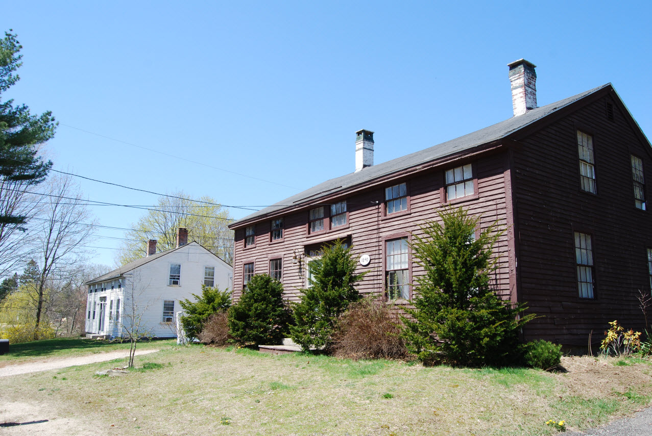


Carolina, Rhode Island
Carolina is a community of 1,048 people in Washington County, Rhode Island.
Why visit Carolina
Townapedia lists 6 museums and landmarks, 2 parks and trails and 1 attraction in and around town.
Highlights include Shannock Hill, Shannock Historic District and Henry Marchant Farm.
July is the warmest month, with average highs of 80°F; January lows average 19°F.
Weather in Carolina
Forecast from the National Weather Service. Full forecast
About Carolina
Carolina is a village that straddles the border of the towns of Charlestown and Richmond on the Pawcatuck River in Washington County, Rhode Island, United States. Rhode Island Route 112 passes through the village. Carolina is identified as a census-designated place, with a population of 970 at the 2010 census.
From the Wikipedia article Carolina, Rhode Island (this version), under CC BY-SA 4.0.
Things to do1

Museums and landmarks6
Shannock Historic District
Monument and historic site · National Register of Historic Places · 1.0 mi
Historic district in Rhode Island, United States

Henry Marchant Farm
Monument and historic site · National Register of Historic Places · 3.3 mi
Human settlement in South Kingstown, Rhode Island, United States of America

Historic Village of the Narragansetts in Charlestown
Monument and historic site · National Register of Historic Places · 3.5 mi
Historic district in Charlestown, Rhode Island

John Hoxsie House
Monument and historic site · National Register of Historic Places · 1.2 mi
Historic house in Rhode Island, United States


Joseph Jeffrey House
Monument and historic site · National Register of Historic Places · 2.1 mi
Historic house in Rhode Island, United States
Parks, trails and playgrounds2


Churches and places of worship1

History
In 1802, the first wooden dam and a gristmill were built on the river at the site of the village, which was then known as Nichols Bridge. A few years later, a cotton mill was established, with production buildings mostly located in Richmond and some employee housing located across the river in Charlestown. Rowland G. Hazard bought the mill in 1843 and renamed it the Carolina Mills Company in honor of his wife Caroline Newbold Hazard of South Kingstown. The village around the mill was also given the same name. The Rhode Island Historic Preservation Commission described 19th-century Carolina as a "center for the surrounding area, including a school, a church, a post office, a bank, several stores, a blacksmith shop, and halls for meetings, lectures, and 'entertainments'." The local post office was named "Carolina Mills" from 1850 until 1879, when it was renamed "Carolina."
In 1862, the complex switched from cotton textile production to production of woolens. The Hazard family operated the mill complex until 1863, when they leased it to T.R. Hyde & Co., which was a partnership between Thomas R. Hyde and Rowland Hazard II that operated the mill until 1868. The mill was sold to new owners in 1869, but Rowland Hazard II operated it as a lessee until at least 1877. The mill complex operated until 1930 or 1935.
From the History section of Carolina, Rhode Island on Wikipedia, under CC BY-SA 4.0.
Schools, colleges and libraries10
Chariho Alternative Learning A
School · 2.3 mi
455C Switch Road, Wood River Junction
Chariho Career And Tech Center
School · 2.3 mi
459 Switch Road, Wood River Junction
Chariho Regional Middle School
School · 2.4 mi
455B Switch Road, Wood River Junction
Map of Carolina
20 places. The map loads OpenStreetMap tiles when you open it.
Climate by month
Monthly table
| Month | High | Low | Rain |
|---|---|---|---|
| Jan | 37°F | 19°F | 4.2 in |
| Feb | 39°F | 21°F | 3.9 in |
| Mar | 46°F | 27°F | 5.7 in |
| Apr | 56°F | 36°F | 4.5 in |
| May | 66°F | 45°F | 3.6 in |
| Jun | 75°F | 54°F | 4.0 in |
| Jul | 80°F | 60°F | 3.3 in |
| Aug | 79°F | 59°F | 4.1 in |
| Sep | 73°F | 52°F | 4.3 in |
| Oct | 62°F | 41°F | 4.5 in |
| Nov | 52°F | 32°F | 4.4 in |
| Dec | 43°F | 25°F | 5.2 in |
U.S. Climate Normals 1991-2020 for Kingston 1 W 72512 (6 mi away), NOAA NCEI.
People and cost of living
American Community Survey 5-year estimates, 2020-2024, U.S. Census Bureau. Estimates have margins of error, larger for small towns.
Disaster history
Washington County has had 18 federal disaster declarations since 2000, most often for severe storms.
- 2024-03-20: Severe Storms And Flooding (Severe Storm)
- 2024-03-20: Severe Storm And Flooding (Severe Storm)
- 2023-04-14: Queens River Fire (Fire)
- 2022-05-12: Severe Winter Storm And Snowstorm (Snowstorm)
- 2021-08-21: Hurricane Henri (Hurricane)
- 2020-03-30: Covid-19 Pandemic (Biological)
OpenFEMA disaster declarations summaries.
Getting there and nearby towns
Westerly State Airport (WST) is the nearest airport with scheduled flights listed in OpenStreetMap, 11 miles away.
- Westerly 10 mi southwest, about 16 min by car
- Pawcatuck 12 mi southwest, about 19 min by car
- Newport 17 mi east, about 27 min by car
- Mystic 17 mi southwest, about 28 min by car
- Old Mystic 18 mi west, about 29 min by car
- Newport East 19 mi east, about 31 min by car
- Jewett City 20 mi northwest, about 32 min by car
- Warwick 21 mi northeast, about 33 min by car
- Cranston 23 mi north, about 37 min by car
- Norwich 23 mi west, about 38 min by car
Drive times are estimates from straight-line distance, not routes.
Local news
Headlines from INDB, the NEMICO news database.
Reviews, tips and questions
Loading what members have shared...
Sources and licences
- NCES EDGE (Public domain): public schools
- NOAA NCEI U.S. Climate Normals 1991-2020 (Public domain): climate by month
- OpenFEMA (Public domain): disaster declarations
- OpenStreetMap contributors (ODbL 1.0): places, airports, map data
- U.S. Census Bureau (Public domain): population, income, housing, education, commute
- Wikidata (CC0 1.0): landmarks and historic places
- Wikimedia Commons (see each image): photos
- Wikipedia (CC BY-SA 4.0): overview and history text
Photo credits
- The Albert S. Potter Octagon House, Jennifer, CC BY-SA 4.0
- Shannock RI, Marcbela (Marc N. Belanger), Public domain
- Henry Marchant Farm, Chris Brent, CC BY-SA 3.0
- JOSEPH JEFFREY HOUSE, WASHINGTON COUNTY, RI, JERRYE & ROY KLOTZ, M.D., CC BY-SA 4.0
- JOHN HOXSIE HOUSE, WASHINGTON COUNTY, RI, JERRYE & ROY KLOTZ, M.D., CC BY-SA 4.0
- The Albert S. Potter Octagon House (4x3), Jennifer, CC BY-SA 4.0
- Unidentified passenger car in Shannock, Rhode Island, May 2017, Pi.1415926535, CC BY-SA 3.0
- Unidentified caboose in Shannock, Rhode Island, May 2017, Pi.1415926535, CC BY-SA 3.0
- U.S. Post Office, Shannock, Rhode Island, May 2017, Pi.1415926535, CC BY-SA 3.0
- Milepost 153 near Shannock station site, May 2017, Pi.1415926535, CC BY-SA 3.0
- Shannock station possible platform remains, May 2017, Pi.1415926535, CC BY-SA 3.0


Page built October 30, 2026. Spotted a mistake? Tell us or suggest a place.