


Norwich, Connecticut
Norwich is a city of 39,973 people in Connecticut, founded in 1659.
Why visit Norwich
Townapedia lists 61 museums and landmarks, 99 parks and trails, 129 places to eat, 12 places to stay and 26 attractions in and around town.
Highlights include Mill Brook Bridge, Samson Occom Bridge, Perkins-Rockwell House and American Thermos Bottle Company Laurel Hill Plant.
July is the warmest month, with average highs of 84°F; January lows average 21°F, and about 28 inches of snow fall in a normal year.
Weather in Norwich
Forecast from the National Weather Service. Full forecast
About Norwich
Norwich is a city in New London County, Connecticut, United States. The Yantic, Shetucket, and Quinebaug Rivers flow into the city and form its harbor, from which the Thames River flows south to Long Island Sound. The city is part of the Southeastern Connecticut Planning Region. The population was 40,125 at the 2020 United States Census.
From the Wikipedia article Norwich, Connecticut (this version), under CC BY-SA 4.0.
Things to do26

Mill Brook Bridge
Bridge · National Register of Historic Places · 2.6 mi
Bridge in United States of America

Samson Occom Bridge
Bridge · National Register of Historic Places · 4.7 mi
Bridge in United States of America
Mohegan-Pequot Bridge
Bridge · 4.6 mi
Bridge in United States of America


14 more on the map.
Museums and landmarks61

Perkins-Rockwell House
Museum · National Register of Historic Places · 1.0 mi
Norwich, Connecticut, listed on the NRHP
42 Rockwell Street, Norwich

American Thermos Bottle Company Laurel Hill Plant
Monument and historic site · National Register of Historic Places · 2.7 mi
Historic district in Norwich, Connecticut

Bean Hill Historic District
Monument and historic site · National Register of Historic Places · 1.3 mi
Historic district in Connecticut, United States

Broad Street School
Monument and historic site · National Register of Historic Places · 1.1 mi
School building in Norwich, United States of America
100 Broad Street, Norwich

Chelsea Parade Historic District
Monument and historic site · National Register of Historic Places · 0.9 mi
Historic district in Connecticut, United States

Downtown Norwich Historic District
Monument and historic site · National Register of Historic Places · 1.8 mi
Historic district in Connecticut, United States

Jail Hill Historic District
Monument and historic site · National Register of Historic Places · 1.5 mi
Historic district in Connecticut, United States

Joseph Carpenter Silversmith Shop
Monument and historic site · National Register of Historic Places
Norwichtown, Connecticut, a house and shop listed on the NRHP
71 East Town Street, Norwich

Laurel Hill Historic District
Monument and historic site · National Register of Historic Places · 2.2 mi
Historic district in Connecticut, United States


kin_House)_-_New_London_County_CT.jpg)


Little Plain Historic District
Monument and historic site · National Register of Historic Places · 1.6 mi
Historic district in Connecticut, United States

Norwich State Hospital
Monument and historic site · National Register of Historic Places · 4.2 mi
Former hospital
49 more on the map.
Parks, trails and playgrounds99


Greeneville Playground
Park · 1.9 mi
Municipal, Open To Public Without Fee
266 Central Avenue, Norwich

Heritage Trail Corridor
Hiking and trails · 1.4 mi
43-47 Maple Grove Avenue, Norwich
24/7
Norwich Archery Club
Hiking and trails · 3.4 mi
Private, Members Or Owners Only; General Recreation
110 Wawecus Hill Road, Bozrah

87 more on the map.
Restaurants and cafes129

Golden Palace
Restaurant · Chinese · 4.4 mi
Alternate phone number: +1 860 848 1247
2173 Norwich-New London Turnpike, Montville
Mo-Su 10:00-21:00
Brick & Basil Wood Fired Pizza Company
Restaurant · Pizza · 1.5 mi
270;276 West Town Street, Norwich
Tu-Fr 11:00-20:00; Sa 12:00-20:00; Su 12:00-18:00
China Moon
Restaurant · Chinese · 2.5 mi
500 Norwich Avenue, Norwich
Mo-Th 10:30-21:30; Fr-Sa 10:30-22:30; Su 11:30-21:30
Jack's Brick Oven Pizza
Restaurant · Pizza · 2.1 mi
493 West Main Street, Norwich
Mo-Fr 11:00-21:30; Sa-Su 11:00-22:30
JoJo’s Breakfast & Mexican Food
Restaurant · Mexican, Breakfast · 2.8 mi
425 Laurel Hill Avenue, Norwich
Mo-Su 07:00-21:00
Joy's Restaurant
Restaurant · Mexican, American, Breakfast · 3.4 mi
671 West Thames Street, Norwich
Mo-Sa 06:00-14:00
Mr. Pan's Chinese Restaurant
Restaurant · Chinese · 3.8 mi
337 Old Canterbury Turnpike, Norwich
Tu-Th 11:00-22:00; Fr-Su 11:00-23:00
Taftville Pizza
Restaurant · Pizza · 2.6 mi
500 Norwich Avenue, Norwich
Tu-Sa 07:00-21:00; Su 07:00-20:00
The Royal Punjabi
Restaurant · Indian · 1.8 mi
198 Main Street, Norwich
Mo-Th 11:30-21:30; Fr-Sa 11:30-22:30
El Traviezo Mexican Restaurant
Restaurant · 2.0 mi
631 North Main Street, Norwich
Mo,Tu,Th-Sa 12:00-21:30; Su 16:00-22:00

117 more on the map.
History
The town of Norwich was founded in 1659, on the site of what is now the neighborhood of Norwichtown, by settlers from Saybrook Colony led by Major John Mason, James Fitch, and Lieutenant Francis Griswold. They purchased the land "nine miles square" that became Norwich from Mohegan Sachem Uncas. One of the co-founders of Norwich was Thomas Leffingwell, who rescued Uncas when surrounded by his Narragansett tribesmen, and whose son established the Leffingwell Inn. In 1668, a wharf was established at Yantic Cove. Settlement was primarily in the three-mile (4.8 km) area around the Norwichtown Green. The 69 founding families soon divided up the land in the Norwichtown vicinity for farms and businesses.
Until 1786, the town of Norwich encompassed what became known as the "Nine Mile Square". Eight Religious Societies were created over the course of the 18th century and in 1786 these were mostly split into new towns, while the Long Society was merged into Preston, Connecticut.
From the History section of Norwich, Connecticut on Wikipedia, under CC BY-SA 4.0.
Where to stay12
Churches and places of worship51
Long Society Meetinghouse
Church · National Register of Historic Places · 2.9 mi
Bozrah Congregational Church and Parsonage
Church · National Register of Historic Places · 4.0 mi
Evans Memorial African Methodist Episcopal Zion Church
Church · African Methodist Episcopal Zion · 1.5 mi
2 McKinley Avenue, Norwich
First Congregational Church of Norwich
Church · United Church Of Christ · 0.4 mi
83 East Town Street, Norwich
Shopping17
Gas and EV charging27
Schools, colleges and libraries41
Healthcare27
Backus Hospital Sexually Transmitted Disease Clinic
Clinic and pharmacy · 0.5 mi
107 Lafayette Street, Norwich
Map of Norwich
250 places. The map loads OpenStreetMap tiles when you open it.
Climate by month
Monthly table
| Month | High | Low | Rain | Snow |
|---|---|---|---|---|
| Jan | 38°F | 21°F | 3.9 in | 9.0 in |
| Feb | 40°F | 23°F | 3.8 in | 7.1 in |
| Mar | 48°F | 29°F | 5.1 in | 5.0 in |
| Apr | 59°F | 39°F | 4.7 in | 0.8 in |
| May | 70°F | 49°F | 3.6 in | 0.0 in |
| Jun | 78°F | 58°F | 4.3 in | 0.0 in |
| Jul | 84°F | 65°F | 3.6 in | 0.0 in |
| Aug | 83°F | 63°F | 4.4 in | 0.0 in |
| Sep | 76°F | 55°F | 4.8 in | 0.0 in |
| Oct | 64°F | 44°F | 4.9 in | 0.0 in |
| Nov | 53°F | 34°F | 4.2 in | 0.3 in |
| Dec | 43°F | 27°F | 5.0 in | 5.6 in |
U.S. Climate Normals 1991-2020 for Norwich Public Utility Plt (2 mi away), NOAA NCEI.
People and cost of living
American Community Survey 5-year estimates, 2020-2024, U.S. Census Bureau. Estimates have margins of error, larger for small towns.
Disaster history
The county has had 24 federal disaster declarations since 2000, most often for severe storms.
- 2024-01-13: Severe Storms, Flooding, And A Potential Dam Breach (Severe Storm)
- 2021-10-30: Remnants Of Hurricane Ida (Hurricane)
- 2021-08-22: Hurricane Henri (Hurricane)
- 2021-01-12: Tropical Storm Isaias (Hurricane)
- 2020-08-06: Tropical Storm Isaias (Hurricane)
- 2020-03-28: Covid-19 Pandemic (Biological)
OpenFEMA disaster declarations summaries.
Getting there and nearby towns
Groton-New London Airport (GON) is the nearest airport with scheduled flights listed in OpenStreetMap, 15 miles away.
- Willimantic 13 mi northwest, about 21 min by car
- New London 15 mi south, about 24 min by car
- Storrs 20 mi northwest, about 32 min by car
- Manchester 27 mi northwest, about 44 min by car
- Middletown 29 mi west, about 47 min by car
- East Hartford 31 mi northwest, about 49 min by car
- Wethersfield 32 mi west, about 51 min by car
- Hartford 34 mi northwest, about 55 min by car
- Newington 34 mi west, about 56 min by car
- Meriden 36 mi west, about 59 min by car
Drive times are estimates from straight-line distance, not routes.
Local news
Headlines from INDB, the NEMICO news database.
Reviews, tips and questions
Loading what members have shared...
Sources and licences
- NCES EDGE (Public domain): public schools
- NOAA NCEI U.S. Climate Normals 1991-2020 (Public domain): climate by month
- OpenFEMA (Public domain): disaster declarations
- OpenStreetMap contributors (ODbL 1.0): places, airports, map data
- U.S. Census Bureau (Public domain): population, income, housing, education, commute
- Wikidata (CC0 1.0): elevation, founding date, time zone, website, landmarks and historic places
- Wikimedia Commons (see each image): photos
- Wikipedia (CC BY-SA 4.0): overview and history text
Photo credits
- Norwich Hospital District - Admin Building (5804251174), CLK Hatcher, CC BY-SA 2.0
- LathropManorNorwichCT, CoolGuySlate, CC BY-SA 4.0
- NorwichT NorwichtownGreen, Magicpiano, CC BY-SA 3.0
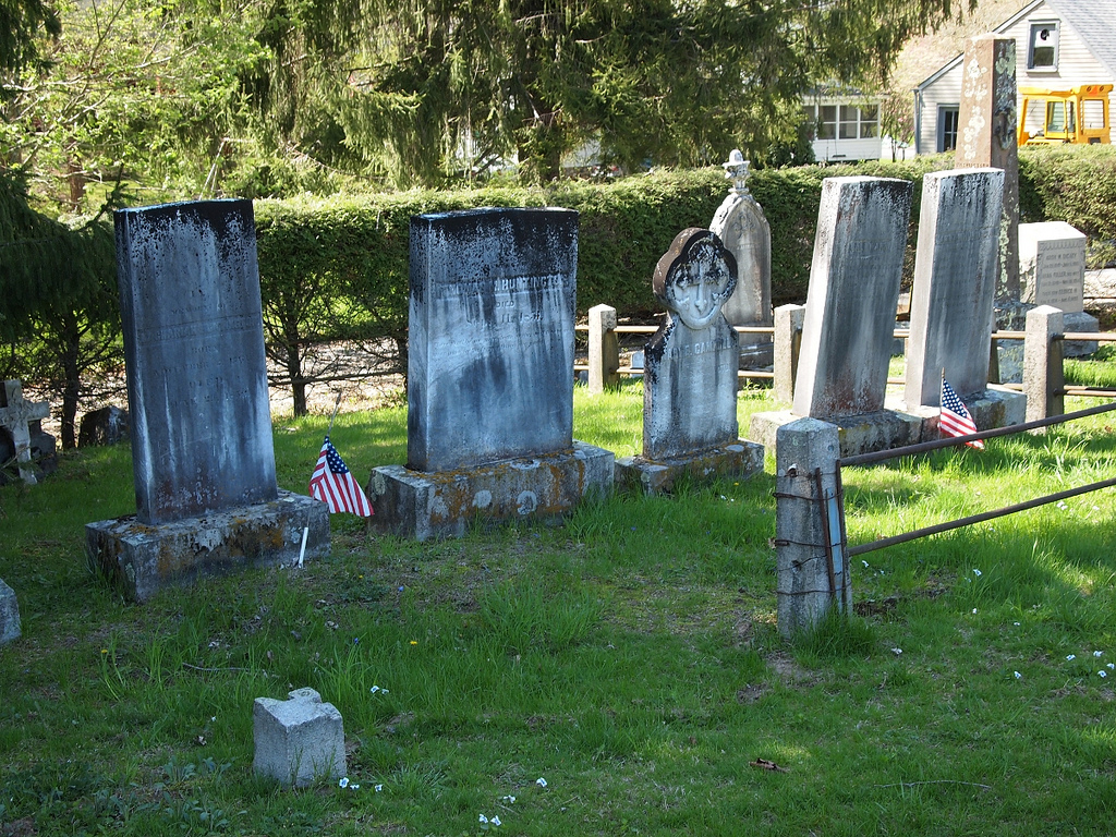
- Norwichtown Historic District - Old Burial Ground 04, CLK Hatcher, CC BY-SA 2.0
- Norwichtown Historic District - Old Burial Ground 03, CLK Hatcher, CC BY-SA 2.0
- Norwichtown Historic District - Old Burial Ground 02, CLK Hatcher, CC BY-SA 2.0
- Norwichtown Historic District - Old Burial Ground, CLK Hatcher, CC BY-SA 2.0
- Norwichtown Historic District - Old Burial Ground gate, CLK Hatcher, CC BY-SA 2.0
- Norwichtown Historic District - Old Burial Ground gate detail, CLK Hatcher, CC BY-SA 2.0
- Norwichtown Historic District - Elm Ave (New London County, Connecticut), CLK Hatcher, CC BY-SA 2.0
- Norwichtown Historic District - 10 Elm Ave (New London County, Connecticut), CLK Hatcher, CC BY-SA 2.0
- NorwichCT BradfordHuntingtonHouse, Magicpiano, CC BY-SA 4.0
- NorwichCT JosephCarpenterSilversmithShop, Magicpiano, CC BY-SA 3.0
- NorwichCT LathropSchool, Magicpiano, CC BY-SA 3.0
- NorwichCT CarpenterHouse, Magicpiano, CC BY-SA 3.0
- NorwichCT LeffingwellInn1, Magicpiano, CC BY-SA 3.0
- NorwichCT LeffingwellInn2, Magicpiano, CC BY-SA 3.0
- NorwichCT CaptRichardCharltonHouse, Magicpiano, CC BY-SA 3.0
- Lee Memorial UMC - Norwich, Connecticut, Farragutful, CC BY-SA 4.0
- Sacred Heart Church - Norwichtown, Farragutful, CC BY-SA 4.0
- Entrance,Norwich Technical High School,Jun21,2013, Cpcool3, CC BY-SA 4.0
- Cathedral of Saint Patrick - Norwich, Connecticut 12, Farragutful, CC BY-SA 4.0
- Perkins-Rockwell House - New London County CT, CLK Hatcher, CC BY-SA 2.0
- LisbonCT MillBrookBridgeRemnant, Magicpiano, CC BY-SA 3.0
- Long Society Meetinghouse, Digitalpilgrim, CC BY-SA 3.0
- Bean Hill Historic District - 199 West Town St (Edmund Goo(d)kin House) - New London County CT, CLK Hatcher, CC BY-SA 2.0
- Little Plain Historic District - 189 Broadway (DeWitt-Sigourney House) - New London County CT, CLK Hatcher, CC BY-SA 2.0
- PostcardNorwichCTBirdseyeView1916, Unknown author Unknown author, Public domain
- John Fox Slater Memorial Museum, 108 Crescent Street, Norwich (New London County, Connecticut), Cervin Robinson, Photographer, Public domain
- Broad Street School - New London County CT, CLK Hatcher, CC BY-SA 2.0
- Jh 76 Church, Recline, CC BY-SA 3.0
- American Thermos Bottle Company Laurel Hill Plant - New London County CT, CLK Hatcher, CC BY-SA 2.0
- Yantic Falls Historic District - mill 04 (New London County, Connecticut), CLK Hatcher, CC BY-SA 2.0
- Downtown Norwich CT, Marcbela (Marc N. Belanger), Public domain
- MoheganRes FortShantokGlade, User:Magicpiano, CC BY-SA 4.0
- Brewster Homestead (New London County, CT), Thundersnow, CC BY-SA 3.0
- Occum Hydroelectric Plant and Dam, Digitalpilgrim, CC BY-SA 3.0
- Lathrop, Dr. Joshua, House (New London County, Connecticut), CLK Hatcher, CC BY-SA 2.0
- East District School (New London County, Connecticut), CLK Hatcher, CC BY-SA 2.0
- Huntington, Gov. Samuel, House (New London County, Connecticut), CLK Hatcher, CC BY-SA 2.0


Page built October 30, 2026. Spotted a mistake? Tell us or suggest a place.