


Chestertown, Maryland
Chestertown is a town of 5,594 people in Kent County, Maryland, founded in 1706.
Why visit Chestertown
Townapedia lists 21 museums and landmarks, 14 parks and trails, 11 places to eat, 4 places to stay and 2 attractions in and around town.
Highlights include Chesapeake Movies, Widehall, Airy Hill and Chestertown Historic District.
July is the warmest month, with average highs of 87°F; January lows average 27°F.
Weather in Chestertown
Forecast from the National Weather Service. Full forecast
About Chestertown
Chestertown is a town in Kent County, Maryland, United States. The population was 5,532 as of the 2020 census. It is the county seat of Kent County, the oldest county in Maryland.
From the Wikipedia article Chestertown, Maryland (this version), under CC BY-SA 4.0.
Things to do2

Museums and landmarks21

Widehall
Monument and historic site · National Register of Historic Places · 0.9 mi
Building in Maryland, United States
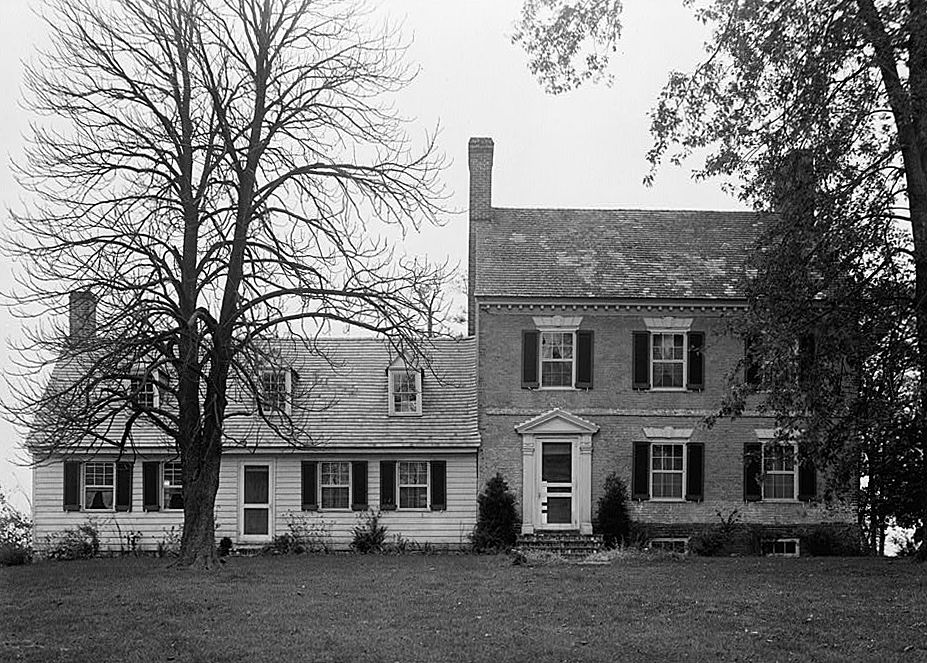
Airy Hill
Monument and historic site · National Register of Historic Places · 2.0 mi
House in Kent County, Maryland

Bernice J.
Monument and historic site · National Register of Historic Places · 1.0 mi
Chesapeake Bay skipjack

Brampton
Monument and historic site · National Register of Historic Places · 1.2 mi
Building in Maryland, United States

Charles Sumner Post No. 25, Grand Army of the Republic
Museum · National Register of Historic Places · 0.8 mi
Building in Maryland, United States

Chester Hall
Monument and historic site · National Register of Historic Places · 1.8 mi
Building in Maryland, United States

Chestertown Armory
Monument and historic site · National Register of Historic Places · 1.1 mi
Arsenal in Maryland, United States of America

Chestertown Historic District
Monument and historic site · National Register of Historic Places · 0.5 mi
Listed on the NRHP in Maryland

Chestertown Railroad Station
Monument and historic site · National Register of Historic Places · 0.8 mi
Railway station in Chestertown, the United States of America

Denton House
Monument and historic site · National Register of Historic Places · 0.9 mi
House in Chestertown, Maryland, USA


Godlington Manor
Monument and historic site · National Register of Historic Places · 2.9 mi
Building in Maryland, United States
Island Image
Monument and historic site · National Register of Historic Places · 3.4 mi
Log canoe
9 more on the map.
Parks, trails and playgrounds14



2 more on the map.
Restaurants and cafes11

China House
Restaurant · Chinese · 0.6 mi
711 Washington Avenue, Chestertown
Procolino's Pizza (Proc’s)
Restaurant · Pizza, Italian, Pasta, Salad, Seafood · 0.5 mi
711 Washington Avenue, Chestertown

The Freeze
Ice cream · 0.5 mi
717 Washington Avenue, Chestertown
Mo-Su 11:00-14:00

Domino's
Fast food · Pizza · 0.4 mi
518 Washington Avenue, Chestertown
Mo-Th 10:30-24:00; Fr-Sa 10:30-01:00; Su 10:30-24:00
Dunkin' Donuts
Fast food · Donut, Coffee Shop · 0.7 mi
315 High Street, Chestertown
History
Indigenous peoples have lived in what is now Chestertown for thousands of years. At the time of European colonization, the primary tribe on the Eastern Shore was the Nanticoke. In Nanticoke oral tradition, their ancestors migrated south from "the land of snow and ice" through the Ohio Valley and the Allegheny Mountains until they reached the Eastern Shore. The Nanticokes spoke an Algonquian language.
Founded in 1706, Chestertown rose in stature when it was named one of the English colony of Maryland's six Royal Ports of Entry. The shipping boom that followed this designation made the town at the navigable head of the Chester River wealthy. In the mid-eighteenth century, Chestertown trailed only Annapolis and was considered Maryland's second leading port.
A burgeoning merchant class infused riches into the town, reflected in the many brick mansions and townhouses that sprang up along the waterfront. Another area in which Chestertown is second only to Annapolis is in its number of existing eighteenth century homes.
As of the 1790 census, Chestertown was the geographical center of population of the United States.
Chestertown was incorporated in 1805, and was named for the Chester River.
From the History section of Chestertown, Maryland on Wikipedia, under CC BY-SA 4.0.
Where to stay4
Churches and places of worship15
Chestertown Baptist Church
Church · Baptist · 0.7 mi
401 Morgnec Road, Chestertown
Bethel African Methodist Episcopal Church
Church · African Methodist Episcopal · 0.4 mi
Shopping2
Gas and EV charging5
Schools, colleges and libraries10
Healthcare2
University of Maryland Shore Medical Center at Chestertown
Hospital · 0.5 mi
100 Brown Street, Chestertown
Map of Chestertown
86 places. The map loads OpenStreetMap tiles when you open it.
Climate by month
Monthly table
| Month | High | Low | Rain | Snow |
|---|---|---|---|---|
| Jan | 41°F | 27°F | 3.3 in | 5.2 in |
| Feb | 44°F | 28°F | 2.9 in | 7.9 in |
| Mar | 52°F | 35°F | 4.2 in | 1.7 in |
| Apr | 64°F | 45°F | 3.7 in | 0.2 in |
| May | 74°F | 55°F | 3.9 in | 0.0 in |
| Jun | 82°F | 64°F | 4.4 in | 0.0 in |
| Jul | 87°F | 69°F | 4.3 in | 0.0 in |
| Aug | 85°F | 67°F | 3.6 in | 0.0 in |
| Sep | 78°F | 60°F | 4.9 in | 0.0 in |
| Oct | 67°F | 48°F | 3.7 in | 0.0 in |
| Nov | 56°F | 38°F | 3.2 in | 0.0 in |
| Dec | 45°F | 31°F | 3.8 in | 1.7 in |
U.S. Climate Normals 1991-2020 for Chestertown Hcn (1 mi away), NOAA NCEI.
People and cost of living
American Community Survey 5-year estimates, 2020-2024, U.S. Census Bureau. Estimates have margins of error, larger for small towns.
Disaster history
Kent County has had 15 federal disaster declarations since 2000, most often for hurricanes.
- 2026-01-24: Severe Winter Storm (Winter Storm)
- 2020-03-26: Covid-19 Pandemic (Biological)
- 2020-03-13: Covid-19 (Biological)
- 2016-03-04: Severe Winter Storm And Snowstorm (Snowstorm)
- 2012-11-20: Hurricane Sandy (Hurricane)
- 2012-10-28: Hurricane Sandy (Hurricane)
OpenFEMA disaster declarations summaries.
Getting there and nearby towns
Phillips Army Air Field (APG) is the nearest airport with scheduled flights listed in OpenStreetMap, 18 miles away.
- Kingstown 2 mi southeast, about 3 min by car
- Church Hill 7 mi southeast, about 11 min by car
- Rock Hall 10 mi southwest, about 17 min by car
- Centreville 12 mi south, about 20 min by car
- Aberdeen Proving Ground 17 mi north, about 27 min by car
- Edgewood 18 mi northwest, about 30 min by car
- Bowleys Quarters 18 mi west, about 29 min by car
- Joppatowne 20 mi northwest, about 33 min by car
- Essex 21 mi west, about 33 min by car
- Middle River 21 mi northwest, about 33 min by car
Drive times are estimates from straight-line distance, not routes.
Local news
Headlines from INDB, the NEMICO news database.
Reviews, tips and questions
Loading what members have shared...
Sources and licences
- NCES EDGE (Public domain): public schools
- NOAA NCEI U.S. Climate Normals 1991-2020 (Public domain): climate by month
- OpenFEMA (Public domain): disaster declarations
- OpenStreetMap contributors (ODbL 1.0): places, airports, map data
- U.S. Census Bureau (Public domain): population, income, housing, education, commute
- Wikidata (CC0 1.0): elevation, founding date, time zone, website, landmarks and historic places
- Wikimedia Commons (see each image): photos
- Wikipedia (CC BY-SA 4.0): overview and history text
Photo credits
- 2022-06-22 17 05 23 View east along Maryland State Route 291 (Morgnec Road) at Maryland State Route 20 (High Street) in Chestertown, Kent County, Maryland, Famartin, CC BY-SA 4.0
- 2022-06-22 16 54 50 View west along Maryland State Route 20 (High Street) just west of Maryland State Route 291 (Morgnec Road) in Chestertown, Kent County, Maryland, Famartin, CC BY-SA 4.0
- 2022-06-22 16 56 11 View east along Maryland State Route 20 (High Street) just west of Maryland State Route 291 (Morgnec Road) in Chestertown, Kent County, Maryland, Famartin, CC BY-SA 4.0
- 2022-06-22 15 53 10 View west along Maryland State Route 291 (Morgnec Road) at Maryland State Route 213 (Washington Avenue) in Chestertown, Kent County, Maryland, Famartin, CC BY-SA 4.0
- 2022-06-22 15 54 45 View south along Maryland State Route 213 (Washington Avenue) at Maryland State Route 291 (Morgnec Road) in Chestertown, Kent County, Maryland, Famartin, CC BY-SA 4.0
- 2022-06-22 16 58 24 View north along Maryland State Route 514 (Flatland Road) at Maryland State Route 20 (High Street) in Chestertown, Kent County, Maryland, Famartin, CC BY-SA 4.0
- 2022-06-22 15 51 53 View north along Maryland State Route 213 (Washington Avenue) at Maryland State Route 291 (Morgnec Road) in Chestertown, Kent County, Maryland, Famartin, CC BY-SA 4.0
- 2022-06-22 17 02 25 View west along Maryland State Route 20 (Chestertown Road) at Maryland State Route 514 (Flatland Road) just west of Chestertown in Kent County, Maryland, Famartin, CC BY-SA 4.0
- ACME in Chestertown, MD, WhisperToMe, CC0
- Dunkin Donuts, Chestertown, Maryland, WhisperToMe, CC0
- Chestertown PD post office, WhisperToMe, CC0
- 2022-06-30 12 23 27 View south along Maryland State Route 289 (Cross Street) at Maryland State Route 213 (Maple Avenue) in Chestertown, Kent County, Maryland, Famartin, CC BY-SA 4.0
- Chestertown Town Hall MD, WhisperToMe, CC0
- Chestertown Natural Foods 03, Bohemian Baltimore, CC BY-SA 4.0
- Widehall Chester River side MD1, Acroterion, CC BY-SA 4.0
- Denton House, Chestertown, MD, Acroterion, CC BY-SA 4.0
- BRAMPTON, CHESTERTOWN, KENT COUNTY, JERRYE & ROY KLOTZ, M.D., CC BY-SA 4.0
- CHESTER HALL, CHESTERTOWN, QUEEN ANNE'S COUNTY, MD, JERRYE & ROY KLOTZ, M.D., CC BY-SA 4.0
- LAURETUM, CHESTERTOWN, KENT COUNTY, MD, JERRYE & ROY KLOTZ, M.D., CC BY-SA 4.0
- Chestertown armory, Acroterion, CC BY-SA 3.0
- Charles Sumner Post GAR MD1, Acroterion, CC BY-SA 4.0
- Godlington Manor HABS MD1, Douglas Barber, HABS photographer, Public domain
- ROSE HILL, JERRYE & ROY KLOTZ MD, CC BY-SA 3.0
- CHESTERTOWN RAILROAD STATION, KENT COUNTY, MD, JERRYE & ROY KLOTZ, M.D., CC BY-SA 4.0
- Custom House, Chestertown MD, Acroterion, CC BY-SA 4.0
- Airy Hill HABS MD1, E.H. Pickering, HABS photographer, Public domain
- RADCLIFFE MILL, CHESTERTOWN, KENT COUNTY, MD, JERRYE & ROY KLOTZ. M.D., CC BY-SA 4.0
- Northern end of the Wayne Gilchrest Trail, Eplack, CC BY-SA 4.0
- George Washington, benefactor of his namesake college - panoramio, Art Anderson, CC BY-SA 3.0
- Triple Tandem turns on Cater Walk - panoramio, Art Anderson, CC BY-SA 3.0
- Kent County Historical Society, WhisperToMe, CC0
- Polistes exclamans 401896448, Nick Spigler, CC0
- The Bookplate 04, Bohemian Baltimore, CC BY-SA 4.0
- The Bookplate 01, Bohemian Baltimore, CC BY-SA 4.0
- The Bookplate 09, Bohemian Baltimore, CC BY-SA 4.0
- The Bookplate 02, Bohemian Baltimore, CC BY-SA 4.0
- The Bookplate 15, Bohemian Baltimore, CC BY-SA 4.0
- The Bookplate 24, Bohemian Baltimore, CC BY-SA 4.0
- The Bookplate 18, Bohemian Baltimore, CC BY-SA 4.0
- The Bookplate 13, Bohemian Baltimore, CC BY-SA 4.0


Page built October 30, 2026. Spotted a mistake? Tell us or suggest a place.