
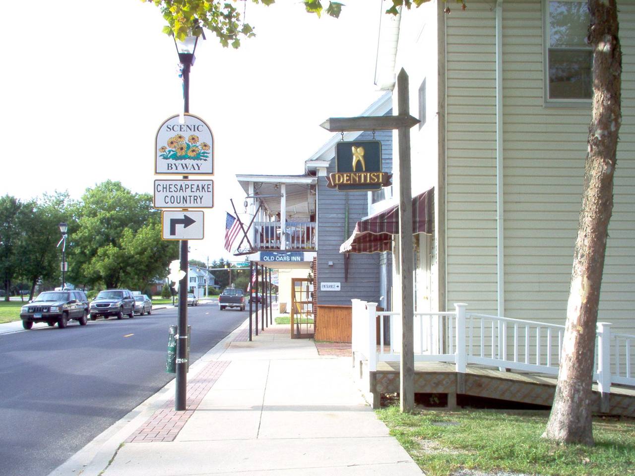


Rock Hall, Maryland
Rock Hall is a town of 1,215 people in Kent County, Maryland, founded in 1707.
Why visit Rock Hall
Townapedia lists 1 museum or landmark, 3 parks and trails and 6 places to eat in and around town.
Highlights include Bayside Landing Park.
July is the warmest month, with average highs of 87°F; January lows average 27°F.
Weather in Rock Hall
Forecast from the National Weather Service. Full forecast
About Rock Hall
Rock Hall, is a waterfront town located directly on the National Chesapeake Scenic Byway in Kent County, Maryland, United States. As of the 2020 census, Rock Hall had a population of 1,198.
From the Wikipedia article Rock Hall, Maryland (this version), under CC BY-SA 4.0.
Museums and landmarks1

Parks, trails and playgrounds3

Restaurants and cafes6

Crepes Ahoy
Restaurant · Crepe
21267 Rock Hall Avenue, Rock Hall
We-Su 09:00-21:00


Churches and places of worship4

History
Originally called Rock Hall Crossroads, the city is now a fishing, sailing and recreational boating town situated on the upper Eastern Shore of the Chesapeake Bay. It is the center of Kent County's maritime industries, and is also a popular tourist destination. It was established in 1707. The city was named for a mansion made of white sandstone, and was incorporated in 1908.
Rock Hall served as a shipping point for tobacco, seafood and other agricultural products, as well as a passenger transport connection for travelers during the Colonial era. Later, fishing and seafood processing became the town's largest industry.
The town missed out on receiving a railroad connection in 1872, when the Kent County Railroad set out to build from Massey via Chestertown and connect with a ferry to Baltimore for both passengers and freight. The company went bankrupt in 1877, having only built a stub from Chestertown to a place called Belair or Parsons and abandoning the rest unfinished.
Rock Hall Harbor remains a working harbor with an active fleet of commercial watermen, charter fishing and commercial sailing boats. It has three museums including a waterman's museum.
Hinchingham and Trumpington are listed on the National Register of Historic Places.
From the History section of Rock Hall, Maryland on Wikipedia, under CC BY-SA 4.0.
Gas and EV charging1
Schools, colleges and libraries4
Map of Rock Hall
19 places. The map loads OpenStreetMap tiles when you open it.
Climate by month
Monthly table
| Month | High | Low | Rain | Snow |
|---|---|---|---|---|
| Jan | 41°F | 27°F | 3.3 in | 5.2 in |
| Feb | 44°F | 28°F | 2.9 in | 7.9 in |
| Mar | 52°F | 35°F | 4.2 in | 1.7 in |
| Apr | 64°F | 45°F | 3.7 in | 0.2 in |
| May | 74°F | 55°F | 3.9 in | 0.0 in |
| Jun | 82°F | 64°F | 4.4 in | 0.0 in |
| Jul | 87°F | 69°F | 4.3 in | 0.0 in |
| Aug | 85°F | 67°F | 3.6 in | 0.0 in |
| Sep | 78°F | 60°F | 4.9 in | 0.0 in |
| Oct | 67°F | 48°F | 3.7 in | 0.0 in |
| Nov | 56°F | 38°F | 3.2 in | 0.0 in |
| Dec | 45°F | 31°F | 3.8 in | 1.7 in |
U.S. Climate Normals 1991-2020 for Chestertown Hcn (11 mi away), NOAA NCEI.
People and cost of living
American Community Survey 5-year estimates, 2020-2024, U.S. Census Bureau. Estimates have margins of error, larger for small towns.
Disaster history
Kent County has had 15 federal disaster declarations since 2000, most often for hurricanes.
- 2026-01-24: Severe Winter Storm (Winter Storm)
- 2020-03-26: Covid-19 Pandemic (Biological)
- 2020-03-13: Covid-19 (Biological)
- 2016-03-04: Severe Winter Storm And Snowstorm (Snowstorm)
- 2012-11-20: Hurricane Sandy (Hurricane)
- 2012-10-28: Hurricane Sandy (Hurricane)
OpenFEMA disaster declarations summaries.
Getting there and nearby towns
Annapolis Seaplane Base (01MD) is the nearest airport with scheduled flights listed in OpenStreetMap, 15 miles away.
- Chestertown 10 mi northeast, about 17 min by car
- Centreville 12 mi southeast, about 19 min by car
- Kingstown 12 mi northeast, about 19 min by car
- Cape St. Claire 13 mi southwest, about 21 min by car
- Edgemere 13 mi northwest, about 21 min by car
- Chester 13 mi south, about 20 min by car
- Grasonville 13 mi south, about 21 min by car
- Lake Shore 14 mi west, about 22 min by car
- Bowleys Quarters 14 mi northwest, about 23 min by car
- Essex 15 mi northwest, about 25 min by car
Drive times are estimates from straight-line distance, not routes.
Local news
Headlines from INDB, the NEMICO news database.
Reviews, tips and questions
Loading what members have shared...
Sources and licences
- NCES EDGE (Public domain): public schools
- NOAA NCEI U.S. Climate Normals 1991-2020 (Public domain): climate by month
- OpenFEMA (Public domain): disaster declarations
- OpenStreetMap contributors (ODbL 1.0): places, airports, map data
- U.S. Census Bureau (Public domain): population, income, housing, education, commute
- Wikidata (CC0 1.0): elevation, founding date, time zone, website
- Wikimedia Commons (see each image): photos
- Wikipedia (CC BY-SA 4.0): overview and history text
Photo credits
- Main Street Dentist, Captain Bluecrab, CC BY-SA 3.0
- 2022-06-30 13 50 36 View west along Maryland State Route 20 (Rock Hall Avenue) just west of Maryland State 445 (Main Street) in Rock Hall, Kent County, Maryland, Famartin, CC BY-SA 4.0
- 2017-08-11 18 46 12 View north along Maryland State Route 445 (Main Street) at Maryland State Route 20 (Rock Hall Avenue) in Rock Hall, Kent County, Maryland, Famartin, CC BY-SA 4.0
- 2022-06-30 14 04 05 View north along Maryland State Route 445 (Main Street) at Maryland State Route 20 (Rock Hall Avenue) in Rock Hall, Kent County, Maryland, Famartin, CC BY-SA 4.0
- 2022-06-30 14 03 27 View south along Maryland State Route 445 (Main Street) at Maryland State Route 20 (Rock Hall Avenue) in Rock Hall, Kent County, Maryland, Famartin, CC BY-SA 4.0
- 2022-06-30 13 49 12 View west along Maryland State Route 20 (Rock Hall Avenue) just east of Maryland State 445 (Main Street) in Rock Hall, Kent County, Maryland, Famartin, CC BY-SA 4.0
- Warehouses at the Rock Hall Marina - panoramio, olekinderhook, CC BY 3.0
- Water and masts at Rock Hall - panoramio, olekinderhook, CC BY 3.0
- 2022-06-30 13 45 26 View west along Maryland State Route 674 (Sharp Street) at Maryland State Route 20 (Rock Hall Road) in Sharpstown, Kent County, Maryland, Famartin, CC BY-SA 4.0
- 2022-06-30 14 42 04 View east along Maryland State Route 20 (Rock Hall Road) just west of Maryland State Route 288 (Crosby Road) in Sharpstown, Kent County, Maryland, Famartin, CC BY-SA 4.0
- 2017-08-11 18 39 23 View east along Maryland State Route 20 (Rock Hall Road) at Maryland State Route 288 (Crosby Road) in Sharpstown, Kent County, Maryland, Famartin, CC BY-SA 4.0
- 2017-08-11 18 39 00 View east along Maryland State Route 288 (Crosby Road) at Maryland State Route 20 (Rock Hall Road) in Sharpstown, Kent County, Maryland, Famartin, CC BY-SA 4.0
- Juvenile Bald eagle in Sweetgum Tree at Eastern Neck National Wildlife Refuge (34252296932), U.S. Fish and Wildlife Service Northeast Region, Public domain
- Bald eagle on log at Eastern Neck National Wildlife Refuge (33569642344), U.S. Fish and Wildlife Service Northeast Region, Public domain
- Maturing Bald eagle at Eastern Neck National Wildlife Refuge (34411492425), U.S. Fish and Wildlife Service Northeast Region, Public domain
- Bald eaglet in nest at Eastern Neck National Wildlife Refuge (34252262952), U.S. Fish and Wildlife Service Northeast Region, Public domain
- Bald eagle on boardwalk at Eastern Neck National Wildlife Refuge (34280805901), U.S. Fish and Wildlife Service Northeast Region, Public domain
- Adult bald eagle in flight at Eastern Neck National Wildlife Refuge (34252248632), U.S. Fish and Wildlife Service Northeast Region, Public domain
- Bald eagle on log at Eastern Neck National Wildlife Refuge (34252289242), U.S. Fish and Wildlife Service Northeast Region, Public domain
- Bald eagle on log in shallow water at Eastern Neck National Wildlife Refuge (34280813331), U.S. Fish and Wildlife Service Northeast Region, Public domain
- Bald eaglet being returned to its nest at Eastern Neck National Wildlife Refuge (34369976796), U.S. Fish and Wildlife Service Northeast Region, Public domain
- Bald eaglet being returned to it's nest at Eastern Neck National Wildlife Refuge (34369963816), U.S. Fish and Wildlife Service Northeast Region, Public domain
- Banding bald eaglet at eastern Neck National Wildlife Refuge (34369980336), U.S. Fish and Wildlife Service Northeast Region, Public domain
- Bald eaglet being returned to it's nest at Eastern neck National Wildlife Refuge (34369967496), U.S. Fish and Wildlife Service Northeast Region, Public domain
- Bald eagles at Eastern Neck National Wildlife Refuge (34252292812), U.S. Fish and Wildlife Service Northeast Region, Public domain
- Preparing to return bald eaglet to it's nest at Eastern Neck national Wildlife Refuge (34252272472), U.S. Fish and Wildlife Service Northeast Region, Public domain
- Bald eaglet in nest at Eastern Neck National Wildlife Refuge (34026639370), U.S. Fish and Wildlife Service Northeast Region, Public domain
- Banding bald eaglet at Eastern Neck National Wildlife Refuge (34252285672), U.S. Fish and Wildlife Service Northeast Region, Public domain
- Preparing to return bald eaglet to nest at Eastern neck national Wildlife Refuge (34280805351), U.S. Fish and Wildlife Service Northeast Region, Public domain
- Adult Bald eagle on ice at Eastern Neck National Wildlife Refuge (34369987396), U.S. Fish and Wildlife Service Northeast Region, Public domain
- Maturing Bald eagle at Eastern Neck National Wildlife Refuge (34026680270), U.S. Fish and Wildlife Service Northeast Region, Public domain
- Bald eagle at Eastern Neck National Wildlife Refuge (34252302382), U.S. Fish and Wildlife Service Northeast Region, Public domain
- Bald eagle at Eastern Neck National Wildlife Refuge (34280806021), U.S. Fish and Wildlife Service Northeast Region, Public domain
- Eagle, almost mature in sweetgum tree at Eastern Neck National Wildlife Refuge (33569655594), U.S. Fish and Wildlife Service Northeast Region, Public domain
- Two bald eagles at Eastern Neck National Wildlife Refuge (34369988056), U.S. Fish and Wildlife Service Northeast Region, Public domain
- School lunch display (29311987271), Oregon State University, CC BY-SA 2.0
- Boats - panoramio (21) (cropped), olekinderhook, CC BY 3.0
- Boats - panoramio (21), olekinderhook, CC BY 3.0
- Can you spot the canine friend - panoramio, olekinderhook, CC BY 3.0
- 2022-06-30 13 46 23 View east along Maryland State Route 674 (Sharp Street) at Grays Inn Creek in Sharpstown, Kent County, Maryland, Famartin, CC BY-SA 4.0


Page built October 30, 2026. Spotted a mistake? Tell us or suggest a place.