


Kingstown, Maryland
Kingstown is a community of 1,713 people in Queen Anne's County, Maryland.
Why visit Kingstown
Townapedia lists 21 museums and landmarks, 13 parks and trails, 3 places to eat, 3 places to stay and 1 attraction in and around town.
Highlights include Widehall, Airy Hill, Chestertown Historic District and Kirwan Meditation Garden.
July is the warmest month, with average highs of 87°F; January lows average 27°F.
Weather in Kingstown
Forecast from the National Weather Service. Full forecast
About Kingstown
Kingstown is a census-designated place (CDP) in Queen Anne's County, Maryland, United States. The population was 1,644 at the 2000 census.
From the Wikipedia article Kingstown, Maryland (this version), under CC BY-SA 4.0.
Things to do1

Museums and landmarks21

Widehall
Monument and historic site · National Register of Historic Places · 1.1 mi
Building in Maryland, United States
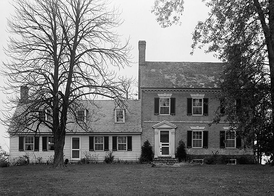
Airy Hill
Monument and historic site · National Register of Historic Places · 2.8 mi
House in Kent County, Maryland
Bernice J.
Monument and historic site · National Register of Historic Places · 1.0 mi
Chesapeake Bay skipjack

Brampton
Monument and historic site · National Register of Historic Places · 2.8 mi
Building in Maryland, United States

Charles Sumner Post No. 25, Grand Army of the Republic
Museum · National Register of Historic Places · 1.2 mi
Building in Maryland, United States

Chester Hall
Monument and historic site · National Register of Historic Places
Building in Maryland, United States

Chestertown Armory
Monument and historic site · National Register of Historic Places · 1.3 mi
Arsenal in Maryland, United States of America

Chestertown Historic District
Monument and historic site · National Register of Historic Places · 1.4 mi
Listed on the NRHP in Maryland

Chestertown Railroad Station
Monument and historic site · National Register of Historic Places · 1.3 mi
Railway station in Chestertown, the United States of America


Denton House
Monument and historic site · National Register of Historic Places · 1.0 mi
House in Chestertown, Maryland, USA
Godlington Manor
Monument and historic site · National Register of Historic Places · 2.2 mi
Building in Maryland, United States
Island Image
Monument and historic site · National Register of Historic Places · 2.8 mi
Log canoe
9 more on the map.
Parks, trails and playgrounds13



1 more on the map.
Restaurants and cafes3


Domino's
Fast food · Pizza · 1.7 mi
518 Washington Avenue, Chestertown
Mo-Th 10:30-24:00; Fr-Sa 10:30-01:00; Su 10:30-24:00
Dunkin' Donuts
Fast food · Donut, Coffee Shop · 1.3 mi
315 High Street, Chestertown
History
The log canoe Mystery was listed on the National Register of Historic Places in 1985.
From the History section of Kingstown, Maryland on Wikipedia, under CC BY-SA 4.0.
Where to stay3
Churches and places of worship13
Chestertown Baptist Church
Church · Baptist · 1.5 mi
401 Morgnec Road, Chestertown
Bethel African Methodist Episcopal Church
Church · African Methodist Episcopal · 1.5 mi
Shopping1
Gas and EV charging3
Schools, colleges and libraries10
Healthcare1
University of Maryland Shore Medical Center at Chestertown
Hospital · 1.3 mi
100 Brown Street, Chestertown
Map of Kingstown
69 places. The map loads OpenStreetMap tiles when you open it.
Climate by month
Monthly table
| Month | High | Low | Rain | Snow |
|---|---|---|---|---|
| Jan | 41°F | 27°F | 3.3 in | 5.2 in |
| Feb | 44°F | 28°F | 2.9 in | 7.9 in |
| Mar | 52°F | 35°F | 4.2 in | 1.7 in |
| Apr | 64°F | 45°F | 3.7 in | 0.2 in |
| May | 74°F | 55°F | 3.9 in | 0.0 in |
| Jun | 82°F | 64°F | 4.4 in | 0.0 in |
| Jul | 87°F | 69°F | 4.3 in | 0.0 in |
| Aug | 85°F | 67°F | 3.6 in | 0.0 in |
| Sep | 78°F | 60°F | 4.9 in | 0.0 in |
| Oct | 67°F | 48°F | 3.7 in | 0.0 in |
| Nov | 56°F | 38°F | 3.2 in | 0.0 in |
| Dec | 45°F | 31°F | 3.8 in | 1.7 in |
U.S. Climate Normals 1991-2020 for Chestertown Hcn (1 mi away), NOAA NCEI.
People and cost of living
American Community Survey 5-year estimates, 2020-2024, U.S. Census Bureau. Estimates have margins of error, larger for small towns.
Disaster history
Queen Anne's County has had 14 federal disaster declarations since 2000, most often for hurricanes.
- 2026-01-24: Severe Winter Storm (Winter Storm)
- 2020-03-26: Covid-19 Pandemic (Biological)
- 2020-03-13: Covid-19 (Biological)
- 2016-03-04: Severe Winter Storm And Snowstorm (Snowstorm)
- 2012-11-20: Hurricane Sandy (Hurricane)
- 2012-10-28: Hurricane Sandy (Hurricane)
OpenFEMA disaster declarations summaries.
Getting there and nearby towns
Phillips Army Air Field (APG) is the nearest airport with scheduled flights listed in OpenStreetMap, 19 miles away.
- Chestertown 2 mi northwest, about 3 min by car
- Church Hill 5 mi southeast, about 9 min by car
- Centreville 11 mi south, about 18 min by car
- Grasonville 19 mi southwest, about 31 min by car
- Edgewood 20 mi northwest, about 32 min by car
- Bowleys Quarters 20 mi west, about 31 min by car
- Essex 22 mi west, about 36 min by car
- Joppatowne 22 mi northwest, about 35 min by car
- Aberdeen 22 mi north, about 36 min by car
- Middle River 23 mi northwest, about 36 min by car
Drive times are estimates from straight-line distance, not routes.
Local news
Headlines from INDB, the NEMICO news database.
Reviews, tips and questions
Loading what members have shared...
Sources and licences
- NCES EDGE (Public domain): public schools
- NOAA NCEI U.S. Climate Normals 1991-2020 (Public domain): climate by month
- OpenFEMA (Public domain): disaster declarations
- OpenStreetMap contributors (ODbL 1.0): places, airports, map data
- U.S. Census Bureau (Public domain): population, income, housing, education, commute
- Wikidata (CC0 1.0): elevation, founding date, time zone, website, landmarks and historic places
- Wikimedia Commons (see each image): photos
- Wikipedia (CC BY-SA 4.0): overview and history text
Photo credits
- Denton House, Chestertown, MD, Acroterion, CC BY-SA 4.0
- BRAMPTON, CHESTERTOWN, KENT COUNTY, JERRYE & ROY KLOTZ, M.D., CC BY-SA 4.0
- CHESTER HALL, CHESTERTOWN, QUEEN ANNE'S COUNTY, MD, JERRYE & ROY KLOTZ, M.D., CC BY-SA 4.0
- LAURETUM, CHESTERTOWN, KENT COUNTY, MD, JERRYE & ROY KLOTZ, M.D., CC BY-SA 4.0
- Chestertown armory, Acroterion, CC BY-SA 3.0
- Godlington Manor HABS MD1, Douglas Barber, HABS photographer, Public domain
- ROSE HILL, JERRYE & ROY KLOTZ MD, CC BY-SA 3.0
- CHESTERTOWN RAILROAD STATION, KENT COUNTY, MD, JERRYE & ROY KLOTZ, M.D., CC BY-SA 4.0
- Custom House, Chestertown MD, Acroterion, CC BY-SA 4.0
- Airy Hill HABS MD1, E.H. Pickering, HABS photographer, Public domain
- RADCLIFFE MILL, CHESTERTOWN, KENT COUNTY, MD, JERRYE & ROY KLOTZ. M.D., CC BY-SA 4.0
- 2022-06-30 11 01 39 View east along Maryland State Route 544 (McGinnes Road) at Maryland State Route 213 (Church Hill Road) in Rolphs, Queen Anne's County, Maryland, Famartin, CC BY-SA 4.0
- Widehall Chester River side MD1, Acroterion, CC BY-SA 4.0
- Sprit topmast Kalmar Nyckel MD1, Acroterion, CC BY-SA 4.0
- 2022-06-29 16 25 35 View south along Maryland State Route 213 (Church Hill Road) at Maryland State Route 544 (McGinnes Road) in Rolphs, Queen Anne's County, Maryland, Famartin, CC BY-SA 4.0
- Rosie Parks Chestertown MD3, Acroterion, CC BY-SA 4.0
- Kalmar Nyckel mizzen mast MD1, Acroterion, CC BY-SA 4.0
- Kalmar Nyckel mainmast MD1, Acroterion, CC BY-SA 4.0
- Kalmar Nyckel dog carving MD1, Acroterion, CC BY-SA 4.0
- Rosie Parks Chestertown MD1, Acroterion, CC BY-SA 4.0
- Rosie Parks Chestertown MD2, Acroterion, CC BY-SA 4.0
- Pride of Baltimore II on the Chester River 2011, Diiscool, CC0
- Virginia Chestertown MD1, Acroterion, CC BY-SA 4.0
- Elsworth stem MD1, Acroterion, CC BY-SA 4.0
- Old Point pilothouse MD1, Acroterion, CC BY-SA 4.0
- Catboat MD1, Acroterion, CC BY-SA 4.0
- Old Point crab dredge MD2, Acroterion, CC BY-SA 4.0
- Old Point crab dredge MD32, Acroterion, CC BY-SA 4.0
- Old Point crab dredge MD1, Acroterion, CC BY-SA 4.0
- Perri Lee MD2, Acroterion, CC BY-SA 4.0
- Widehall, Chestertown, Maryland, Acroterion, CC BY-SA 4.0
- Sultana Chestertown MD1, Acroterion, CC BY-SA 4.0
- Chestertown Volunteer Fire Company A, WhisperToMe, CC0
- Chestertown Volunteer Fire Company Brooks Bldg, WhisperToMe, CC0
- Chestertown Volunteer Fire Company, WhisperToMe, CC0
- ChestertownHistoricLRWalls, Linda Roy Walls, CC BY-SA 3.0
- Schooner Virginia Chester River MD2, Acroterion, CC BY-SA 4.0
- Kalmar Nyckel Chester River MD1, Acroterion, CC BY-SA 4.0
- Elsworth and Lady Maryland MD1, Acroterion, CC BY-SA 4.0
- Lady Maryland Chester River MD2, Acroterion, CC BY-SA 4.0


Page built October 30, 2026. Spotted a mistake? Tell us or suggest a place.