



Copperas Cove, Texas
Copperas Cove is a city of 37,947 people in Bell County, Texas, founded in March 25, 1879.
Why visit Copperas Cove
Townapedia lists 7 museums and landmarks, 10 parks and trails, 25 places to eat, 3 places to stay and 4 attractions in and around town.
Highlights include Cinergy Cinemas, Copperas Cove Stagestop and Post Office, First Baptist Church of Copperas Cove and High Chapparal Park.
August is the warmest month, with average highs of 97°F; January lows average 36°F.
Weather in Copperas Cove
Forecast from the National Weather Service. Full forecast
About Copperas Cove
Copperas Cove is a city located in Central Texas at the southern corner of Coryell County, with smaller portions in Lampasas and Bell Counties. Founded in 1879 as a small ranching and farming community, the city is the largest in Coryell County, with a population of 36,670 at the 2020 census. The city's economy is closely linked to nearby Fort Hood, making it part of the Killeen-Temple-Fort Hood metropolitan statistical area.
From the Wikipedia article Copperas Cove, Texas (this version), under CC BY-SA 4.0.
Things to do4

Cinergy Cinemas
Cinema and theater · 2.5 mi
402 Constitution Drive, Copperas Cove

Museums and landmarks7

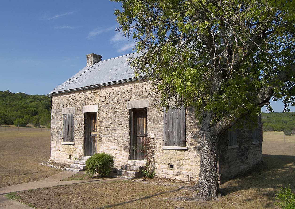
Copperas Cove Stagestop and Post Office
Monument and historic site · National Register of Historic Places · 1.4 mi
Building in Copperas Cove (vicinity), Coryell County, Texas
"Dawn to dusk"
First Baptist Church of Copperas Cove
Monument and historic site · Baptist · 0.8 mi


Parks, trails and playgrounds10

High Chapparal Park
Park · 0.7 mi
High Chapparal Drive, Copperas Cove
sunrise-sunset

Hills of Cove Golf Course
Golf course · 2.0 mi
1408 Golf Course Road, Copperas Cove

Restaurants and cafes25



McAlister's Deli
Restaurant · Sandwich · 2.8 mi
232 Robert Griffin III Drive, Copperas Cove

Burger King
Fast food · Burger · 1.2 mi
1001 East Highway 190, Copperas Cove
Mo-Th 06:00-20:30; Fr-Sa 06:00-22:30; Su 07:00-22:30
Chick-fil-A
Fast food · Chicken · 2.8 mi
202 Robert Griffin III Drive, Copperas Cove
Mo-Sa 06:30-22:00; Su off
Papa John's
Fast food · Pizza · 2.6 mi
2726 East Highway 190, Copperas Cove
Mo-Th 10:00-24:00; Fr-Sa 10:00-01:00; Su 10:00-24:00
13 more on the map.
History
The first evidence of human habitation in the Five Hills area dates back to at least 4,000 BC. Artifacts, such as skeletal remains, arrowheads, and other stone tools, have been found along local creek beds and valley floors. These first residents were nomadic hunters, traveling in small groups following migrating buffalo herds. When the Spanish came to Texas, a small Plains tribe known as the Tonkawa inhabited the area. The powerful Comanche controlled a vast stretch of land to the north and west, making now-Coryell County a hostile battleground as settlers moved into the area.
From the History section of Copperas Cove, Texas on Wikipedia, under CC BY-SA 4.0.
Where to stay3
Super 8 by Wyndham Copperas Cove
Motel and hotel · 0.6 mi
302 West Highway 190, Copperas Cove
Churches and places of worship22
First Assembly of God Church - Copperas Cove
Church · Pentecostal · 1.5 mi
2205 FM 3046, Copperas Cove
The Church of Jesus Christ of Latter-day Saints
Church · Mormon · 1.9 mi
1502 Virginia Avenue, Copperas Cove
Shopping5
Gas and EV charging9
Schools, colleges and libraries30
C. R. Clements / Hollie Parsons Elementary School
School · 1.8 mi
1115 Northern Dancer Drive, Copperas Cove
C R Clements/Hollie Parsons El
School · 1.8 mi
1115 Northern Dancer, Copperas Cove
Healthcare2
Map of Copperas Cove
117 places. The map loads OpenStreetMap tiles when you open it.
Climate by month
Monthly table
| Month | High | Low | Rain | Snow |
|---|---|---|---|---|
| Jan | 60°F | 36°F | 2.5 in | 0.0 in |
| Feb | 63°F | 40°F | 2.2 in | 0.0 in |
| Mar | 70°F | 47°F | 3.3 in | 0.0 in |
| Apr | 77°F | 54°F | 2.1 in | 0.0 in |
| May | 84°F | 63°F | 4.7 in | 0.0 in |
| Jun | 92°F | 70°F | 3.2 in | 0.0 in |
| Jul | 96°F | 72°F | 2.7 in | 0.0 in |
| Aug | 97°F | 73°F | 1.6 in | 0.0 in |
| Sep | 90°F | 67°F | 3.9 in | 0.0 in |
| Oct | 80°F | 56°F | 3.4 in | 0.0 in |
| Nov | 69°F | 46°F | 2.7 in | 0.0 in |
| Dec | 60°F | 38°F | 2.4 in | 0.0 in |
U.S. Climate Normals 1991-2020 for Killeen (14 mi away), NOAA NCEI.
People and cost of living
American Community Survey 5-year estimates, 2020-2024, U.S. Census Bureau. Estimates have margins of error, larger for small towns.
Disaster history
Bell County has had 15 federal disaster declarations since 2000, most often for hurricanes.
- 2024-05-17: Severe Storms, Straight-Line Winds, Tornadoes, And Flooding (Flood)
- 2021-02-19: Severe Winter Storms (Severe Ice Storm)
- 2021-02-14: Severe Winter Storm (Severe Ice Storm)
- 2020-03-25: Covid-19 Pandemic (Biological)
- 2020-03-13: Covid-19 (Biological)
- 2008-09-10: Hurricane Ike (Hurricane)
OpenFEMA disaster declarations summaries.
Getting there and nearby towns
Robert Gray Army Airfield (GRK) is the nearest airport with scheduled flights listed in OpenStreetMap, 6 miles away.
- Kempner 5 mi southwest, about 7 min by car
- Killeen 11 mi east, about 18 min by car
- Lampasas 16 mi west, about 26 min by car
- Harker Heights 17 mi east, about 27 min by car
- Nolanville 19 mi east, about 30 min by car
- Belton 26 mi east, about 42 min by car
- Cedar Park 42 mi south, about 1 h 15 min by car
- Brushy Creek 43 mi south, about 1 h 15 min by car
- Round Rock 44 mi south, about 1 h 15 min by car
- Waco 52 mi northeast, about 1 h 30 min by car
Drive times are estimates from straight-line distance, not routes.
Local news
Headlines from INDB, the NEMICO news database.
Reviews, tips and questions
Loading what members have shared...
Sources and licences
- NCES EDGE (Public domain): public schools
- NOAA NCEI U.S. Climate Normals 1991-2020 (Public domain): climate by month
- OpenFEMA (Public domain): disaster declarations
- OpenStreetMap contributors (ODbL 1.0): places, airports, map data
- U.S. Census Bureau (Public domain): population, income, housing, education, commute
- Wikidata (CC0 1.0): elevation, founding date, time zone, website, landmarks and historic places
- Wikimedia Commons (see each image): photos
- Wikipedia (CC BY-SA 4.0): overview and history text
Photo credits
- Copperas Cove downtown-2009, Viceroy Bob, Public domain
- Copperas cove stagestop, Larry D. Moore, CC BY 4.0
- Mt. Hiram Lodge No. 595, A.F. & A.M. Texas Historic Marker 3519, Michael Britton, CC BY-SA 3.0
- Ogletree Stage Stop and Post Office, Copperas Cove, Texas Historical Marker (9179233441), Nicolas Henderson from Coppell, Texas, Public domain
- 2026 0528 CopperasCoveDowntown, CopperasCoveChamber, CC0
- ISS067-E-170861 - View of Earth, Earth Science and Remote Sensing Unit , Lyndon B. Johnson Space Center, Public domain
- Tactical signal channel satellite terminal, US Army, 2010, GovWin a Deltek Network from Herndon, USA, CC BY 2.0

Page built October 30, 2026. Spotted a mistake? Tell us or suggest a place.