


Why visit Coxsackie
Townapedia lists 13 museums and landmarks, 8 parks and trails, 2 places to eat and 3 attractions in and around town.
Highlights include Coxsackie Light, Lampman Hill, Bronck Farm 13-Sided Barn and Bronck House.
July is the warmest month, with average highs of 85°F; January lows average 18°F, and about 31 inches of snow fall in a normal year.
Weather in Coxsackie
Forecast from the National Weather Service. Full forecast
About Coxsackie
Coxsackie is a village in Greene County, New York, United States. The population was 2,746 at the 2020 census.
From the Wikipedia article Coxsackie (village), New York (this version), under CC BY-SA 4.0.
Things to do3

Coxsackie Light
Lighthouse · 1.7 mi
Lighthouse in New York, United States


Museums and landmarks13

Bronck Farm 13-Sided Barn
Monument and historic site · National Register of Historic Places · 2.1 mi
Historic barn in Greene County, New York
Bronck House
Monument and historic site · National Register of Historic Places · 2.3 mi
Historic house in New York, United States
Bronk-Silvester House
Monument and historic site · National Register of Historic Places
Historic house in New York, United States

James Lynch House
Monument and historic site · National Register of Historic Places · 1.2 mi
Historic house in New York, United States
Lynch Hotel
Monument and historic site · National Register of Historic Places · 1.1 mi
Historic hotel at Newton Hook, Columbia County, New York
Reed Street Historic District
Monument and historic site · National Register of Historic Places · 0.7 mi
Historic district in New York, United States
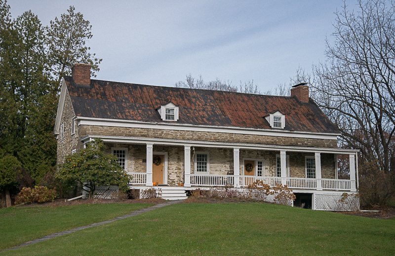
Rushmore Farm
Monument and historic site · National Register of Historic Places · 2.6 mi
Historic house in New York, United States

Stuyvesant Railroad Station
Monument and historic site · National Register of Historic Places · 2.5 mi
Railway station in Stuyvesant, the United States of America
Van Bergen House
Monument and historic site · National Register of Historic Places · 2.3 mi
Historic house in New York, United States
William A. Witbeck House
Monument and historic site · National Register of Historic Places · 3.3 mi
Historic house in New York, United States
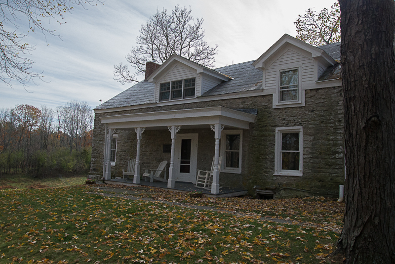


Peter Houghtaling Farm and Lime Kiln
Monument and historic site · National Register of Historic Places · 3.4 mi
R. and W. Scott Ice Company Powerhouse and Ice House Site
Monument and historic site · National Register of Historic Places · 0.9 mi
1 more on the map.
Parks, trails and playgrounds8



Restaurants and cafes2

History
The original plot of land was sold by American Indians to Pieter Bronck in 1661 for 150 guilders in beaver pelts.
The lower part of the village was once called "Reeds Landing". In the late 19th century, this area contained several factories and a steamboat landing, now replaced by a waterfront park. The district was built up around industries that serviced, by way of the Hudson River, New York City to the South and points North. There were several ice houses that harvested ice from the river as well as brick foundries, iron foundries, carriage makers and lumber treating. Warehousing and transport from local farms was also an important industry.
The remains of the steam freighter Storm King still rest here, in the river just north of the park, where she sank at her moorings in the 1930s. She is still visible except at the highest tide or during flooding. Near this area in the early 20th century was a popular sandy beach that drew thousands of visitors on summer weekends. The beach eroded away after channelization of the Hudson during the 1930s, when deep water navigation was extended up to Albany.
A ferry service connected the village to Newtons Hook across the river in Columbia County until June 12, 1938.
In 1947, the Coxsackievirus was isolated from an outbreak in upstate New York, and was named after the village, being the location where the outbreak first began.
From the History section of Coxsackie (village), New York on Wikipedia, under CC BY-SA 4.0.
Churches and places of worship6
Saint Mary Catholic Church
Church · Roman Catholic · 0.4 mi
80 Mansion Street, Coxsackie
Shopping2
Gas and EV charging2
Schools, colleges and libraries6
Healthcare2
Map of Coxsackie
44 places. The map loads OpenStreetMap tiles when you open it.
Climate by month
Monthly table
| Month | High | Low | Rain | Snow |
|---|---|---|---|---|
| Jan | 35°F | 18°F | 2.7 in | 8.2 in |
| Feb | 38°F | 19°F | 2.6 in | 8.5 in |
| Mar | 48°F | 28°F | 3.3 in | 4.4 in |
| Apr | 63°F | 38°F | 3.6 in | 0.3 in |
| May | 74°F | 49°F | 3.5 in | 0.0 in |
| Jun | 81°F | 58°F | 5.0 in | 0.0 in |
| Jul | 85°F | 62°F | 3.9 in | 0.0 in |
| Aug | 83°F | 61°F | 4.5 in | 0.0 in |
| Sep | 75°F | 54°F | 4.3 in | 0.0 in |
| Oct | 64°F | 43°F | 4.2 in | 0.0 in |
| Nov | 51°F | 33°F | 3.0 in | 0.5 in |
| Dec | 40°F | 25°F | 3.6 in | 9.1 in |
U.S. Climate Normals 1991-2020 for Hudson Correctional Facility (8 mi away), NOAA NCEI.
People and cost of living
American Community Survey 5-year estimates, 2020-2024, U.S. Census Bureau. Estimates have margins of error, larger for small towns.
Disaster history
Greene County has had 23 federal disaster declarations since 2000, most often for severe storms.
- 2021-08-22: Hurricane Henri (Hurricane)
- 2020-03-20: Covid-19 Pandemic (Biological)
- 2020-03-13: Covid-19 (Biological)
- 2017-07-12: Severe Winter Storm And Snowstorm (Snowstorm)
- 2012-10-30: Hurricane Sandy (Hurricane)
- 2012-10-28: Hurricane Sandy (Hurricane)
OpenFEMA disaster declarations summaries.
Getting there and nearby towns
Great Barrington Airport (GBR) is the nearest airport with scheduled flights listed in OpenStreetMap, 24 miles away.
- Sleepy Hollow Lake 4 mi south, about 6 min by car
- Stottville 5 mi southeast, about 8 min by car
- Athens 6 mi south, about 10 min by car
- Kinderhook 6 mi northeast, about 9 min by car
- Lorenz Park 6 mi south, about 10 min by car
- Valatie 8 mi northeast, about 12 min by car
- Jefferson Heights 9 mi south, about 15 min by car
- Catskill 10 mi south, about 16 min by car
- Niverville 10 mi northeast, about 17 min by car
- Chatham 11 mi east, about 17 min by car
Drive times are estimates from straight-line distance, not routes.
Local news
Headlines from INDB, the NEMICO news database.
Reviews, tips and questions
Loading what members have shared...
Sources and licences
- NOAA NCEI U.S. Climate Normals 1991-2020 (Public domain): climate by month
- OpenFEMA (Public domain): disaster declarations
- OpenStreetMap contributors (ODbL 1.0): places, airports, map data
- U.S. Census Bureau (Public domain): population, income, housing, education, commute
- Wikidata (CC0 1.0): elevation, founding date, time zone, website, landmarks and historic places
- Wikimedia Commons (see each image): photos
- Wikipedia (CC BY-SA 4.0): overview and history text
Photo credits
- Bronk-Silvestre House 8-14-2016, RobertDrake2015, CC BY-SA 3.0
- Bronck Farm 13-Sided Barn - 01, Basvb, CC BY-SA 3.0
- Reed Street Historic District Jul 08, Doug Kerr from Upstate New York, CC BY-SA 2.0
- Bronck-house, Dmadeo, CC BY-SA 4.0
- StuyvesantStation, John E Leslie III, CC BY-SA 4.0
- Van Bergen House 11-10-2016, RobertDrake2015, CC BY-SA 4.0
- Rushmore Farm 11-10-2016, RobertDrake2015, CC BY-SA 4.0
- Peter Houghtaling Farm and Lime Kiln 11-10-2016, RobertDrake2015, CC BY-SA 4.0
Page built October 30, 2026. Spotted a mistake? Tell us or suggest a place.