


Cumberland Hill, Rhode Island
Cumberland Hill is a community of 8,648 people in Providence County, Rhode Island.
Why visit Cumberland Hill
Townapedia lists 58 museums and landmarks, 7 parks and trails, 7 places to eat, 1 place to stay and 5 attractions in and around town.
Highlights include Diamond Hill, Beacon Pole Hill, Allen Street Historic District and Alphonse Gaulin Jr. House.
July is the warmest month, with average highs of 84°F; January lows average 19°F, and about 42 inches of snow fall in a normal year.
Weather in Cumberland Hill
Forecast from the National Weather Service. Full forecast
About Cumberland Hill
Cumberland Hill is a census-designated place (CDP) in the town of Cumberland, in Providence County, Rhode Island, United States. As of the 2020 census, Cumberland Hill had a population of 8,140.
From the Wikipedia article Cumberland Hill, Rhode Island (this version), under CC BY-SA 4.0.
Things to do5


Museums and landmarks58

Allen Street Historic District
Monument and historic site · National Register of Historic Places · 3.3 mi
United States historic place

Alphonse Gaulin Jr. House
Monument and historic site · National Register of Historic Places · 3.0 mi
United States historic place

Arnold Mills Historic District
Monument and historic site · National Register of Historic Places · 3.4 mi
Historic district in Cumberland, Rhode Island

Ashton Historic District
Monument and historic site · National Register of Historic Places · 3.0 mi
United States historic place

Ballou House
Monument and historic site · National Register of Historic Places · 2.1 mi
Historic house in Lincoln, Rhode Island, USA

Ballou-Weatherhead House
Monument and historic site · National Register of Historic Places · 1.7 mi
Historic house in Rhode Island, United States

Berkeley Mill Village
Monument and historic site · National Register of Historic Places · 3.7 mi
Cumberland (Berkeley), RI, listed on the NRHP in Rhode Island

Burlingame-Noon House
Monument and historic site · National Register of Historic Places
Historic house in Rhode Island, United States

Cato Hill Historic District
Monument and historic site · National Register of Historic Places · 3.6 mi
Historic district in Rhode Island, United States
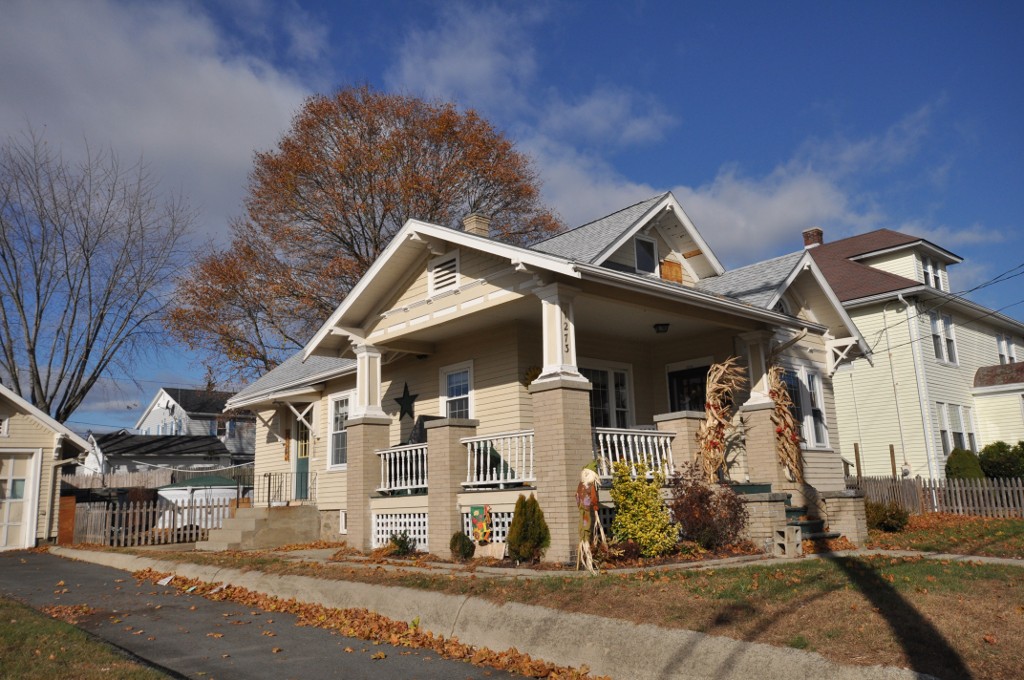
Frank Wilbur House
Monument and historic site · National Register of Historic Places · 3.0 mi
Historic house in Rhode Island, United States

French Worsted Company Mill Historic District
Monument and historic site · National Register of Historic Places · 2.8 mi
Historic mill complex in Woonsocket, Rhode Island
Glenark Mills
Monument and historic site · National Register of Historic Places · 3.4 mi
Factory in Rhode Island, United States of America
46 more on the map.
Parks, trails and playgrounds7

Restaurants and cafes7




Where to stay1
Holiday Inn Express & Suites
Motel and hotel · 1.7 mi
194 Fortin Drive, Woonsocket
Churches and places of worship7
Saint Joan of Arc Catholic Church
Church · Roman Catholic
3357 Mendon Road, Cumberland
Gas and EV charging2
Schools, colleges and libraries46
Ashton School
School · 0.9 mi
2602 Mendon Road (Transitional Building), Cumberland
Map of Cumberland Hill
133 places. The map loads OpenStreetMap tiles when you open it.
Climate by month
Monthly table
| Month | High | Low | Rain | Snow |
|---|---|---|---|---|
| Jan | 38°F | 19°F | 4.4 in | 12.3 in |
| Feb | 40°F | 21°F | 3.7 in | 10.7 in |
| Mar | 47°F | 28°F | 4.9 in | 7.6 in |
| Apr | 60°F | 38°F | 4.7 in | 1.9 in |
| May | 70°F | 48°F | 3.6 in | 0.0 in |
| Jun | 78°F | 57°F | 4.3 in | 0.0 in |
| Jul | 84°F | 63°F | 3.6 in | 0.0 in |
| Aug | 82°F | 62°F | 4.0 in | 0.0 in |
| Sep | 75°F | 54°F | 4.2 in | 0.0 in |
| Oct | 64°F | 42°F | 5.1 in | 0.1 in |
| Nov | 53°F | 33°F | 4.2 in | 1.0 in |
| Dec | 43°F | 25°F | 5.3 in | 7.9 in |
U.S. Climate Normals 1991-2020 for Woonsocket (2 mi away), NOAA NCEI.
People and cost of living
American Community Survey 5-year estimates, 2020-2024, U.S. Census Bureau. Estimates have margins of error, larger for small towns.
Disaster history
Providence County has had 17 federal disaster declarations since 2000, most often for severe storms.
- 2024-03-20: Severe Storms And Flooding (Severe Storm)
- 2024-03-20: Severe Storm And Flooding (Severe Storm)
- 2024-01-07: Severe Storms, Flooding, And Tornadoes (Severe Storm)
- 2022-05-12: Severe Winter Storm And Snowstorm (Snowstorm)
- 2021-08-21: Hurricane Henri (Hurricane)
- 2020-03-30: Covid-19 Pandemic (Biological)
OpenFEMA disaster declarations summaries.
Getting there and nearby towns
North Central State Airport (SFZ) is the nearest airport with scheduled flights listed in OpenStreetMap, 4 miles away.
- Woonsocket 3 mi northwest, about 4 min by car
- Valley Falls 5 mi southeast, about 8 min by car
- North Attleborough Town 6 mi east, about 10 min by car
- Central Falls 7 mi southeast, about 11 min by car
- Pawtucket 8 mi southeast, about 13 min by car
- Franklin Town 8 mi north, about 13 min by car
- Greenville 8 mi southwest, about 13 min by car
- Bellingham 8 mi north, about 13 min by car
- Attleboro 9 mi east, about 15 min by car
- Providence 11 mi south, about 17 min by car
Drive times are estimates from straight-line distance, not routes.
Local news
Headlines from INDB, the NEMICO news database.
Reviews, tips and questions
Loading what members have shared...
Sources and licences
- NCES EDGE (Public domain): public schools
- NOAA NCEI U.S. Climate Normals 1991-2020 (Public domain): climate by month
- OpenFEMA (Public domain): disaster declarations
- OpenStreetMap contributors (ODbL 1.0): places, airports, map data
- U.S. Census Bureau (Public domain): population, income, housing, education, commute
- Wikidata (CC0 1.0): elevation, founding date, time zone, website, landmarks and historic places
- Wikimedia Commons (see each image): photos
- Wikipedia (CC BY-SA 4.0): overview and history text
Photo credits
- Dormition of the Virgin Mary Parish, Cumberland Hill RI, John Phelan, CC BY-SA 3.0
- CumberlandRI JohnColeFarm, User:Magicpiano, CC BY-SA 4.0
- Tyler Mowry House in North Smithfield Rhode Island, Swampyank, CC BY-SA 3.0
- Grove Street Elementary School, Woonsocket RI, John Phelan, CC BY-SA 3.0
- Downtown Woonsocket Historic District, Marcbela, Public domain
- LincolnRI OldAshton KelleyHouse BlackstoneCanal, User:Magicpiano, CC BY-SA 4.0
- WoonsocketRI 110-114MainStreet, Magicpiano, CC BY-SA 3.0
- WoonsocketRI FrankWilburHouse, User:Magicpiano, CC BY-SA 4.0
- Woonsocket City Hall 2015, Kenneth C. Zirkel, CC BY-SA 4.0
- Hanora Mills, Woonsocket RI, John Phelan, CC BY-SA 3.0
- LincolnRI BallouHouse, User:Magicpiano, CC BY-SA 4.0
- CumberlandRI BallouWeatherheadHouse, User:Magicpiano, CC BY-SA 4.0
- Smithfield Friends Meeting House, Swampyank at English Wikipedia, CC BY-SA 3.0
- Woonsocket District Courthouse 2015, Kenneth C. Zirkel, CC BY-SA 4.0
- Rector's house St Josephs Church, Kenneth C. Zirkel, CC BY-SA 3.0
- St. Charles Borromeo Church Complex Woonsocket, Rhode Island, Swampyank, CC BY-SA 3.0
- LincolnRI WhippleCullenHouse, User:Magicpiano, CC BY-SA 4.0
- WoonsocketRI AlphonseGaulinJrHouse, Magicpiano, CC BY-SA 3.0
- Hope Street School, Woonsocket RI, John Phelan, CC BY-SA 3.0
- Logee House, Woonsocket RI, John Phelan, CC BY-SA 3.0
- Stadium Theater Building Woonsocket Rhode Island, Swampyank at English Wikipedia, CC BY-SA 3.0
- WoonsocketRI OldSeniorHighSchool, Magicpiano, CC BY-SA 4.0
- L'Eglise du Precieux Sang, Swampyank at English Wikipedia, CC BY-SA 3.0
- WoonsocketRI PothierHouse, Magicpiano, CC BY-SA 3.0
- St. Ann's Church, Woonsocket RI, John Phelan, CC BY-SA 3.0
- CumberlandRI WhippleJenckesHouse, User:Magicpiano, CC BY-SA 4.0
- WoonsocketRI JenckesMansion, Magicpiano, CC BY-SA 3.0
- WoonsocketRI CatoHill ClarksonLane, Magicpiano, CC BY-SA 3.0
- CumberlandRI ArnoldMillsVillage 1, User:Magicpiano, CC BY-SA 4.0
- CumberlandRI FranklinFarm, User:Magicpiano, CC BY-SA 4.0
- YMCA-PO Woonsocket, Marcbela (Marc N. Belanger), Public domain
- Berkeley Mill RI, Marcbela (Marc N. Belanger), Public domain
- John Arnold House Woonsocket, Rhode Island RI, Swampyank, CC BY-SA 3.0
- Woonsocket Civil War Monument, Swampyank at English Wikipedia, CC BY-SA 3.0
- French Worsted Mills, Marcbela (Marc N. Belanger), Public domain
- ValentineWhitman, Swampyank at en.wikipedia, Public domain
- WoonsocketRI AllenStreet 02, Magicpiano, CC BY-SA 3.0
- Museum of Work and Culture Woonsocket, Swampyank at English Wikipedia, CC BY-SA 3.0
- Manville Housing, Marcbela, CC0
- Ashton Mill Village, Marcbela (Marc N. Belanger), Public domain


Page built October 30, 2026. Spotted a mistake? Tell us or suggest a place.