


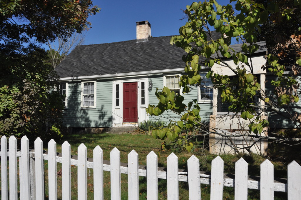


Greenville, Rhode Island
Greenville is a community of 8,296 people in Providence County, Rhode Island.
Why visit Greenville
Townapedia lists 27 museums and landmarks, 10 parks and trails, 27 places to eat and 12 attractions in and around town.
Highlights include Bryant University, Blanchard Farms, Allendale Mill and Allenville Mill Storehouse.
July is the warmest month, with average highs of 84°F; January lows average 19°F, and about 42 inches of snow fall in a normal year.
Weather in Greenville
Forecast from the National Weather Service. Full forecast
About Greenville
Greenville is a village and census-designated place (CDP) in the town of Smithfield, Rhode Island, United States. As of the 2020 census, Greenville had a population of 9,061. The CDP is centered on the village of Greenville but also encompasses the nearby villages of West Greenville and Spragueville, as well as the Mountaindale Reservoir and beach.
From the Wikipedia article Greenville, Rhode Island (this version), under CC BY-SA 4.0.
Things to do12

Bryant University
School · 3.3 mi
Private university in Smithfield, Rhode Island, United States

Blanchard Farms
Farm and orchard · 2.4 mi
255 West Greenville Road, Scituate
Mo-Sa 09:00-17:30; Su 09:00-17:00


Museums and landmarks27

Allendale Mill
Monument and historic site · National Register of Historic Places · 4.2 mi
Historic district in North Providence, Rhode Island

Allenville Mill Storehouse
Monument and historic site · National Register of Historic Places · 2.6 mi
Warehouse in Esmond, Rhode Island

Andrews-Luther Farm
Monument and historic site · National Register of Historic Places · 3.0 mi
Human settlement in Scituate, Rhode Island, United States of America

Angell-Ballou House
Monument and historic site · National Register of Historic Places · 2.8 mi
Historic house in Smithfield, Rhode Island, United States

Belknap School
Monument and historic site · National Register of Historic Places · 3.5 mi
Historical building in Johnston, Rhode Island

Brown Avenue Historic District
Monument and historic site · National Register of Historic Places · 2.4 mi
Historic district in Rhode Island, United States

Cornell-Randall-Bailey Roadhouse
Monument and historic site · National Register of Historic Places · 3.3 mi
Building in Rhode Island, United States of America
Daniel Angell House
Monument and historic site · National Register of Historic Places · 2.7 mi
Historic house in Rhode Island, United States
Eddy Homestead
Monument and historic site · National Register of Historic Places · 3.3 mi
Building in Rhode Island, United States

Edwin H. Farnum House
Monument and historic site · National Register of Historic Places · 3.2 mi
Historic house in Rhode Island, United States

Georgiaville
Monument and historic site · National Register of Historic Places · 2.3 mi
Human settlement in Rhode Island, United States of America
Greystone Historic District
Monument and historic site · National Register of Historic Places · 3.3 mi
Historic district in Rhode Island, United States
15 more on the map.
Parks, trails and playgrounds10






Restaurants and cafes27



Knight Farm Apple Orchard & Farmer's Omelette Breakfast Restaurant
Restaurant · Breakfast · 1.7 mi

15 more on the map.
Churches and places of worship7
Old Congregational Church
Church · National Register of Historic Places · 3.6 mi
Saint Thomas Episcopal Church and Rectory
Church · National Register of Historic Places · 0.6 mi
Shopping11
Gas and EV charging3
Schools, colleges and libraries38
Excel Academy Rhode Island
School · 4.0 mi
622 Woonasquatucket Avenue, North Providence
Healthcare1
Map of Greenville
136 places. The map loads OpenStreetMap tiles when you open it.
Climate by month
Monthly table
| Month | High | Low | Rain | Snow |
|---|---|---|---|---|
| Jan | 38°F | 19°F | 4.4 in | 12.3 in |
| Feb | 40°F | 21°F | 3.7 in | 10.7 in |
| Mar | 47°F | 28°F | 4.9 in | 7.6 in |
| Apr | 60°F | 38°F | 4.7 in | 1.9 in |
| May | 70°F | 48°F | 3.6 in | 0.0 in |
| Jun | 78°F | 57°F | 4.3 in | 0.0 in |
| Jul | 84°F | 63°F | 3.6 in | 0.0 in |
| Aug | 82°F | 62°F | 4.0 in | 0.0 in |
| Sep | 75°F | 54°F | 4.2 in | 0.0 in |
| Oct | 64°F | 42°F | 5.1 in | 0.1 in |
| Nov | 53°F | 33°F | 4.2 in | 1.0 in |
| Dec | 43°F | 25°F | 5.3 in | 7.9 in |
U.S. Climate Normals 1991-2020 for Woonsocket (8 mi away), NOAA NCEI.
People and cost of living
American Community Survey 5-year estimates, 2020-2024, U.S. Census Bureau. Estimates have margins of error, larger for small towns.
Disaster history
Providence County has had 17 federal disaster declarations since 2000, most often for severe storms.
- 2024-03-20: Severe Storms And Flooding (Severe Storm)
- 2024-03-20: Severe Storm And Flooding (Severe Storm)
- 2024-01-07: Severe Storms, Flooding, And Tornadoes (Severe Storm)
- 2022-05-12: Severe Winter Storm And Snowstorm (Snowstorm)
- 2021-08-21: Hurricane Henri (Hurricane)
- 2020-03-30: Covid-19 Pandemic (Biological)
OpenFEMA disaster declarations summaries.
Getting there and nearby towns
North Central State Airport (SFZ) is the nearest airport with scheduled flights listed in OpenStreetMap, 4 miles away.
- Chepachet 6 mi west, about 10 min by car
- Providence 8 mi southeast, about 13 min by car
- Cranston 8 mi southeast, about 13 min by car
- Central Falls 8 mi east, about 13 min by car
- Woonsocket 9 mi north, about 14 min by car
- Pawtucket 9 mi east, about 15 min by car
- Valley Falls 9 mi east, about 14 min by car
- East Providence 11 mi southeast, about 18 min by car
- North Seekonk 11 mi east, about 18 min by car
- North Attleborough Town 13 mi northeast, about 21 min by car
Drive times are estimates from straight-line distance, not routes.
Local news
Headlines from INDB, the NEMICO news database.
Reviews, tips and questions
Loading what members have shared...
Sources and licences
- NCES EDGE (Public domain): public schools
- NOAA NCEI U.S. Climate Normals 1991-2020 (Public domain): climate by month
- OpenFEMA (Public domain): disaster declarations
- OpenStreetMap contributors (ODbL 1.0): places, airports, map data
- U.S. Census Bureau (Public domain): population, income, housing, education, commute
- Wikidata (CC0 1.0): elevation, founding date, time zone, website, landmarks and historic places
- Wikimedia Commons (see each image): photos
- Wikipedia (CC BY-SA 4.0): overview and history text
Photo credits
- Greenville Baptist Church, Greenville RI, John Phelan, CC BY-SA 4.0
- William Winsor School in Greenville Rhode Island in the town of Smithfield Rhode Island, Swampyank, CC BY-SA 4.0
- JohnstonRI EddyHomestead, Magicpiano, CC BY-SA 3.0
- JohnstonRI DanielAngellHouse, User:Magicpiano, CC BY-SA 4.0
- NorthProvidenceRI GreystoneChurch, User:Magicpiano, CC BY-SA 4.0
- North Scituate Baptist Church Rhode Island, Swampyank at English Wikipedia, CC BY-SA 3.0
- Old Congregational Church Scituate RI, Swampyank at English Wikipedia, CC BY-SA 3.0
- Georgiaville Mill, Marcbela (Marc N. Belanger), Public domain
- ScituateRI AndrewsLutherFarm, Magicpiano, CC BY-SA 3.0
- Belknap School, Johnston RI, John Phelan, CC BY-SA 3.0
- Saint Thomas Episcopal Church, Swampyank at en.wikipedia, CC BY-SA 3.0
- Smithville Seminary, Swampyank at English Wikipedia, CC BY-SA 3.0
- Greystone Mills, Marcbela (Marc N. Belanger), Public domain
- Ira B. Sweet House front, Kenneth C. Zirkel, CC BY-SA 3.0
- Waterman-Winsor Farm House in Greenville RI in the town of Smithfield Rhode Island USA, Swampyank, CC BY-SA 3.0
- Allenville Mill Storehouse, Kenneth C. Zirkel, CC BY-SA 3.0
- Smithfield Exchange Bank in Greenville Rhode Island RI USA, Swampyank, CC BY-SA 3.0
- Mathewson Farm, Johnston RI, John Phelan, CC BY-SA 3.0
- Angell-Ballou House Smithfield front 2013, Kenneth C. Zirkel, CC BY-SA 3.0
- GlocesterRI MantonHuntFarnumFarm 2, Magicpiano, CC BY-SA 3.0
- Cornell Randall Bailey Roadhouse, Johnston RI, John Phelan, CC BY-SA 3.0
- Stephen Winsor House driveway entrance off Austin Avenue in Greenville RI in Smithfield Rhode Island USA, Swampyank, CC BY-SA 3.0
- Dame Farm, Snake Den Park, daawn, CC BY-SA 2.0
- JohnstonRI EdwinHFarnumHouse, User:Magicpiano, CC BY-SA 4.0
- Allendale Mill 1969, Jack Boucher, Public domain
- Bryant Center, SayCheeeeeese, Public domain
- SmithfieldRI StephenWinsorHouseSouthLawn, Magicpiano, CC BY-SA 3.0
- Gymnopus dryophilus 101165483, Deana Thomas, CC BY-SA 4.0
- Gymnopus dryophilus 101165487, Deana Thomas, CC BY-SA 4.0
- Gymnopus dryophilus 101165492, Deana Thomas, CC BY-SA 4.0
- Sammy Dutch-1, Sds29, CC BY-SA 4.0
- Stillwater Scenic Trail under the George Washington Highway, Smithfield RI, John Phelan, CC BY-SA 4.0
- Georgiaville Baptist Church, Smithfield RI, Kenneth C. Zirkel, CC BY-SA 4.0
- Saint Michael's Church, Smithfield RI, Kenneth C. Zirkel, CC BY-SA 4.0
- Parking lot, Stillwater Scenic Trail, Smithfield RI, John Phelan, CC BY-SA 4.0
- Stillwater Scenic Trail, Smithfield RI, John Phelan, CC BY-SA 4.0
- Stillwater Pond, Stillwater Scenic Trail, Smithfield RI, John Phelan, CC BY-SA 4.0
- Smith Appleby House-2013, Kenneth C. Zirkel, CC BY-SA 3.0
- Smith Appleby House flare 2013, Kenneth C. Zirkel, CC BY-SA 3.0
- Smithfield station buiding and tracks, September 2018, Pi.1415926535, CC BY-SA 3.0


Page built October 30, 2026. Spotted a mistake? Tell us or suggest a place.