


Freital, Germany
Freital is a town of 39,281 people in Saxony, Germany, founded in October 1, 1921.
Why visit Freital
Townapedia lists 149 museums and landmarks, 83 parks and trails, 140 places to eat, 26 places to stay and 66 attractions in and around town.
Highlights include Gut Pesterwitz, Babisnauer Pappel, Windbergbahn and Bergbaumuseum.
Weather in Freital
Forecast from MET Norway (CC BY 4.0). Full forecast
About Freital
Freital (German pronunciation: [ˈfʁaɪˌtaːl] ) is a town in the district of Sächsische Schweiz-Osterzgebirge in Saxony, Germany. The town is situated on a small river, the Weißeritz, and is eight kilometres (5 mi) southwest of Dresden.
From the Wikipedia article Freital (this version), under CC BY-SA 4.0.
Travel tips from other travellers: Freital on Wikivoyage (CC BY-SA 4.0).
Photos of Freital


Things to do66

Gut Pesterwitz
Farm and orchard · 2.8 km
1b An der Winzerei, Freital
Mo-Fr 08:00-18:00; Sa 08:00-12:00

Babisnauer Pappel
Monument and historic site · 7.7 km
Tree in Germany

Morettisches Opernhaus
Cinema and theater · 8.5 km
Former opera house in Dresden, Germany

Opernhaus am Taschenberg
Cinema and theater · 8.3 km
Theatre in Dresden, Saxony, Germany

Opernhaus am Zwinger
Cinema and theater · 8.2 km
Former opera house in Dresden, Germany


Staatsschauspiel Dresden
Cinema and theater · 8.1 km
Building of state drama theatre in Dresden, Saxony, Germany

Freitaler Milchtanke
Farm and orchard · 4.4 km
5 Lübauer Straße, Freital
Mo-Su 07:00-10:00,11:00-22:00
Damhirschfleisch
Farm and orchard · 3.8 km
Fleisch und mehr
12 Saalhausener Straße, Wilsdruff
Nov-Jan "on"

54 more on the map.
Museums and landmarks149


Freitaler Nase
Monument and historic site · 1.4 km
Eine alte Schmiede ... wurde abgerissen ... ein Brunnen aus Kunststein


Jochhöhschlösschen
Monument and historic site · 2.2 km
42d Am Jochhöh, Freital


Kursächsische Postmeilensäule
Monument and historic site · 4.4 km
Nachbau des Originals, Aufstellung Mai 2013
Markt
137 more on the map.
Parks, trails and playgrounds83

Oskarshausen
Sports field and stadium · 1.1 km
39 Burgker Straße, Freital
2022 Apr 09-24 Mo-Su 09:00-19:00; 2022 Apr 25 We,Fr 12:00-19:00;...

Brühl's Terrace
Park · 8.6 km
Historic architectural ensemble in Dresden, Germany





Exotischer Gemeinschaftsgarten Coschütz
Park · 2.9 km
Gemeinschaftsgarten mit den Themenschwerpunkten Permakultur, biologisches Gärtnern, exotischer Obst und Gemüseanbau, natürlich auch...
71 more on the map.
Restaurants and cafes140

Akropolis
Restaurant · Greek · 1.3 km
83 Dresdner Straße, Freital
PH,Mo-Tu,Th-Su 11:30-14:30,17:30-23:30; We off

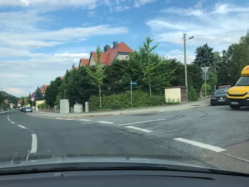

Gasthof Coschütz
Restaurant · Regional · 3.7 km
1 Kleinnaundorfer Straße, Dresden
We-Sa 11:00-23:00; Su 11:00-17:00
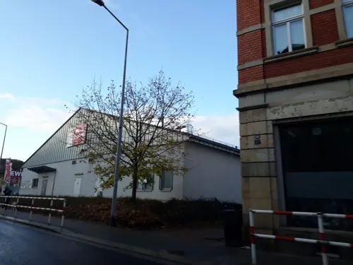
Wirtshaus Alte Schmiede
Restaurant · Regional · 1.0 km
Andere Öffnungszeiten nach Vereinbarung
246 Dresdner Straße, Freital
Mo-We 11:00-14:00, 17:00-21:00; Th off, Fr 11:00-14:00,...
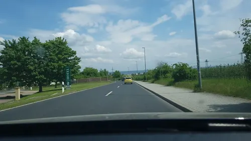
Albertheim
Restaurant · German · 3.5 km
23 Elbtalblick
Mo-Fr 11:30-15:00,17:00-24:00; Sa,PH 11:30-24:00; Su 11:30-22:00
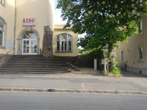
Bar & Restaurant Kedo
Diner · American · 4.3 km
208 Kesselsdorfer Straße, Dresden
Tu-Th,Su 18:00-23:00, Fr,Sa 18:00-24:00
Casa Vina
Restaurant · Italian, Vietnamese, Pizza · 2.7 km
143 Karlsruher Straße, Dresden
Mo-Tu off; We-Th 11:30-14:00,17:30-22:00; Fr-Sa...

Brasserie Ehrlich
Restaurant · German · 3.4 km
1 Wiesenweg, Freital
Mo-We off "nach Absprache"; Th-Sa 17:00+; Su 12:00-14:00,17:00+;...

Erblehngericht Somsdorf
Restaurant · German · 4.2 km
9 Höckendorfer Straße, Freital
We-Sa 17:00-23:00; Su 11:30-14:30,17:00-20:00
128 more on the map.
History
The town's recorded history begins with the well-known Dresden Document (Dresdner Urkunde) of 1206 in which noblemen appear to be named after Potschappel, Döhlen and Wurgwitz. The fact that these are mentioned for the first time in the document is pure coincidence, because Potschappel and Wurgwitz had probably existed for several centuries, perhaps since the 9th century. There is no further mention of the lords of Potschappel until the year 1309, but the lords of Döhlen are referred to in 1228 with the appearance of Arnold "de Zukerade" (the first mention of Zauckerode). The Potschappel line may have become the lords of Sürßen, some of whom appear to have moved to Upper Lusatia. There is some likelihood that this was a line of vassals of the burgraves of Dohna, who were heavily involved in the colonisation and expansion of their estates in the areas of Rabenau and Dippoldiswalde. The lords of Wurgwitz, whose history is readily traceable, were simultaneously colonising land at the behest of the Bishop of Meissen and were - at least under Bruno of Porstendorf - close allies. According to the Dresden Document, other noblemen named after Wurgwitz are encountered until the 15th century. Most of the districts of Freital were mentioned for the first time in the 14th or even in the 15th century.
Read more of the history
The early modern history of the present-day Freital is closely linked with the history of coal mining in the Döhlen Basin, which is part of the territory of Freital today. Mining was mentioned for the first time in 1549.
The ducal official, Hans Biener Moritz, was granted coal mining privileges by the Duke of Saxony. It has been passed down that coal had been discovered earlier, but only a few farmers were able to mine it from just below the surface in order to gather fuel for their own needs. In 1571, coal was mined for the first time in Burgk and then three years later in Potschappel. When the upper seams of coal were exhausted the shafts fell into disuse.
In 1743, the so-called coal mandate was passed, which gave landowners the right to mine the coal on their property. By the mid-18th century, about 30 small businesses had been founded, but due to their small size and insufficient experience they were fared poorly in the face of competition.
This situation changed with the onset of industrialisation. The Kingdom of Saxony wanted its share. In 1799, the Leopold-Erbstolln pit was acquired, followed in 1806 by the estates of Zauckerode and Döhlen, together with all the mining rights in the Potschappel coal fields. By 1822, all companies west of the Weißeritz had been added. From the many small businesses, a single, large enterprise had now been created, the "Royal Saxon Coal Company of Zauckerode" (Königlich–Sächsisches Steinkohlenwerk Zauckerode).
On the other side of the Weißeritz, businesses merged in 1819, when Carl Friedrich August Krebß (later Baron of Burgk) became the new owner of the manor at Burgk. He inherited five mineshafts and bought nearby coalfields. Afterwards he founded the "Baron of Burgke Coal and Iron Works" (Freiherrlich von Burgker Steinkohlen- und Eisenhüttenwerke).
During this centralization of ownership, there was rapid development in technology and the related industry. The upswing was economically so significant that coal mining around the area of Plauen (Plauenscher Grund) was technically and organizationally ranked among the best in Germany for several decades, roughly until the 1870s. There were many technical innovations, such as the "wet jigger" (nasse Siebsetzer) in 1810 and the first steam engines in 1820.
In 1823, coal began to be coked in Burgk and, from 1828, the first gas was produced. As a result, Burgk, became the first village in the world to have public gas lighting. In 1842, the first Saxon smelting furnace entered service. It was located in the area of Burgk iron works. In order to extract the large quantities of water from the pits, water management structures had to be built, such as the Tiefe-Weißeritz-Stolln (1800–1838) and the Tiefe Elbstolln (1817–1836).
On 2 August 1869, there was a firedamp explosion in the pits of Segen-Gottes-Schaft and Neuhoffnungschacht in the Burgk coal mines, in which 276 miners died. This disaster is recalled by a recalled a monument at the Segen-Gottes-Schaft near the Windberg.
On 1 October 1921 the villages of Deuben, Döhlen and Potschappel merged to form the town of Freital. The first discussions about such a merger had taken place at the end of the 19th century. Because no name for the new town had been accepted, there was a competition for the best name. Suggestions included "Deupodö-Stadt" (by Deuben, Potschappel and Döhlen), or "Dreistadt". In the end, a proposal by town councillor Herman Henker to call the new town "Freital" ("free valley") was accepted.
In 1924, Freital, which had hitherto come under the district (Amtshauptmannschaft) of Dresden-Altstadt, was made an independent town within the Kreishauptmannstadt of Dresden.
From the History section of Freital on Wikipedia, under CC BY-SA 4.0.
More about Freital
Geography
Freital is located southwest of Dresden in the Döhlen Basin, through which the Weißeritz flows from south-west to north-east. The Windberg hill, is the town's local mountain and well-known landmark, rising about 100 metres (330 ft) above the valley floor. The lowest part of the town is the point where the Weißeritz enters the territory of the city of Dresden (about 195 metres (640 ft) above sea level).
The two rivers, the Red Weißeritz and Wild Weißeritz, merge in Hainsberg, a district of Freital. Other tributaries of the combined Weißeritz in the Freital area are the Wiederitz, Poisenbach and smaller, mainly canalized streams like the Vorholzbach, Burgker Bach, the Birkigter Bach, the Somsdorfer Bach and the Weißiger Bach. There are no natural lakes; the tailing pond near the slag heap and the Zauckerode retention basin were both constructed in the 20th century.
Geologically, the Döhlen Basin is a Rotliegendes depression that was formed at the end of the Carboniferous period. It is located between the Elbe Valley zone and the Ore Mountain gneiss massif.
In the northeast Freital borders on the state capital of Dresden. Neighbouring municipalities in Sächsische Schweiz-Osterzgebirge are from the east and clockwise: Bannewitz, Rabenau, Höckendorf, Tharandt and Wilsdruff.
From the Wikipedia article Freital, under CC BY-SA 4.0.
Notable people from Freital
 Tom StarkeGerman association football playerPhoto: Rufus46, CC BY-SA 3.0
 Anne MatthesGerman volleyball playerPhoto: Ailura, CC BY-SA 3.0 at
 Tim Schreiberfootball playerPhoto: Steffen Prößdorf, CC BY-SA 4.0
 Anna-Konstanze SchröderGerman politician (born 1980)Photo: Susie Knoll, CC BY-SA 4.0
- Helmut RolederGerman football player
- Andreas SchulzEast German rower
- Nico WaltherGerman bobsledder
- Uwe BewersdorfEast German pair skater
- Jens Kruppaswimmer
- Ellen KiesslingGerman and East German middle-distance runner
- Klaus EmmerichGerman film director and screenwriter
- Daniel RosinGerman footballer
Born in Freital, according to Wikidata (CC0). Each name links to its Wikipedia article.
Where to stay26
Churches and places of worship31
Shopping34
Gas and EV charging14
Schools, colleges and libraries36
Healthcare11
Helios Weißeritztal-Kliniken Klinikum Freital
Hospital · 1.1 km
7 Bürgerstraße, Freital
Map of Freital
250 places. The map loads OpenStreetMap tiles when you open it.
Getting there and nearby towns
Dresden Airport (DRS) is the nearest airport with scheduled flights listed in OpenStreetMap, 17 km away.
- Dresden-Gittersee map
- Gorbitz 5 km north, about 5 min by car
- Bannewitz 5 km east, about 5 min by car
- Löbtau 6 km northeast, about 6 min by car
- Dresden 8 km northeast, about 8 min by car
- Wilsdruff 10 km northwest, about 10 min by car
- Mickten 10 km northeast, about 10 min by car
- Radebeul 12 km north, about 12 min by car
- Dippoldiswalde 12 km south, about 12 min by car
- Klotzsche 15 km northeast, about 15 min by car
- Coswig 15 km north, about 15 min by car
Drive times are estimates from straight-line distance, not routes.
Towns near Freital


Keep exploring
Local news
Headlines from INDB.
Reviews, tips and questions
Loading what members have shared...
Sources and licences
- GeoNames (CC BY 4.0): population, coordinates, regions and time zone
- Mapillary (see each image): photos
- OpenStreetMap contributors (ODbL 1.0): places, airports, map data
- Wikidata (CC0 1.0): elevation, founding date, time zone, website, landmarks and historic places
- Wikimedia Commons (see each image): photos
- Wikipedia (CC BY-SA 4.0): overview and history text
Photo credits
- Freital-pano, User:Kolossos, CC BY-SA 3.0
- City-Center Freital 2021-02 3, Hgzh, CC BY-SA 4.0
- Hüttengrundbach Höhe Neumarkt Freital 2021-02 2, Hgzh, CC BY-SA 4.0
- Technologie- und Gründerzentrum Freital 2021-02 3, Hgzh, CC BY-SA 4.0
- City-Center Freital 2021-02 2, Hgzh, CC BY-SA 4.0
- Technologie- und Gründerzentrum Freital 2021-02 4, Hgzh, CC BY-SA 4.0
- Bahnhofstraße Freital 2021-02, Hgzh, CC BY-SA 4.0
- Hüttengrundbach Höhe Neumarkt Freital 2021-02 1, Hgzh, CC BY-SA 4.0
- Technologie- und Gründerzentrum Freital 2021-02 6, Hgzh, CC BY-SA 4.0
- Technologie- und Gründerzentrum Freital 2021-02 2, Hgzh, CC BY-SA 4.0
- Neumarkt Freital 2021-02 4, Hgzh, CC BY-SA 4.0
- Dresdner Straße Höhe Neumarkt Freital 2021-02, Hgzh, CC BY-SA 4.0
- Technologie- und Gründerzentrum Freital 2021-02 7, Hgzh, CC BY-SA 4.0
- Technologie- und Gründerzentrum Freital 2021-02 5, Hgzh, CC BY-SA 4.0
- 2020 Freital City Center Lageplan, Geri-oc, CC0
- Stadthaus Dresdner Straße 209 Freital 2021-02 4, Hgzh, CC BY-SA 4.0
- 2021 Freital Dresdner Straße 207 Rückansicht (DRK Ärztehaus), Geri-oc, CC0
- Freital Krankenhaus mit Sankra 1957, Freital, CC0
- City-Center Freital 2021-02 4, Hgzh, CC BY-SA 4.0
- Flood in Freital 2002. 080, Dieter Rebhahn, CC BY-SA 4.0
- 2021 Freital Dresdner Straße 205 Rückansicht (AOK), Geri-oc, CC0
- Neumarkt Freital 2021-02 2, Hgzh, CC BY-SA 4.0
- Technologie- und Gründerzentrum Freital 001, Loracco, CC BY-SA 3.0
- Technologie- und Gründerzentrum Freital 002, Loracco, CC BY-SA 3.0
- 2021 Freital Dresdner Straße 203 Rückansicht (Polizeiposten Freital), Geri-oc, CC0
- City-Center Freital 2021-02 1, Hgzh, CC BY-SA 4.0
- Stadthaus Dresdner Straße 209 Freital 2021-02 3, Hgzh, CC BY-SA 4.0
- Stadthaus Dresdner Straße 209 Freital 2021-02 2, Hgzh, CC BY-SA 4.0
- City-Center Deuben (Freital) 001, Loracco, CC BY-SA 4.0
- Stadthaus Dresdner Straße 209 Freital 2021-02 1, Hgzh, CC BY-SA 4.0
- Neumarkt Freital 2021-02 1, Hgzh, CC BY-SA 4.0
- Technologie- und Gründerzentrum Freital 2021-02 1, Hgzh, CC BY-SA 4.0
- 2019 Freital Parken Citycenter, Geri-oc, CC0
- Building Dresdner Straße 213 Freital, Loracco, CC BY-SA 4.0
- 2020 Freital 'Tauziehen' von Olaf Stoy aufgestellt am 8. Mai 2020, Geri-oc, CC0
- 2020 Freital Plakette Neumarkt zur Stadtgründung, Geri-oc, CC0
- 2021 Freital Dresdner Straße 209 Rückansicht (Ärztehaus), Geri-oc, CC0
- Babisnauer Pappel 2, Frank Ulbricht, CC BY-SA 3.0
- Hoftheater-Dresden-19-Jh, Karl Heinrich Beichling, Public domain
- Arolsen Klebeband 15 059, Johann Oswald Harms, Public domain
- Dresdens Festungswerke im Jahre 1811 Abb 09, Friedrich August Kannegiesser (1768–1845), Public domain
- Erstes Opernhaus Sempers ca1850 1860, Carl Täubert, Public domain
- Dresden - Semperoper - 2013, Avda, CC BY-SA 3.0
- Schauspielhaus Dresden, Aconcagua, CC BY-SA 3.0
- Dresden Elbterrasse, Immanuel Giel, CC BY-SA 3.0
- ZOO Dresden, Wakowlk, CC BY-SA 3.0
- Dresden Anglikanische Kirche. All Saints Church. Aufnahme um 1875, Unknown author Unknown author, Public domain
- Dresden-Annenkirche, User:Kolossos, CC BY-SA 3.0
- Aquarell der Dresdner Sophienkirche, Christian Gottlob Hammer, Public domain
- Dresden Hochschule für Bildende Kuenste 2, X-Weinzar, CC BY-SA 2.5
- Wettiner gymnasium dresden, Sirfalas, CC BY-SA 4.0
- Luftgaukommando dresden2, Lysippos, CC BY-SA 3.0
- TU-Dresden-Georg-Schumann-Bau, Hullbr3ach, CC BY-SA 2.5
- Hochschule für Technik und Wirtschaft (HTW) Dresden - Zentralgebäude, Campus Friedrich List Platz, HTW Dresden (Fotograf: Peter Sebb), CC BY-SA 3.0
- 20070905060MDR Freital-Hainsberg Hoffnungskirche, Jörg Blobelt, CC BY-SA 4.0
- Bahnhof Freital-Birkigt, R.D. - Rolf-Dresden, CC BY 3.0
- FTL-Somsdorf-Kirche-2, SchiDD, CC BY-SA 4.0
- Niederhermsdorfer Hof (1, Freital-Wurgwitz, Oberhermsdorfer Straße 1), Inkowik, CC BY-SA 3.0
- Königlich-Sächsische Triangulirung Station 77 Opitzhöhe 01, Derbrauni, CC BY-SA 4.0
- DD-SaalhausenerStr-Schule, SchiDD, CC BY-SA 4.0
- Deutsches Stuhlbaumuseum 02, Derbrauni, CC BY-SA 4.0
- DD-Bienertpark-Plauen-03, SchiDD, CC BY-SA 4.0
- DD-Bienertpark-Dölzschen-12, SchiDD, CC BY-SA 4.0
- 20200531220DR Dresden-Coschütz Robotron Heilbronner Straße 21, Jörg Blobelt, CC BY-SA 4.0
- DD-Gittersee-Kirche-3, SchiDD, CC BY-SA 4.0
- Cunnersdorf-Bahnhof, SchiDD, CC BY 3.0
- 2016 Freital Katholische Kirche, Geri-oc, CC0
- BSZ Otto Lilienthal Freital-Burgk 2021-02 5, Hgzh, CC BY-SA 4.0
- Dresden, Gorbitzer Park, 17.6.2.40-040218, Albrecht Voß, CC BY-SA 4.0
- 2015 Pesterwitz Bauernmarkt im Gut Pesterwitz, Geri-oc, CC0
- 2017 Freital Burgk Bergbaumuseum, Geri-oc, CC0
- 2016 Freital Brunnen Freitaler Nase, Geri-oc, CC0
- FTL-Franzosensteine-3, SchiDD, CC BY-SA 4.0
- 2015 Freital unter Denkmalschutz Jochhöh-Schlösschen, Geri-oc, CC0
- Winterwanderung im Rabenauer Grund (3187803871), Martin Hey from Dresden, Germany, CC BY 2.0
- 2017 Freital Potschappel Goldener Löwe, Geri-oc, CC0
- 2017 Freital Hainsberg Gästehaus am Backofenfelsen, Geri-oc, CC0
- 2017 Pesterwitz Panorama Restaurant und Pension, Geri-oc, CC0
- 2018 Freital-Kleinnaundorf Friedenskapelle, Geri-oc, CC0
- 2015 Döhlen Lutherkirche, Geri-oc, CC BY-SA 3.0
- 2021 Freital Deuben Christuskirche, Geri-oc, CC0
- 2015 Potschappel Emmauskirche, Geri-oc, CC0
- Bibliothek Freital Zweigstelle Zauckerode, Geri-oc, CC0
- 20260226.Freital.Oskarshausen.-012, Bybbisch94, CC BY-SA 4.0
- 2023-06-03 Luftbad Dölzschen, Dresden, 01, Stefan Kühn, CC0
- Dresden, Kleinnaundorfer Straße 1, Gasthof Coschütz, 17.6.2.40-050759, Albrecht Voß, CC BY-SA 4.0
- Street-level photo, thomas, CC BY-SA 4.0
- Street-level photo, bejotel, CC BY-SA 4.0
- Street-level photo, thomas, CC BY-SA 4.0
- Street-level photo, thomas, CC BY-SA 4.0
- Street-level photo, thomas, CC BY-SA 4.0
- Street-level photo, thomersch, CC BY-SA 4.0
- Street-level photo, thomas, CC BY-SA 4.0
- Street-level photo, bejotel, CC BY-SA 4.0
- Street-level photo, juwie69, CC BY-SA 4.0
- Street-level photo, bejotel, CC BY-SA 4.0
- Street-level photo, fahrradfahrer, CC BY-SA 4.0
- Street-level photo, rororo, CC BY-SA 4.0
- Street-level photo, canislupus, CC BY-SA 4.0
- Street-level photo, robot8a, CC BY-SA 4.0
- Street-level photo, atze02, CC BY-SA 4.0
- Street-level photo, Tatfahren, CC BY-SA 4.0
- Street-level photo, fell3, CC BY-SA 4.0
- Street-level photo, Tatfahren, CC BY-SA 4.0
- Street-level photo, thomas, CC BY-SA 4.0
- Street-level photo, fahrradfahrer, CC BY-SA 4.0
- Street-level photo, thomas, CC BY-SA 4.0
- Street-level photo, thomersch, CC BY-SA 4.0
- Street-level photo, canislupus, CC BY-SA 4.0
- Street-level photo, thomersch, CC BY-SA 4.0
- Street-level photo, thomas, CC BY-SA 4.0
- Street-level photo, thomas, CC BY-SA 4.0


Page built November 9, 2026. Spotted a mistake? Tell us or suggest a place.