


Sai Mai, Thailand
เขตสายไหม
Sai Mai is a city of 188,123 people in Bangkok, Thailand, founded in November 21, 1997.
Why visit Sai Mai
Townapedia lists 8 museums and landmarks, 25 parks and trails, 126 places to eat, 31 places to stay and 1 attraction in and around town.
Highlights include Dream World, Royal Thai Air Force Museum, Constitution Defense Monument and Safari World.
Weather in Sai Mai
Forecast from MET Norway (CC BY 4.0). Full forecast
About Sai Mai
Sai Mai (Thai: สายไหม, pronounced [sǎːj mǎj]) is one of the 50 districts (khet) of Bangkok, Thailand. It is bounded by (from north clockwise): Lam Luk Ka district of Pathum Thani province; Khlong Sam Wa, Bang Khen and Don Mueang of Bangkok.
From the Wikipedia article Sai Mai district (this version), under CC BY-SA 4.0.
Photos of Sai Mai


Things to do1

Museums and landmarks8


Constitution Defense Monument
Monument and historic site · 7.3 km
Monument dedicated to the victory of Siamese gorvernment led by People's Party in the conflit with Boworadet rebellion led by royalist...
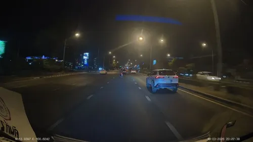

National Memorial
Monument and historic site · 4.4 km
National Memorial of Thailand

Parks, trails and playgrounds25

Safari World
Park · 8.7 km
Tourist attraction in Bangkok that consists of two parks named Marine Park and Safari Park




13 more on the map.
Restaurants and cafes126
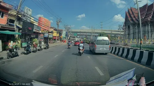
สินาทอาหารเจ Sinart Vegan
Restaurant · Thai · 4.8 km
Thanon Song Prapha, ดอนเมือง Don Mueang
Mon-Sun 08:30-17:00
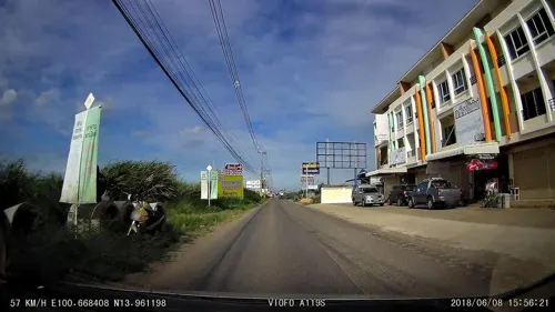
Kraichan Cafe & Bar
Cafe · Coffee Shop, Asian, Regional, Diner · 5.1 km
88/11 ถนนโชติเวช
Mo-Su 10:00-24:00
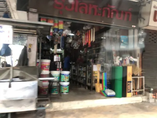

ยายแดง ก๋วยเตี๋ยวเรือโบราณ ลำลูกกาคลอง 2
Restaurant · Noodle, Thai · 4.6 km
10/16 ถนน ซอยลำลูกกา 11
Mo-Su 09:00-20:00
Love Station Rangsit-Klong1
Restaurant · Thai · 5.6 km
106/42 ปทุมธานี
Mo-Su 17:00-00:00
แฝดก๋วยเตี๋ยวไก่มะระ คลองสองทับสาม
Restaurant · Noodle · 4.9 km
สะพานดารุณี วัดแก้ว
Su-Tu 09:30-17:00; We-Sa 09:00-17:00

Lamune
Cafe · Coffee Shop · 2.6 km
Mo-Fr 07:30-16:00; Sa-Su 09:00-16:00

Lemonmade Cake เค้กวันเกิด
Bakery · 4.7 km
95/1 เสมาฟ้าคราม
11:30-21:00
Nittaya Kai Yang
Restaurant · Japanese · 3.8 km
Mo-Su 10:00-22:00
Samyan Rice Porridge
Restaurant · Thai · 4.0 km
Mo-Su 05:00-23:00
114 more on the map.
History
Sai Mai was the name of a muban (village) in tambon (sub-district) Khu Khot, Lam Luk Ka District, Pathum Thani Province. It was transferred to Bang Khen district and promoted to subdistrict (tambon) in 1940. Due to the growth of population in the area, Sai Mai was elevated to district status effective 21 November 1997 to improve service and administration.
The name of the village, "Sai Mai" (which can be interpreted as "late or not?"), is believed to have come from a common question in the past. Because the area was once so far from downtown, people often asked, "Will we be late getting here ?" The name has no connection to the sweet snack roti sai mai.
The dominant feature of the district is Khlong (canal) Lat Phrao. The canal is thought to have been dug in the early period of the Rattanakosin Kingdom (1782–1932). Khlong Lat Phrao is one of nine canals in Bangkok that drains rainwater flowing into the city from northern Thailand, but it has been neglected for decades and clogged with refuse. In January 2016, 1.6 billion baht was allocated to rehabilitate the canal, widen it to 38 metres and deepen it to four metres. Construction is to be completed by June 2019.
From the History section of Sai Mai district on Wikipedia, under CC BY-SA 4.0.
Where to stay31
N-Siri Resort & Hotel เอ็นสิริ รีสอร์ท แอนด์ โฮเทล
Motel and hotel · 5.7 km
99/304/1 ลำลูกกาซอย71, ปทุมธานี
N-Siri Resort & Hotel โรงแรมเอ็นสิริ
Motel and hotel · 5.7 km
99/304/1 Lam Luk ka 71, Pathum Thani
Churches and places of worship15
Wat Phon Phra Ruang Prasit
Place of worship · Thai Mahanikaya · 4.4 km
Shopping41
Growpets โกรว์เพ็ทช็อป สาขาพหลโยธิน54
Grocery · 2.4 km
17/8 ซอยพหลโยธิน 54/1 แยก 4
Gas and EV charging23
Schools, colleges and libraries35
โรงเรียนสวนอักษร
School · 5.9 km
100/99 หมู่ที่ 12 ซอย ปาร์ค 8 วังทองริเวอร์ปาร์ค พหลโยธิน, คูคต
Healthcare17
คลังยาอาม่า - ตลาดสี่มุมเมือง
Clinic and pharmacy · 5.2 km
355/115-16 หมู่ที่ 15 ซอย พหลโยธิน 77
Map of Sai Mai
250 places. The map loads OpenStreetMap tiles when you open it.
Getting there and nearby towns
Don Mueang International Airport (DMK) is the nearest airport with scheduled flights listed in OpenStreetMap, 5 km away.
- Chatuchak 14 km southwest, about 14 min by car
- Lat Phrao 14 km south, about 14 min by car
- Bueng Kum 15 km south, about 15 min by car
- Mueang Nonthaburi 16 km southwest, about 16 min by car
- Pak Kret 16 km west, about 16 min by car
- Din Daeng 17 km southwest, about 17 min by car
- Bang Kapi 17 km south, about 17 min by car
- Bang Sue 17 km southwest, about 17 min by car
- Dusit 21 km southwest, about 21 min by car
- Bangkok 24 km southwest, about 24 min by car
Drive times are estimates from straight-line distance, not routes.
Towns near Sai Mai


Keep exploring
Local news
Headlines from INDB.
Reviews, tips and questions
Loading what members have shared...
Sources and licences
- GeoNames (CC BY 4.0): population, coordinates, regions and time zone
- Mapillary (see each image): photos
- OpenStreetMap contributors (ODbL 1.0): places, airports, map data
- Wikidata (CC0 1.0): elevation, founding date, time zone, website, landmarks and historic places
- Wikimedia Commons (see each image): photos
- Wikipedia (CC BY-SA 4.0): overview and history text
Photo credits
- Soi Phahon Yothin 54, Sai Mai, Phoebus 28, CC BY-SA 4.0
- Khlong Thanon, Sai Mai, Bangkok 10220, Thailand - panoramio, Phong Phat G, CC BY-SA 3.0
- Dream World, Thailand, No machine-readable author provided. Manop assumed (based on copyright claims)., CC BY-SA 3.0
- Navaratna Srichamara at Lak Si Monument, เนาวรัตน์ ศรีจามร (Navaratna Srichamara), Public domain
- Safari World, Lerdsuwa, CC BY-SA 3.0
- Grumman F8F-1 Bearcat at the Royal Thai Air Force Museum, Mztourist, CC BY-SA 3.0
- โรงพยาบาลภูมิพลอดุลยเดช1, Dharmadana, CC BY-SA 4.0
- วัดสายไหม3, Dharmadana, CC BY-SA 4.0
- โบสถ์วัดศูนย์หลัง, Parmanza, CC BY-SA 4.0
- วัดดอนเมือง กรุงเทพ 3, Dharmadana, CC BY-SA 4.0
- วัดหนองใหญ่ กรุงเทพ 1, Dharmadana, CC BY-SA 4.0
- วัดอยู่ดีบำรุงธรรม1, Dharmadana, CC BY-SA 4.0
- 2025-01-11 Water park Sai Mai, Pathumthani, CC BY-SA 4.0
- Royal Thai Air Force Museum - panoramio (5), Kasom SKULTAB, CC BY-SA 3.0
- ดร.เกริก, KrirkUniversity, CC BY-SA 4.0
- KhuKhot P&R Building2023, ยุทธนาสาระขันธ์, CC BY-SA 4.0
- Save One Go Markert near Yaek Kor Por Aor Station - 4 August 2025, Rynamoon, CC0
- Khu Khot, Lam Luk Ka District, Pathum Thani 12130, Thailand - panoramio (1), obarber in thailand, CC BY 3.0
- ชุมชนบ้านริมคลองสายใหม ตอนใต้ - panoramio, obarber in thailand, CC BY 3.0
- ชุมชนบ้านริมคลองสายใหม ตอนเหนือ - panoramio, obarber in thailand, CC BY 3.0
- Khu Khot, Lam Luk Ka District, Pathum Thani 12130, Thailand - panoramio (2), obarber in thailand, CC BY 3.0
- B.Kh17k-11-06 (30892-1232) (14733081526), Alec Wilson from Khon Kaen, Thailand, CC BY-SA 2.0
- B.Kh17k-4-06 (30677-1214) (14569397710), Alec Wilson from Khon Kaen, Thailand, CC BY-SA 2.0
- Nissan Serena (C23) 02, M.rJirapat, CC BY-SA 4.0
- วัดโพสพผลเจริญ1 - panoramio, obarber in thailand, CC BY 3.0
- บริเวรท่าน้ำวัดโพสพผลเจริญ - panoramio (5), obarber in thailand, CC BY 3.0
- ร้านขายของ ริมท่าน้ำวัดโพสพผลเจริญ - panoramio, obarber in thailand, CC BY 3.0
- วัดโพสพผลเจริญ2 - panoramio, obarber in thailand, CC BY 3.0
- Khu Khot, Lam Luk Ka District, Pathum Thani 12130, Thailand - panoramio, obarber in thailand, CC BY 3.0
- Fighter formation (14569395750), Alec Wilson from Khon Kaen, Thailand, CC BY-SA 2.0
- บริเวรริมคลองหน้าวัดโพสพผลเจริญ1 - panoramio, obarber in thailand, CC BY 3.0
- บริเวรท่าน้ำวัดโพสพผลเจริญ - panoramio, obarber in thailand, CC BY 3.0
- บริเวรหน้าวัดโพสพผลเจริญ5 - panoramio, obarber in thailand, CC BY 3.0
- บริเวรท่าน้ำวัดโพสพผลเจริญ - panoramio (2), obarber in thailand, CC BY 3.0
- บริเวรหน้าวัดโพสพผลเจริญ4 - panoramio, obarber in thailand, CC BY 3.0
- บ่อเลี้ยงเต่าบริเวรวัดโพสพผลเจริญ - panoramio (1), obarber in thailand, CC BY 3.0
- บริเวรท่าน้ำวัดโพสพผลเจริญ ปลาเยอะแยะมากมาย - panoramio, obarber in thailand, CC BY 3.0
- บ่อเลี้ยงเต่า - panoramio, obarber in thailand, CC BY 3.0
- บ่อเลี้ยงเต่าบริเวรวัดโพธิ์สพเจริญผล - panoramio, obarber in thailand, CC BY 3.0
- โบสถ์วัดโพสพผลเจริญ1 - panoramio, obarber in thailand, CC BY 3.0
- Street-level photo, ThailandCambodia, CC BY-SA 4.0
- Street-level photo, ThailandCambodia, CC BY-SA 4.0
- Street-level photo, ozflor, CC BY-SA 4.0
- Street-level photo, ozflor, CC BY-SA 4.0
- Street-level photo, lvl5, CC BY-SA 4.0
- Street-level photo, kirana, CC BY-SA 4.0
- Street-level photo, poramet, CC BY-SA 4.0
- Street-level photo, ThailandCambodia, CC BY-SA 4.0
- Street-level photo, ThailandCambodia, CC BY-SA 4.0
- Street-level photo, ThailandCambodia, CC BY-SA 4.0
- Street-level photo, ozflor, CC BY-SA 4.0


Page built November 10, 2026. Spotted a mistake? Tell us or suggest a place.