


Why visit Grimma
Townapedia lists 176 museums and landmarks, 28 parks and trails, 119 places to eat, 22 places to stay and 100 attractions in and around town.
Highlights include Bismarckturm (Grimma), Johannas Höh, Göschenhaus and Schloss Döben.
Weather in Grimma
Forecast from MET Norway (CC BY 4.0). Full forecast
About Grimma
Grimma (German pronunciation: [ˈɡʁɪma] ; Upper Sorbian: Grima, pronounced [ˈɡʁʲima]) is a town in Saxony, Central Germany, on the left bank of the Mulde, 25 kilometres (16 mi) southeast of Leipzig. Founded in c. 1170, it is part of the Leipzig district.
From the Wikipedia article Grimma (this version), under CC BY-SA 4.0.
Travel tips from other travellers: Grimma on Wikivoyage (CC BY-SA 4.0).
Things to do100

Bismarckturm (Grimma)
Scenic view · 3.0 km
Das 16 m hohe Bauwerk ist gleichzeitig Aussichts- und Wasserturm. Der Wasservorratsbehälter wurde im Keller des Bauwerkes installiert.
Turmweg, Grimma

Johannas Höh
Scenic view · 10.1 km
Der Rundturm wurde 1911 vom Burkartshainer Gutsherren gestiftet und 1986 wiedererrichtet. Er bietet einen guten Überblick über das...
24/7

Hofladen Otterwisch
Farm and orchard · 8.0 km
6c Wiesenstraße, Otterwisch
Tu-Fr 08:00-18:00; Sa 08:00-11:00; Mo,Su,PH off


Muldebrücke Kössern
Bridge · 7.0 km
Sechsbogige steinerne Straßenbrücke (K 8339) über die Freiberger Mulde, An der Muldenbrücke in Grimma OT Kössern

Viadukt Kössern
Bridge · 8.5 km
Viadukt Kössern, Eisenbahnbrücke über die Mulde, in Grimme OT Kössern. Muldentalbahn, Eisenbahnstrecke Borsdorf - Coswig


88 more on the map.
Museums and landmarks176




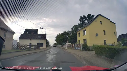

Königlich sächsischer Meilenstein
Monument and historic site · 9.5 km
Königlich sächsischer Stationsstein in Lauterbach, umfunktioniert zum Wegweiser

Transformatorenturm Klinga
Monument and historic site · 7.2 km
Kulturdenkmal in Sachsen: Turm ist eingeschossig, Klinkersockel, massiv, verputzt, auf quadratischem Grundriss, Laterne verschiefert,...
Krankenhausstraße, Parthenstein

Hängebrücke
Monument and historic site · 0.8 km
Hängebrücke erbaut 1924 - 1925 Fußgängerbrücke über die Mulde mit stadtseitigem Brückenhäuschen, Colditzer Weg in Grimma.


Königlich sächsischer Meilenstein
Monument and historic site · 3.5 km
Königlich sächsischer-Abzweigstein, steht in einer Hecke zwischen Gehweg und Parkplatz

Königlich sächsischer Meilenstein
Monument and historic site · 6.4 km
Königlich-Sächsischer-Ganzmeilensteinan der S11 in Kleinbardau, halb im Gehsteig versenkt
164 more on the map.
Parks, trails and playgrounds28


ArkaZien - Die verwunschene Erlebniswelt
Sports field and stadium · 3.4 km
ArkaZien - Die verwunschene Erlebniswelt
26 Neue Grimmaer Straße, Grimma
Tu-Th,Sa,Su 10:00-18:00; Mo,Fr off
Muldentalbad-Kleinbothen
Sports field and stadium · 5.4 km
29 Badstraße, Grimma
May,Sep 10:00-18:00; Jun 10:00-21:00; Jul,Aug 09:00-21:00



16 more on the map.
Restaurants and cafes119

Zur Wassermühle
Restaurant · Regional · 3.5 km
Historisches Gasthaus "Zur Wassermühle" Höfgener Dorfstraße 10 in Grimma OT Höfgen
10 Höfgener Dorfstraße, Grimma
Mo 11:00-22:00; Fr 17:00-22:00; Tu-Th off; Sa,Su 11:00-22:00
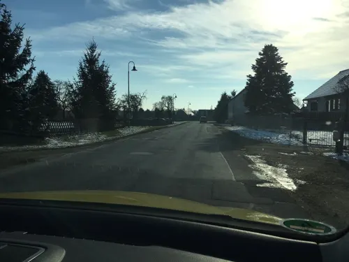
Delphi
Restaurant · Greek · 8.4 km
Haustiere erlaubt
70 Hauptstraße, Otterwisch
Mo-Su 11:30-14:00,17:00-22:30

Bäckerei-Cafè Wolf
Cafe · German · 10.0 km
25 Bahnhofstraße, Naunhof
Mo-Fr 05:30-17:00; Sa 05:30-12:00; Su 07:00-11:00; PH off
CAFÉ MARGRET
Cafe · German · 10.4 km
2 Markt, Naunhof
Mo-Fr 07:00-13:00; Sa 07:00-11:00; Su 07:30-11:30
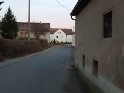
Gasthof Kleinbothen
Restaurant · German · 5.7 km
10 Badstraße, Grimma
Mo,Tu,Fr,Sa 11:00-22:00; We,Su 11:00-16:00
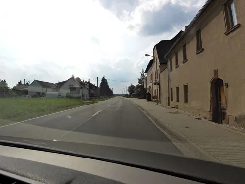
Goldene Krone
Restaurant · German · 10.9 km
44 Leipziger Straße, Belgershain
Mo-We 16:00-21:00; Fr,Sa 16:00-22:00; Th,Su,PH off

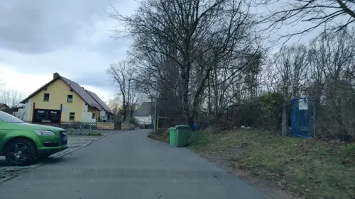
Hudelburg
Restaurant · German · 10.8 km
1 Kirschallee, Bad Lausick
Sep-May Mo,Tu,Th 17:00-22:00; Sep-May,Jun-Aug Fr 15:00+;...
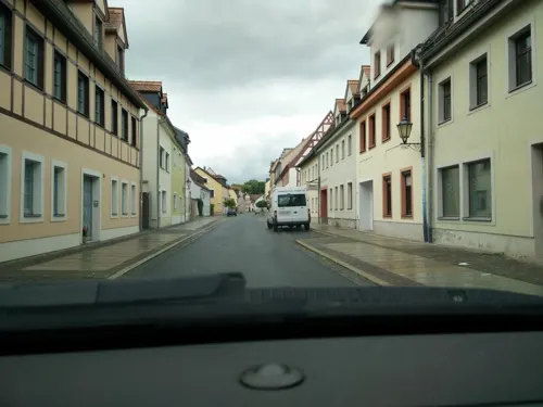

Mc Döner
Restaurant · Kebab · 1.9 km
2 Schillerstraße, Grimma
Tu-Fr 10:00-21:00; Sa 11:00-21:00; Su 12:00-21:00; Mo off
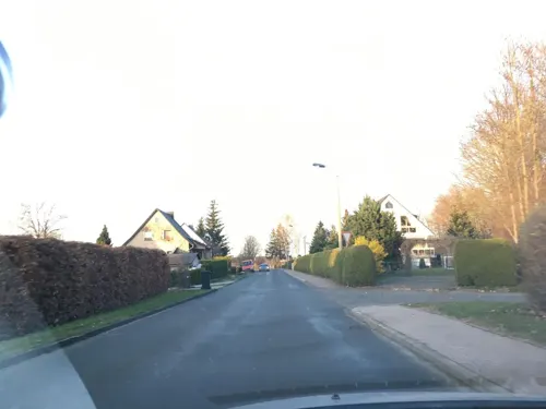


Restaurant & Bowling Waldschänke
Restaurant · German · 10.3 km
42 Badstraße, Bad Lausick
Mo-Th 17:00-21:00; Fr 16:00-23:00; Sa 11:30-23:00; Su 11:30-21:00
Restaurant Korfu
Restaurant · Greek · 10.0 km
7 Lindenstraße, Naunhof
Mo-Th,Su 17:00-22:00; Th-Su 11:00-14:00; Fr-Sa 17:00-23:00
107 more on the map.
History
Grimma is of Sorbian origin and was first documented in 1065. The Margraves of Meissen and the Electors of Saxony often resided at the castle in the town.
The town was chosen as one of three government elite boarding schools, the 'Princely Schools of Saxony', in 1550. The purpose of these schools was to educate future civil servants and to prepare them for further studies at universities which is why a number of historical personalities are biographically related to this rather small town. The Gymnasium St. Augustine still exists today as one of only a few public boarding schools in Saxony.
Grimma was the scene of witch trials between 1494 and 1701. At least two women were executed as witches.
Due to the town being located at the second main railway line between Leipzig and Dresden (via Meissen), the town developed well in the 19th century.
The town was affected by heavy flooding in 2013. Work had by this time started on the construction of flood barriers, but their completion had been delayed by local opposition.
In 2017, the Confessional Evangelical Lutheran Conference held their international, triennial convention in Grimma.
From the History section of Grimma on Wikipedia, under CC BY-SA 4.0.
Where to stay22
Churches and places of worship34
Shopping31
Gas and EV charging14
Schools, colleges and libraries31
Evangelische Schule für Sozialwesen "Luise Höpfner"
School · Evangelical · 10.9 km
26 Badstraße, Bad Lausick
Healthcare12
Map of Grimma
250 places. The map loads OpenStreetMap tiles when you open it.
Getting there and nearby towns
Leipzig-Altenburg Airport (AOC) is the nearest airport with scheduled flights listed in OpenStreetMap, 31 km away.
- Wurzen 15 km north, about 15 min by car
- Taucha 23 km northwest, about 23 min by car
- Markkleeberg 25 km west, about 25 min by car
- Leipzig 27 km northwest, about 27 min by car
- Oschatz 28 km east, about 28 min by car
- Mittweida 33 km southeast, about 33 min by car
- Penig 33 km south, about 33 min by car
- Markranstädt 36 km west, about 36 min by car
- Burgstädt 36 km south, about 36 min by car
- Schkeuditz 39 km northwest, about 39 min by car
Drive times are estimates from straight-line distance, not routes.
Local news
Headlines from INDB.
Reviews, tips and questions
Loading what members have shared...
Sources and licences
- GeoNames (CC BY 4.0): population, coordinates, regions and time zone
- Mapillary (see each image): photos
- OpenStreetMap contributors (ODbL 1.0): places, airports, map data
- Wikidata (CC0 1.0): elevation, founding date, time zone, website
- Wikimedia Commons (see each image): photos
- Wikipedia (CC BY-SA 4.0): overview and history text
Photo credits
- Grimma, Markt, Rathaus-005, Tilman2007, CC BY-SA 3.0
- August-Bebel-Str 14 (Grimma) - Lapidarium 03, Cookroach, CC BY-SA 4.0
- August-Bebel-Str 14 (Grimma) - Lapidarium 01, Cookroach, CC BY-SA 4.0
- August-Bebel-Str 14 (Grimma) - Lapidarium 04, Cookroach, CC BY-SA 4.0
- August-Bebel-Str 14 (Grimma) - Ansicht Lapidarium, Cookroach, CC BY-SA 4.0
- August-Bebel-Str 14 (Grimma) - Lapidarium 02, Cookroach, CC BY-SA 4.0
- August-Bebel-Str 14 (Grimma) - Grabmale Fam.Mey, Cookroach, CC BY-SA 4.0
- August-Bebel-Str 14 (Grimma) - Leichenhalle, Cookroach, CC BY-SA 4.0
- August-Bebel-Str 14 (Grimma) - Grabmal der Pfarrer, Cookroach, CC BY-SA 4.0
- GrimmaPost, Jwaller, CC BY-SA 3.0
- August-Bebel-Str 14 (Grimma) - Stele am Mittelweg, Cookroach, CC BY-SA 4.0
- Leipziger Str 20 (Grimma) 01, Cookroach, CC BY-SA 4.0
- Leipziger Str 18 (Grimma) 03, Cookroach, CC BY-SA 4.0
- Leipziger Str 20 (Grimma) 02, Cookroach, CC BY-SA 4.0
- 20190926.Grimma.Begräbniskirche Zum Heiligen Kreuz.-022, Bybbisch94, Christian Gebhardt, CC BY-SA 4.0
- Leipziger Str 17 (Grimma), Cookroach, CC BY-SA 4.0
- Straße des Friedens 1 - Leipziger Str 15 (Grimma), Cookroach, CC BY-SA 4.0
- August-Bebel-Str 14 (Grimma) - Grabmal Fam.Göschen, Cookroach, CC BY-SA 4.0
- 20190926.Grimma.Begräbniskirche Zum Heiligen Kreuz.-021, Bybbisch94, Christian Gebhardt, CC BY-SA 4.0
- August-Bebel-Str 14 (Grimma) - Säule am Mittelweg, Cookroach, CC BY-SA 4.0
- 20190926.Grimma.Begräbniskirche Zum Heiligen Kreuz.-023, Bybbisch94, Christian Gebhardt, CC BY-SA 4.0
- 20190926.Grimma.Begräbniskirche Zum Heiligen Kreuz.-017, Bybbisch94, Christian Gebhardt, CC BY-SA 4.0
- August-Bebel-Str 14 (Grimma) - Geläuthaus der Kirchglocken auf dem Friedhof, Cookroach, CC BY-SA 4.0
- GrimmaHusarendenkmal, Jwaller, CC BY-SA 3.0
- August-Bebel-Str 14 (Grimma) - Ansicht Friedhofswege, Cookroach, CC BY-SA 4.0
- 20190926.Grimma.Begräbniskirche Zum Heiligen Kreuz.-025, Bybbisch94, Christian Gebhardt, CC BY-SA 4.0
- August-Bebel-Str 14 (Grimma) - Grabmal E.R.Schille, Cookroach, CC BY-SA 4.0
- 20190926.Grimma.Begräbniskirche Zum Heiligen Kreuz.-014, Bybbisch94, Christian Gebhardt, CC BY-SA 4.0
- 20190926.Grimma.Begräbniskirche Zum Heiligen Kreuz.-024, Bybbisch94, Christian Gebhardt, CC BY-SA 4.0
- Grimma Husarendenkmal, Radler59 ( talk ), CC BY-SA 4.0
- 20190926.Grimma.Begräbniskirche Zum Heiligen Kreuz.-012, Bybbisch94, Christian Gebhardt, CC BY-SA 4.0
- August-Bebel-Str 14 (Grimma) - Grabmal Fam.Schleider, Cookroach, CC BY-SA 4.0
- Leipziger Str 18 (Grimma) 02, Cookroach, CC BY-SA 4.0
- 20190926.Grimma.Begräbniskirche Zum Heiligen Kreuz.-011, Bybbisch94, Christian Gebhardt, CC BY-SA 4.0
- 20190926.Grimma.Begräbniskirche Zum Heiligen Kreuz.-013.3, Bybbisch94, Christian Gebhardt, CC BY-SA 4.0
- August-Bebel-Str 14 (Grimma) - Grabplatte an Kirche, Cookroach, CC BY-SA 4.0
- 20190926.Grimma.Begräbniskirche Zum Heiligen Kreuz.-013.1, Bybbisch94, Christian Gebhardt, CC BY-SA 4.0
- 20190926.Grimma.Begräbniskirche Zum Heiligen Kreuz.-013.2, Bybbisch94, Christian Gebhardt, CC BY-SA 4.0
- 20190926.Grimma.Begräbniskirche Zum Heiligen Kreuz.-015, Bybbisch94, Christian Gebhardt, CC BY-SA 4.0
- August-Bebel-Str 14 (Grimma) - Friedhofskirche 02, Cookroach, CC BY-SA 4.0
- SchlossDoeben, Bilderguru22, Public domain
- Das Gymnasium St. Augustin, die einstige Landes- und Fürstenschule Grimma, von der Mulde aus, Holger Zürch, CC BY-SA 3.0
- Pöppelmannbrücke Grimma, Jana Maenz, CC BY-SA 3.0
- Haus Energie Großbothen, Saalebaer, CC0
- 2013 Muldental Grimma 037 Wehrkirche Höfgen, Steffen 962, CC0
- Bismarckturm Grimma, Marcel Dennhardt ( MacDevil ), CC BY-SA 3.0
- 20090321330MDR Grimma Frauenkirche, Jörg Blobelt, CC BY-SA 4.0
- KircheNerchau2018-8, Ghostwriter123, CC BY-SA 4.0
- Pomssen Kirche-01, Radler59, CC BY-SA 4.0
- Lauterbach Kgl Saechs MS, Radler59, CC BY-SA 3.0
- Koessern Eisenbahnbruecke Mulde-01, Radler59 ( talk ), CC BY-SA 4.0
- Grimma Haengebruecke-04, Radler59 ( talk ), CC BY-SA 4.0
- Kleinbardau Kgl Saechs MS, Radler59, CC BY-SA 3.0
- 15514-Großbothen-1913-Muldenbrücke bei Kössern-Brück & Sohn Kunstverlag, Brück & Sohn Kunstverlag Meißen, CC0
- Nitzschka Kirche-02, Radler59, CC BY-SA 4.0
- Johannashöh2, Jwaller, CC BY-SA 4.0
- Schoenbach Kirche1, Radler59, CC BY-SA 3.0
- Göschenhaus Schillerstr (Hohnstädt) 01, Cookroach, CC BY-SA 4.0
- DürrweitzschenKirche, Jwaller, CC BY-SA 3.0
- KössernJagdhaus2, Jwaller, CC BY-SA 4.0
- TrebsenKirche1, Jwaller, CC BY-SA 3.0
- Schillerstr 15 (Hohnstädt) - Dorfkirche, Cookroach, CC BY-SA 4.0
- DöbenKirche3, Jwaller, CC BY-SA 3.0
- RiffLausick, Tnemtsoni, CC BY-SA 3.0
- Klinga Transformatorenturm-01, Radler59 ( talk ), CC BY-SA 4.0
- Grossbardau Kgl Saechs MS-01, Radler59 ( talk ), CC BY-SA 4.0
- GrethenAlteSee, Jwaller, CC BY-SA 3.0
- Döbener Wald - Zugang Kastanienallee, Cookroach, CC BY-SA 4.0
- NSG Haselberg-Straßenteich IMG 1215, Michael Wolf ( Webseite ), CC BY-SA 3.0
- Mittelteich Rohrbach, Dendrolagus, CC BY-SA 3.0
- NSG Schmielteich Polenz IMG 1242, Michael Wolf ( Webseite ), CC BY-SA 3.0
- Hoefgen Gasthaus Wassermuehle, Radler59 ( talk ), CC BY-SA 4.0
- Fachwerkhof in Höfgen, Dguendel, CC BY-SA 3.0
- Grossbuch Kirche, Radler59 ( talk ), CC BY-SA 4.0
- Klinga Kirche, Radler59 ( talk ), CC BY-SA 4.0
- Station 107 Deditzhöhe, Radler59, CC BY-SA 3.0
- Juttapark-Mulde1, Jwaller, CC BY-SA 4.0
- Street-level photo, bejotel, CC BY-SA 4.0
- Street-level photo, shogun, CC BY-SA 4.0
- Street-level photo, AR88, CC BY-SA 4.0
- Street-level photo, frankenstein91, CC BY-SA 4.0
- Street-level photo, kopra, CC BY-SA 4.0
- Street-level photo, bejotel, CC BY-SA 4.0
- Street-level photo, kopra, CC BY-SA 4.0
- Street-level photo, shogun, CC BY-SA 4.0
- Street-level photo, zoegglmeyr, CC BY-SA 4.0
- Street-level photo, bejotel, CC BY-SA 4.0
- Street-level photo, bejotel, CC BY-SA 4.0
- Street-level photo, bejotel, CC BY-SA 4.0
- Street-level photo, bejotel, CC BY-SA 4.0
- Street-level photo, AR88, CC BY-SA 4.0
- Street-level photo, shogun, CC BY-SA 4.0
- Street-level photo, bejotel, CC BY-SA 4.0


Page built November 8, 2026. Spotted a mistake? Tell us or suggest a place.