


Pfullingen, Germany
Pfullingen is a town of 18,269 people in Baden-Wurttemberg, Germany.
Why visit Pfullingen
Townapedia lists 40 museums and landmarks, 39 parks and trails, 270 places to eat, 13 places to stay and 19 attractions in and around town.
Highlights include Kamino, Theater Reutlingen Die Tonne, Heimatmuseum and Kunstmuseum Reutlingen | konkret.
Weather in Pfullingen
Forecast from MET Norway (CC BY 4.0). Full forecast
About Pfullingen
Pfullingen (German pronunciation: [ˈpfʊlɪŋən] ; Swabian: Pfullenga) is a town in the district of Reutlingen, Baden-Württemberg, Germany. It is situated 3 km southeast of Reutlingen at the foot of the Swabian Alb.
From the Wikipedia article Pfullingen (this version), under CC BY-SA 4.0.
Things to do19







7 more on the map.
Museums and landmarks40


Kunstmuseum Reutlingen | konkret
Museum · 3.6 km
14 Eberhardstraße, Reutlingen
Tu-Su,PH 11:00-17:00; Th 11:00-20:00; Mo off; easter -2 days,Dec...

Naturkundemuseum
Museum · 3.1 km
4 Weibermarkt, Reutlingen
Mo-We,Fr,Sa 11:00-17:00; Th 11:00-19:00; Su,PH 11:00-18:00

Baumannsche Mühle / Trachtenmuseum
Museum
Trachten- und Mühlenmuseum
5/2 Josefstraße, Pfullingen
May-Oct Su,PH 14:00-17:00

Glashaus
Monument and historic site · 3.1 km
Ausstellungshaus und Veranstaltungsort
34 Oberamteistraße, Reutlingen
"Nur zu offiziellen Veranstaltungsterminen"


Kunstverein Reutlingen e.V.
Museum · 3.6 km
14 Eberhardstraße, Reutlingen
We-Fr 14:00-18:00, Sa,Su 11:00-17:00


Heimatmuseum Eningen
Museum · 3.4 km
3 Eitlinger Straße, Eningen unter Achalm
Apr-Oct Su[1] 14:00-17:00
28 more on the map.
Parks, trails and playgrounds39


Kreuzeiche Stadion
Sports field and stadium · 3.2 km
4 An der Kreuzeiche, Reutlingen



Frauenstraße/Volkspark
Playground · 3.2 km
Nov-Mar 08:00-20:00; Apr-Oct 08:00-21:00

27 more on the map.
Restaurants and cafes270

Restaurant Schützenhaus
Restaurant · Regional, German · 2.8 km
2 Mark (Gewand), Reutlingen
Tu-Sa 11:00-21:30; Su,PH 11:00-21:30; Mo off

Bangalore Bistro
Restaurant · Indian, South Indian · 3.4 km
Authentische Küche aus den fünf südindischen Staaten, jetzt endlich auch im Schwabenländle.
20 Mauerstraße, Reutlingen
Tu-Th 11:30-22:00, Fr 11:30 -23:00, Sa 09:30-23:00, Su 11:30-15:30
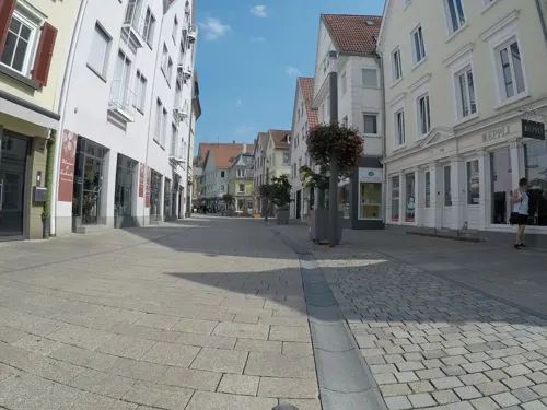
Bio-Bäckerei Berger
Bakery · 3.0 km
Bio Bäckerei Berger
127 Wilhelmstraße, Reutlingen
Mo-Fr 06:00-18:30; Sa 06:00-17:00; Su off; PH off
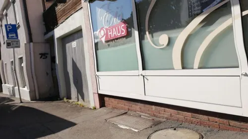
Eishaus
Ice cream · Ice Cream · 3.5 km
23 Sorten feinstes Speiseeis, auch Sorten ohne Milchprodukte
1 Schwanenstraße, Eningen unter Achalm
week 11-42 Mo,Tu,Th,Fr,Sa 12:00-19:00; week 11-42 Su 13:00-19:00; We off
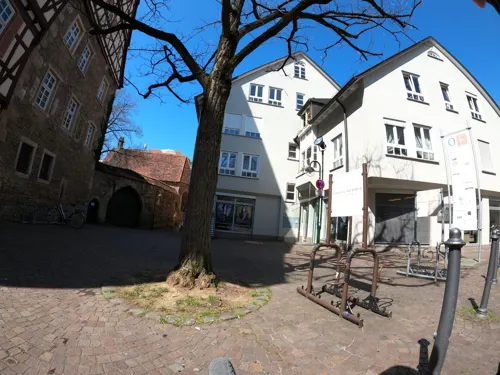
En Ville
Restaurant · Italian · 3.1 km
Trattoria Winebar Gelsomino
Oberamteistraße
Mo-We 11:00-17:30; Th,Fr 11:00-14:30,17:30-23:00; Sa 11:30-23:00; Su,PH off
Frau Möller‘s Bar & Kitchen
Restaurant · Burger, Steak House · 1.3 km
Burger, Steaks, American Diner
145 Klosterstraße, Pfullingen
Mo-Th 17:00-23:00; Fr 17:00-00:00; Sa 15:00-00:00; Su 17:00-23:00; PH off

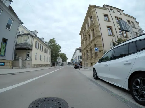
Ließchen
Restaurant · Regional · 3.3 km
Kneipe, Bar, Vesperstube
3 Kaiserpassage, Reutlingen
Tu-Th 16:00-24:00; Fr 16:00-01:00; Sa 15:00-01:00; Su,Mo off
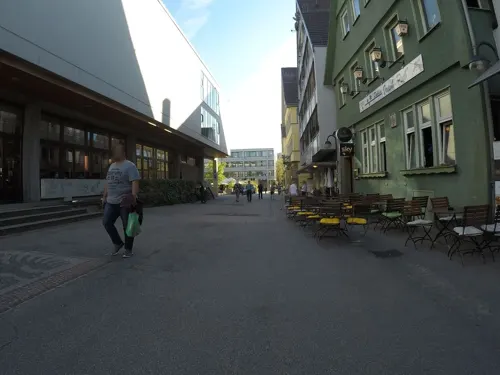
MaMa
Restaurant · Afghan · 3.3 km
Restaurant | Bar | Lounge
16 Marktplatz, Reutlingen
Mo-Th 11:00-23:00; Fr,Sa,Su 09:30-01:00
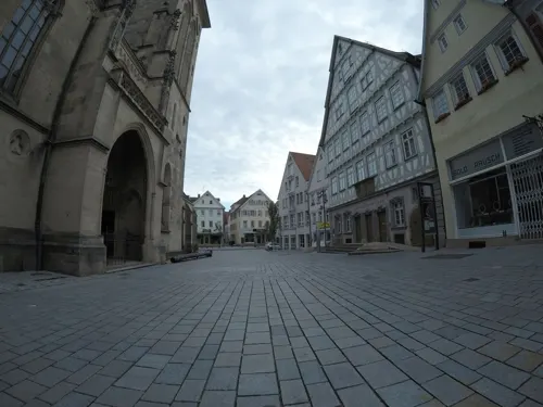


Vis a Vis
Bar and pub · Regional, Sandwich, Sausage, Tarte Flambee, Snacks · 3.1 km
Ihre gemütliche Café-Kneipe im Herzen Reutlingens
105 Wilhelmstraße, Reutlingen
Tu-Th 09:30-23:30; Fr-Sa 09:30-01:00
258 more on the map.
History
In a deed of donation of Otto I, Holy Roman Emperor in the year 937 Pfullingen was first documented.
Towards the end of the 14th century, Pfullingen lost due to the cities wars his town privileges to the city of Reutlingen and was captured and destroyed.
The Monastery in Pfullingen was founded in 1250 by two sisters, Mechtild and Irmel, from a family of minor nobility in Pfullingen. The Holy Roman Emperors granted it preferential rights and freedoms. The monastery Hofmeister also managed the monastery's properties at Genkingen and Reicheneck. During the Reformation, the monastery was dissolved and disintegrated. In 1793 the ruins were completely removed.
In 1487 the last lord of Pfullingen, Caspar Remp, sold his holdings including castle and all goods to Eberhard I, Duke of Württemberg, thus, the town came under control of Württemberg. Together with the villages Unter-and Oberhausen, Honau, Lichtenstein, Holzelfingen and Kleinengstingen Pfullingen formed an Unteramt which became part of Oberamt of Urach.
From the History section of Pfullingen on Wikipedia, under CC BY-SA 4.0.
Where to stay13
Hotel am Arbach
Motel and hotel · 2.3 km
20/1 Arbachtalstraße, Eningen unter Achalm
Churches and places of worship29
Nikolaikirche / Citykirche
Church · Protestant · 3.5 km
1 Nikolaiplatz, Reutlingen
Shopping68
Gas and EV charging20
Schools, colleges and libraries35
Healthcare22
Map of Pfullingen
250 places. The map loads OpenStreetMap tiles when you open it.
Getting there and nearby towns
Manfred Rommel Airport Stuttgart (STR) is the nearest airport with scheduled flights listed in OpenStreetMap, 25 km away.
- Reutlingen 3 km northwest, about 3 min by car
- Bad Urach 13 km east, about 13 min by car
- Tübingen 14 km northwest, about 14 min by car
- Weil im Schönbuch 21 km northwest, about 21 min by car
- Schönaich 25 km northwest, about 25 min by car
- Wendlingen am Neckar 25 km northeast, about 25 min by car
- Wernau 29 km northeast, about 29 min by car
- Sindelfingen 30 km northwest, about 30 min by car
- Plochingen 31 km northeast, about 31 min by car
- Stuttgart 36 km north, about 36 min by car
Drive times are estimates from straight-line distance, not routes.
Local news
Headlines from INDB.
Reviews, tips and questions
Loading what members have shared...
Sources and licences
- GeoNames (CC BY 4.0): population, coordinates, regions and time zone
- Mapillary (see each image): photos
- OpenStreetMap contributors (ODbL 1.0): places, airports, map data
- Wikidata (CC0 1.0): elevation, founding date, time zone, website, landmarks and historic places
- Wikimedia Commons (see each image): photos
- Wikipedia (CC BY-SA 4.0): overview and history text
Photo credits
- Schoenbergturm bei PfullingenV1, Schwiebi, CC BY-SA 3.0
- Pfullingen Mühlendenkmal 2026 Schild, Windharp, CC BY-SA 4.0
- Pfullingen Mühlendenkmal 2026, Windharp, CC BY-SA 4.0
- Pfullingen Klostersee, 5R-MFT, CC BY-SA 4.0
- Pfullingen Kirchstraße 18 (2), Windharp, CC BY-SA 4.0
- Pfullingen Laiblinsplatz 12 (1), Windharp, CC BY-SA 4.0
- Pfullingen Pfarrhaus II, Vux, CC BY-SA 3.0
- Pfullingen Stadtbücherei, 5R-MFT, CC0
- Pfullingen Kirchstraße 18 (1), Windharp, CC BY-SA 4.0
- Pfullingen Laiblinsplatz 12 (2), Windharp, CC BY-SA 4.0
- Pfullingen Passyplatz, 5R-MFT, CC BY-SA 4.0
- Pfullingen Laiblinsplatz 12 (3), Windharp, CC BY-SA 4.0
- Pfullingen Kirchstraße 10 (1), Windharp, CC BY-SA 4.0
- Pfullingen Klosterstraße 14 (1), Windharp, CC BY-SA 4.0
- Pfullingen Martinskirche-3, Vux, CC BY-SA 3.0
- Pfullingen Klosterstraße 14 (2), Windharp, CC BY-SA 4.0
- Pfullingen Kirchstraße 6 (1), Windharp, CC BY-SA 4.0
- Die 2020 renovierte Martinskirche in Pfullingen, Iris O'Meara, CC BY-SA 4.0
- Pfullingen Uhlandschule Front, Windharp, CC BY-SA 4.0
- Pfullingen Klosterstraße 16 (1), Windharp, CC BY-SA 4.0
- Pfullingen Kaiserstraße 1 (2), Windharp, CC BY-SA 4.0
- Pfullingen Marktplatz 1, Alupus, CC BY-SA 3.0
- Pfullingen Klosterstraße 16 (2), Windharp, CC BY-SA 4.0
- Pfullingen Klosterstraße 14-3 (1), Windharp, CC BY-SA 4.0
- Pfullingen Klosterstraße 14 (3), Windharp, CC BY-SA 4.0
- Pfullingen Uhlandschule Front Geradegestellt, Windharp, CC BY-SA 4.0
- Seitenansiht Martinskirche Pfullingen, Iris O'Meara, CC BY-SA 4.0
- Pfullingen Klosterstraße 14-1 (1), Windharp, CC BY-SA 4.0
- Pfullingen Martinskirche-2, Vux, CC BY-SA 3.0
- 2020 renovierte Martinskirche in Pfullingen mit Eingang, Iris O'Meara, CC BY-SA 4.0
- Pfullingen Kirchstraße 2 (1), Windharp, CC BY-SA 4.0
- Pfullingen Uhlandschule Schild, Windharp, CC BY-SA 4.0
- Pfullingen Uhlandschule Schwein, Windharp, CC BY-SA 4.0
- Martinskirche in Pfullingen, Roland Puskaric, CC BY-SA 4.0
- Pfullingen Uhlandschule Seite, Windharp, CC BY-SA 4.0
- Pfullingen Uhlandschule Schulbereich Schild, Windharp, CC BY-SA 4.0
- Pfullingen Klosterstraße 34 (1), Windharp, CC BY-SA 4.0
- Reutlingen Marienkirche 2012-04, Helmlechner, CC BY-SA 3.0
- Reutlingen Hochschule Fahnen, Windharp, CC BY-SA 4.0
- Naturtheater Reutlingen, dealerofsalvation, CC BY-SA 3.0
- RT Friedrich-List-Gymnasium 001, Greencherry, CC BY-SA 4.0
- FSG Pfullingen D-Bau, WikiHilpi, CC0
- Reutlingen Gartentor, dierk schaefer, CC BY 2.0
- 1dfh-georgenberg-2, Dieter F. Heinlin, CC BY-SA 3.0
- Nikolaikirche Reutlingen Westansicht, Vux, CC BY-SA 3.0
- Schönbergturm-02, Muck, CC BY-SA 4.0
- Reutlingen Marienkirche Heimatmuseum, Fundador at German Wikipedia, Public domain
- Stadion an der Kreuzeiche, Sven Scharr, CC BY-SA 3.0
- THR Eingang, Smrathr, CC BY-SA 4.0
- Freibad Markwasen Reutlingen 2005, Foto: Manfred Grohe, CC BY-SA 4.0
- Ursulahochberg Pfullingen, Tobias Boley, CC BY-SA 4.0
- NSG Echazaue, Schild, Friedi13, CC BY-SA 4.0
- Achalm, NSG Wagenhals, Eningen unter Achalm, Vux ( Diskussion ), CC BY-SA 3.0 de
- Stadtbibliothek Reutlingen 30, Giftzwerg 88, CC BY-SA 3.0
- Schönbergturm Pfullingen - Pfullinger Onderhos - panoramio - qwesy qwesy, qwesy qwesy, CC BY 3.0
- Reutlingen die Tonne Front, Windharp, CC BY-SA 4.0
- Pfullingen Martinskirche-1, Vux, CC BY-SA 3.0
- Reutlingen Kamino Eingang, Windharp, CC BY-SA 4.0
- Cineplex Planie Reutlingen 02, Giftzwerg 88, CC BY-SA 3.0
- NSG Kugelberg, Traubensaft2, CC BY-SA 4.0
- NSG Hohenäcker-Imenberg, Friedi13, CC BY-SA 4.0
- Reutlingen Georgenschule Eingang, Windharp, CC BY-SA 4.0
- Naturdenkmal Wackerstein, Friedi13, CC BY-SA 4.0
- Pfullinger Hallen-4, Vux, CC BY-SA 3.0
- Reutlingen Naturkundemuseum, Laserlicht, CC BY-SA 4.0
- Spendhaus Reutlingen, Autor, CC BY-SA 3.0
- Pfullingen Baumannsche Mühle-5, Vux, CC BY-SA 3.0
- Stadtgarten Reutlingen 01, Giftzwerg 88, CC BY-SA 3.0
- Leonhardskirche Reutlingen 05, Giftzwerg 88, CC BY-SA 3.0
- St. Wolfgang Reutlingen 02, Giftzwerg 88, CC BY-SA 3.0
- Pfullingen St. Wolfgang-Kirche, Vux, CC BY-SA 3.0
- Pfullingen Magdalenenkirche Turm 1, Windharp, CC BY-SA 4.0
- Pfullingen-Blick-vom-Restaurant-Fritz 2021-08-08 MTh, ( MTheiler ), CC BY-SA 4.0
- Lichtenstein-Unterhausen, Scheffelstraße 10, Hl. Bruder Konrad, DSC00041, Vux, CC BY-SA 4.0
- Isolde-Kurz-Gymnasium Reutlingen 01, Giftzwerg 88, CC BY-SA 3.0
- Pfullingen Wilhelm-Hauff-Realschule (3), Windharp, CC BY-SA 4.0
- Eningen Versöhnungskirche (2), Windharp, CC BY-SA 4.0
- Pfullingen Friedenskirche (2), Windharp, CC BY-SA 4.0
- Reutlingen Schuetzenhaus 2024-06-23 Biergarten MTh, MTheiler, CC BY-SA 3.0
- Reutlingen, Hl. Geist (08), Subbass1, CC BY-SA 4.0
- Spitalhof und Spitalkirche Reutlingen, Dem Zwickelbert sei Frau 15:58, 21. Mai 2009 (CEST), Public domain
- Pfullingen Schloss-Schule (4), Windharp, CC BY-SA 4.0
- Glashaus 1, Dulliman, CC BY 4.0
- Reutlingen Industriemagazin Eingang, Windharp, CC BY-SA 4.0
- Reutlingen Planie 1 Fenster, Windharp, CC BY-SA 4.0
- Street-level photo, snaysard, CC BY-SA 4.0
- Street-level photo, snaysard, CC BY-SA 4.0
- Street-level photo, snaysard, CC BY-SA 4.0
- Street-level photo, snaysard, CC BY-SA 4.0
- Street-level photo, photastic2, CC BY-SA 4.0
- Street-level photo, snaysard, CC BY-SA 4.0
- Street-level photo, snaysard, CC BY-SA 4.0
- Street-level photo, snaysard, CC BY-SA 4.0
- Street-level photo, snaysard, CC BY-SA 4.0
- Street-level photo, rausk, CC BY-SA 4.0
- Street-level photo, snaysard, CC BY-SA 4.0
- Street-level photo, snaysard, CC BY-SA 4.0
- Street-level photo, snaysard, CC BY-SA 4.0
- Street-level photo, snaysard, CC BY-SA 4.0
- Street-level photo, snaysard, CC BY-SA 4.0
- Street-level photo, snaysard, CC BY-SA 4.0
- Street-level photo, snaysard, CC BY-SA 4.0
- Street-level photo, snaysard, CC BY-SA 4.0
- Street-level photo, dulliman, CC BY-SA 4.0
- Street-level photo, snaysard, CC BY-SA 4.0


Page built November 8, 2026. Spotted a mistake? Tell us or suggest a place.