


Why visit Bad Urach
Townapedia lists 60 museums and landmarks, 30 parks and trails, 101 places to eat, 15 places to stay and 49 attractions in and around town.
Highlights include Forum22, Landvielfalt Blankenhorn, Residenzschloss Urach and Beginenhaus.
Weather in Bad Urach
Forecast from MET Norway (CC BY 4.0). Full forecast
About Bad Urach
Bad Urach (German pronunciation: [baːt ˈʔuːʁax] ) is a town in the district of Reutlingen, Baden-Württemberg, Germany. It is situated 14 km east of Reutlingen, at the foot of the Swabian Jura (or Swabian Alps), and is known for its spa and therapeutic bath.
From the Wikipedia article Bad Urach (this version), under CC BY-SA 4.0.
Things to do49

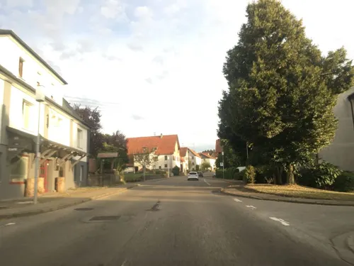
Landvielfalt Blankenhorn
Farm and orchard · 5.8 km
Milchautomat, Frischwarenautomat (Eier, Kartoffeln, Äpfel), Feldgemüse, eingekochte Gemüse, selbst gekochter Fruchtaufstrich, Obst,...
15 Untere Brühlstraße, St. Johann
Mo,Th 09:00-12:00; Tu-Fr 17:00-19:00; Sa 08:00-13:00; Su,PH off

Hohe Warte
Monument and historic site · 5.1 km
Mountain in Baden-Württemberg, Germany


Hofladen am Heidengraben
Farm and orchard · 5.5 km
1 Strohweiler Steig, Grabenstetten
24/7


37 more on the map.
Museums and landmarks60

Residenzschloss Urach
Monument and historic site
18 Bismarckstraße, Bad Urach
Apr-Oct: Tu-Su,PH 10:00-17:00, Mo off; Nov-Mar: Mo off, We,Fr...


Schlossmühle
Monument and historic site
Stadtbücherei Volkshochschule Musikschule Jugendblasorchester
10 Graf-Eberhard-Platz, Bad Urach
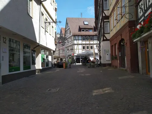
Stadtmuseum Klostermühle
Museum
3 Hermann-Prey-Platz, Bad Urach
Tu-We,Fr-Sa 14:00-17:00, Th 14:00-18:00, Su 10:00-12:00,13:00-17:00

Entdeckerwelt Bad Urach
Museum
21 Bismarckstraße, Bad Urach
Apr-Oct: Mo-Fr 10:30-16:00, Sa-Su,PH 09:00-17:00; Nov-Mar: Tu-Su...

Heidengrabenzentrum
Museum · 5.2 km
2, Erkenbrechtsweiler
Th-Su 11:00-17:00; PH 11:00-17:00; Mo-We off


Evangelisches Dekanamt Pfarramt I Amanduskirche
Monument and historic site · Protestant
2 Gabriel-Biel-Platz, Bad Urach

48 more on the map.
Parks, trails and playgrounds30

Freibad Dettingen an der Erms
Sports field and stadium · 4.9 km
May 15-Sep 15 Mo-Fr 07:00-20:00; May 15-Sep 15 Sa-Su,PH...




18 more on the map.
Restaurants and cafes101
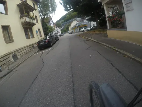

Naturfreundehaus Waldheim Dettingen/Erms
Restaurant · Regional · 4.7 km
Sa 14:00-18:00; Su 10:00-17:00; PH 10:00-17:00
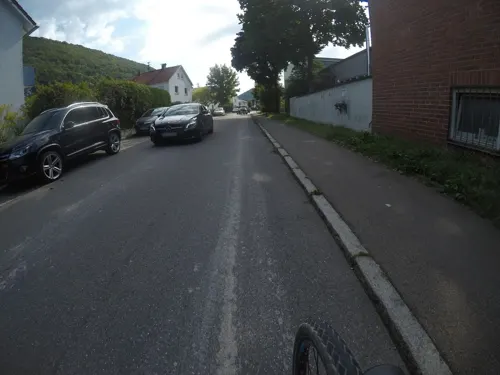
BeckaBeck
Cafe · Breakfast, Cake, Pastry · 1.6 km
2 Max-Eyth-Straße, Bad Urach
Mo-Fr 06:00-18:30; Sa 06:00-17:30; Su,PH 08:00-17:30

BeckaBeck `Zum Becki`
Bakery · 5.7 km
Im Sommer können Sie bei uns ein leckeres Frühstück im Außenbereich genießen.
13 Uracher Straße, Dettingen an der Erms
Mo-Fr 06:00-18:30; Sa 06:00-17:30; Su,PH 07:30-17:30

Café BeckaBeck
Cafe · Breakfast, Cake, Pastry
11 Marktplatz, Bad Urach
Mo-Fr 06:00-18:00; Sa,Su,PH 07:00-18:00
Gasthaus Linde
Restaurant · German, Soup · 5.2 km
6 Friedrich-Ebert-Straße, Dettingen an der Erms
Mo,Fr,Sa 11:45-13:30,17:30-20:00; Su 11:30-14:00,17:30-19:30
Gasthaus Ochsen
Restaurant · German, Regional · 5.6 km
4 Schneckenhofengasse, Dettingen an der Erms
We,Fr,Sa 17:00-22:00; Th 10:00-14:30, 17:00-22:00; Su,PH 11:30-22:00
Pizzeria Rostica
Restaurant · Italian, Pizza
1 Wilhelmsplatz, Bad Urach
Mo off, Su 11:30-14:00,17:30-21:30, Tu-Sa 17:30-22:00,17:30-23:15


89 more on the map.
History
In the early Stone Age, the Alb was already populated, and several caves in the area show evidence that they provided shelter for the inhabitants.
During the Alemanni period, Bad Urach had an important castle. Owing to its prime location on a hill overlooking the Erms Valley, Hohenurach Castle was built around 1025. In the Middle Ages Bad Urach (at that time only known as Urach) became a centre of power. The castle became a state prison in the late Middle Ages; the poet Philipp Nikodemus Frischlin died while trying to escape over its walls in 1590. In the 18th century, the fortress was razed to the ground by the citizenry.
Around 1260, Urach became part of Württemberg. Nearly 100 years later, at the time when Württemberg was divided, the southern part of the region was governed from Urach, the so-called "secret capital", which was the residential home of the Dukes of Württemberg from 1442 until 1482. Count Eberhard the Bearded was born here in 1445 and returned there frequently throughout his life. Over the next several centuries, the town prospered and became a centre for weaving. It escaped serious damage during any wars and so remains in excellent historical condition. In 1867 a cousin of the king of Württemberg was created Duke of Urach but lived 21 kilometres (13 mi) away at Lichtenstein Castle.
Since 1985 the town has been a nationally recognized spa town.
From the History section of Bad Urach on Wikipedia, under CC BY-SA 4.0.
Where to stay15
Churches and places of worship20
Peter und Paul
Church · Protestant · 5.9 km
4 Schlattstaller Straße, Grabenstetten
Shopping19
Gas and EV charging4
Schools, colleges and libraries13
Healthcare13
Neuwiesen Apotheke
Clinic and pharmacy · 5.4 km
66 Hülbener Straße, Dettingen an der Erms
m&i Fachklinik Hohenurach 2
Clinic and pharmacy · 2.5 km
47 Immanuel-Kant-Straße, Bad Urach
Map of Bad Urach
250 places. The map loads OpenStreetMap tiles when you open it.
Getting there and nearby towns
Manfred Rommel Airport Stuttgart (STR) is the nearest airport with scheduled flights listed in OpenStreetMap, 26 km away.
- Reutlingen 14 km west, about 14 min by car
- Wendlingen am Neckar 20 km north, about 20 min by car
- Wernau 22 km north, about 22 min by car
- Weil im Schönbuch 29 km northwest, about 29 min by car
- Stuttgart 36 km northwest, about 36 min by car
- Waiblingen 38 km north, about 38 min by car
- Winnenden 43 km north, about 43 min by car
- Ulm 45 km east, about 45 min by car
- Welzheim 46 km north, about 46 min by car
- Weil der Stadt 48 km northwest, about 48 min by car
Drive times are estimates from straight-line distance, not routes.
Local news
Headlines from INDB.
Reviews, tips and questions
Loading what members have shared...
Sources and licences
- GeoNames (CC BY 4.0): population, coordinates, regions and time zone
- Mapillary (see each image): photos
- OpenStreetMap contributors (ODbL 1.0): places, airports, map data
- Wikidata (CC0 1.0): elevation, founding date, time zone, website, landmarks and historic places
- Wikimedia Commons (see each image): photos
- Wikipedia (CC BY-SA 4.0): overview and history text
Photo credits
- BadUrachMarktplatz, Ssch, CC BY-SA 3.0
- Church porch of Stiftskirche Bad Urach (2), PiotrMig, CC BY-SA 4.0
- Bad Urach Lange Straße34, Photo: Andreas Praefcke, CC BY 4.0
- 00 2266. Turm der Kirche St. Amandus - Bad Urach, W. Bulach, CC BY-SA 4.0
- Bad Urach Wilhelmsplatz3 ehemaliges Residenz-Theater, Photo: Andreas Praefcke, Public domain
- Bad Urach Eberleplatz 1 und Espachbrunnen, Windharp, CC BY-SA 4.0
- Bad Urach Münsinger Straße 6, Windharp, CC BY-SA 4.0
- Bad Urach Wilhelmstraße, Photo: Andreas Praefcke, CC BY 4.0
- Bad Urach Lange Straße Laufbrunnen (1), Windharp, CC BY-SA 4.0
- Bad Urach Eberleplatz Espachbrunnen (1), Windharp, CC BY-SA 4.0
- Bad Urach Eberleplatz Espachbrunnen Schild, Windharp, CC BY-SA 4.0
- Bad Urach Eberleplatz 1 (1), Windharp, CC BY-SA 4.0
- Bad Urach Eberleplatz Espachbrunnen (2), Windharp, CC BY-SA 4.0
- Bad Urach Freiwillige Feuerwehr (1), Windharp, CC BY-SA 4.0
- Bad Urach Eberleplatz 1 (2), Windharp, CC BY-SA 4.0
- Bad Urach Münsinger Straße 6 Balkon (1), Windharp, CC BY-SA 4.0
- Bad Urach Münsinger Straße 6 Balkon (2), Windharp, CC BY-SA 4.0
- Bad Urach, Lange Straße, PiotrMig, CC BY-SA 4.0
- Bad Urach Freiwillige Feuerwehr (2), Windharp, CC BY-SA 4.0
- Bad Urach Münsinger Straße 6 Gartentor, Windharp, CC BY-SA 4.0
- Bad Urach, Ermsstraße (98847589) (1), JoeGue, CC BY-SA 4.0
- Bad Urach Münsinger Straße 6 (2), Windharp, CC BY-SA 4.0
- Bad Urach, Ermsstraße (98847589) (2), JoeGue, CC BY-SA 4.0
- Bad Urach Eberleplatz 1 (3), Windharp, CC BY-SA 4.0
- Bad Urach Wilhelmstraße 7 Gasthausschild, Windharp, CC BY-SA 4.0
- Bad Urach Lange Straße9, Photo: Andreas Praefcke, CC BY 4.0
- Bad Urach Wilhelmstraße 7 (2), Windharp, CC BY-SA 4.0
- Bad Urach Wilhelmstraße 7 (1), Windharp, CC BY-SA 4.0
- Bad Urach Wilhelmstraße5 Ausleger, Photo: Andreas Praefcke, CC BY 4.0
- 00 1268 Bad Urach - Rathaus, W. Bulach, CC BY-SA 4.0
- Bad Urach Marktplatz16, Photo: Andreas Praefcke, CC BY 4.0
- Beim Schloß 2 Bad Urach 20200715 048, Tilman2007, CC BY-SA 4.0
- Bad Urach Marktplatz17 Krone img01, Photo: Andreas Praefcke, CC BY 4.0
- Beim Schloß 12 Bad Urach 20200715 050, Tilman2007, CC BY-SA 4.0
- Beim Schloß 9 Bad Urach 20200715 049, Tilman2007, CC BY-SA 4.0
- Bad Urach Marktplatz17 Krone img02, Photo: Andreas Praefcke, CC BY 4.0
- Beim Schloß 1 Bad Urach 20200715 052, Tilman2007, CC BY-SA 4.0
- Bad Urach Marktplatz12, Photo: Andreas Praefcke, CC BY 4.0
- HoheWarteAussichtsturm, Ssch, CC BY-SA 3.0
- Heidengraben-6592, Dietrich Krieger, CC BY-SA 3.0
- Uracher Wasserfall 000, Wildfeuer, CC BY 2.5
- Burg Hohenurach 03 Blick von unten03, Wildfeuer, CC BY 2.5
- NSG Upfinger Ried 03, Friedi13, CC BY-SA 4.0
- Geg bad urach, Steffen Schwerdtfeger, CC BY-SA 3.0 de
- St. Johann (W.) - Upfingen - Marienkirche - Turm von Südosten 2, Roman Eisele, CC BY-SA 4.0
- Schillerhoehle-20160704c, Karle3, CC BY-SA 4.0
- UrachStiftskircheAbendbild, Mussklprozz, CC BY-SA 3.0
- Dettingen-Erms - Mitte - 20110716, Speifensender, CC BY-SA 3.0
- Calverbühl, Johannes Baier, CC BY 3.0
- NSG Rutschen, Fotograf50+, CC BY-SA 4.0
- Bad Urach Stadtbücherei (Schlossmühle), Windharp, CC BY-SA 4.0
- Bad Urach Forum 22 (3), Windharp, CC BY-SA 4.0
- Bad Urach-Nord-20080503, Speifensender, CC BY-SA 3.0
- Dettingen Stiftskirche 01, Schwäbin, CC BY-SA 3.0 de
- Grabenstetten Peter- und Paul-Kirche, Dr. Eugen Lehle, CC BY-SA 3.0
- Bad Urach Hotel Bischoffs, Windharp, CC BY-SA 4.0
- Kath. Kirche - Maria zum guten Stein (Dettingen an der Erms), Vux, CC BY 3.0
- Schloß-Urach-2010, Misburg3014, CC BY-SA 3.0
- Bad Urach Beginenhaus Front, Windharp, CC BY-SA 4.0
- Bad urach Schlossmühle, Varus111, CC BY 3.0
- Stuttgarter Straße 15, Haus am Gorisbrunnen Bad Urach 20200715 129, Tilman2007, CC BY-SA 4.0
- Landappbw 164245 1817 Hof Mönchshof Bad Urach, David, CC0
- Jugendherberge Bad-Urach 2020 MTh, MTheiler, CC BY-SA 4.0
- Graf-Eberhard-Platz 11 Bad Urach 20200715 105, Tilman2007, CC BY-SA 4.0
- Street-level photo, mfa, CC BY-SA 4.0
- Street-level photo, mfa, CC BY-SA 4.0
- Street-level photo, ente, CC BY-SA 4.0
- Street-level photo, mfa, CC BY-SA 4.0
- Street-level photo, ente, CC BY-SA 4.0
- Street-level photo, akovt, CC BY-SA 4.0
- Street-level photo, descilla, CC BY-SA 4.0
- Street-level photo, mammi71, CC BY-SA 4.0
- Street-level photo, mfa, CC BY-SA 4.0
- Street-level photo, tasmaniadevil, CC BY-SA 4.0
- Street-level photo, ente, CC BY-SA 4.0
- Street-level photo, ente, CC BY-SA 4.0
- Street-level photo, mfa, CC BY-SA 4.0
- Street-level photo, tasmaniadevil, CC BY-SA 4.0
- Street-level photo, bct, CC BY-SA 4.0
- Street-level photo, soulcover, CC BY-SA 4.0
- Street-level photo, bct, CC BY-SA 4.0
- Street-level photo, mcliquid, CC BY-SA 4.0


Page built November 8, 2026. Spotted a mistake? Tell us or suggest a place.