


Why visit Roding
Townapedia lists 53 museums and landmarks, 30 parks and trails, 60 places to eat, 16 places to stay and 57 attractions in and around town.
Highlights include Faschaberg, Giglberg, Alte Wehrkirche and Feuerwehrmuseum.
Weather in Roding
Forecast from MET Norway (CC BY 4.0). Full forecast
About Roding
Roding (German: [ˈʁoːdɪŋ] ) is a town in the district of Cham, in Bavaria, Germany, near the Czech border.
From the Wikipedia article Roding, Germany (this version), under CC BY-SA 4.0.
Things to do57


Rotes Höhenvieh aus der Regentalaue - Fuchs
Farm and orchard · 4.8 km
63 Untertraubenbach, Cham
"nach Bestellung"



45 more on the map.
Museums and landmarks53


Ehem. Schloss Strahlfeld
Monument and historic site · 5.5 km
2 Am Jägerberg, Roding

Ehem. Wasserburg mit Kirche
Monument and historic site · 3.6 km
Im Burghof, Roding
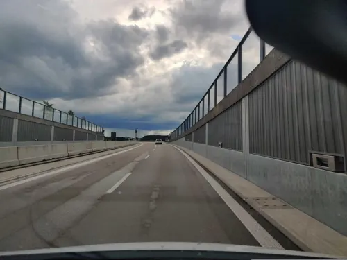

Kloster Strahlfeld
Monument and historic site · 5.5 km
2 Am Jägerberg, Roding

KZ-Gedenkstätte
Monument and historic site · 2.9 km
Mahnmal für die beim Todesmarsch aus dem KZ Flossenbürg nach Wetterfeld hier Verstorbenen

Rokoko-Kirche
Monument and historic site · 1.9 km
1 Heilbrünnl, Roding

Ruine "Altes Schloss"
Monument and historic site · 3.6 km
Eine Besichtigung ist nur von außen möglich, z.B Burgraben, Burgmauer und Torturm. Für Rollstuhlfahrer ist die Anlage gleichermaßen geeignet.


41 more on the map.
Parks, trails and playgrounds30




Regentalhänge zwischen Kirchenrohrbach und Zenzing
Hiking and trails · 7.2 km

Natur-Eislaufbahn
Sports field and stadium · 0.7 km
"im Winter bei starkem Frost"
Freibad Platschare Roding
Sports field and stadium · 0.9 km
54 Nanzinger Weg, Roding

18 more on the map.
Restaurants and cafes60

Hotel Gasthof zum Türlinger
Restaurant · Regional · 8.4 km
5 Schloßstraße, Schorndorf
Mo,Tu,Th,Fr 17:00-23:00, Th,Fr 09:00-14:00; Sa,Su 09:00-23:00
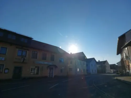
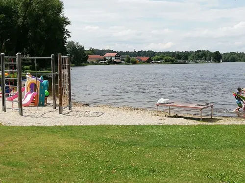
Seewirt Neubäuer See
Restaurant · Bavarian, Regional · 8.3 km
4 Seestraße, Roding
Mo-Sa 11:30-20:30; Su,PH 11:30-20:00



Roma
Restaurant · Pizza
2 Arnulfstraße, Roding
Su,Tu-Fr 11:00-14:00, 17:00-22:00, Sa 17:00-22:00


Schießl
Restaurant · Regional · 8.4 km
1-3 Seestraße, Roding
Mo-Fr 18:00-20:00; We,Th,Sa,Su 11:00-13:00,18:00-20:00
48 more on the map.
Where to stay16
Churches and places of worship37
St. Vitus
Church · Roman Catholic · 4.5 km
1 Obere Hauptstraße, Pösing
Shopping15
Gas and EV charging11
Schools, colleges and libraries10
Werner-von-Siemens-Schule - Außenstelle Roding
School
15 Max-Reger-Straße, Roding
Healthcare5
Map of Roding
250 places. The map loads OpenStreetMap tiles when you open it.
Getting there and nearby towns
Flugplatz Straubing-Wallmühle (RBM) is the nearest airport with scheduled flights listed in OpenStreetMap, 33 km away.
- Pösing 5 km northeast, about 5 min by car
- Schorndorf 7 km southeast, about 7 min by car
- Stamsried 8 km north, about 8 min by car
- Michelsneukirchen 8 km south, about 8 min by car
- Cham 10 km east, about 10 min by car
- Straubing 35 km south, about 35 min by car
- Regensburg 36 km southwest, about 36 min by car
- Zwiesel 56 km east, about 56 min by car
- Sulzbach-Rosenberg 66 km northwest, about 1 h by car
- Vilsbiburg 83 km south, about 1 h 30 min by car
Drive times are estimates from straight-line distance, not routes.
Local news
Headlines from INDB.
Reviews, tips and questions
Loading what members have shared...
Sources and licences
- GeoNames (CC BY 4.0): population, coordinates, regions and time zone
- Mapillary (see each image): photos
- OpenStreetMap contributors (ODbL 1.0): places, airports, map data
- Wikidata (CC0 1.0): elevation, founding date, time zone, website
- Wikimedia Commons (see each image): photos
- Wikipedia (CC BY-SA 4.0): overview and history text
Photo credits
- Roding stadtansicht os, Michael Jobst, Public domain
- Stadtpfarrkirche St. Pankratius Roding 01, Helmlechner, CC0
- Roding, Christuskirche, Orgel (6), Subbass1, CC BY-SA 4.0
- Roding, Christuskirche, Orgel (8), Subbass1, CC BY-SA 4.0
- Roding, Christuskirche, Orgel (1), Subbass1, CC BY-SA 4.0
- Roding, Christuskirche, Orgel (1) (cropped), Subbass1, CC BY-SA 4.0
- Roding, Christuskirche, Orgel (2), Subbass1, CC BY-SA 4.0
- Roding, Christuskirche, Orgel (2) (cropped), Subbass1, CC BY-SA 4.0
- Roding, Christuskirche, Orgel (3), Subbass1, CC BY-SA 4.0
- Roding, Christuskirche, Orgel (5), Subbass1, CC BY-SA 4.0
- Roding, Christuskirche, Orgel (4), Subbass1, CC BY-SA 4.0
- Roding, Christuskirche, Orgel (7), Subbass1, CC BY-SA 4.0
- Falkensteiner Straße 2, Roding, Helmlechner, CC0
- Sebastianikapelle Roding 02, Helmlechner, CC0
- Ehemalige Fronfeste Roding, Helmlechner, CC0
- St. Pankratius Roding Turm 01, Helmlechner, CC0
- Schulstraße 1, Roding, Helmlechner, CC0
- St. Pankratius Roding Turm 02, Helmlechner, CC0
- Annakapelle Roding, Helmlechner, CC0
- Sebastianikapelle Roding 01, Helmlechner, CC0
- Stadtpfarrkirche St. Pankratius Roding 03, Helmlechner, CC0
- Stadtpfarrkirche St. Pankratius Roding 02, Helmlechner, CC0
- Paradeplatz 6, Roding 02, Helmlechner, CC0
- Josephi- und Anna-Kapelle Roding, Helmlechner, CC0
- Altes Rathaus Roding 03, Helmlechner, CC0
- Paradeplatz 8, Roding, Helmlechner, CC0
- Altes Rathaus Roding 02, Helmlechner, CC0
- Altes Rathaus Roding, Helmlechner, CC0
- Marktplatz 5, Roding, Helmlechner, CC0
- Marktplatz 6, Roding, Helmlechner, CC0
- Marktplatz 9, Roding 01, Helmlechner, CC0
- St. Pankratius Roding Turm 03, Helmlechner, CC0
- Regenstraße 9, Roding, Helmlechner, CC0
- Bäckergasse 4, Roding, Helmlechner, CC0
- Roding am Regen 03, Helmlechner, CC0
- Roding Stadtansicht 02, Helmlechner, CC0
- Roding am Regen 04, Helmlechner, CC0
- Roding, Regen-Brücke, Terrassen, Hochwasser 2024-09, HerrAdams, CC BY-SA 4.0
- Roding am Regen 02, Helmlechner, CC0
- Roding Stadtansicht 06, Helmlechner, CC0
- Schwaerzenburg, Schmid Marco, Thanried, CC BY-SA 3.0 de
- Josephi und Anna Kapellen Roding, O DM, CC BY-SA 3.0
- Wetterfeld, Matthias Süß, CC BY-SA 3.0
- Heilige Drei Koenige und Matthaeus Friedersried, O DM, CC BY-SA 3.0
- Josephilapelle Roding Obergeschoss und Annakapelle, O DM, CC BY-SA 3.0
- St. Pankraz Roding Kirche, O DM, CC BY-SA 3.0
- Schloss Stamsried, GZilch, CC BY-SA 4.0
- Poesing kirche, Pedro ximenez, CC BY-SA 3.0 de
- Wetterfeld-Kirche-01a, Asurnipal, CC BY-SA 4.0
- Pfarrkirche Maria Immaculata Schorndorf, Konrad Lackerbeck, Public domain
- Roding-EvKirche-10, Asurnipal, CC BY-SA 4.0
- NSG Neubäuer See, Rosa-Maria Rinkl, CC BY-SA 4.0
- Fluss "Regen" bei Untertraubenbach, Rosa-Maria Rinkl, CC BY-SA 4.0
- Regen zwischen Zenzing und Kirchrohrbach, Rosa-Maria Rinkl, CC BY-SA 4.0
- Klosteransicht, Crazy.wen, Public domain
- Regen-wallfahrtskirche-heilbrünnl, Mboesch, CC BY-SA 4.0
- Klosteransicht-2, crazy.wen, Public domain
- Street-level photo, 5rmft, CC BY-SA 4.0
- Street-level photo, ryhk, CC BY-SA 4.0
- Street-level photo, wegavision, CC BY-SA 4.0
- Street-level photo, Olivy, CC BY-SA 4.0
- Street-level photo, Olivy, CC BY-SA 4.0
- Street-level photo, 5rmft, CC BY-SA 4.0
- Street-level photo, foxconn11, CC BY-SA 4.0
- Street-level photo, raspberry, CC BY-SA 4.0
- Street-level photo, raspberry, CC BY-SA 4.0
- Street-level photo, dirk18, CC BY-SA 4.0


Page built November 8, 2026. Spotted a mistake? Tell us or suggest a place.