


Schwarzenbach an der Saale, Germany
Schwarzenbach an der Saale is a town of 11,375 people in Bavaria, Germany.
Why visit Schwarzenbach an der Saale
Townapedia lists 23 museums and landmarks, 13 parks and trails, 58 places to eat, 9 places to stay and 14 attractions in and around town.
Highlights include Hauknock, Föhrlberg, Erika-Fuchs-Haus, Museum für Comic und Sprachkunst and Altes Rathaus.
Weather in Schwarzenbach an der Saale
Forecast from MET Norway (CC BY 4.0). Full forecast
About Schwarzenbach an der Saale
Schwarzenbach an der Saale (German pronunciation: [ˈʃvaʁtsn̩bax ʔan deːɐ̯ ˈzaːlə] , lit. 'Schwarzenbach on the Saale') is a small industrial town in the district of Hof, in Bavaria, Germany. It is situated on the river Saale, 11 km south of Hof.
From the Wikipedia article Schwarzenbach an der Saale (this version), under CC BY-SA 4.0.
Things to do14


2 more on the map.
Museums and landmarks23

Erika-Fuchs-Haus, Museum für Comic und Sprachkunst
Museum
12 Bahnhofstraße, Schwarzenbach a.d.Saale
Tu-Su 10:00-18:00


Schloß Döhlau
Monument and historic site · 6.4 km
1 Am Schloss, Döhlau


Burgruine Hallerstein
Monument and historic site · 4.2 km
53 Hallerstein, Schwarzenbach a.d.Saale

Traktor-Museum am Bahnhof
Museum
7 Bahnhofsplatz, Schwarzenbach a.d.Saale



11 more on the map.
Parks, trails and playgrounds13




1 more on the map.
Restaurants and cafes58

Dynamite Bärlas
Restaurant · Burger, Steak, Hot Stone · 5.8 km
9 Bärlas, Weißdorf
Th 19:00-22:00; Fr-Sa 18:00-22:00; Su 11:00-15:00
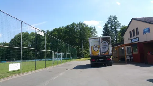
Restaurant Athen Förbau
Restaurant · Greek · 2.4 km
14 Schwarzenbacher Straße, Schwarzenbach a.d.Saale
Tu-Th 17:00-22:00; Fr-Su 11:30-14:00,17:00-22:00
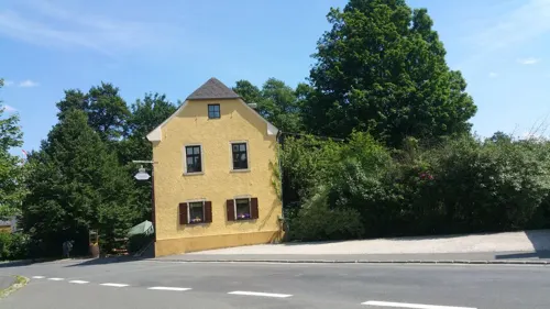
Teschner's Herrschaftliche Gastwirtschaft
Restaurant · German · 2.6 km
3 Seulbitzer Straße, Schwarzenbach a.d.Saale
We-Sa 18:00+; Su 11:30-14:00, 18:00+
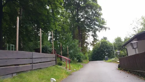
Waldgastätte Friedrichsruh
Restaurant · German · 6.1 km
25 Reuthstraße, Oberkotzau
Su 10:00+; Tu-Sa,PH 14:00+
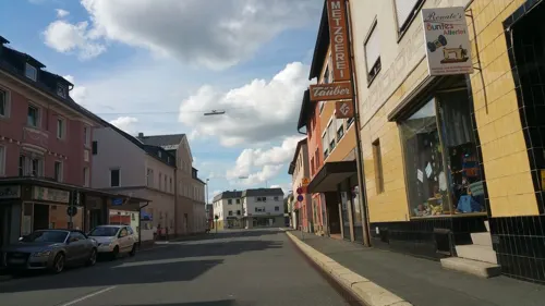
Reinel Bäckerei Oberkotzau
Bakery · 4.5 km
10 Hofer Straße, Oberkotzau
We-Fr 06:30-12:00; Sa 06:00-12:00; PH off
Da Maria
Restaurant · Italian · 4.5 km
11 Hofer Straße, Oberkotzau
Fiedler
Bakery
7 Rehauer Straße, Schwarzenbach a.d.Saale
Mo-Fr 06:00-13:00,14:00-18:00; Sa 06:00-12:30
Gasthaus Jahn
Restaurant · Regional, German, Pizza · 6.5 km
17 Hofer Straße, Döhlau
Hanacozy
Restaurant · Asian, Noodle, Vietnamese, Diner, Curry, Udon · 2.7 km
7 Steinbachstraße, Schwarzenbach an der Saale


46 more on the map.
Where to stay9
Churches and places of worship10
Yunus Emre Camii Moschee
Place of worship · 2.9 km
15 Pilgramsreuther Straße, Schwarzenbach an der Saale
Shopping8
Gas and EV charging3
Ladestation Rossmann
EV charging
22 Kirchenlamitzer Straße, Schwarzenbach a.d.Saale
Schools, colleges and libraries6
BVJ-Kompetenzzentrum Marienberg
School · 0.8 km
50 Marienstraße, Schwarzenbach a.d.Saale
Jean-Paul-Grundschule Schwarzenbach/Saale
School · 0.8 km
9 Breslauer Straße, Schwarzenbach a.d.Saale
Healthcare2
Map of Schwarzenbach an der Saale
146 places. The map loads OpenStreetMap tiles when you open it.
Getting there and nearby towns
Verkehrslandeplatz Hof-Plauen (HOQ) is the nearest airport with scheduled flights listed in OpenStreetMap, 9 km away.
- Oberkotzau 4 km north, about 4 min by car
- Döhlau 7 km north, about 7 min by car
- Rehau 8 km northeast, about 8 min by car
- Konradsreuth 8 km northwest, about 8 min by car
- Selb 15 km southeast, about 15 min by car
- Wunsiedel 21 km south, about 21 min by car
- Bad Staffelstein 68 km west, about 1 h 15 min by car
- Gera 74 km north, about 1 h 15 min by car
- Jena 82 km north, about 1 h 15 min by car
- Sulzbach-Rosenberg 81 km south, about 1 h 15 min by car
Drive times are estimates from straight-line distance, not routes.
Local news
Headlines from INDB.
Reviews, tips and questions
Loading what members have shared...
Sources and licences
- GeoNames (CC BY 4.0): population, coordinates, regions and time zone
- Mapillary (see each image): photos
- OpenStreetMap contributors (ODbL 1.0): places, airports, map data
- Wikidata (CC0 1.0): elevation, founding date, time zone, website, landmarks and historic places
- Wikimedia Commons (see each image): photos
- Wikipedia (CC BY-SA 4.0): overview and history text
Photo credits
- Epprechtstein 006, PeterBraun74, CC BY-SA 3.0
- Uprode1, PeterBraun74 at German Wikipedia, Public domain
- Schwarzenbach Building 2014 xy 9, PeterBraun74, CC BY-SA 3.0
- Oberkotzau Schwesnitz, TPO, CC BY-SA 3.0
- Schloss Oberkotzau, Aagnverglaser, CC0
- Wojaleite Ansicht, Adrian Michael, CC BY-SA 3.0
- Oberkotzau, St. Antonius (02), Subbass1, CC BY-SA 4.0
- Hallerstein 2014 xy 4, PeterBraun74, CC BY-SA 3.0
- Hallerstein 2014 xy 8, PeterBraun74, CC BY-SA 3.0
- Erika-Fuchs-Haus, Schwarzenbach an der Saale, Kreuzschnabel, CC BY-SA 3.0
- Förbau 065, PeterBraun74, CC BY-SA 3.0
- Schwarzenbach (Saale), St. Franziskus (01), Subbass1, CC BY-SA 4.0
- Schwarzenbach Saale, upload by User:Parpan05, CC BY-SA 3.0
- Schwarzenbach a.d.Saale, Marktplatz 5-002, Tilman2007, CC BY-SA 3.0
- DoehlauSchloss, PeterBraun74, CC BY-SA 3.0
- Hallerstein, Dorfkirche (06), Subbass1, CC BY-SA 4.0
- Schwarzenbach LangerGang, PeterBraun74, CC BY-SA 3.0
- Hallerstein 2014 xy 6, PeterBraun74, CC BY-SA 3.0
- Street-level photo, b4sti4n, CC BY-SA 4.0
- Street-level photo, b4sti4n, CC BY-SA 4.0
- Street-level photo, b4sti4n, CC BY-SA 4.0
- Street-level photo, b4sti4n, CC BY-SA 4.0
- Street-level photo, b4sti4n, CC BY-SA 4.0
- Street-level photo, changchun1, CC BY-SA 4.0
- Street-level photo, changchun1, CC BY-SA 4.0
- Street-level photo, b4sti4n, CC BY-SA 4.0
- Street-level photo, b4sti4n, CC BY-SA 4.0
- Street-level photo, b4sti4n, CC BY-SA 4.0
- Street-level photo, geo, CC BY-SA 4.0
- Street-level photo, b4sti4n, CC BY-SA 4.0
- Street-level photo, b4sti4n, CC BY-SA 4.0
- Street-level photo, b4sti4n, CC BY-SA 4.0
- Street-level photo, changchun1, CC BY-SA 4.0
- Street-level photo, changchun1, CC BY-SA 4.0
- Street-level photo, b4sti4n, CC BY-SA 4.0
- Street-level photo, b4sti4n, CC BY-SA 4.0
- Street-level photo, b4sti4n, CC BY-SA 4.0
- Street-level photo, b4sti4n, CC BY-SA 4.0
- Street-level photo, b4sti4n, CC BY-SA 4.0
- Street-level photo, b4sti4n, CC BY-SA 4.0
- Street-level photo, b4sti4n, CC BY-SA 4.0
- Street-level photo, geo, CC BY-SA 4.0


Page built November 8, 2026. Spotted a mistake? Tell us or suggest a place.